Category Archives: santa monica mountains

California Black Walnut Along the Phantom Trail

California Black Walnut Along the Phantom Trail

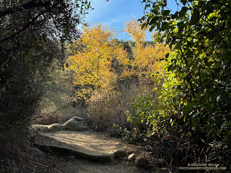
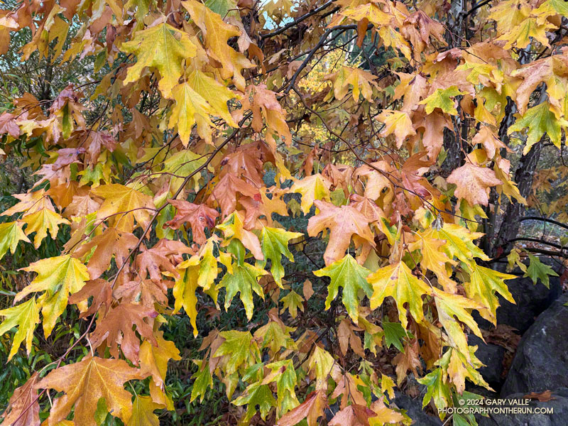
A California black walnut lends a little Fall color to the chaparral on the Phantom Trail in Malibu Creek State Park.

From a run of the Phantom Loop, starting at the Cistern Trailhead on Mulholland Highway. Here’s an interactive 3D-terrain view of the 7-mile route.

Some related posts:
Spring Fever Running the Phantom Loop in Malibu Creek State Park
Ladyface Via the Phantom Trail and Heartbreak Ridge
Bulldog Loop Plus the Phantom Loop

Wandering Around Malibu Creek State Park

Century Dam from the end of the Forest Trail in Malibu Creek State Park.

Here are a few images from a meandering run in Malibu Creek State Park on the Cistern, Lookout, Crags Road, Forest, and Chaparral Trails.

Some related posts:
Spring Fever Running the Phantom Loop in Malibu Creek State Park
Malibu Creek State Park: Lake Vista Ridge, the Forest Trail, and September Wildflowers
Afternoon Run on the Forest and Lost Cabin Trails in Malibu Creek State Park

Fog, Flowers and an Ingenious Spider on the Trippet Ranch Loop

Ingenuity meets Opportunity. Photography by Gary Valle.
Ingenuity meets Opportunity

In their forecast discussion for today, the NWS Los Angeles Oxnard commented, “A long-lasting and extreme heatwave will continue across the region, and especially the interior…” The high temperature was expected to range from 105 to 115 across the interior valleys, mountains and deserts.

Indian pink, golden yarrow, and California everlasting along the Garapito Trail.
Indian pink, golden yarrow, and California everlasting.

I was doing the Trippet Ranch Loop from the Top of Reseda. The highs on the San Fernando Valley side of the Santa Monica Mountains were expected to be in the 90s. But keep in mind that’s essentially the temperature in the shade. In full sun, the temperature could be 10 to 15 degrees higher. When I reached the Hub, at 7:00 in the morning the in-the-sun temperature was already around 90 degrees.

Nearer the coast, temps were expected to be a little cooler. From the Hub, I could see why. A shallow marine layer had developed along the coast. A couple of miles later, as I neared Trippet Ranch, I descended into a bank of wonderfully cool fog. It wouldn’t last, but I enjoyed the coolness as I continued down to Trippet Ranch and around to the Musch Trail.

I hadn’t run very far on the Musch Trail when I came across a remarkable spider web. The spider had ingeniously bowed a flexible stalk of tall grass to build its web. This solution avoided having to span the web between two stalks. I also wondered if the added tension would make the web more efficient.

At Musch Camp, I topped off my water bottle and then continued working up the trail. Near a still-seeping vernal creek, a speckled-orange Humboldt lily bloomed brightly in a patch of poison oak.

Plummer's mariposa lily along the Garapito Trail. (thumbnail)
Plummer’s mariposa lily along the Garapito Trail

From the camp, the Musch Trail climbs about 400′, in a bit over a mile, to the junction of Eagle Rock and Eagle Springs Fire Roads. A left turn here leads past Eagle Rock to the top of the Garapito Trail.

Other than the Bent Arrow Trail—which remains closed—the Garapito Trail is the “End of Reseda” trail most impacted by our back-to-back wet rain seasons. At times, washouts, debris flows, slides, fallen trees, and vigorously growing chaparral plants have made the trail nearly impassable. The Santa Monica Mountains Task Force worked tirelessly over the Winter to restore the trail.

Of course, the rain that caused all the problems on the Garapito Trail has also resulted in numerous wildflowers along that trail. Today, some of the most prominent were scarlet larkspur, scarlet monkeyflower, Indian pink, and Plummer’s mariposa lily. And, Garapito Creek was still trickling in July!

This high-resolution, interactive, 3-D terrain view shows the Trippet Ranch Loop (yellow). The track of the closed Bent Arrow Trail is shown in red.

Some related posts:
Trippet Ranch Loop, Musch and Garapito Trails – February 2024
Trippet Ranch Loop Plus Temescal Peak and Temescal Lookout
Fogbow Near the Top of Hell Hill in Pt. Mugu State Park

Encinal Canyon – Mishe Mokwa Loop – Sandstone Peak Running Adventure

Tri Peaks from the Mishe Mokwa Trail. Photography by Gary Valle'.
Tri Peaks from the Mishe Mokwa Trail.

I enjoy doing trail runs with an added element of adventure, exploration, or quirkiness. A run might climb a peak, look for a particular wildflower, or check out a rock formation, a creek, or an old trail. The possibilities are endless.

Whenever I’ve done the out-and-back trail run from Encinal Canyon to Mishe Mokwa, I’ve thought about extending it to Sandstone Peak. Doing so would add the ascent of the highest peak in the Santa Monica Mountains to an already excellent run. Even better, I could run from Encinal Canyon to Mishe Mokwa, do the Mishe Mokwa Loop — including Sandstone Peak — then run back to Encinal Canyon. That would be an exceptionally scenic 26+ miles, with much of it on the Backbone Trail.

An advantage to doing the run this Spring is that back-to-back wet rain seasons have recharged the area’s streams, and I would (theoretically) be able to get water from a creek on the Mishe Mokwa Trail. Another plus is that all the rain has resulted in historic conditions, with extraordinary displays of a variety of wildflowers.

Pond along the Backbone Trail, surrounded by deerweed, black sage. (thumbnail)
Pond along the Backbone Trail, surrounded by deerweed, black sage.

The day dawned overcast and cool, a deep marine layer covering most of the area. I was running west on the Backbone Trail between Encinal Canyon and Mishe Mokwa. The weather could not have been better for the initial 10+ miles of what I hoped to be a challenging and enjoyable run.

Along the way, I marveled at the explosion of wildflowers along the Backbone Trail. In addition to the extensive bloom of deerweed, pitcher sage, black sage, canyon sunflower and purple nightshade lined the trail.

About 8 miles into the run, as the Backbone Trail crossed the west shoulder of Triunfo Peak, a new trail sign had been posted. It marked the recently completed trail connecting the Backbone Trail to Yellow Hill Fire Road and the top of Triunfo Peak. The new trail replaces a use trail that had evolved here, and expands the route choices when running or hiking in the area.

Canyon live-forever on the rocks below Mishe Mokwa. (thumbnail)
Canyon live-forever on the rocks below Mishe Mokwa.

It was still overcast as I ran through the little valley below Mishe Mokwa. Above, I could see the Backbone Trail winding up toward Sandstone Peak and into the clouds. There was a colorful selection of wildflowers along the trail, including speckled Clarkia, canyon live-forever, yellow monkeyflower, woolly blue-curls, and others.

I had planned to make a go-no-go decision at Mishe Mokwa, but something in me had already made that decision miles ago.

When I reached Mishe Mokwa, I didn’t stop. I jogged across Yerba Buena Road and started hiking up the Mishe Mokwa Trail. It was still cool and my legs felt surprisingly good. The only question was: Would the creek at Split Rock actually be running?

Having run the Mishe Mokwa – Sandstone Peak Loop on other adventures, and climbed at Echo Cliffs, I was familiar with the trails. The 6+ mile loop from the Mishe Mokwa parking area is one of the most scenic short loops in the Santa Monica Mountains and deservingly popular.

Golden yarrow along the Mishe Mokwa Trail. (thumbnail)
Golden yarrow along the Mishe Mokwa Trail.

The Mishe Mokwa Trail traverses the rocky slopes directly across the canyon from Echo Cliffs and Balance Rock. The dramatic rock formations are so close that climbers can be heard conversing as they climb the steep faces. This stretch of trail is demanding and has a few steep steps— up and down — that have to be navigated.

As I worked past Echo Cliffs, I passed a large group of hikers that had stopped to enjoy the view from the top of a prominent outcrop.

Earlier, I’d encountered a runner coming down the trail, and he’d been pessimistic about using the creek as a water source. But the burbling sound echoing in the canyon below me left little doubt that the creek was running.

A wildflower-lined section of the Mishe Mokwa Trail near Echo Cliffs. (thumbnail)
A wildflower-lined section of the Mishe Mokwa Trail near Echo Cliffs.

It seemed everyone on the trail converged at Split Rock. When I arrived, one large group was already taking a break there, and by the time I finished getting water, another group joined them.

As a water source, the creek was a bit funky. I debated skipping it but thought of a friend’s comments regarding water sources on the Arizona Trail. How bad could it be? The drainage below Tri Peaks is relatively isolated and there are no cattle. At least, that’s how I rationalized it.

With the cool conditions, I only needed about a half-liter of water. And, of course, a little way up the trail, there was another — probably better — water source. I briefly debated dumping my water and refilling, but decided to continue.

At Split Rock, the character of the trail changes. It becomes much more straightforward as it gains elevation, passes below Tri Peaks, joins the Backbone Trail, and circles around to Sandstone Peak.

After being cloudy for most of the run, skies cleared while I was on Sandstone Peak. (thumbnail)
After being cloudy for most of the run, skies cleared while I was on Sandstone Peak.

Given the number of people on the Mishe Mokwa and Backbone Trails, I expected the top of Sandstone Peak to be a busy place. But the timing worked out perfectly — only two people were on the summit. Most of the clouds had cleared, revealing Sandstone Peak’s superb views.

Since I did the loop counterclockwise, the return to the Mishe Mokwa parking area from Sandstone Peak was much shorter (and steeper) than the trails to get there. Bush lupine lined the road; its unique fragrance and vibrant color a treat for the senses.

Damaged section of the Backbone Trail above Mishe Mokwa. May 2024. (thumbnail)
Damaged section of the Backbone Trail above Mishe Mokwa

Partway down, the shoulder of the trail had collapsed in a slide. It had been temporarily stabilized with a large white sheet of plastic that must have been visible from miles away. Continuing the descent, I took great care not to miss the turn onto the connector to the Mishe Mokwa Trail. At this point in the run, I didn’t want to do any “bonus mileage!”

The return from Mishe Mokwa to Encinal Canyon is a bit of a blur. Everyone I encountered on the trail — and particularly the mountain bikers — were super-cool, several offering a quick high-five as they passed. The encouragement must have helped — my time returning to the Encinal Canyon Trailhead was faster by a few minutes than the time going out!

This interactive 3-D terrain view shows my GPS track of the Encinal Canyon – Mishe Mokwa Loop – Sandstone Peak Running Adventure. The map can be zoomed, tilted, rotated, and panned. It is initially zoomed in on the Mishe Mokwa loop.

And BTW, even though it was a cool day, I was nearly out of water when I got back to Encinal. It took a little time to purify the water from the creek but having the additional water helped. So far, no obvious problems have resulted.

Some related posts:
Encinal Canyon to Mishe Mokwa Out and Back Trail Run
Encinal Canyon to Triunfo Peak
Balance Rock
Mishe Mokwa – Sandstone Peak – Grotto Trail Run

Deerweed Carpets Hills and Canyons in the Santa Monica Mountains

Deerweed (Acmispon glaber) blooming near the Encinal Canyon Trailhead of the Backbone Trail. May 2024.
Deerweed (Acmispon glaber) blooming near the Encinal Canyon Trailhead of the Backbone Trail.

A deerweed superbloom has emerged in the western Santa Monica Mountains this May, covering hillsides with a multitude of small yellow flowers.

The extensive bloom is occurring near the end of a two-year period that is the wettest in Los Angeles in over a century.

Sullivan Ridge – Will Rogers – Temescal Loop from the Top of Reseda

Creek in Rustic Canyon near the bottom of the Josepho Drop Trail.
Creek in Rustic Canyon from near the bottom of the Josepho Drop Trail.

The most popular trail run from the Top of Reseda to Will Rogers State Historic Park takes Fire Road #30 up to the Hub, turns left (east), and then follows the Roger’s Road segment of the Backbone Trail all the way to the Park. Many do the run as a keyhole loop, picking up the Rivas Canyon Trail on the west side of Will Rogers and using that trail to connect to Temescal Canyon. The Temescal Ridge Trail is then used to return to the Hub and Fire Road #30. The run is about 21 miles and gains/loses about 3400′.

There is another — more adventurous — way to do a loop from the Top of Reseda that visits Will Rogers and then returns via the Rivas Canyon and Temescal Ridge Trails. It is about the same length as the regular route and very nearly a complete loop. That’s the route I was doing this morning.

Solitary oak along Sullivan Ridge Fire Road. (thumbnail)
Solitary oak along Sullivan Ridge Fire Road.

Instead of going up to the Hub, I ran east about 2.5 miles on dirt Mulholland to Sullivan Ridge Fire Road and then 3.5 miles down the fire road to “Josepho junction.” There’s a yellow fire gate here, and the road changes from dirt to pavement.

From this point, the goal is to get to the Josepho Drop Trail — a short (0.75-mile) trail that connects Rustic Canyon to the Backbone Trail above the bridge. From the creek to the Backbone Trail, the trail gains about 650′. Much of it is steep, rough, and rubbly.

Years ago, we would run down the private service road from Sullivan Ridge to Camp Josepho, then follow a use trail down the canyon to the Josepho Drop Trail. That hasn’t been an option for some time, but there are other — more interesting — ways to get to the Josepho Drop.

Bougainvillea along the Old Stables Trail. (thumbnail)
Bougainvillea along the Old Stables Trail.

One option is to continue south from Joespho junction on the fire road a tenth of a mile to a single-track trail on the right. On some maps, the trail is labeled the “Old Stables Trail.” Initially, the trail contours below the crest of the ridge but eventually winds down into Rustic Canyon in the area of Murphy Ranch —  an abandoned 1930s compound said to have been a haven for fascists and Nazi sympathizers.

On the way down, there are vestiges of the old compound —  a flourishing Bougainvillea, an overgrown corral, an out-of-place palm.

Near the bottom, another trail/road enters from the left. I turned right here and followed the trail around a corner with a low, graffitied wall, and then down canyon about 130 yards to a trail sign near the creek. The collapsed structure found here must be the ruins of the stables.

Trail sign marking junction of the Will Rogers and Josepho Drop Trails. (thumbnail)
Trail sign marking junction of the Will Rogers and Josepho Drop Trails.

Finding the junction at the trail sign is the key to staying on route. According to Google Earth, the approximate location is 34.074534°, -118.516381°. The coordinates recorded for the photo are 34° 4′ 28.480000″ N, 118° 30′ 58.720000″ W.

A right-hand (west) turn at the sign crosses the creek and joins the Josepho Drop Trail. I’ve explored the trail south of the sign a few times. In about a half-mile, it leads to the heavily graffitied building that housed the diesel generators for the enclave. Not only is the building graffitied, but everything within reach of a spray can — walls, steps, pavement —  even the trees are painted.

Maps show the “Will Rogers Trail” continuing to Will Rogers, but as the trail sign says, the trail is not maintained. With the rain we’ve had the last couple of years, there’s little doubt the trail is washed out, overgrown, and would be time-consuming to follow.

Creek at bottom of Josepho Drop Trail. (thumbnail)
Creek at bottom of Josepho Drop Trail.

I returned up the canyon to the trail sign and followed the Josepho Drop Trail west across the creek . It looked like some trailwork had been done on the bottom part of the trail.

As I worked up the trail, I kept an eye out above. The last time up the Drop, I’d encountered a mountain biker bumping down a steep and very rutted section of the trail. It looked like he was riding down stairs.

When I reached the top of the Drop, I turned left on the Backbone Trail and continued down to Will Roger’s State Park. The loop was completed by following the Rivas Canyon Trail over to Temescal Canyon, then picking up the Temescal Ridge Trail and following it past Skull Rock and Green Mountain to the Hub. From the Hub, Fire Road #30 was followed back to dirt Mulholland and the top of Reseda.

Eucalyptus along the Inspiration Point Loop Trail in Will Rogers State Historic Park. (thumbnail)
Eucalyptus along the Inspiration Point Loop Trail in Will Rogers State Historic Park

I was surprised to find that without the side trip to the Murphy Ranch powerhouse, the Sullivan Ridge variant of the Will Rogers – Temescal Ridge loop is virtually the same length as the “regular” route down the Roger’s Road segment of the Backbone Trail. It just has a bit more elevation gain.

If a shorter run is preferred, another option is to turn right (north) on the Backbone Trail at the top of the Drop and follow that to the Hub. From the Hub, it’s about 2.5 miles to the trailhead at the Top of Reseda. This variant of the trail run works out to about 16.5 miles.

This interactive 3-D terrain view shows my GPS track (yellow) of the Sullivan Ridge – Will Rogers – Temescal Loop from the Top of Reseda. Also shown is my GPS track (red) of the Roger’s Road option on the Backbone Trail.

Here are some photos taken along the way, including some native, non-native, and ornamental flowers.

Some related posts:
Will Rogers – Rivas Canyon – Temescal Canyon Trail Run
Will Rogers – Temescal Loop