Category Archives: trails|mt. pinos

Pinos to Abel Plus

Western terminus of the Vincent Tumamait Trail.
Grouse Mountain from the Vincent Tumamait Trail near Cerro Noroeste Road

I was glad I didn’t turn around and head back to the car. At the beginning of the run smoke from the Whittier Fire (near Lake Cachuma) covered Mt. Pinos in an ugly shroud. Fortunately, a couple of hours into the run, the wind shifted to the north, removing the smoky veil and greatly improving the visibility and air quality.
Hikers on the Vincent Tumamait Trail near Mt. Pinos.

Even it was smoky, at least the weather was cool. Following the torrid conditions at the Mt. Disappointment 50K the previous Saturday, and hot weather during the week, cool was good.

Mt. Pinos is often a good choice for escaping the triple digit heat of a Los Angeles heatwave. The elevation of the Chula Vista trailhead (8350′) is higher than the highest trailhead on Angeles Crest Highway — Dawson Saddle (7909′) and about 1000′ higher than the popular Inspiration Point (7370′) trailhead on the PCT.
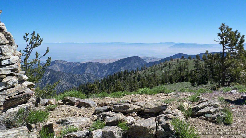
Chumash spirit tower on Sawmill Mountain.

My usual “Pinos to Abel” run starts at the Chula Vista trailhead and follows a dirt service road to the summit of Mt. Pinos (8831′). At the nearby wildlife viewing area it picks up the Vincent Tumamait Trail and heads west, taking a short detour to Sawmill Mountain (8818′) and the Chumash spirit tower, and then continues toward Mt. Abel (Cerro Noroeste). The trail ends at Cerro Noroeste Road, but a short climb up through the pine trees leads to the summit of Mt. Abel (8280+’) and Campo Alto. On the way back I usually run down the North Fork Trail to the spring at Sheep Camp, and sometimes extend the run by descending to Lily Meadows Camp (6250′).
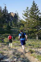
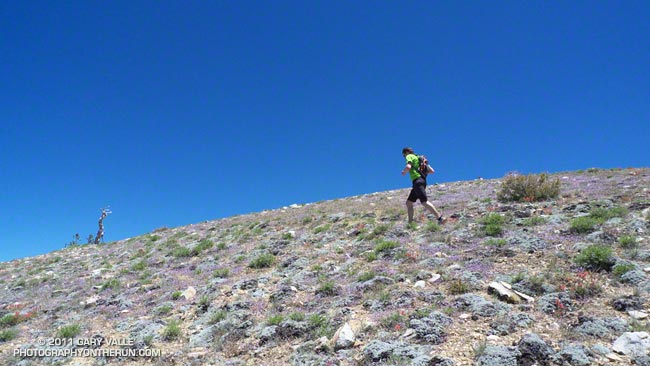
Runners on the Vincent Tumamait Trail below Mt. Pinos.

It’s rare to see other runners doing the Pinos to Abel run. Dan and Dameon first passed me descending from Mt. Pinos. Our paths would cross several times over the course of the morning. They were running in the Mt. Pinos area for the first time and having a great time exploring the trails.

One of those times was on the top of Mt. Abel. They were thinking about hitting Grouse Mountain (8582′) on the way back to Pinos and asked about the route. The use trail to Grouse branches off the Vincent Tumamait Trail near a saddle ENE of the peak and about 0.3 mile west of the North Fork Trail junction. It leads to the northern summit of Grouse’s twin summits in about a quarter-mile.
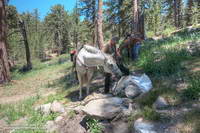
Horse taking a drink at Sheep Camp.
What’s in the bag?

I didn’t do Grouse Mountain today, but did take the North Fork Trail down to Sheep Camp. Today, the plan was to just go a “little way” down the trail below Sheep Camp to see if a particular plant was flowering. Beyond Sheep Camp the North Fork Trail drops like a rock, and it turned into one of those, “I’ll just go a little farther down” kind of things. Before I came to my senses I’d lost nearly 1000′ in elevation while looking for the plant.

After chugging back up to the spring at Sheep Camp, I refilled my Camelbak(TM) and then continued up to the Vincent Tumamait Trail and headed east, retracing my steps to Mt. Pinos, and back to the trailhead.

Some related posts: Thunderstorm, Vincent Tumamait Trail

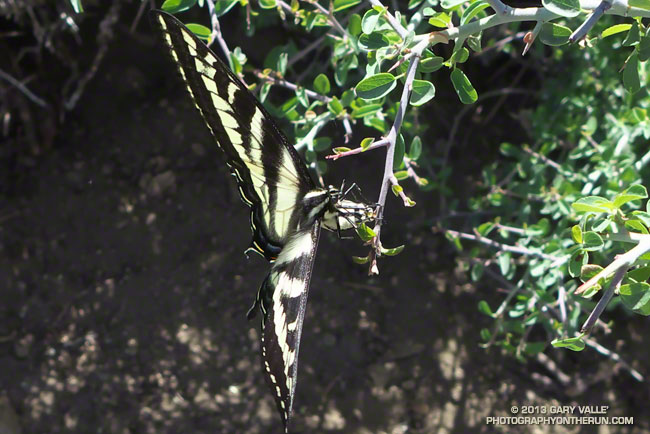
Western Tiger Swallowtail Laying Eggs on Snow Bush

Western Tiger Swallowtail Laying Eggs on Snow Bush

We had run from Mt. Pinos (8831′) to Mt. Abel (~8280′) on the Vincent Tumamait Trail stopping by Sawmill Mountain (8816′) and Sheep Camp (8200′) along the way. Valley temps were forecast be well into the 100s, but here had ranged from a cool 60-something in the shade to the high 70s on the exposed sections of trail — perfect for trail running.

I’d paused at about 8700′ on the way back up Mt. Pinos to take a photo of some phlox, when a western tiger swallowtail flitted past and started to land here and there on a spiney low shrub at the margin of the trail. There was something peculiar about the butterfly’s behavior. Rather than stopping completely, it would hover briefly at one spot and then move to another. There were no flowers on the snow bush where it was hovering, so it wasn’t feeding.

Perhaps 18-24 inches away, the butterfly reacted when I started to move the camera, so I just stood quietly, holding the camera near my waist and took several photos.

A closer look at the photos revealed the butterfly was laying golden-green eggs on the snow bush.

Some related posts: Tiger Swallowtail on Snow Plant, Western Tiger Swallowtail, Vincent Tumamait Trail, Thunderstorm, Atmospheric Dynamics

Air Conditioning

Nearing the summit area of Mt. Pinos

Enjoyed a combination Father’s Day & July 4th visit from Brett over the weekend. Friday we did a fun run at Malibu Creek State Park and today we headed up to Mt. Pinos to get in a cooler, higher altitude run.


In addition to Mt. Pinos (8831′), there are three other peaks along the broad ridge traversed by the Vincent Tumamait Trail — Sawmill Mountain (8818′), Grouse Mountain (8582′), and Mt. Abel/Cerro Noroeste (8280+’). I’ve run past the indistinct path to Grouse Mountain numerous times on the way to Mt. Abel, always commenting “someday I have to check that out.” Finally, today we did.

On the way to Grouse we did the short detour to the top of Sawmill. Since my last visit the Chumash spirit tower on the peak had grown, no doubt from the many fine days and views enjoyed here. This morning the snow-covered mountains of the Southern Sierra could be seen above the haze of the San Joaquin Valley.


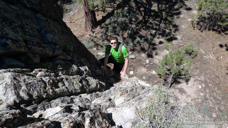
The ascent of Grouse was straightforward. Like Sawmill Mountain, it has two nearly equal height summits. We found a small granite crag northeast of the summit and climbed a short steep route on its west face. It had fun technical moves on mostly good holds, but in running shoes you had to pay attention — especially on the downclimb!

On the way back to Mt. Pinos we stopped by Sheep Camp. The short side trip to this idyllic spot is essentially compulsory. It would be easy to spend the afternoon here, listening to the wind in the pines and the gurgling of the spring; smelling the sun-warmed pine needles; and enjoying the greens, yellows, reds and blues of Summer.

I always feel a little twinge of regret when leaving Sheep Camp, but it was a great day to be on the move, and soon we were back on the trail and enjoying that as well.
 
Some related posts: Vincent Tumamait Trail, Atmospheric Dynamics

Atmospheric Dynamics

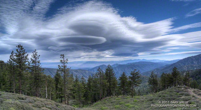
Complex of mountain wave clouds to the north-northeast of Mt. Pinos

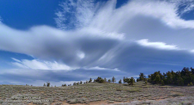
These unusual clouds are a complex of lenticular clouds to the north-northeast of Mt. Pinos, photographed this morning from near Mt. Abel. They were produced by strong south-southwesterly winds blowing across the east-west oriented Emigdio and Tehachapi mountain ranges, north of Los Angeles. Here’s another view of these clouds from near the summit of Mt. Pinos.


The winds were associated with the circulation of an unseasonably strong low pressure system off the California coast. The storm system has resulted in measurable rain as far south as Santa Barbara County, and new rainfall records for the date were set in San Francisco, Paso Robles and Santa Maria.


The photographs were taken during a blustery out and back trail run from Mt. Pinos to Mt. Abel on the Vincent Tumamait Trail in the Chumash Wilderness. At the start of the run, the temperature at the Chula Vista trailhead (8400′) on Mt. Pinos was a chilly 39°F. In exposed areas the wind speed was 20-25 mph with gusts to around 50 mph.

Other than the potential for deadfall, the wind wasn’t too bad in the trees. The Vincent Tumamait Trail was in the best condition I’ve seen in years.

Update June 6, 2011. The low that was off the Central California coast Saturday and most of Sunday and an associated cold front set a new rainfall record for June 5 at Santa Barbara Airport, and produced a few sprinkles and showers in the Los Angeles area.

Some related posts: Mountain Weather, Lenticular Wave Clouds, Mt. Pinos – Mt. Abel Out & Back

Cooler Climes

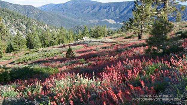
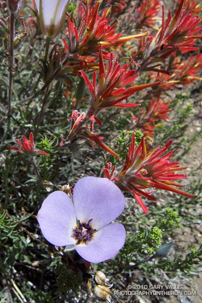
Paintbrush on the Vincent Tumamait Trail

Paintbrush on the Vincent Tumamait Trail

Thursday afternoon the temperature in Woodland Hills hit 107°F. Friday was 103°F, and Saturday 104°F. Weekdays I run in the afternoon, and after running in that heat, I needed to escape to cooler climes. One way to beat the broiling temps was to head for the high country.

There are several higher elevation areas within a couple hours drive of Los Angeles. My favorites are Mt. Baden-Powell (9399′), Mt. Baldy (10,064′), Mt. Pinos (8831′), Mt. San Jacinto (10,834′) and San Gorgonio Mountain (11,499′).


Mariposa and paintbrush
Today the choice was Mt. Pinos. It had been a few weeks since I’d run there, and the driving time to the Chula Vista parking lot on Mt. Pinos is about the same as that to Islip Saddle in the San Gabriels. Also, it’s usually cooler running between Mt. Pinos and Mt. Abel, than between Islip Saddle and Mt. Baden-Powell.

It was a little breezy and chilly up on Mt. Pinos, Sawmill Mountain and Mt. Abel. What a change from during the week. At the start of the run the temperature was about 40-50 degrees cooler than my last run at Ahmanson Ranch.

I did an extended version of the usual 14.5 mile out and back course on the Vincent Tumamait Trail. This variation drops down to Lilly Camp (6600′) on the North Fork Trail before continuing to Mt. Abel. The side trip adds about 6 miles and 1700′ of gain. It was a bit warmer down at Lilly Meadow Camp, but the air conditioning kicked back in once I returned to the main trail.

Some related posts: Running Hot & Cold, Up & Down Mt. Baldy’s South Ridge, Vincent Tumamait Trail, Autumn Trail Running on Mt. San Jacinto, San Gorgonio High Line 2009

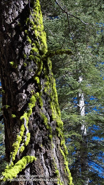
Wolf Lichen on White Fir

Wolf lichen (Letharia vulpina) on white fir

The vibrance of the green caught my eye. Flourishing as a result of a May’s unusually cool, damp, and cloudy weather, the wolf lichen on this White Fir seemed to glow in the morning sun. I was on the Vincent Tumamait Trail, in a dense forest of White Fir and Jeffrey Pine.

The weather at 8500 ft. was idyllic, but here – as elsewhere in the mountains – Spring had been slow to arrive. Scattered patches of snow remained on the forest floor, and the smell of damp soil, warm pine needles, and broken fir limbs filled the air. Exposed by melting snow, the Winter workings of voles wound snake-like across the ground, and I wondered how many mountain canyons had started with the erosion of a vole’s Winter run.

Given its bright chartreuse green color, it isn’t surprising that this lichen (Letharia vulpina) has been used by various indigenous groups to make a dye. Perhaps more of a curiosity is that it is toxic, and has reportedly been used as a poison, and medicinal remedy.

From Sunday’s trail run in the Chumash Wilderness.

Some related trail runs: Fresh Air Traverse, Mt. Pinos – Mt. Abel Out & Back