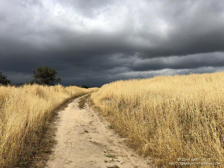
From a run this May in Upper Las Virgenes Canyon Open Space Preserve (Ahmanson Ranch).
Normal rainfall for May at Downtown Los Angeles (USC) is 0.26 inch. This year Los Angeles recorded 0.81 inch in May, according to the NWS .
It was definitely wet and cool! Nineteen days were partly cloudy to cloudy. Ten days recorded at least a trace of rain. The average high was 70 degrees.
Oddly, during our recent drought, above normal May rainfall totals were recorded in 2011 (0.45 inch), 2013 (0.71 inch), and 2015 (0.93 inch). The most rainfall recorded in May at Los Angeles was 3.57 inches in 1921.
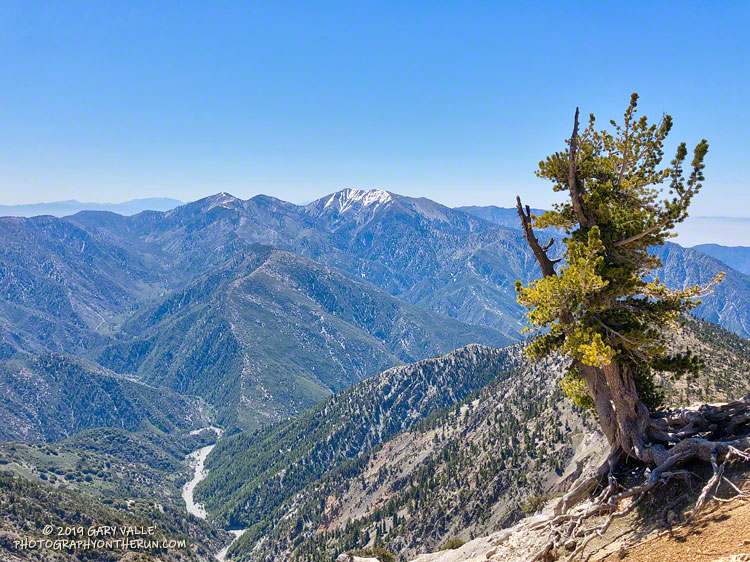
Each year, around Memorial Day, I like to do the out and back on the Pacific Crest Trail from Islip Saddle to Mt. Baden-Powell. It’s fun to see how much snow (if any) remains on Mt. Baden-Powell and to get an idea of how much snow there is on Mt. Baldy, San Jacinto Peak and San Gorgonio Mountain. It’s also a good way to continue acclimating to higher elevation.
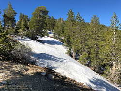
Snow at 8750′ near the junction of the PCT and Dawson Saddle Trail
This year I was a couple of weeks late getting to Baden-Powell, having done runs on Mt. Wilson Memorial Day weekend and Mt. Waterman the weekend after. That’s OK, over much of the holiday weekend it was cold and snowy at the higher elevations of the local mountains. The temperature at the Big Pine RAWS (6964′) was in the thirties all day Sunday, May 26, and it was certainly much colder than that at 9400′ on Baden-Powell.
There were no worries about snow flurries and cold weather today! The weather was perfect for the run. Cool in the shade and warm in the sun.
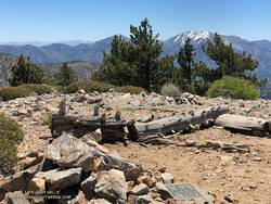
Summit of Throop Peak.
In some places between Throop Peak and Baden-Powell, there was still snow on the trail, but it could be avoided by moving to the sunny side of the crest. The last time there was more snow here in late May – early June was in 2010.
Perhaps because of the more seasonable weather, there were many (mostly) happy people on the trail that, like me, were thoroughly enjoying the wonderful day.
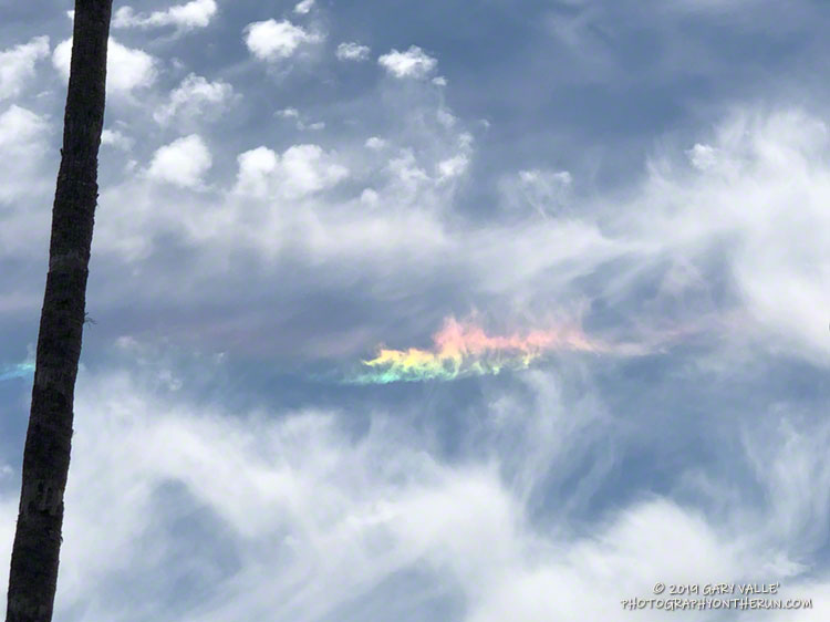
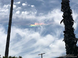
Colors in the sky other than blue and white quickly catch the eye. This afternoon, just before driving over to Ahmanson for a run, I noticed a peculiar band of vivid spectral colors mixed in with a patchwork of high altitude cirrus clouds.
The bright band of color was in the wrong place to be a sundog, but because of its association with the cirrus clouds was likely some type of halo. Ice halos are formed by the refraction and reflection of light by the facets of an ice crystal, such as those found in cirrus.
When I got back from the run I checked online and found Les Cowley’s Atmospheric Optics web site. This site provides a wealth of info about ice halos and other optical atmospheric phenomena. The web site even makes available software to simulate various halos.
Circumhorizontal arc fragment over the San Fernando Valley, near Los Angeles, on May 29, 2019. Click for larger image.
The height of the sun above the horizon, the height of the band of color, and the prismatic sequence of the colors and their brightness all suggest the band is a segment of a circumhorizontal arc.
While not an everyday phenomenon, the circumhorizontal arc is more common at Los Angeles’ latitude than a higher latitude city such as Seattle or London. If 0 degrees is the horizon and 90 degrees is directly overhead, the circumhorizontal arc can only be seen when the sun is higher than about 58 degrees. When the photo above was taken, the sun was at 69 degrees.
When I left the house to drive over to Ahmanson Ranch, the temperature in West Hills was 92 °F. It had been five months since it was that warm.
It’s been my experience that the first hot weather of Spring is often associated with an uptick of snake sightings. Over the past seven days or so, I’d seen a very young rattlesnake and a couple of small gopher snakes, but so far, that was it. With the warm weather, I thought I might see a snake on my run today, I just didn’t expect it to be in this manner.
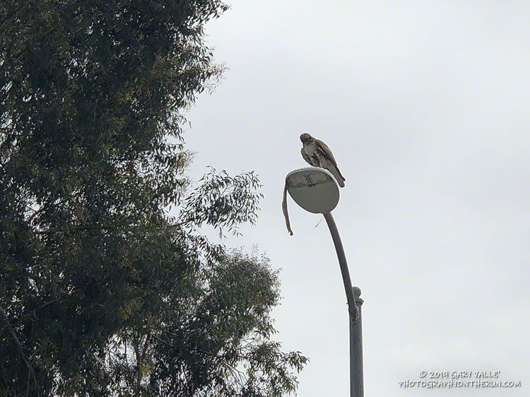
Lost in thought, I was just about to the entrance of Upper Las Virgenes Canyon Open Space Preserve (aka Ahmanson Ranch) when I was startled by a large red-tailed hawk flying from right to left directly in front of me. Something long was dangling from its talons.
I stopped and watched as the raptor, fumbling with a large snake, awkwardly flew onto the top of a street light. The snake was dangling precariously from the light, and the bird seemed to be having a little trouble holding it.
The snake looked relatively heavy-bodied, and at the time I thought it might be a rattlesnake. That brought to mind a story of a hawk somehow dropping a rattlesnake into a car. However improbable, I didn’t want to approach the hawk and frighten it. I have enough problems with rattlesnakes on the ground and don’t need them falling from the sky.
I got what photos I could with my phone and headed out for a run.
You know how it is when you’ve seen a snake — anything sinuous on the trail sets off the brain’s snake alert. During my run I saw a couple of stick snakes, but no real ones. Finishing my run, I pressed the Start/Stop button on my watch and started walking across the parking lot.
Red-tailed hawk waiting to retrieve a dropped gopher snake.
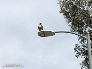
What? I squinted my eyes… Was the hawk still perched on the street light? No way, more than an hour had passed!
Continuing across the parking lot, I could see the hawk was still there, but where was the snake?
Cautiously, I approached the light post. I didn’t want to agitate the hawk or stumble onto an upset rattlesnake.
Sometime during my run, the hawk had dropped the snake — a gopher snake — and was waiting to retrieve it. It lay upside down on the street — sans its head. Rattlesnake or not, the hawk had removed the dangerous bit first.
I’ll be curious to see if the snake is still in the street tomorrow.
Update April 11, 2019. The following day (Tuesday) no trace of the snake remained, but the red-tailed hawk was still there — perched on an adjacent street light. On Wednesday the bird was gone.
The sun had not yet risen and the poppies along Danielson Road were still tightly furled against the morning’s chill. The purl of Upper Sycamore Creek resonated in the canyon below — a wonderful tone that in recent years has too often been squelched by drought.
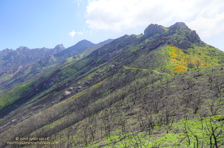
I was running to the Old Boney Trail and the start of the ridge that follows along Boney Mountain’s western escarpment to the massif’s huge summit plateau. Several of the Santa Monica Mountains highest peaks are on this plateau, including the range’s highest peak, Sandstone Peak.
In December I’d climbed this route to check the impact of the Woolsey Fire on the area. From the top of the ridge I’d been disheartened by what I saw. Tri Peaks and Sandstone Peak and much of the top of the Boney Mountain massif were a blackened, barren mess.
Now, three months later, I was headed back to Boney Mountain and would continue to Sandstone Peak for the first time since the fire.
Parked in a turnout on Mulholland Hwy, I finished putting on sunscreen and then pushed the Start/Stop button on my watch to dial in the GPS and pair my HRM. Outside, it was a chilly 43 degrees. Sunrise was nearing and the strengthening March sun was forecast to push temps well into the 70s.
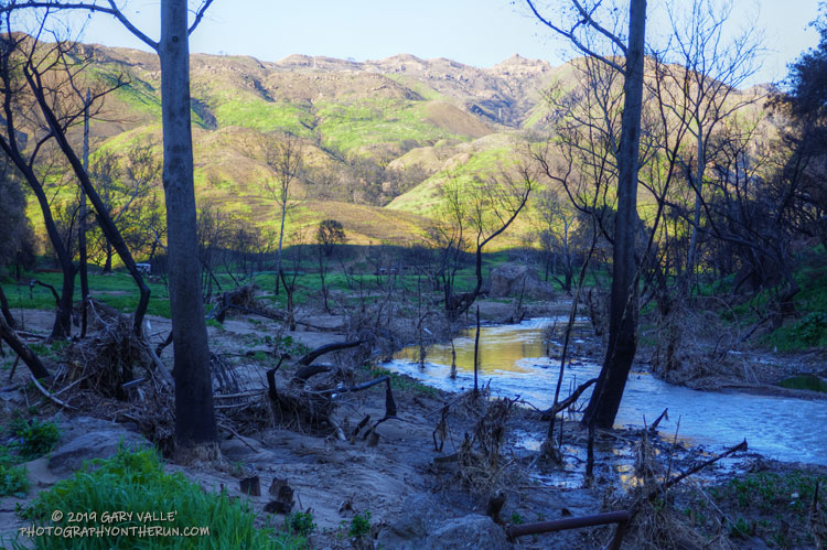
In the aftermath of Woolsey Fire, I’d returned to Malibu Creek State Park to see the wildflowers; gauge the response of the creek to heavy Winter rains; check on the health of the redwoods along the Forest Trail, and assess the ongoing recovery of the burned chaparral.
Today’s run of the Bulldog Loop would be a follow-up to two runs in the park in December 2018, which found a fire-ravaged landscape just beginning the long process of recovery.