I like splashing through streams as much as anyone does, but today I wanted to try and keep my shoes and socks dry. This Winter that’s been surprisingly hard to do.
Weekdays, I often run from the Victory trailhead at Ahmanson Ranch over to Las Virgenes Canyon and back. But it had rained in the Los Angeles area for four days straight. There was just no question that Ahmanson was going to be wet and muddy, and Las Virgenes Creek would be too wide to jump. I’d have to wade the creek crossings — again.
Paintbrush (Castilleja affinis) along Rocky Peak Road
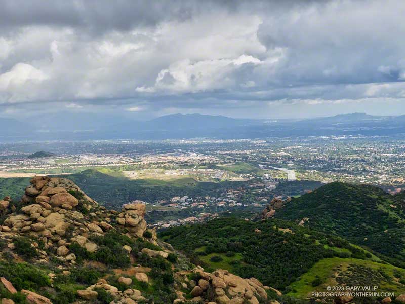
That’s why this afternoon, I was doing an out-and-back run on Rocky Peak Road from the 118 Frwy trailhead. As a result of the area’s sandstone geology, Rocky Peak Road is usually a pretty good place to run during periods of wet weather. For one thing, there are no creeks to cross. Plus, the rocky and sandy road doesn’t have many areas of “glob on your shoes” mud. It also has excellent views of the San Fernando and Simi Valleys and surrounding mountains.
My turnaround point today was the top of the Chumash Trail, which is a little less than four miles from the Rocky Peak trailhead. I sometimes continue past the Chumash Trail another mile to Fossil Point.
Today, there was one short, muddy stretch that could be mostly avoided and a few large mud puddles I could walk around. At the end of the run I didn’t have to switch shoes to drive home!
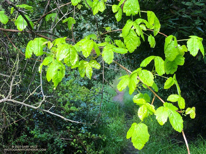
Fresh new leaves of poison oak hanging above the Backbone Trail
When one of the runners coming down the Rogers Road segment of the Backbone Trail saw me coming up the trail, he commented, “At least now we know the trail goes through!”
He was only half-joking. With all the wet weather, trails may not only be wet and muddy but might be flooded, severely eroded, blocked by trees and debris, or destroyed by runoff, mudslides, or slope failures.
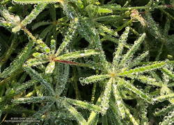
Water droplets on bedstraw (aka cleavers) along the Backbone Trail
It had rained the previous two days, and more rain was forecast in a day or two. I was on this stretch of the Backbone Trail because I wanted to check out a use trail near High Point (Goat Peak) in the Santa Monica Mountains. I could do that by slightly modifying the route described in “Racing the Weather to High Point (Goat Peak) and Back.”
Two use trails connect to the High Point trail near High Point. Both are on the east side of the ridge. When traveling northbound from High Point, the first trail encountered is the “Rivas Ridge Trail.” Its junction with the High Point trail is on a hilltop, a bit more than a tenth of a mile north of High Point. The junction with the other trail — aptly named the “Great Escape” — is about a tenth of a mile north of the Rivas Ridge trail junction and a quarter-mile north of High Point.
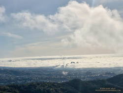
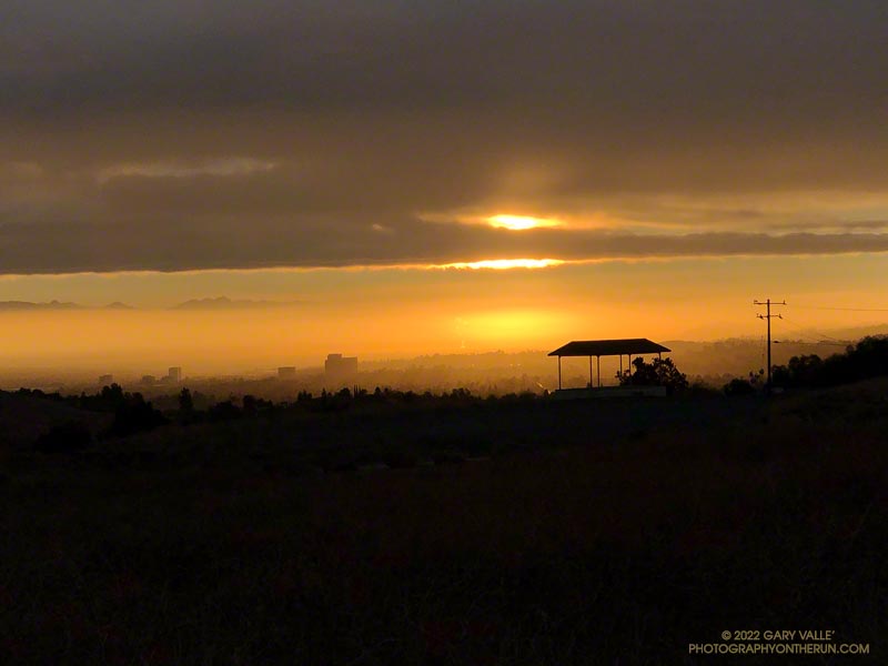
West L.A and advancing marine layer clouds in the Los Angeles Basin.
Instead of doing the run as a pure out and back, on the way back, I took the Great Escape down to the Backbone Trail. This short use trail connects to the Backbone Trail about 0.4 mile south of “The Oak Tree.” It was an interesting trail to explore and only added about a third of a mile to the regular out-and-back route.
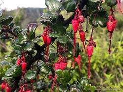
Fuchsia-flowered gooseberry along the Backbone Trail
The condition of the Backbone Trail between Fire Road #30 and The Oak Tree was about what you would expect during such an active rain season. There were a few slimy, slippery spots and some eroded stretches of trail. My shoes and socks were already soaked from the wet grass along the trail by the time I reached The Mud Puddle. This was good because I didn’t waste any time looking for a way around the flooded section of trail — I just waded right in. Nearby, a short section of trail had collapsed in a slide, but there was enough of a shoulder to easily go around it.
With the wet rain season, everything is growing like crazy. This includes poison oak, which was already dangling into the trail in several places. More wildflowers were beginning to bloom. This scarlet-red Fuchsia-flowered gooseberry was blooming along the Backbone Trail near its junction with the High Point Trail.
The paved turnout where I usually park at the Stunt Road trailhead was covered with mud, rocks, and debris. And near the entrance of Calabasas Peak fire road, two large boulders had been dragged to the shoulder to clear the road.
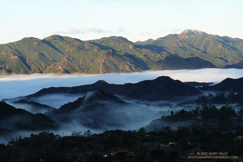
Following another big storm in a Winter of big storms, I was doing the Topanga Lookout Ridge Loop — curious to see what I could see. Nearby Stunt Ranch Reserve had recorded over 10 inches of rain the past three days, and there had been numerous reports of low elevation snow.
The clouds were associated with a front that stalled to the north of Los Angeles, resulting in some surprising and substantial rainfall totals in Santa Barbara and San Luis Obispo Counties. No measurable rain was reported in Los Angeles County by the NWS.
From an early morning run at Ahmanson Ranch (Upper Las Virgenes Canyon Open Space Preserve) on September 20th.
After weeks of dealing with one heatwave after another it was a strange sensation. I was cold. I had on an extra shirt and sleeves, but the slopes of Mt. Islip were deep in shadow and the wind was gusting to 20 mph. The thermometer on my pack read 41 degrees, but the “feels like” temperature had to be in the 30s.
I was in the first mile of an out and back trail run from Islip Saddle to Mt. Baden-Powell. A San Gabriels classic, the route gains (and loses) about 3800′ over 16.5 miles on the PCT.
This morning I was doing the basic out and back, but Mt. Hawkins, Throop Peak and Mt. Burnham are easy peaks that can done along the way. Mt Islip is is a bit more of a detour, but can also be added to the route.
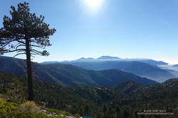
Mt. Baldy and environs from the PCT, between Mt. Hawkins and Throop Peak.
It’s also possible to start the out and back at the Windy Gap Trailhead (5836′) in the Crystal Lake Recreation Area. The distance to Baden-Powell is about the same, but the lower trailhead adds about 800′ of gain.
As I chugged up one of the initial steep sections, I thought about what it must have been like for this year’s participants in the AC100. This year, because the AC100 was an out and back from Wrightwood to Shortcut Saddle, runners got to do this tough segment after running more than 75 miles!
Here is an interactive, 3D terrain view of the out and back from Islip Saddle to Mt. Baden-Powell. The map can be zoomed, tilted, rotated, and panned using the navigation control on the right. Track and placename locations are approximate and subject to errors. Poor weather, and other conditions may make this route unsuitable for this activity.