Castle Peak

Castle Peak and the San Fernando Valley. The San Gabriel Mountains are in the distance.

First published May 12, 2007.

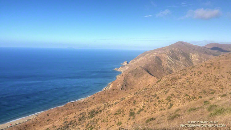
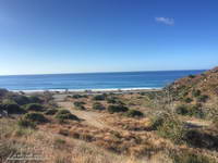
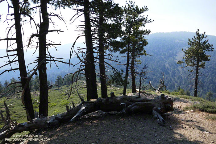
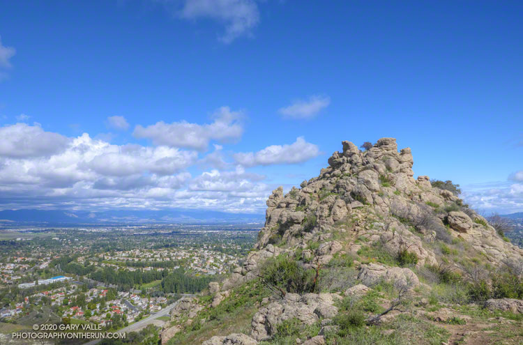
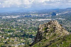
From the rocky summit of Castle Peak I traced the course of Bell Creek into the San Fernando Valley, imagining the broad valley as it might have been a few hundred years before. Bell Creek would have joined Chatsworth and El Scorpion Creeks to form the Los Angeles River. Unconfined, the river would have been a riparian ribbon of willow green, winding its way across the valley and through a patchwork of grassland and sage scrub. Areas of the valley would have been punctuated with oaks, wetlands, and scattered chaparral.

Trail leading to Castle Peak

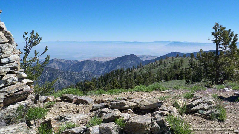
A wall of marine haze would likely be seen near Kaweenga, and threads of smoke might mark the location of other communities. Later in the year, the grasslands would be set afire, promoting next year’s growth, and protecting and enhancing the health of the oaks. As they do today, the San Gabriel Mountains would beckon in the east — but would be antenna free.

Prickly phlox blooming near the summit of Castle Peak.
Prickly phlox near the summit of Castle Peak.

There would have been little noise… No distant horns, freeway drone, or roar of airplanes. Occasionally, a broken voice might have wafted up from the community below. The wind would rustle between the summit rocks, and the loudest noise might be the song of the canyon wren, or screech of the scrub jay.

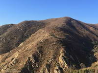
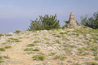
Known by the Ventureño name Kas’élewun, Castle Peak is a landmark of spiritual significance to the Chumash and Gabrielino. Perched at the end of a tongue-like ridge, the peak stood over the multi-cultural community of Huwam, where Chumash, Tongva and Tataviam people lived.

Kas’élewun and the nearby Cave of Munits were places of power and ceremony. Stories would be told of the sorcerer Munits and his death upon the mountain, and of a gruesome creature inhabiting its caves. Some would tremble at the thought, and an angry parent might caution a child to behave, or risk angering the beast on the mountain.

Castle Peak with the San Fernando Valley and Warner Center in the background.
Castle Peak, San Fernando Valley and Warner Center.

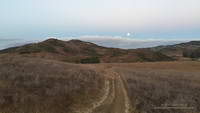
It is a haunting night, and torn clouds race past a silvery moon. From the margin of the village I glance up to Kas’élewun to see a solitary figure briefly silhouetted on its summit. I rub my eyes and only the clouds remain…

Note: Like so many placenames in the Valley,  “Castle” appears to be a corruption of the Chumash name for the peak, Kas’élewun. Rather than alluding to a castle, it can be translated as “tongue,” perhaps because the formation sits at the end of a long ridge that extends out into the valley . The title photograph of Castle Peak is from a run on March 19, 2020.

Ray Miller Training Run

Pacific coast and Mugu Peak from the Ray Miller segment of the Backbone Trail.

There’s magic in the morning, when the owls hoot softly and there is a chill in the air.

I’d started my run from the Wendy Dr. trailhead when there was just enough light to see the trail. The moon was poised low in the western sky, full and bright. As I passed the frame of the Chumash ‘Ap at the Satwiwa Native American Indian Culture Center I’d thought about the Chumash, and how well they must have known this land. It is one thing to visit a place, and quite another to live there.

Moon setting over Rancho Sierra Vista/ Satwiwa.

Today the plan had been to run to the Ray Miller Trailhead and do a little of the Ray Miller 50K course along the way. At the start of the run I hadn’t decided which route I was going to take to Ray Miller — Hell Hill or Fireline. I’d finally opted for Fireline, since that route would follow the last 5 miles of the 50M/50K course and is much more runnable.

I hadn’t run Fireline since the 2013 Ray Miller 50K. With only 7 miles on my legs (instead of 26) it didn’t seem nearly as steep. Once at the top of Fireline, and after doing a bit more uphill on Overlook fire road, I eventually got to the best part of today’s run — the 2.5 miles of scenic downhill on the Backbone Trail to the Ray Miller trailhead on PCH.

PCH at the Ray Miller Trailhead.

The Pacific was painted in a palette of wide-gamut blues and although it was hazy offshore, there were excellent views along the coast. To the west Anacapa and Santa Cruz Islands could just be seen in the ocean haze and Mugu Peak loomed golden in the morning sun. The Ray Miller Trail is very popular and on the way down I passed several runners in the first miles of their morning run.

At the Ray Miller parking lot my Garmin fenix read 12 miles. Just like climbing a mountain, getting to the turnaround point of a long self-supported run is only part of the adventure. I gulped down some water at the water fountain; checked how much water I had left in my pack; ate a Snickers left over from Halloween; and then started the 1000′ climb back up the Ray Miller Trail to the Overlook fire road.

The Mugu Peak Trail starts in upper La Jolla Canyon and climbs up and around Mugu Peak.

The run was going well and at the start of the climb I was thinking about following the 50M/50K course up and around Mugu Peak before starting the trek back to Wendy Drive. By the time I’d reached the top of Ray Miller and had climbed up to the high point of Overlook fire road my mileage appetite wasn’t so big. Following a short side trip into La Jolla Valley, I returned to the Overlook fire road, descended Hell Hill and Wood Canyon, and started working my way back up Sycamore Canyon on the Two Foxes Trail.

At the Danielson Multi-use area there was a large group participating in a guided hike. A familiar runner with a distinctive hat was making his way around the group. It was photographer and ultrarunner Larry Gassan. Larry joined me for the remainder of the run and his stories made the run back up Sycamore Canyon and Upper Sycamore much more interesting.

Pinos to Abel Plus

Western terminus of the Vincent Tumamait Trail.
Grouse Mountain from the Vincent Tumamait Trail near Cerro Noroeste Road

I was glad I didn’t turn around and head back to the car. At the beginning of the run smoke from the Whittier Fire (near Lake Cachuma) covered Mt. Pinos in an ugly shroud. Fortunately, a couple of hours into the run, the wind shifted to the north, removing the smoky veil and greatly improving the visibility and air quality.

Hikers on the Vincent Tumamait Trail near Mt. Pinos.

Even it was smoky, at least the weather was cool. Following the torrid conditions at the Mt. Disappointment 50K the previous Saturday, and hot weather during the week, cool was good.

Mt. Pinos is often a good choice for escaping the triple digit heat of a Los Angeles heatwave. The elevation of the Chula Vista trailhead (8350′) is higher than the highest trailhead on Angeles Crest Highway — Dawson Saddle (7909′) and about 1000′ higher than the popular Inspiration Point (7370′) trailhead on the PCT.

Chumash spirit tower on Sawmill Mountain.

My usual “Pinos to Abel” run starts at the Chula Vista trailhead and follows a dirt service road to the summit of Mt. Pinos (8831′). At the nearby wildlife viewing area it picks up the Vincent Tumamait Trail and heads west, taking a short detour to Sawmill Mountain (8818′) and the Chumash spirit tower, and then continues toward Mt. Abel (Cerro Noroeste). The trail ends at Cerro Noroeste Road, but a short climb up through the pine trees leads to the summit of Mt. Abel (8280+’) and Campo Alto. On the way back I usually run down the North Fork Trail to the spring at Sheep Camp, and sometimes extend the run by descending to Lily Meadows Camp (6250′).

Runners on the Vincent Tumamait Trail below Mt. Pinos.

It’s rare to see other runners doing the Pinos to Abel run. Dan and Dameon first passed me descending from Mt. Pinos. Our paths would cross several times over the course of the morning. They were running in the Mt. Pinos area for the first time and having a great time exploring the trails.

One of those times was on the top of Mt. Abel. They were thinking about hitting Grouse Mountain (8582′) on the way back to Pinos and asked about the route. The use trail to Grouse branches off the Vincent Tumamait Trail near a saddle ENE of the peak and about 0.3 mile west of the North Fork Trail junction. It leads to the northern summit of Grouse’s twin summits in about a quarter-mile.

Horse taking a drink at Sheep Camp.
What’s in the bag?

I didn’t do Grouse Mountain today, but did take the North Fork Trail down to Sheep Camp. Today, the plan was to just go a “little way” down the trail below Sheep Camp to see if a particular plant was flowering. Beyond Sheep Camp the North Fork Trail drops like a rock, and it turned into one of those, “I’ll just go a little farther down” kind of things. Before I came to my senses I’d lost nearly 1000′ in elevation while looking for the plant.

After chugging back up to the spring at Sheep Camp, I refilled my Camelbak(TM) and then continued up to the Vincent Tumamait Trail and headed east, retracing my steps to Mt. Pinos, and back to the trailhead.

Some related posts: Thunderstorm, Vincent Tumamait Trail

A Little Green in Las Llajas Canyon

Las Llajas Canyon, in the eastern Simi Valley

Not everywhere is parched and brown in moisture-starved Southern California. There are a few places that have slurped up a few extra raindrops and are turning green.

This patch of green is in Las Llajas Canyon, in the eastern Simi Valley. Judging from the green growth and dried mud on the road in the upper part of the canyon, there must have been some extra rainfall here. There was even some water in one section of the creek.

Las Llajas Canyon is part of the 50K & 30K courses in the Bandit Trail Runs coming up February 16, 2014 at Corriganville Park in Simi Valley, CA.

Note: The Bandit Trail Runs event is now Rocky Peak Trails.

Some related posts: Bandit 50K 2013 Notes, Las Llajas Longhorns, Chumash-Las Llajas Loop

Bandit Country II

Rocky Peak Park

February is a busy month for SoCal trail runners. The Ray Miller 50/50 is Saturday, February 2; the Bandit 50K/30K/15K/6K is Sunday, February 17; the XTERRA SoCal Series continues February 3 at Mission Gorge; and the Big Baz Winter Trail Run Series continues on February 2 & 16 at Blue Jay Campground.

Yesterday’s run to Mugu Peak included several of the trails on the Ray Miller Course, so this morning I got in some miles on the Bandit trails. The title photo was taken near the high point of the Bandit 50K and 30K courses in Rocky Peak Park.

This year, rather than doing two Chumash – Las Llajas loops, Bandit 50K runners will do a new out and back segment in Tapo Canyon Open Space to Tapo Canyon Rd. Both 50K and 30K runners we’ll run up Las Llajas Canyon — in the distance on the left — and then up from the old oil field to Rocky Peak Road. After a short downhill Rocky Peak Road climbs to “Fossil Point” the high point of the course.

Related post: Bandit 50K 2011 Notes

Air Conditioning

Nearing the summit area of Mt. Pinos

Enjoyed a combination Father’s Day & July 4th visit from Brett over the weekend. Friday we did a fun run at Malibu Creek State Park and today we headed up to Mt. Pinos to get in a cooler, higher altitude run.


In addition to Mt. Pinos (8831′), there are three other peaks along the broad ridge traversed by the Vincent Tumamait Trail — Sawmill Mountain (8818′), Grouse Mountain (8582′), and Mt. Abel/Cerro Noroeste (8280+’). I’ve run past the indistinct path to Grouse Mountain numerous times on the way to Mt. Abel, always commenting “someday I have to check that out.” Finally, today we did.

On the way to Grouse we did the short detour to the top of Sawmill. Since my last visit the Chumash spirit tower on the peak had grown, no doubt from the many fine days and views enjoyed here. This morning the snow-covered mountains of the Southern Sierra could be seen above the haze of the San Joaquin Valley.


The ascent of Grouse was straightforward. Like Sawmill Mountain, it has two nearly equal height summits. We found a small granite crag northeast of the summit and climbed a short steep route on its west face. It had fun technical moves on mostly good holds, but in running shoes you had to pay attention — especially on the downclimb!

On the way back to Mt. Pinos we stopped by Sheep Camp. The short side trip to this idyllic spot is essentially compulsory. It would be easy to spend the afternoon here, listening to the wind in the pines and the gurgling of the spring; smelling the sun-warmed pine needles; and enjoying the greens, yellows, reds and blues of Summer.

I always feel a little twinge of regret when leaving Sheep Camp, but it was a great day to be on the move, and soon we were back on the trail and enjoying that as well.
 
Some related posts: Vincent Tumamait Trail, Atmospheric Dynamics