Born to Run

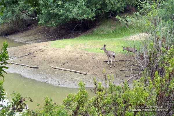
Mule deer at Trippet Ranch in Topanga State Park

Deer seem to be plentiful in the Trippet Ranch area, and are frequently seen at this pond near the parking lot, or grazing among the oaks.

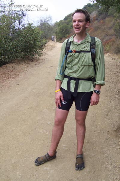
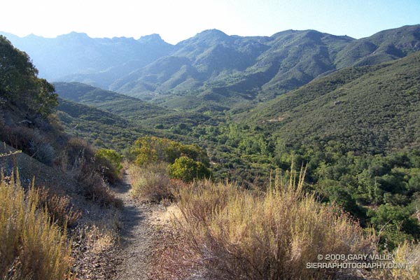
Barefoot trail runnerRunning the Trippet Ranch Loop in Topanga State Park was a pleasant way to unwind after doing the Mt. Disappointment 50K last weekend. This 12.5 mile trail run from the End of Reseda is on a mix of fire roads and single track trail in chaparral and live oak woodland. I like to do the fire roads out to Trippet Ranch, and single track Musch and Garapito trails back. The elevation gain/loss on the loop is about 1800′.

Running up the hill to the Hub on the way out to Trippet Ranch we noticed some barefoot prints mixed in with the mountain bike and running shoe tracks. Based on the gait, the tracks were from a runner — and from the speed they worked up the hill, the runner was feeling pretty good.

At the Hub the bare feet continued on our route, down Eagle Springs fire road, and about 10 minutes later they ended — at a smiling runner wearing Vibram Five Fingers. Returning to running after a year and a half hiatus to start a family, Chris had recently read Christopher McDougall’s Born to Run, and been inspired to try barefoot running.

Here’s a Cesium browser View of a GPS trace of the Trippet Ranch loop from Marvin Braude Mulholland Gateway Park at the southern end of Reseda Blvd., in the San Fernando Valley.

Some related posts: Ferns Along the Garapito Trail, Musch Trail Mule Deer, Garapito Trail Green

Ramping Down for Mt. Disappointment

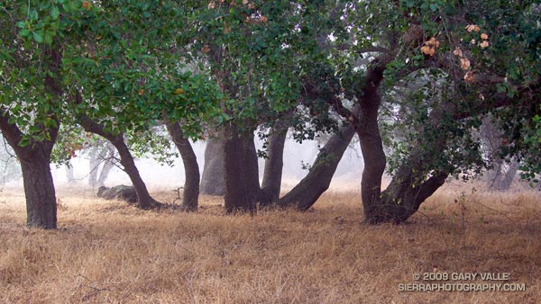
Live oaks at Sage Ranch Park.

Note: The Mt. Disappointment Endurance Run is now the Angeles National Forest Trail Race.

Or should that be ramping UP for Mt. Disappointment? Anyway, started tapering for the Mt. Disappointment run next Saturday. Did the 13 mile Cheeseboro Canyon keyhole loop from the Victory Trailhead of Ahmanson Ranch yesterday, and then stretched the legs at Sage Ranch today. Both mornings were cool, with low clouds and fog — very pleasant!


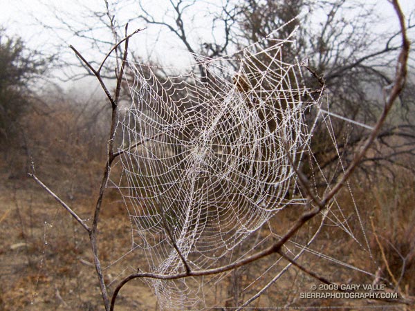
Spider web
Here’s hoping for “not too hot” weather for the race. At the moment, the GFS and ECMWF weather models show a weak upper level trough moving through California in the Friday-Saturday timeframe. Such a scenario should increase the chances of “seasonable” temps for the race — which would still be quite warm, but maybe not crazy hot.

Update Friday Morning 8/07/09. Broad upper level trough over California this morning is keeping things cool. Yesterday the high recorded at Mt. Wilson was 70, and the low overnight was 48! Southern part of the trough is forecast to hang back over Southern California through Saturday, which could result in temps a little BELOW normal for the Mt. Disappointment race. We’ll see!

Related post: Mt. Disappointment 50K 2008 Notes

Summer Returns

Poison Oak along the Blue Canyon Trail.

Poison Oak Along the Blue Canyon Trail.

Since nearly all my weekday runs are in the afternoon, on Summer weekends I usually like to escape the heat and do a run in the mountains — the higher, the better. But today even the mountains were going to be hot. Hot enough that the National Weather Service had issued an Excessive Heat Warning for a combination of heat and humidity that would “create a dangerous situation in which heat illnesses are likely.”

It would be cooler at the higher elevations of the Sierra, but there was good chance of thunderstorms developing along the crest of the Sierra, as well as most of the higher mountains of Southern California. Considering the options, I finally decided to do an early morning run in Pt. Mugu State Park. If I was going to run in the heat, it might as well be a scenic run close to home. Maybe the weather in the mountains would be better next weekend.
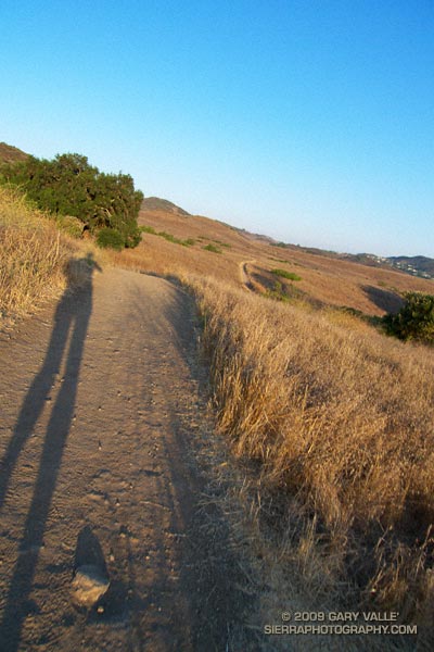

Sunrise on the Satwiwa loop trail.
There are many excellent courses at Pt. Mugu State Park. The course I was doing today is a “backward” variant of the Boney Mountain Half Marathon Course — up the Old Boney Trail, down to the Danielson Multi-use area, up Ranch Center fire road to the Hidden Pond Trail, and then back on the Upper Sycamore Trail. Water is normally available at Danielson Multi-use area and at the start of the Upper Sycamore Trail.

I should have started the run at dawn, but instead ambled along a section of the Satwiwa Loop trail at sunrise. The light was muted and golden, stretching my shadow well out on the trail ahead. Cool trickles of air filled each dip and gully and I wondered how long the temperate conditions would last. Ironically, the last time I had done this course it had been blustery and cold, and there had been snow on the mountains above Ventura. Not today…
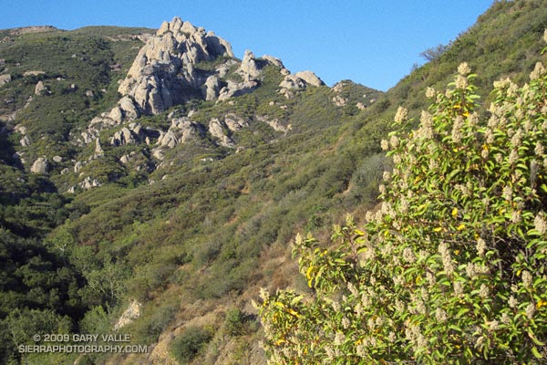

Crags above the Danielson cabin site on Boney Mountain.
It was warm running up the east facing section of the Old Boney Trail, but not yet hot. The crags to the west of the Danielson cabin site, gleamed in the morning sun, and for a brief instant I debated climbing the ridge. The impulse passed, and once over the shoulder of Boney Mountain, I thoroughly enjoyed the (mostly) downhill running through the Boney Mountain Wilderness to the Blue Canyon Trail junction. Cool air draining from the shaded slopes of Boney Mountain kept temps reasonable in the canyon, and the running was good all the way to the Danielson Multi-use area.

Descending to the Old Boney and Blue Canyon trail junction.
At the Multi-use area there is a choice. The coolest and most direct route to the Upper Sycamore Trail is up shaded (and paved) Sycamore Canyon road. But with the Mt Disappointment race looming, I wanted to get in more time and elevation gain, so opted for the longer, more exposed route up the Ranch Center fire road, and then along the ridge on the Hidden Pond Trail. Yes it was hot, and the humidity was up a bit, but it was still scenic and enjoyable in a “I’m not going to let the heat get to me” kind of way. And I knew a water faucet was waiting for me at the point where the Hidden Pond Trail rejoins Sycamore Canyon road, and the Upper Sycamore Trail continues eastward.

Maybe it was the heat, or maybe the coyote had learned to scavenge food from hikers — whatever the case the coyote ahead of me on the Upper Sycamore trail didn’t seem to be in any particular hurry to get off the trail. Coyotes are an odd sort, very intelligent and adaptable, but in my experience not normally any kind of threat.

Usually they will scurry away from a runner. This coyote wasn’t scurrying anywhere. I picked up the pace and clapped my hands, and eventually the animal grudgingly took cover to the side of the trail. But, as it turns out, only about 4 feet off the trail. This was odd, brazen behavior, and I kept a wary eye as I passed.

The final challenge of the morning was the hot climb up to Satwiwa on the Danielson road from the end of the Upper Sycamore Trail. The hill isn’t long or particularly steep, but it faces directly into the sun. With the heat of the day building, it wasn’t easy.

Overall it was an excellent run that would have been even better with an earlier start. Here’s a Cesium browser View of a GPS trace of the approximately 14.5 mile route.

Related post: Big Sycamore Canyon Circuit
Southern California Thunderstorms an El Nino Calling Card?

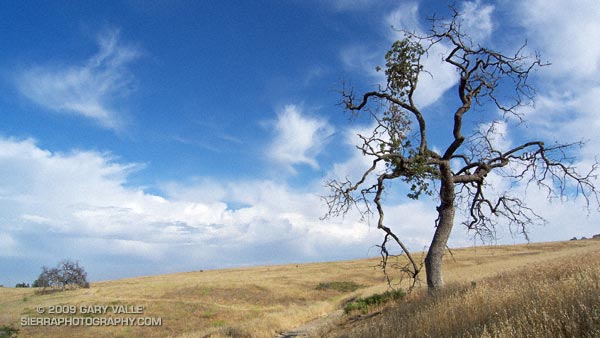
Valley oak on Lasky Mesa, with a line of thunderstorms in the distance.

Off to the south, I heard the distant rumble of thunder. The developing line of thunderstorms had swept through the West Valley about an hour before I began my run at Ahmanson Ranch.

Unusual weather for June. Not so much that there were thunderstorms, but that the thunderstorms were in part the result of an unseasonably strong jet embedded in the base of an upper level low.

It’s a bit of a stretch, but an argument could be made that these storms were a calling card of an increasingly energetic atmosphere, and a developing El Niño.

Several factors point to an increased probability of El Niño conditions developing over the next few months. Among them, Equatorial Pacific SSTs have increased, and the subsurface heat content is the highest it’s been since the El Niño of 2006-07.

But as the short-lived 2006-07 El Niño event demonstrates, an El Niño is more than just warm Pacific equatorial SSTs. Through complex forcing and feedback mechanisms, the atmosphere and oceans have to cooperate on a global scale. Generally speaking the atmosphere speeds up when there is an El Niño, and slows down during a La Nina.

And it looks like the atmosphere may be speeding up. Orbits of the Global Wind Oscillation, a measure of atmospheric momentum, have been shifting upward, in the direction of more energetic values usually associated with an El Niño.

But an El Niño is not a done deal. The climate system is just leaning in that direction. As climate scientist Klaus Wolter has pointed out, in a similar situation in 1973-1975, the climate fell back into a La Niña for another year. At this point it appears we may be diverging from that analog case. We’ll see!

Update June 6, 2009. The April-May Multivariate ENSO Index (MEI) value, released today, has increased by 0.54 to +0.34. As discussed by MEI originator, Klaus Wolter, the 3-month rise of the MEI since January-February is the 4th highest on record for this time of year, exceeded only by the strong Niño of 1997. According to Dr. Wolter, if next month’s MEI rank is at least the same as this month (37th), “it would be unprecedented for it to drop below that high-neutral ENSO-phase range by the end of 2009, virtually excluding a return to La Niña, based on the MEI record since 1950.”

Related links: ENSO Diagnostic Discussion, ENSO Wrap-Up

Point Reyes: Sky Trail Keyhole Loop

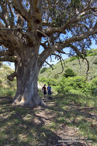
Sprawling eucalyptus on the Coast Trail, near the Sky Trail junction, in Pt. Reyes National Seashore.

Like an Ent, of Tolkien’s Middle Earth, the huge tree hummed softly. We were on the Coast Trail in Point Reyes National Seashore, near Kelham Beach, about halfway into a 14.5 mile hike/run. We’d paused under the sprawling limbs of the Tasmanian blue gum to enjoy its shade and eat a quick snack.


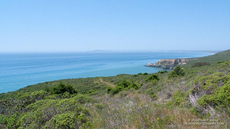
Pt. Resistance and Pt. Reyes from the Sky Trail, near its junction with the Coast Trail.
Rather than the singing of an Ent,  the resonating buzz was from the wing-beats of many thousands of bees, foraging in the tree. But, it was certainly the kind of day an Ent would relish. Instead of fog and chill gales, the day was warm, with just enough of a breeze to tickle a leaf. Below the bluff, a lazy ocean lapped at the shore, barely mustering enough strength to generate an occasional wave.

Awed by the size of the tree, Brett, Amanda and I joined hands to create a crude measuring tape, but our combined reach only encircled about half of the trunk. We estimated its girth at chest height to be about 30 ft! An oak tree this size would be ancient — perhaps several hundred to a 1000 years old. But, eucalyptus followed the Gold Rush into California, and the tree could be no older than about 150 years!

It was comfortable in the shade of the tree, and we were not in a rush to get back on the trail. Near record high temperatures had been forecast, and the expected 70-80 degree temps along the coast and 90-100 degree temps inland seemed about right.


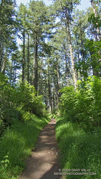
Lush Douglas fir forest along the Sky Trail in Pt. Reyes National Seashore.
We’d started at the Sky trailhead on Limantour Road, and followed the Sky Trail up through lush Douglas fir forest, past Sky Camp, to the Woodward Valley Trail. Here, at an impossibly green meadow, we had turned off the Sky Trail, and followed the Woodward Valley Trail down the shoulder of the ridge to its junction with the Coast Trail.

Now we had to get that elevation back. Nearby a hummingbird dashed and darted among the peach colored monnkeyflowers, and lodged a territorial complaint as we returned to his trail. In a couple of minutes we turned sharply left onto the Sky Trail and began the steep climb back up the hill.

Here’s a NPS map of Pt. Reyes (PDF) and Cesium browser View of a GPS trace of our route.

Tomorrow, a loop through the Presidio and under the Golden Gate Bridge.

Spanish Broom on Calabasas Peak – and the Altiplano?

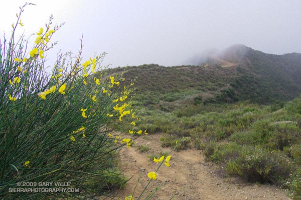
Spanish broom near Calabasas Peak.

Saturday, I’d run in the Malibu Creek Challenge 22K. Today I Wanted to do something low key. Not too long, not too steep, but still a run that would work out the kinks that follow a race. I finally settled on the Secret Trail to Calabasas Peak, a 4.25 mile course with an elevation gain/loss of around 750 ft.


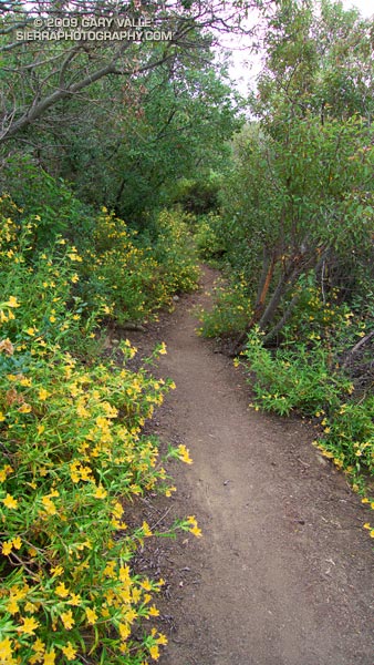
Bush monkeyflower along the Secret Trail.
The low clouds and fog that surged into the Santa Monica Mountains on Saturday had returned during the night. The mustard and monkeyflower along the trail were soaked with dew, and now, so was I. Running felt good, and the two or so miles to the peak passed quickly.

The sun had nearly burned through the morning overcast, and just below the summit of Calabasas Peak, the bright yellow flowers of a Spanish broom seemed to capture and concentrate the subdued sunlight.

Spanish broom (Spartium junceum) is a twiggy, green shrub that originated in the Mediterranean. It is common at lower elevations of our local mountains. According to the California Invasive Plant Council it was introduced as an ornamental in San Francisco in 1848, and planted along highways in Southern California in the 1930s. Its color and fragrance are distinctive.

Prior to running the Inca Trail we did an acclimatization run at 11,000 ft on the altiplano near Chinchero. The very first flower I saw on the run was a Spanish broom! This suggests that Spanish broom could spread to higher elevations of the San Gabriel Mountains, particularly if climate change results in more arid conditions.

Some related posts: Peru Running, Secret Trail to Calabasas Peak, Tapia Bound