Secret Trail Variations

Rock Formations Along Calabasas Peak Fire Road

Rock Formations Along Calabasas Peak Fire Road

There are several good trail runs that start at the trailhead for the Secret Trail on Mulholland Highway in Calabasas. All are a mix of single track trail and dirt road. The longer options listed incorporate segments of the Backbone Trail. Mileages and elevation gain/loss are approximate.

  • Out & Back to Calabasas Peak: 4.25 miles 870′ gain/loss
  • Out & Back to Stunt Road: 7.5 miles 1500′ gain/loss
  • Out & Back to Saddle Peak: 15.5 miles 3300′ gain/loss
  • Secret Trail to Malibu Canyon via Saddle Peak: 14.3 miles 2600 gain’ 3600′ loss


Following yesterday’s Mt. Disappointment training run, I was looking to do something without a huge elevation gain (Kenyon Devore was plenty) and not too long. The out and back to Stunt Road was the perfect run for the day.

Some related posts: Secret Trail to Calabasas Peak, A Long Run Kind of Day, Tapia Bound

Mt. Disappointment 50K 2011 Training Run

Valley Forge Trail (Before scheduled trail work)

Note: The Mt. Disappointment Endurance Run is now the Angeles National Forest Trail Race.

This year the Mt. Disappointment 50K course will be the most difficult to date — 33.1 miles with an elevation gain/loss of 6195′ according to course info. And that isn’t a fanciful elevation gain, exaggerated to hype the race. Ask any Mt. Dis runner, it’s a real number that has left both the experienced and uninitiated crawling up the Kenyon Devore Trail at the end of the race.


To introduce us to the changes in the 2011 course, Gary & Pam Hilliard and Fausto & Cindy Rowlan arranged today’s training run — complete with course markings and an aid station. Pam and Cindy took care of the aid station at West Fork, and Fausto marked the course. (Thank you!!)


The 50K course is similar to last year’s, but instead of running all the way down to Red Box on the Mt. Wilson Road, at about mile 2.5 it turns right onto the Valley Forge Trail and descends 2.7 miles to the Gabrielino Trail. The course then turns UP canyon and follows the Gabrielino Trail 1.6 miles to Red Box Road. From this point, the 50K course is the same as in 2010. The combination of bonus elevation gain, bonus distance, and additional technical trail could increase times in the middle of the pack by 30-40 minutes or more.


On today’s training run we did the first 11 miles of the 50K course down to West Fork, then followed the last 5 miles of the course up the Gabrielino and Kenyon Devore trails to the top of Mt. Wilson. The training run was a little less than half the length, and a little more than half the elevation gain of the 50K course. Working up Kenyon Devore, even having done it numerous times, I was shaking my head and asking myself, “and how is this going to feel after 29 miles?”

About 30 runners participated, many of them sandwiching the training run between races and other difficult runs. Conversations ranged from whether you need to do long training runs to do ultras, to favorite gels and drinks. But one runner’s story surpassed all others. He was in a wheelchair from age 6 to age 19, had corrective surgery, and since then has run nearly 200 marathons or ultras — including a 50K the weekend before the training run!

Note: The title photo is of the Valley Forge Trail.

San Gabriel Mountains Running Adventure

Manzanita Trail below Vincent Gap

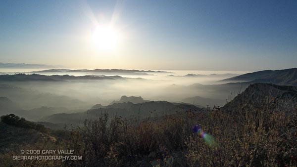
Some runs in the San Gabriels are more adventurous than others, and I’d mentioned to Devy that on this run we would likely have to deal with rock slides, washed out sections of trail, an annoying amount of bugs, and warm — if not hot — temperatures. We might even run into a bear. Devy is the owner of Andes Adventures, and having cut his trail running teeth exploring Peru’s Cordilleras Blanca and Huayhuash, his response was “sounds like fun, let’s go!”

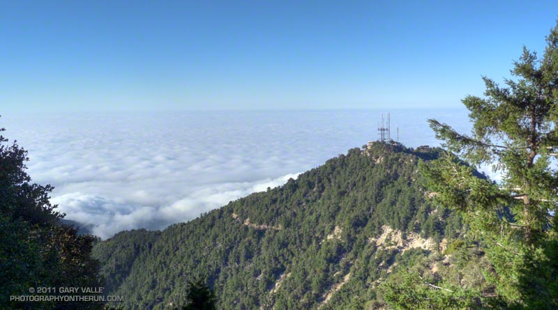
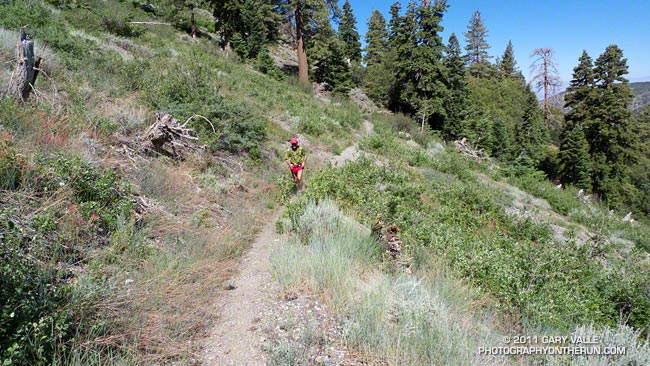
The loop is a favorite, combining sections of the High Desert National Recreation Trail and Pacific Crest Trail. The route starts at Islip Saddle (6650′), descends to South Fork Campground (4560′), then climbs all the way back up the summit of Mt. Baden-Powell (9,399′). From Baden-Powell it returns to Islip Saddle on the PCT. It’s 23.5 miles of scenic single track trail with a cumulative elevation gain/loss of around 5700′. Done as part of a normal week of running, and with stops along the way, it usually takes about the same time to do this course as a hilly 50K race.


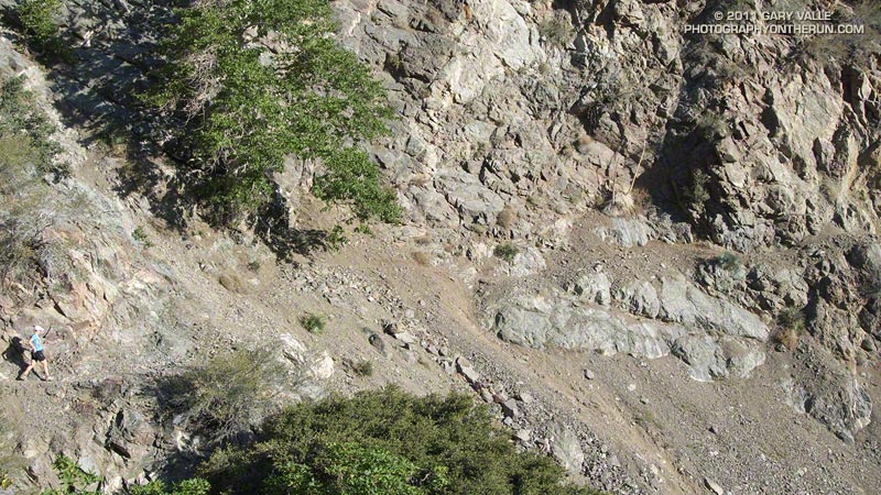
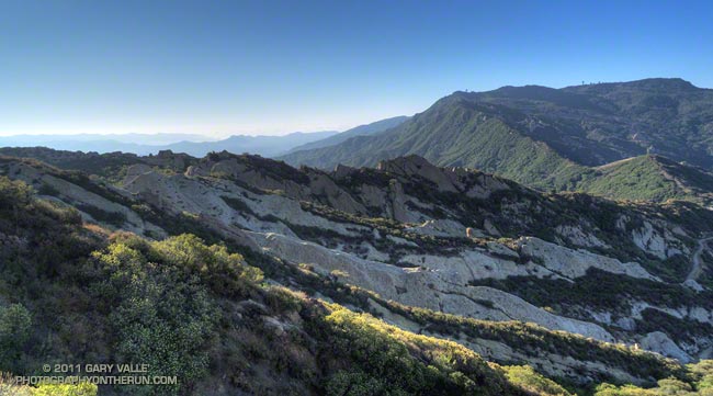
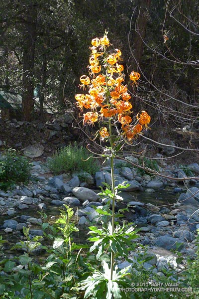
The South Fork and Manzanita trails are part of the High Desert National Recreation Trail. The 5.25 mile long South Fork Trail descends the rugged canyon of the South Fork of Big Pine Creek. Due to the tortured geology of the area — the San Andreas fault zone is nearby — the trail is in a constant state of change. Each time I’ve run it, its condition has been a bit different. It has many rocky sections, and at various points along the trail it is necessary to cross the debris from small rock slides.

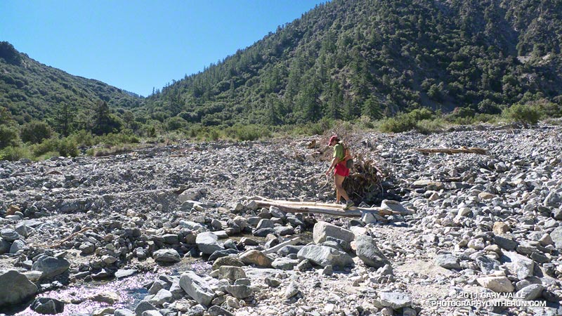
According to the nearby Valyermo RAWS the temperature was around 80 degrees when we rolled into South Fork Campground. Not too bad. It would be near 100 later in the day, and it’s not uncommon for temps to hit the 90’s here by 8:00 or 9:00 in the morning. The (unmarked) Manzanita segment of the High Desert National Recreation Trail starts on the east side of the campground and in about 5.6 miles leads to Vincent Gap (6565′).


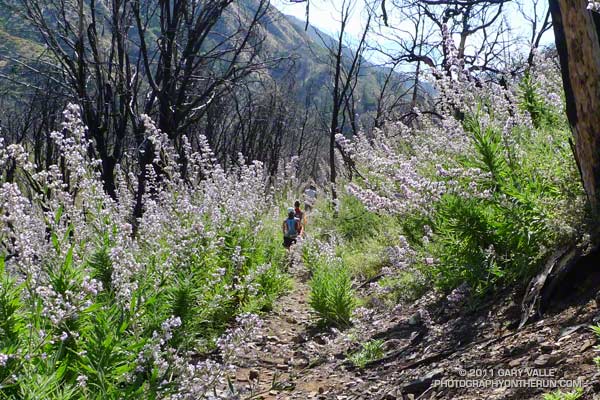
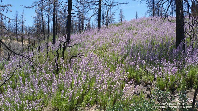
The news of the day was the condition of the Manzanita Trail. Sections of this trail have been washed out for several years, and after December’s record-setting rainfall it seemed the trail could only be worse. Surprise, surprise, the trail was mostly repaired! We didn’t even have to use tree roots for handholds!

Vincent Gap is at about mile 11 on the route, and about 2200′ into the 5000′ climb up Baden-Powell from the desert. As you might expect on a nice Summer weekend the PCT up Baden-Powell was very busy. In part because we wanted to save some for the outstanding running between Baden-Powell and Islip, and in part because we couldn’t go any faster, the pace was pretty leisurely going up the peak.

Ah… the water at Little Jimmy Spring… Like last week, still so cold I thought it was going to give me an ice cream headache.

Related post: Islip Saddle – Mt. Baden-Powell South Fork Loop

Getting Over Poodle-dog Bush Dermatitis

Poodle-dog bush along Angeles Crest Highway, July 30, 2011.
Poodle-dog bush along Angeles Crest Highway

It’s been several weeks now since my bout of contact dermatitis from Poodle-dog bush*. The dermatitis was much better after a week, but took about two weeks to completely go away. I’ve heard this is typical, and several people commented that their Poodle-dog bush experience was similar to mine.

Update July 12, 2011. A running friend who recently did some trail work removing Poodle-dog bush on the Kenyon Devore Trail sent this photograph of a blotchy red rash that developed on his forearm. He first noticed a reaction four days after doing the trail work, and the photograph was taken 10 days after exposure. As in my case, several hours later he commented that the blotchy rash had merged into a more general inflammation with swelling.

Flowers of Poodle-dog bush, a plant that causes contact dermatitis in many people.
Flowers of Poodle-dog bush

The other day I was asked if I’d rather have dermatitis from poison oak or Poodle-dog bush. The reactions are so different, they are hard to compare. Plus, my exposure to Poodle-dog bush was probably a worst case scenario. It was as if the goo from the plant was painted on my arms and legs with a brush, and left to cure. I’m guessing that an equivalent exposure to poison oak would have been much, much worse.  The reaction to Poodle-dog bush seems to vary quite a lot from person to person, and some people have been severely affected.

I was a little worried that the extreme exposure to Poodle-dog bush might make me hypersensitive to the plant, but that doesn’t appear to be the case. About a week after recovering from the dermatitis, I did some trailwork with a group that cleared a section of overgrown trail in Shortcut Canyon. Not only was there Poodle-dog bush, but poison oak and stinging nettle as well. With normal precautions — long pants, long sleeves & gloves — I didn’t have a problem.

As long as you don’t have to wade through it, the oceans of violet flowered Poodle-dog bush in the Station Fire burn area are striking. I’ve heard Poodle-dog bush described as an invasive plant. While it is an unbelievably prolific fire-follower that seems to invade an area after a fire, it is a native California plant. Given just how prevalent it is after a fire, it probably plays a key role in the recovery process, perhaps helping to restore the chemical balance of the soil, as well as providing mulch.

*The taxonomic name for Turricula parryi (Poodle-dog bush) has changed to Eriodictyon parryi. The Jepson Manual: Vascular Plants of California, Second Edition (2012) has returned Turricula to the genus Eriodictyon, as originally described by Gray. According to the Wikipedia entry for Turricula (April 11, 2012), “… molecular phylogenetic analysis carried out by Ferguson (1998) confirms that Turricula should be treated as a separate genus within a clade (Ferguson does not use the term “subfamily”) that includes Eriodictyon, and also the genera Nama and Wigandia; Eriodictyon is the genus to which Turricula is closest in molecular terms, and is its sister taxon.” I use “Turricula” and “Poodle-dog bush” interchangeably as a common name.

Related post: After the Station Fire: Contact Dermatitis from Turricula parryi – Poodle-dog Bush and these additional posts.

Tiger Swallowtail on Snow Plant

A western tiger swallowtail butterfly feeding on the nectar of the flowers of snow plant.

Even though snow plant (Sarcodes sanguinea) is an unusual plant that does not contain chlorophyll and depends on a tree and a fungus for its nourishment, it still has flowers, and the flowers still have nectar.

This was the first time I’d seen any kind of insect feeding on its flowers.

From Sunday’s out & back run from Islip Saddle to Mt. Baden-Powell.

Some related posts: Snow Plant, Western Tiger Swallowtail

Upper Las Virgenes Canyon: Humboldt Lily Run

Humboldt lily in Upper Las Virgenes Canyon

Was looking to get in a short run this morning and decided to check if any Humboldt lilies were blooming in Upper Las Virgenes Canyon.

The last time I’d seen Humboldt lilies bloom here was June 2006, following an unusually wet Spring and a two year period in which Downtown Los Angeles recorded 50+ inches of rain. 

This Spring some months were wet and some months were dry, but December 2010 was the wettest in Los Angeles in 121 years. Add to the mix that the last two water years Los Angeles recorded above average rainfall, and it seemed there was a pretty good chance the Upper Las Virgenes Canyon lilies would be in bloom.

I’d seen lily stalks in other areas in recent weeks, and some blooming Humboldt lilies in the San Gabriel Mountains, but when I checked Upper Las Virgenes Canyon in early May, there had been none. But today there was — right in the middle of thorny patch of blackberry bushes.

Also blooming in the canyon were California wild rose and the non-native plant moth mullein — so named because of the similarity of the flower’s anthers to the fuzzy appearing antennae of a moth.

Related post: Humboldt Lily