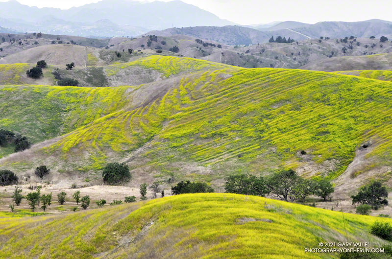
Mustard flowering in Cheeseboro Canyon reveals the underlying structure of a hill.
According to the Dibblee geologic map of the area, the strata are part of the Modelo Formation. And… the Modelo Trail passes directly over the top of the hill.
There was hardly any wind on the drive out to Azusa, and I wondered if the offshore wind event forecast to peak this morning was going to happen. But after winding up Highway 39 to the Windy Gap Trailhead, all doubts vanished. The wind was blowing in powerful gusts that shook the car and my enthusiasm.
Morning light on Islip Ridge
Not only was it windy, it was cold. I briefly debated going down to warmer climes — temps were forecast to be in the 80s and 90s in the valleys — but decided to at least run up to Windy Gap and see what it was like there.
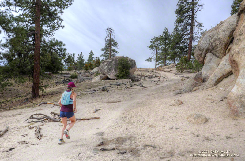
As is often the case, once I got moving, it wasn’t too bad on the Windy Gap Trail. It was very windy in some spots and nearly calm in others – just what you would expect on the lee size of a mountain ridge. One thing was consistent — there was almost no sunlight on the trail.
Ribbon of sunlight on trees along the Windy Gap Trail.
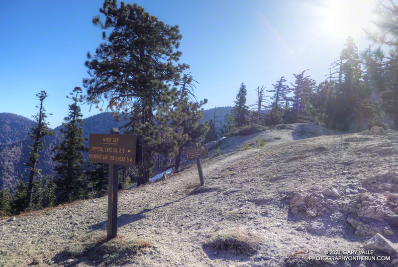
I’d been curious to see how the run/hike to Windy Gap (7588′) from the Windy Gap Trailhead (5836′) in the Crystal Lake Recreation Area compared to starting at the Islip Saddle Trailhead (6650′) on Hwy 2. It turns out the distance using either approach is the same — a little over 2.5 miles. But, the Windy Gap Trailhead is lower, so starting there adds a little over 800′ of gain. Today, that extra gain was helping to keep me warm.
As I worked up the last long switchback I could see and hear the trees on the crest being buffeted by the wind. Reaching Windy Gap I’d was relieved to see that it looked the same as it always has. As shown on fire maps, Windy Gap was not burned in the Bobcat Fire.
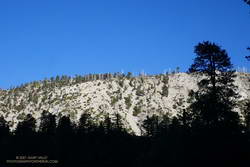
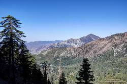
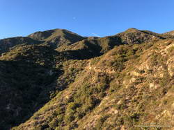
Mt. Islip (left) from the Windy Gap Trail
That relief was short-lived as I was just about knocked down by a gust of wind. I’ve passed by Windy Gap many times, and the wind this morning was the strongest I’ve experienced there.
Later I found that several gusts over 50 mph were recorded at Chilao that morning. Because of terrain effects, I would not be surprised if the gusts at Windy Gap were 60 mph or more. The gusts were “stop you in your tracks, blow you over” strong. And it was cold. The temperature sensor on my pack read 34°F.
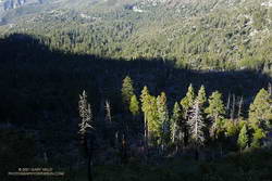
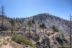
Twin Peaks and Mt. Wilson from the South Mt. Hawkins Trail
Out of curiosity, I ran a short distance along the PCT to see if conditions improved. That was a bad idea. I turned around and got the heck off the crest.
Running back down the Windy Gap Trail, I wasn’t ready to call it a day. It occurred to me that I could run down to the South Mt. Hawkins Trail — the old South Hawkins Lookout service road — and then run up to South Mt. Hawkins. Maybe the old road would be more wind-protected than the Windy Gap Trail.
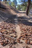
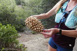
Jeffrey pine cones along the South Mt. Hawkins Trail
And maybe not! Looking at the topography, I could not figure out why the wind on some sections of the South Mt. Hawkins road was so strong. Some gusts were as strong as at Windy Gap. The noise from the wind in the trees was deafening, and amplified my concern about falling trees and flying debris. I did not want to have a “Weather Channel” moment.
Although the wind was strong, the sun was now higher, and some sections of the road were warmed by the sun. This made a big difference. As I wound into and out of the side canyons, the temperature varied from the high 30s to the low 50s. In two places there were small, dirty patches of icy snow.
Ironically, the wind and temperature were relatively moderate on the summit of South Mt. Hawkins! After taking a few photos, I descended the “Ridge Trail” to the South Mt. Hawkins trail/road, and made my way back to the Windy Gap Trail and the trailhead.
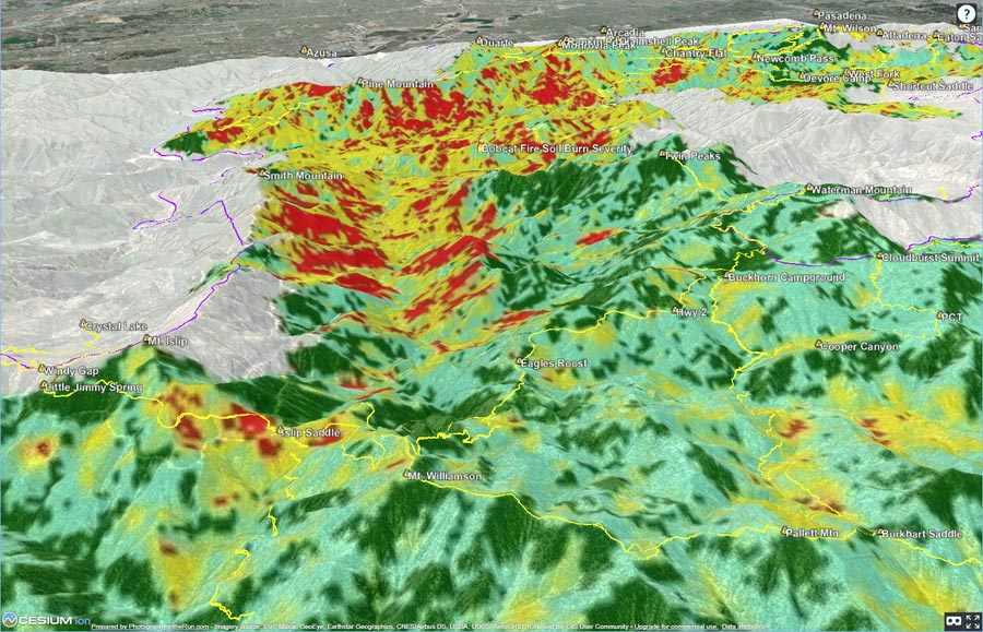
The 3D terrain image above shows an overlay of the Bobcat Post-Fire BAER Soil Burn Severity Map from the Burned Area Emergency Response (BAER) Imagery Support website. The burn severity classes are high (red), moderate (yellow), low (light green), unburned/very low (dark green), and no data (black).
GPS tracks (yellow) of the Pacific Crest Trail and some other trails and routes in the area have been added. An unofficial version of the Bobcat Fire closure boundary (purple) has also been added. The closure boundary data is from CalTopo and appears to be based on Forest Order 05-01-21-03 (PDF). Locations of GPS tracks, placenames, soil burn severity, and the closure boundary are all approximate and subject to errors.
Below are some starting points in the 3D terrain viewer:
Snow — if there has been snow — disappears quickly from the middle elevations of the San Gabriels this time of year. Activity increases with the rising snowline, as visitors eye their favorite trails and peaks.
I was driving up Hwy 2 to Three Points to do a run with Skye. In a normal year we would be doing the Three Points – Mt. Waterman Loop, but for the second time in 11 years, the trails in the Mt. Waterman area had been closed by a wildfire. In 2009, the Station Fire burned 160,557 acres in the San Gabriel Mountains, and just last year, the Bobcat Fire burned 115,796 acres. In several places, including Mt. Waterman, the Bobcat Fire burned terrain that had been burned in the Station Fire.
Coulter pine cone, heavy with resin
With entry prohibited in most of the Bobcat Fire burn area, the Three Points Loop around Mt. Waterman was out for now. Instead, we decided to do a segment of the traditional AC100 course from Three Points to Chilao, and then return to Three Points using the Silver Moccasin Trail.
On today’s run we followed the Pacific Crest Trail northbound from Three Points toward Sulphur Springs Trail Camp. Just before the camp, the PCT splits. We followed the left fork (uphill), and then around to the South Fork Little Rock Creek drainage and Sulphur Springs Road. The PCT parallels the road for about a half-mile, then crosses the road. At this point we left the PCT behind and continued up the road (5N04) to Alder Saddle and forest road 3N17. We continued left (south) on 3N17, bearing left on Santa Clara Divide Road at a fork, and going uphill to Rosenita Saddle.
At Rosenita Saddle we turned right (southwest) onto the Mt. Hillyer Trail. The trail starts at the back of a small parking area. The trail climbs to the high point of Mt. Hillyer, and then descends through large granite boulders in the Horse Flats bouldering area. (If you are a rock climber, bring your shoes!) The Mt. Hillyer Trail intersects the Silver Moccasin Trail near the Horse Flats Campground.
To add a little mileage and elevation gain, we turned right (south) on the Silver Moccasin Trail and continued to Chilao Campground. After saying hi to Chilao, we turned around and followed the Silver Moccasin Trail north, back to Three Points.
The trail run was a little over 13 miles, with a cumulative elevation gain of about 2100′. The high point was about 6200′, on Mt. Hillyer. The route-finding on the loop can be a bit tricky the first time around.
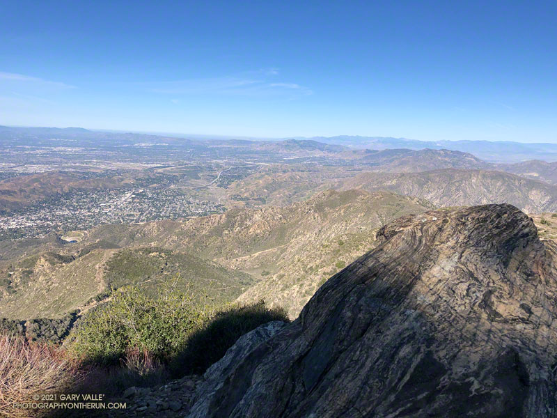
View west from Mt. Lukens, across the Crescenta and San Fernando Valleys.
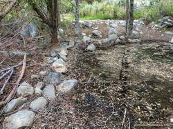
It was a chilly 45 degrees in the canyon, and I had already resigned myself to having to wade across Big Tujunga Creek. But I didn’t even get my shoes wet. The water level was low enough that the large rocks placed across the creek were high and dry.
Low water made it easy to cross Big Tujunga Creek.
It was a good start to what was to be an excellent run and hike. As I gained elevation, it was evident there had been recent work on the trail. Trimmings from the brush along the trail were still green, and in several spots the tread had been freshly manicured. The higher I climbed, the more work had been done. In a couple of places, substantial washouts had been repaired.
Last year, the trailwork ended abruptly about halfway up the trail. Not so this year. An impressive amount of work had been done to clear the trail of a tortuous mix of dead scrub oaks and thorny brush. Without having to crawl over, around, and through those snarls, my roundtrip time to the summit and back was a full hour faster than last year. Many thanks to whoever worked on the trail!
Here’s an interactive, 3D terrain view that shows a GPS track of the route up and down the Stone Canyon Trail on Mt. Lukens. The view can be zoomed, tilted, rotated, and panned. Placemark and track locations are approximate and subject to errors.