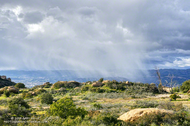
There were many reports of snow, sleet, hail, and graupel around the area yesterday.
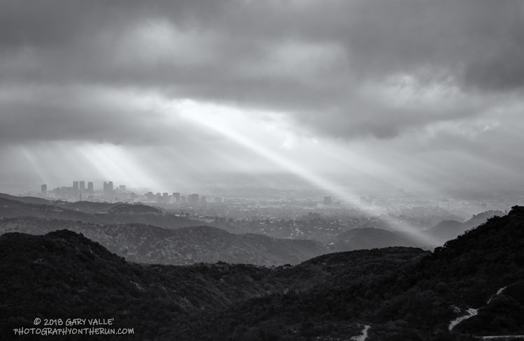
It was definitely cold! The afternoon temperature at 1700′ at the Cheeseboro RAWS was around 42°F. And the temperature was probably cooler in the vicinity of convective showers, such as the one above.
The photograph is from Sage Ranch, at an elevation of about 2000′. I was hoping to see some snow on the ground — but no cloud buildups cooperated.
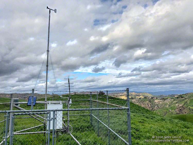
This afternoon’s run was to the Cheeseboro Remote Automated Weather Station (RAWS). The station is perched on the ridge between Las Virgenes Canyon and Cheeseboro Canyon, along the Cheeseboro Ridge power line service road.
It is about 5 miles from the Victory Trailhead of Upper Las Virgenes Canyon Open Space Preserve (formerly Ahmanson Ranch) and one of many good runs from that trailhead into the Cheeseboro – Palo Comado Canyon area.
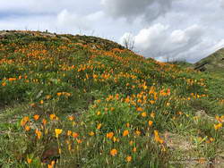
California poppies in Las Virgenes Canyon
Runs in the Ahmanson Ranch area are especially scenic at the moment. Above average rainfall has produced lush green growth in the oak grasslands following the Woolsey Fire. Many of the oaks are beginning to sprout new leaves and poppies and other wildflowers are beginning to bloom. Today there was a nice show of poppies in Las Virgenes Canyon at the connector leading to Cheeseboro Ridge and Cheeseboro Canyon.
Operated by the BLM and NPS the Cheeseboro RAWS (CEEC1) has been in service since September 1995. The station was in the area burned by the 2005 Topanga and 2018 Woolsey Fires and was active throughout each event.
Following are some of the extremes recorded by the station:
• Highest hourly temperature was 115 °F on July 7, 2018.
• Lowest hourly temperature was 32 °F on December 12, 1998.
• Maximum hourly wind speed was 37 mph on October 22, 2007.
• Maximum wind gust was 92 mph on January 6, 2003.
• Maximum daily precipitation was 5.01 inches on February 12, 2003.
So far this rain year (July 1 to June 30), 15.67 inches of rain has been recorded by the station.
Yesterday’s atmospheric river event increased the rainfall total for Downtown Los Angeles (USC) since July 1 to 15.50 inches, surpassing the normal annual Rain Year total of 14.93 inches. Last year, as of February 14, Los Angeles had only recorded 1.97 inches of rain.
As a result of all the wet weather, we’ve also been much cooler this December – February than last year. Since December 1 the average high at Downtown Los Angeles has been more than 7 degrees cooler than last year.
The Climate Prediction Center has just issued an El Nino Advisory for the presence of weak El Nino conditions in the equatorial Pacific. However, it is the interaction of the ocean and atmosphere that matters, and the atmosphere is behaving as if stronger El Nino conditions are present.
For the date, Los Angeles rainfall is at about 165% of normal and there’s still more than two months left in the rain season. We’ll see if the wet trend continues!
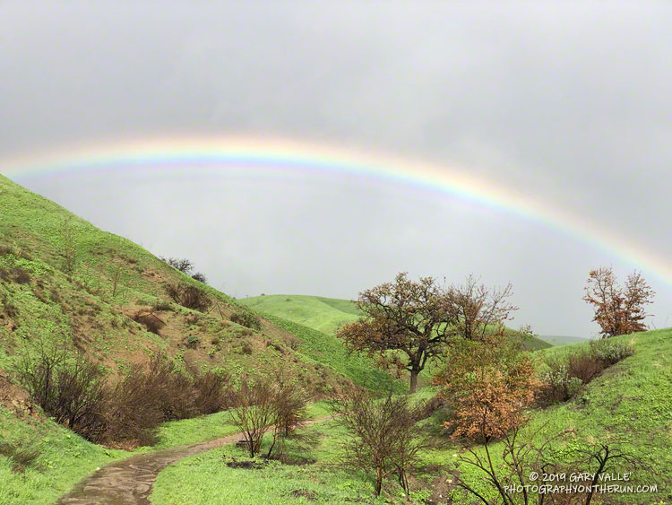
The title photo is from a recent run at Ahmanson Ranch. This open space area was burned in the November 2018 Woolsey Fire.
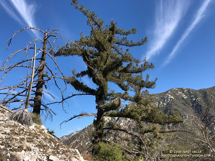
It’s been nine years since the Station Fire burned 160,577 acres in Angeles National Forest. The Red Box – Bear Canyon – Gabrielino loop is a long time favorite adventure run that I’ve enjoyed doing many years before and after that 2009 fire.
The loop was the first I did when the area reopened in May 2011. The trails were in poor shape — overgrown and damaged from flash floods. The notorious fire-follower Poodle-dog bush had flourished in the wake of the fire and was particularly bad along the Gabrielino Trail between Switzer’s and Red Box. Thinking I was “immune” to the plant, I brazenly plowed through it, and as a result spent several inflamed nights trying to sleep in a reclining chair.
Each year Bear Canyon and upper Arroyo Seco recover a little more. Poodle-dog bush is in decline and in many areas nearing the end of its life-cycle. The chaparral, bay trees and oaks are all recovering; and the bigcone Douglas-firs that survived the fire have become more fully-foliaged.
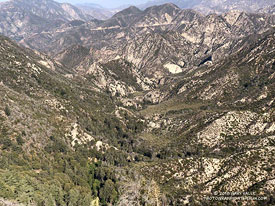
Bear Canyon from the upper Bear Canyon Trail. Click for larger image.
This year Bear Canyon was a little drier than last. The creek was a trickle, disappearing in the sand in some areas and creating small pools in others. The path in the upper part of the canyon, above Bear Canyon Camp, was better defined, but still tricky to follow in some spots.
With the dry conditions, most of the poison oak had already turned red. It was easy to spot, but difficult to avoid. The “stinging nettle” creek crossing higher in the canyon wasn’t as overgrown as last year, but I still managed to brush against a plant or two.
Bear Canyon ends at Arroyo Seco, downstream of Switzer Falls. After turning upstream on the Bear Canyon Trail, I hadn’t run far when I encountered a couple of mountain bikers. They asked me, “is this the trail to JPL?”
This wasn’t the first time that I’d encountered misplaced riders or hikers on this section of trail. Some get misplaced looking for the falls and others mistakenly follow the Bear Canyon Trail down into Arroyo Seco instead of continuing high in the canyon on the Gabrielino Trail. Because of the completion of the restoration of the Gabrielino Trail there were a few more riders on the trail than usual.
The smoke in the Owens Valley was as thick as PCH fog, and I wondered if it would extend into the higher elevations of the Sierra.
From Whitney Portal Road I couldn’t see any of the ridges on Lone Pine Peak and the visibility at the bottom of Horseshoe Meadow Road wasn’t much better. Gradually, as I drove up one long switchback and then another, the smoke thinned. At Horseshoe Meadow the sky in the direction of the crest was a decent Sierra blue, but smoke still spoiled the views down the canyons and over the valley.
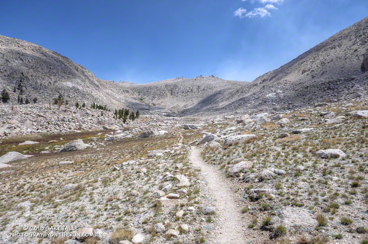
As usual, I parked at the equestrian and overflow parking area for the New Army Pass Trail. From here, the start of the Cottonwood Pass Trail is a 5 minute walk SSW through the trees and downhill. I prefer to do the loop clockwise, going over Cottonwood Pass first, and then New Army Pass later in the run. Late season, I’ve also done the loop using (old) Army Pass, but that is more of a mountaineer’s route and is often blocked by snow and ice.
New Army Pass is fairly high — 12,300′ — and the east side is quite steep near the top. Depending on the year, snow and ice can be an issue, even in mid-summer. When doing the loop clockwise, confirm in advance that New Army Pass will be passable with your level of experience and the equipment you’ll be carrying.