Category Archives: nature|botany

Late Start on the Bulldog Loop

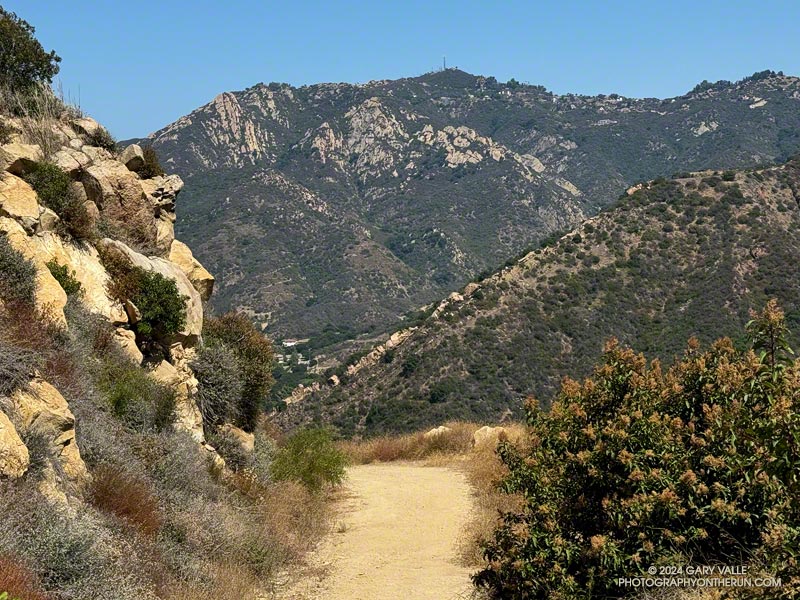
Saddle Peak from the Mesa Peak Mtwy on the Bulldog Loop.

It was near dawn, and I was driving west on the 101 Freeway, going to the Wendy Drive Trailhead to do a run in Pt. Mugu State Park.

I’d just passed Moorpark Road and changed lanes to exit at Lynn Road. Suddenly, the whole car started to shake. The vibration was so intense it took a moment to realize I had a flat tire. [Expletive deleted!] I pulled onto the shoulder of the freeway and cursed again.

After decades without a flat, I had managed to have two in just three weeks. Both were early on Sunday morning and on the way to do a run. The first happened on Angeles Forest Highway while driving to Islip Saddle. That time, I was able to pull into a large turnout and change the tire. Traffic wasn’t an issue. Not so on the Ventura Freeway. The flat was on the driver’s side, and the shoulder was narrow. I called for service.

Apparently, there aren’t many roadside service vehicles out and about before sunrise on a Sunday. An hour and a half later, I was finally headed back to the San Fernando Valley.

I was first in line when Tires Buy Mark opened at 10:00. While waiting for the tire to be patched, I debated a Plan B for a run. Eventually, I decided to do an extended version of the Bulldog Loop. The run would be in the middle of the day, which wasn’t ideal, but it was nearby.  It would be an excellent 16-mile run, even if a little on the toasty side.

At 11:30, I started up the short hill at the beginning of the Cistern Trail. Even though it wasn’t an unusually hot day, the temperature in the sun was already in the 90s, and there wasn’t a cloud in the sky.

It was slightly cooler on the trail along Malibu Creek. There was still water pooled in the creek, and I was glad the seasonal footbridge was in place. A pool near the M*A*S*H site was surprisingly large.
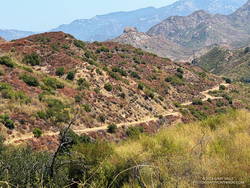
A section of Bulldog Mtwy low on the climb.

I expected it to be warm on the Bulldog climb, and it was. I just pretended I was on the second loop of the Bulldog 50K and continued chugging up the hill. Speaking of which… The Bulldog Ultra was the previous weekend, and a new course record was set in the 50K. Anthony Fagundes did the 29 mile course in the remarkable time of 3:30:03. This works out to an AVERAGE pace of 7:15 min/mile! His race analysis on Strava lists a split on the downhill on Mesa Peak Mtwy fire road at 5:25 min/mile. I don’t have the exact time, but on the first loop it looks like he did the Bulldog climb — from Crags Rd. to Castro Crest Mtwy — in about 30 minutes.

It took me a little longer than that to get up Bulldog. There was a noticeable drop in temperature as I worked up to the top of the long climb. On Castro Crest and Mesa Peak fire roads, the temperature was a relatively comfortable 80-something. The breeze from the ocean was intermittent, but when present, felt like air conditioning.

There weren’t many wildflowers. One interesting exception was Santa Susana tarweed (Deinandra minthornii). It was blooming on the sandstone rocks where the Backbone Trail goes through a prominent rock gateway, east of the Corral Canyon Trailhead.
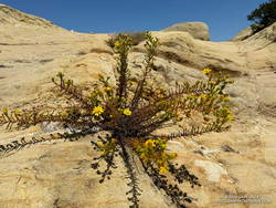
Santa Susana tarweed along the Backbone Trail, east of the Corral Canyon Trailhead.

The plant has a California Rare Plant Rank of 1B.2, which means it is considered “rare, threatened, or endangered in California and elsewhere…” The plant normally blooms after Winter rains. In the ANF technical notes** accompanying its description on SMMflowers.org, B. A. Prigge & A. C. Gibson describe how the plant may produce out-of-season flowers in the Summer, following a wet rain season with late Spring precipitation.

Here is an interactive, high-resolution, 3D terrain view of a variation of the Bulldog Loop that starts at the Cistern Trail. The notations assume the route is being done counterclockwise. An optional out-and-back on the Forest Trail is shown as a red track. Two routes are shown for crossing Malibu Creek in Tapia Park. One route uses a trail that rock-hops across the creek, and the other the bridge on Malibu Canyon Road, near the Piuma Road junction.

The option on Malibu Canyon Road requires crossing the highway twice. There is a pedestrian walkway on the east side of the bridge and a traffic light and crosswalk at Piuma Road. The trail that crosses the creek directly can be a little tricky to find because of other use trails in the area. When there is heavy rain, the flow may be too high to cross the creek safely.

Today, I decided to use the highway. There was a never-ending line of cars headed to and from the beach. It probably would have been faster — and safer — to use the trail. After crossing the creek on the highway bridge, and before doing the climb on the Tapia Spur Trail, I topped off my water at a faucet in the Tapia Day Use Area. Later, I also grabbed a quick drink at the water faucet next to the restrooms at the main Malibu Creek State Park parking lot.

From the main parking lot, it’s about 1.4 miles along Crags Road to the bottom of the Lookout Trail, and from there another three-quarters of a mile back to the Cistern Trailhead on Mulholland Highway.

Some related posts:
A Displaced Bridge, Exceptional Backbone Trail Views, and a Card Table Along the Bulldog Loop
Forest Run
Best Trailhead to Start the Bulldog Loop?
Bulldog Loop Plus the Phantom Loop

**A Naturalist’s Flora of the Santa Monica Mountains and Simi Hills, California by Barry A. Prigge and Arthur C. Gibson

Trying to Use AI to Solve a Malibu Creek State Park Plant Mystery

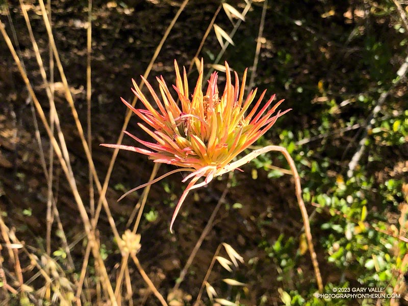
Terminal leaf cluster of Purple Clarkia (Clarkia purpurea), after it has flowered.

Recently, while doing the Bulldog Loop in Malibu Creek State Park, I noticed a peculiar plant about a half-mile up the Bulldog climb. The linear, red-tinged “petals” were unusual in the early morning light. I snapped a photo of it, planning to identify it later.

When I looked at the photo later that day, I couldn’t ID the plant. Hoping to get some hint about its identity, I tried various “AI-powered” searches and apps. This included Google Lens, Bing Visual Search, Pl@ntNet, iNaturalist Seek, PlantSnap, Flora Incognita, LeafSnap, and others. The most common matches were air plants such as Tillandsia ionantha and various species of paintbrush.

This wasn’t a huge surprise. The AI-based applications were having the same problems I was having — they were not “familiar” with this particular stage of the plant’s life cycle. They also were not keying on an important element of the image.

After a few days without any progress identifying the plant, I headed back to Malibu Creek State Park to take a closer look at the plant.

That turned out to be more challenging than expected. Even though I had the plant’s GPS coordinates, the time of day was different, with different lighting. The plant was also less colorful than before. I walked up and down a 30-yard stretch of Bulldog fire road several times before finally seeing it.

Once located, it didn’t take long to find examples of the plant at an earlier stage of development. In one case, with leaves on the stem and another with leaves and a flower. This helped solve the mystery.

It turned out the plant was one with which I was familiar — Purple Clarkia (Clarkia purpurea). The title photo is after the plant has flowered and all but a terminal cluster of leaves on the stem have wilted. The 8-grooved, elongated-football-shaped structures intermixed with the leaves are ovaries. These are distinctive. A human expert would have immediately zeroed in on these.

The flowers of Purple Clarkia are usually much larger than seen here. They are typically purple-pink with a wine-red spot on each of the four petals. However, the color of the flowers varies, and wine-colored flowers are not uncommon. The size of the flower also varies. Jepson mentions that the subspecies intergrade extensively.

Using the photo of the plant in flower, some of the AI-based apps identified the genus as Clarkia and/or the species as purpurea, or at least included Clarkia among their suggestions.

Sculpted in an Elfin Forest

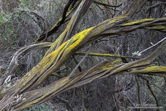
Gold dust lichen on big pod Ceanothus along the Garapito Trail.

Sculpted in an elfin forest, this fused, twisted and fluted trunk of a big pod Ceanothus is accented with gold dust lichen, a lichen of the genus Chrysothrix — probably C. granulosa or C. xanthina.

From this morning’s Trippet Ranch Loop trail run from the End of Reseda (Marvin Braude Mulholland Gateway Park).

Manzanita Leaf Galls and Aphids

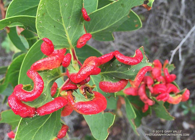
Manzanita Leaf Galls and Aphids

Was running down the Chamberlain segment of the Backbone Trail Saturday, when a flash of bright red on a manzanita bush caught my eye.

Very bizarre, as nature often is. At first glance I thought the bulbous red objects on the manzanita were some kind of larvae, but on closer inspection could see it was a swelling of the leaf. My first thought was some kind of viral infection.

What they turned out to be are aphid induced leaf galls. Galls generally provide a protective habitat and enhanced food source for the inducing species and their tenants.

Related post: Scrub Oak Apple Gall

If It Looks Like a Hummingbird and Flies Like a Hummingbird…

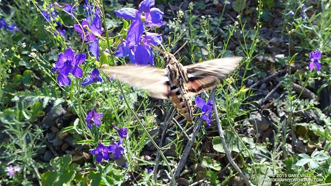
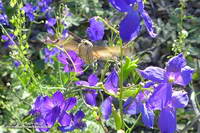
hummingbird moth feeding on spreading larkspur

I was on the way back from Mugu Peak and about four hours into my run. I’d stopped at an exposure of Miocene age shale along the Upper Sycamore Trail. The gray-brown rubble is home to an intensely blue-purple wildflower called spreading larkspur (Delphinium patens ssp. hepaticoideum).


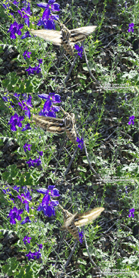
Click for animation
I’d just snapped a series of bracketed exposures of one patch of the flowers when suddenly there was the bumblebee-on-steroids buzzing of a hummingbird in front of me.

At least I thought it was a hummingbird. It sounded like a hummingbird and was about the right size. Its blurred wings were shaped like a hummingbird’s. It flew with the precision of a hummingbird, darting from flower to flower, deftly feeding on each blossom’s nectar using its oddly shaped beak.


Click for larger image
But it wasn’t a hummingbird — it was a hummingbird moth — a white-lined sphinx (Hyles lineata). I’d read about hummingbird moths, but to have one suddenly appear and start feeding on a larkspur plant I happened to be photographing was extraordinary.

Apparently the problem of feeding on the high-energy nectar in certain types of flowers is sufficiently definitive as to have produced a very similar evolutionary solution in wildly different organisms.

The sphinx moth is described as flying like a hummingbird, but which lineage produced this elegant solution first? It may have been the moth! A trace fossil of a sphinx moth found in Early Eocene Asencio Formation of Uruguay appears to predate the earliest known Oligocene fossils of hummingbird-like birds! In any case it appears that both hovering moths and birds co-evolved with the flowering plants on which they feed and pollinate.

Related post: Hummingbird Stories

Just Me and the Meadowlarks

La Jolla Valley from Mugu Peak

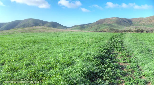
I had to stop running and take it all in. Soaked by recent rains, La Jolla Valley was renewed and green. To my right a meadowlark warbled its silvery call, and in the distance at first one and then another bird followed in song.

Isolated for weeks by the closure of Pacific Coast Highway and Pt. Mugu State Park, the La Jolla Loop Trail was trackless and in places overgrown. Wet with dew, the mustard choking the trail had soaked my shoes and socks.

Sprinkled among the greens were whites, purples, pinks, reds and yellows of the first stage of a wildflower explosion. A sweet scent drifted on the breeze. Running in the valley was like running in a remote and seldom-visited wilderness.


There had been much to see on the run from Wendy Drive. Before the Park closed in December I had surveyed the aftermath of the December 12 flash floods in Sycamore Canyon, Blue Canyon and Upper Sycamore Canyon. One of the reasons for today’s run was to see what had happened in this part of the Park.

Wood Canyon parallels Sycamore Canyon and is probably its largest tributary. Based on the height of the debris piled against the trees, the flash flood that roared down Wood Canyon must have been astounding! Looking down the stream course reminded me of flash floods I’d seen on creeks and streams during the El Nino’s of 1997-98 and 2004-2005.


Bowl-shaped La Jolla Valley is an independent drainage, separate from Sycamore and Wood Canyons and their tributaries. It acts like a huge rain collector and funnels all the runoff down deeply cut La Jolla Canyon to the ocean. In La Jolla Valley all the creeks were scoured by the flash flooding and the small footbridge west of the group campground was washed out. The vernal stock pool on the Loop Trail above La Jolla Canyon was once again full.


It’s no surprise that the December flash floods washed out the trail in La Jolla Canyon. I can’t think of a steeper and more narrow canyon in the park.  The flow must have been phenomenal! The La Jolla Canyon Trail is closed and barricaded at its juncture with the Loop Trail. Here are archived maps of Rancho Sierra Vista/Satwiwa and Pt. Mugu State Park originally from the NPS Santa Monica Mountains web site. Also see the Pt. Mugu State Park maps on VenturaCountyTrails.org.

In recent years the drought has dramatically reduced the number and variety of wildflowers blooming in the Santa Monica Mountains. Not so this year. Since October 1 Camarillo Airport has recorded 7.0 inches of rain, which is about 92% of normal. Last year over the same period only 0.84 inch had been recorded.


Many species are already blooming and many more will be blooming soon. On today’s run I saw shooting stars, encelia, lupine, nightshade, monkeyflower, paintbrush, California poppy, bladder pod, wild hyacinth, phacelia, wishbone bush and more. A small patch of chocolate lilies were in bloom along the eastern segment of the Loop Trail.

La Jolla Valley and Mugu Peak can be busy places, but today it was just me and the meadowlarks.

Update February 3, 2015. According to the Ventura Star six miles of Pacific Coast Highway from Las Posas Road to the Sycamore Cove Day-use Area reopened today providing access to Pt. Mugu State Park from the south. Note that the La Jolla Canyon Trail is still closed and likely to be for some time.

Some related posts: Pt. Mugu State Park Debris Flows and Flash Floods, Wendy Drive – Mugu Peak Challenge, Laguna Peak, La Jolla Valley, and the Channel Islands