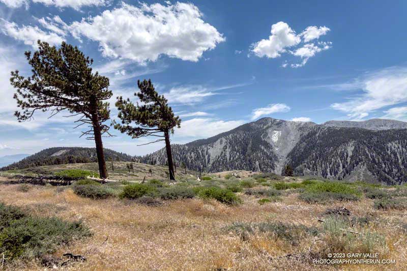
It’s been about a month and a half since Tropical Storm Hilary soaked Southern California with record-setting rainfall.
The unusual amount of Summer rain has resulted in a second Spring at Ahmanson Ranch, with some plants behaving as if it were March or April.
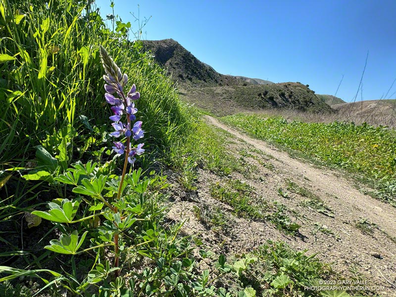
Not only are plants growing as if it were Spring, some are flowering. The lupine pictured above usually blooms at Ahmanson Ranch in March, April, and May. Now, as a result of T.S. Hilary’s rain, it’s flowering in October!
Those plants that usually flower in the Fall, such as telegraph weed, vinegar weed, and common sunflower, are much more widespread than usual.
Spring-like conditions are present in many areas of Southern California. On Sunday, I ran the Phantom Trail in Malibu Creek State Park. Some sections were so overgrown that it was challenging just to navigate the trail, much less run it. Ticks were also a problem.
I took a few tentative steps into the dense brush and stopped. It was just too overgrown. I backtracked a few feet to the overlook at the top of Lake Vista Trail and reconsidered. If it was this overgrown all along the ridge, it was going to take a long time to get to the summit.
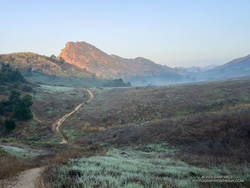
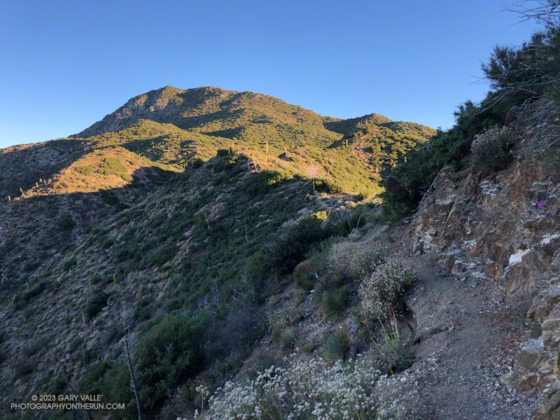
First sun on Lake Vista Butte and Ridge.
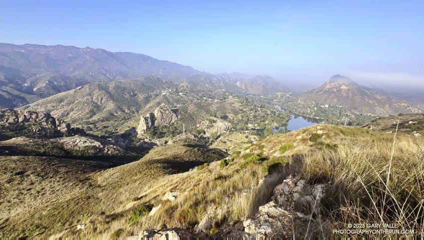
I was trying to get to the top of “Lake Vista Butte,” a high point along a prominent ridge of volcanic rock that stands between Reagan Ranch and Malibu Creek. The ridgeline and summit provide a unique perspective of Malibu Creek, Century Lake, Goat Buttes, Malibou Lake, and much of Malibu Creek State Park.
I dove back in, walking on top of a dense mat of dried deerweed and then working around a thicket of laurel sumac. Even if it was buried in a tangle of chaparral, it helped to know there was a path along the ridge. As I worked east along the ridgeline, the path would briefly emerge, only to disappear under another mass of scrub and brush.
Wishbone bush blooming along Lake Vista Ridge.
In places, enterprising orb-weaver spiders had constructed intricate webs across remnants of trail. Their artwork was easy to spot in the morning sun, and even though their webs blocked the trail, they could not be disturbed. At least the spiders were out in the open. A rattlesnake could be anywhere in the rocks and brush and might not be kind enough to give a warning.
The route along the ridge wasn’t technically challenging, but like the spider’s web, required patience to complete. Low in the sky, the morning sun complicated the route-finding, making it more difficult to see sections of the trail and link them together. Far outweighing these inconsequential difficulties were the exceptional views of Malibu Creek State Park’s crags, canyons and mountains while traversing the ridge.
The Forest Trail along Century Lake.
As often happens, the return to the Lake Vista Trail took less time than the ascent. Back at the overlook, I began retracing my steps down the Lake Vista and Deer Leg Trails and over to the top of the Cage Creek Trail. I was headed down to Malibu Creek to check the condition of the Forest Trail.
The Forest Trail is the “Walden Pond” of Malibu Creek State Park. Bordered by Century Lake on one side and the steep slopes of a rocky butte on the other, it is a contemplative place and one-of-a-kind habitat. It is home to towering coast redwoods, sprawling live oaks, sweet-smelling California bay, and water-loving California sycamores. Deer, ducks, bullfrogs, herons, hawks, falcons, and other wildlife may be seen here.
Fallen trees have been accumulating on the Forest Trail for months. On my last visit, following T.S. Hilary’s passage, another large oak had fallen near the beginning of the trail, making it unusable. Today, I was happy to find that the trees had been cleared, and the Forest Trail could be followed to its end at Century Lake Dam.
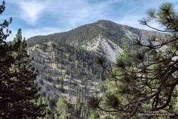
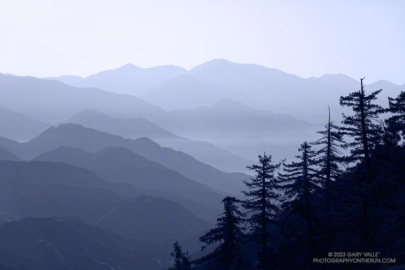
Strawberry Peak from the Strawberry Trail, near Lawlor Saddle.
Last weekend I’d considered doing a run from Red Box, but finally decided to go to higher elevation and do a combination run and climb.
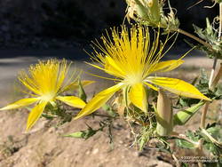
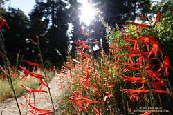
Blazing star.
The puzzle to solve this weekend was to find a run that was closer to home, higher than the Santa Monica Mountains, and had a “decent amount” of elevation gain. The solution put me right back at Red Box, doing two of the most popular peaks in the Front Range — Strawberry Peak (6164′) and San Gabriel Peak (6161′).
The main difference is that the 2018 run/hike was on a cool day in March, rather than a hot day in August. In 2018, I did San Gabriel Peak first, then Strawberry. The order didn’t matter. The temperature on both peaks that day was mostly in the 40s.
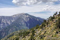
Mt. Disappointment (left) and Strawberry Peak from the San Gabriel Peak Trail.
Today, it was essential to do Strawberry first, and get started early. The use trail between Lawlor Saddle and Strawberry’s summit faces south and east, and has very little shade. It’s steep and strenuous an no fun at all in the hot sun.
I left the Red Box parking lot at about 6:00 a.m. On the way up, the temperature ranged from the mid-50s to the mid-70s. On the way down, in some places it was already in the 90s. While it was hot in the sun on the upper part of the mountain on the descent, the traverse around Mt. Lawlor on the Strawberry Trail was still mostly in the shade and a relatively cool 75 to 80 degrees.
San Gabriel Peak isn’t the solar oven that Strawberry is. Much of the Bill Riley/Mt. Disappointment Trail faces north and a scrub oak forest provides some shade. Continuing up San Gabriel Peak after doing Strawberry, the temps were generally in the low to mid-80s.
Angeles Crest Highway was still closed between Red Box and Vincent Gap, and the heatwave continued. I was trying to decide where to run.
I briefly considered the Circuit Around Strawberry Peak, but yesterday at 10:00 a.m., the “in-the-shade” temperature at Clear Creek was already 92°F, and the “in-the-sun” fuel temperature 109°F. By 1:00 p.m., the fuel temp reached a scorching 122°F!
Although trailheads such as Three Points and Islip Saddle couldn’t be accessed using Angeles Crest Highway, the highway was open from Wrightwood to Inspiration Point and Vincent Gap. After seeing the temps at Clear Creek, it took about two seconds to make the decision to head to the San Gabriels’ high country.
sulfur flower-lined section of the PCT east of Inspiration Point
From Inspiration Point (7,365′), I ran east on the PCT about 7 miles to the North Backbone Trailhead on Mt. Baldy. Over most of that stretch, the temperature was a blissful 60-something degrees. Other times, I’ve driven to this trailhead — which requires a high-clearance vehicle — or run to the trailhead from Wrightwood. But the run along Blue Ridge is a favorite. It is especially scenic, with fantastic views of Mt. Baden-Powell, Iron Mountain, Pine Mountain, and Mt. Baldy.
Crossing the top of a chute on Mt. Baldy’s North Backbone.
Following a short descent, I resumed climbing the steep, somewhat loose ridge. After about ten minutes, I scrambled onto the crest of the ridge and crossed the top of a prominent, rocky chute. More than a thousand feet below, avalanche-hardened snow gleamed white in the sun at the base of the chute.
Another 10 minutes of climbing and I reached the Pine Mountain Juniper. Straddling the rocky crest at an elevation of about 9000′, this stalwart tree is estimated to be 800 – 1000 years old. It is a remarkable tree in a remarkable location. Except for one short, steep, eroded section, the remainder of the trail to the top of Pine Mountain (9648′) was relatively straightforward.
Dawson Peak and Mt. Baldy from Pine Mountain’s south summit.
Pine is the second-highest peak in the San Gabriels and has excellent views of the surrounding terrain. It is higher than Mt. Baden-Powell (9399′) and Dawson Peak (9575′) but a few hundred feet lower than Mt. Baldy (10,064′).
From Pine Mountain, the North Backbone trail continues over Dawson Peak another 2.5 miles to Mt. Baldy. There was still a long ribbon of snow along the east side of the upper North Backbone, but it looked like the trail might avoid it. I would have liked to confirm that, but today the top of Pine was my planned turnaround point. As it was, with the warm weather, I thought I might run short on water on the return to Inspiration Point.
Leaving Pine behind, I started back down — jogging when it made sense — but trying not to do anything stoopid. On the way down, I kept reaching behind me and squeezing the bladder in my hydration pack. I guess I was hoping that it would magically be more full than the last time I checked. It never was.
San Gabriel beardtongue along the PCT on Blue Ridge.
Back at the North Backbone Trailhead, and definitely low on water, I decided it was a good time to run the dirt road back to the top of the Acorn Trail and see how much shorter it was than the PCT. The answer was not much — only about a tenth of a mile.
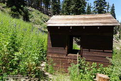
I’d been willing to push the water envelope because it had been a heavy snow year. I expected the spring near Guffy Camp would probably be running. I’d passed the side trail to the spring a bunch of times but never ventured down the steep slope. My impression was that the spring was often low or nearly dry. This time when I reached the side trail, I headed down.
Pumphouse at Guffy Spring, surrounded by giant larkspur.
And down and down… It sure seemed like a long way to the spring, but when I checked the track, it was less than a quarter-mile with an elevation loss of about 200′.
Back on the PCT, the temperature was generally in the mid-eighties but was warmer on south-facing slopes. At about 1:00 p.m., the in-the-sun fuel temperature at the Big Pines RAWS was 109°F. I was very happy to have the extra water.
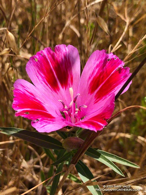
An unusually wet rain season not only increases the population of many wildflowers, it can produce wildflowers not usually seen in an area.
The Farewell to Spring (Clarkia amoena) pictured above was one of very small population found in Upper Las Virgenes Canyon Open Space Preserve (aka Ahmanson Ranch) in June 2023. The California native is much more common in the Bay Area and coastal Northern California. It probably found its way to Ahmanson by way of a local garden.
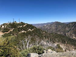
On June 1, Angeles National Forest reduced the size of the Bobcat Fire Closure, opening up most of the upper West Fork San Gabriel River area. Curious to see how the West Fork area is recovering from the Bobcat Fire, today I ran a slightly shortened version of the ANFTR/Mt. Disappointment 25K course.
Since the Mt. Wilson parking lot is usually closed until mid-morning, this morning’s run started and ended at a small turnout near the top of the Kenyon Devore Trail on the loop road on Mt. Wilson. The ANFTR Trail Races start at the main Mt. Wilson parking lot.
I’d recently done the San Gabriel Peak and Bill Riley Trails and knew they were in reasonable condition. And I’d read that AC100 Trail Work Teams led by Gary Hilliard and Ken Hamada had cleared the Gabrielino and Kenyon Devore Trails earlier this year. So, I didn’t expect to have a repeat of the epic fallen-tree obstacle course that I experienced doing this course in 2020.