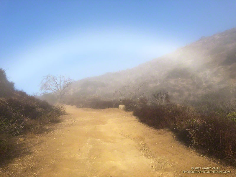
Fogbows form opposite the sun in a manner similar to rainbows, except the water droplets that create a fogbow are much smaller than raindrops. Because a fog droplet is so small, the physics of the interaction is different. The result is often a diffuse, primarily white bow.
The photograph of the fogbow was taken Sunday morning on an out and back run from Wendy Drive to Mugu Peak. The sun was about 14 degrees above the horizon. More about fogbows and other atmospheric phenomena can be found on Les Cowley’s Atmospheric Optics website.
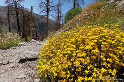
From mid Summer into Fall, the vibrant yellow flowers of rabbitbrush add a refreshing hit of color to the greens, grays, and browns of the San Gabriel Mountains.
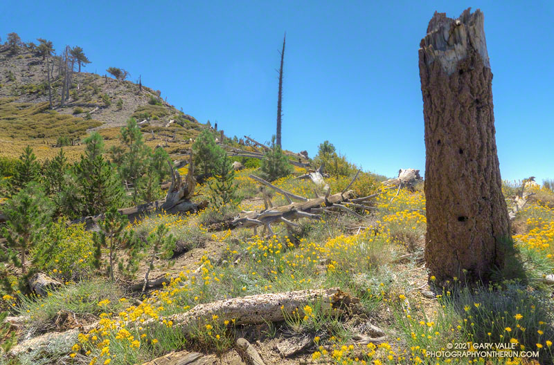
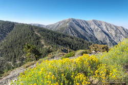
The title photo was taken along the PCT, at an elevation of about 8600′, near Mt. Hawkins. The area was burned in the 2002 Curve Fire. Here, and elsewhere in the burn area, new trees — now in their teens — are slowly replacing some of the trees lost in the fire.
The last time I was on this part of the North Backbone Trail it was bitterly cold and very windy. Today it was just very windy. Even though the air temperature was in the 70s, the “wind chill” was enough that I was considering grabbing the sleeves and shell from my pack.
I stopped in the lee of a sprawling, stunted lodgepole pine and enjoyed a moment of relief, shielded from the wind. But there wasn’t that much mountain above me, and I resumed zig-zagging up the final steep stretch of trail. Climbing a little higher, I could see the trail sign that marks the top of the North Backbone Trail.
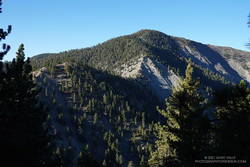
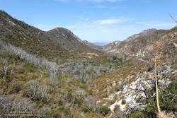
Point 8555 and Pine Mountain from the PCT
Mt. Baldy from Wrightwood is a more difficult variation of the North Backbone Trail route. Instead of driving to the North Backbone Trailhead on East Blue Ridge Road (F.R. 3N06), you run/hike to the trailhead using the Acorn Trail and a short stretch of Blue Ridge Road or the PCT. (The dirt road is slightly shorter, but you don’t have to dodge off-road vehicles when on the PCT.)
Including Pine Mountain (9648′) and a short detour to the top of Dawson Peak (9575′), the regular North Backbone route is about 8 miles long and gains/loses around 4700′. Starting in Wrightwood at the small parking area on Acorn Drive ups those totals to around 15 miles, with a 6800′ gain/loss.
Rabbitbrush along the North Backbone Trail, between Pine Mountain and Dawson Peak
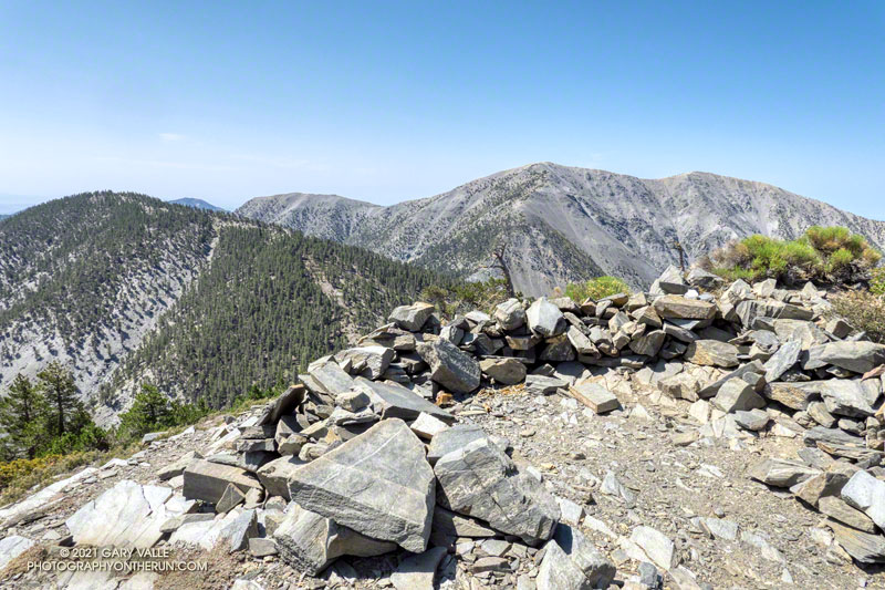
A mix of hikers and trail runners were scattered across the broad summit of Mt. Baldy (10,064′). The wind wasn’t as strong on the summit as it had been on the North Backbone. Smoke from the Western wildfires reduced the visibility, but the air quality and view were still pretty good.
Like many mountains, the adventure didn’t end on the top of the peak. The elevation gain on the way back to Wrightwood is significant, and much of the downhill demands close attention — especially on tired legs. I squeezed the water bladder in my pack and tried to estimate how much was left. The day was just going to get warmer, and I hoped it was enough to get me back over Dawson Peak and Pine Mountain. On the way up, I’d stashed a small water bottle near the North Backbone Trailhead, and that would help on the final few miles.
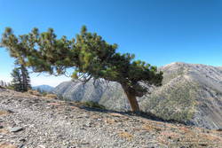
Windswept Jeffrey pine near Dawson Peak
Other than initially running past my water stash, the descent went well. Once on the PCT I could run normally — well, more or less normally — and it didn’t take long to get over to the Acorn Trail.
When doing the AC100 and related training runs, I’d run/hiked up the Acorn Trail a number of times, but I’d never run down it. After all the rough trail on the North Backbone, it was great to be able to cruise down through a forest of pine and fir on a well-groomed trail! Here’s an elevation profile of the route.
I’d decided to stay off the higher peaks because a combination of monsoon moisture and an upper level low was probably going to produce some thunderstorms in the high country. The action was forecast to stay east of of the Mt. Wilson area, but there was a chance there might be enough clouds to knock the temperature down a few degrees.
But a chance is just that, and the day dawned mostly clear and warm at Red Box. A few feathery high clouds had no effect on the sun, and as I jogged up Mt. Wilson road to the start of the Mt. Disappointment Trail, the temperature was already in the 80s.
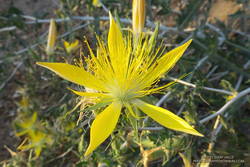
Blazing star near the Mt. Disappointment Trailhead.
I was doing a 15-mile version of the Red Box – Bear Canyon loop. The main trails that make up this version of the loop are the Mt. Disappointment Trail, San Gabriel Peak Trail, Mt. Lowe Fire Road, Upper Bear Canyon Trail, Bear Canyon Trail, and the Gabrielino Trail. Refer to a trail map for additional details.
As it turned out, the Bear Canyon Trail was in the best condition I’ve seen in years. Thank you Bear Canyon Trail Crew! While still rustic, the trail between the old cabin site and the trail camp was a bit more worn than usual, and a little easier to follow. In some years it can be much more difficult to navigate.
No one was camped at Bear Canyon Trail Camp. The condition of the creek was similar to 2018. There were a few small pools here and there, but almost no surface flow. In addition, strict fire restrictions are currently in effect. See Forest Order No. 05-01-21-04.
The dry conditions had one benefit — I didn’t have any issues with stinging nettle. There was still plenty of poison oak, but it was drying out and turning red. For the most part the poison oak could be avoided.
The Gabrielino Trail between Switzer Falls and Switzer’s Picnic area was as busy as usual, including one hiker walking their cat!
View down Arroyo Seco from the Gabrielino Trail, about 1.5 miles from Red Box
As I worked up the Gabrielino Trail above Switzer’s, I kept looking for those monsoon clouds. Temps in the sun on the exposed trail was in the high 90s, and it was a relief to finally get to the more shaded sections near Red Box.
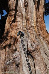
The adventure combines a seven-mile run on the PCT along Blue Ridge with a strenuous 1.5 mile, 1500′ climb up the North Backbone Trail to the summit of Pine Mountain (9648′). The Pine Mountain Juniper, estimated to be 800-1000 years old, is found at the 9000′ level of the North Backbone Trail.
Trunk of the Pine Mountain Juniper. Click for larger image.
On the way out I was glad to see the PCT had been rerouted around a steep, rocky stretch of trail below Mountain High West’s snow-making pond. I stayed on the PCT except for a very short section of dirt road between the top of the Acorn Trail and the overlook of the huge Wright Mountain landslide scar. The single track is more pleasant, and I didn’t have to worry about vehicles or their dust. I left the PCT when I was directly above the North Backbone Trailhead. A short path descended to the road.
The North Backbone Trail seems to be getting more attention these days. This adventure could be extended to include Dawson Peak and Mt. Baldy. A similar route was part of the 44-mile Big Pines Marathon — possibly the first mountain ultra in the U.S.
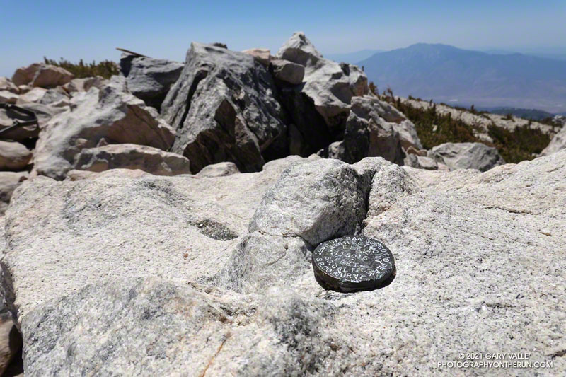
GPS elevation marker on the summit of San Gorgonio Mountain
For the second time this month, I was crossing San Gorgonio’s summit plateau and relieved to be nearing the summit. Most of the uphill was done! My route was the same both times — South Fork, Dollar Lake, Divide, and Summit Trails up; then the Summit Trail, Sky High, Dry Lake, and South Fork Trails down. Here is an interactive, 3D terrain view of the route.
The changes along the South Fork Trail in just two weeks were remarkable to see. It may be Summer in the lowlands, but Spring was still in progress on the mountain. Withered-looking black oaks were now flush with leaves; newly sprouted ferns had unfurled, filling areas of the understory with bright green fronds; colorful wildflowers seemed to have appeared overnight.
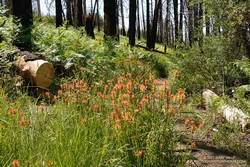
Paintbrush and ferns along the South Fork Trail
Over the past two weeks, trailwork continued in the area. The start of South Fork Trail was rerouted for a second time since the 2015 Lake Fire, avoiding a very steep, root-filled section. In a continuing battle, some of the dead trees that had fallen on the trail had been cleared.
Earlier in the month a few small patches of snow could still be seen on the mountain, but today it was nearly gone. Only one tiny, stubborn patch of snow remained on the crest, near the summit. Most of Southern California recorded below average precipitation this past year. According to OntheSnow.com, nearby Snow Summit recorded 121″ total snowfall in the 2020-2021 season. This compares to 110″ in the 2019-2020 season and 143″ in the wet 2018-2019 season. A paltry 36″ was reported in 2017-2018.
As I started up the final rocky hill to the top of San Gorgonio, a small group of hikers scrambled down from the summit. As was the case earlier in the month, the summit area was nearly empty. On an ascent in September 2019 — when wilderness permits were not required — I’d estimated 40-50 people on, or around, Gorgonio’s summit. The restoration of the permits seemed to have made a big difference.
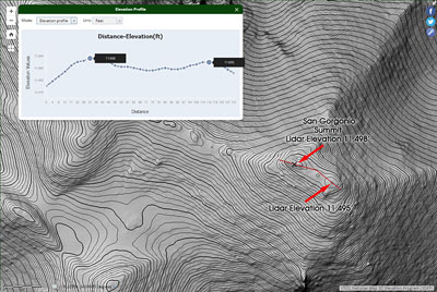
3DEP Lidar data for the top of San Gorgonio Mountain. Click for larger image.
Out of curiosity, following the run I checked the high resolution 3DEP Lidar data for San Gorgonio. It resolves the twin summits, and indicates the official (west) summit is about three feet higher.
In 1989, the “San Bernardino County Surveyors” determined the elevation of San Gorgonio Mountain to be 11,501.6 feet. They placed this small marker on summit. The USGS page Global Positioning Application and Practice discusses some higher precision GPS equipment and survey methods. The elevation of the mountain has probably shifted a little since that measurement was done.
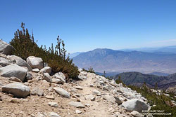
San Jacinto Peak from 11,200′ on the Sky High Trail
After comparing notes with a runner doing the clockwise version of the route I was doing, I headed back down the Summit Trail to its junction with the Sky High Trail.
By their very nature, mountain trails are scenic, but the Sky High Trail is exceptionally so. Running down the Sky High Trail is what running in the mountains is all about. It is spectacular! That doesn’t mean it’s a cakewalk. The trail is rough, rocky, and crosses steep slopes. As with any trail on such terrain, snow on the trail can be a serious issue.
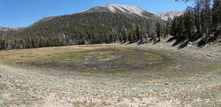
Dry Lake, June 6, 2021
The Sky High Trail ends at Mineshaft Saddle. From here, I picked up the Dry Lake Trail and continued down, down, down. Above Dry Lake, a section of trail pummeled by an avalanche in 2019 had been restored. Continuing, the trail winds down through a complex of glacial moraines above Dry Lake. and then follows the margin of a large moraine down to Dry Lake. The lake dried up early this year, and was already dry on June 6.
Golden yarrow along the Dry Lake Trail
It can be very warm in the afternoon on the Dry Lake Trail between Dry Lake and South Fork Meadows, but today gusty winds kept the temperature moderate. At South Fork Meadows, I gulped down a liter-bottle of water, enjoying the cool shade, and then finished the run.