Category Archives: running|races

Mt. Disappointment 50K Returns!

Runners work up the San Gabriel Peak Trail toward Mt. Disappointment.

Note: The Mt. Disappointment Endurance Run is now the Angeles National Forest Trail Race.

Following a two year hiatus the challenging Mt. Disappointment 50K was run today in near perfect weather conditions.

Temperature at Clear Creek for Mt. Disappointment 50Ks from 2005-2015
Temperature at Clear Creek for Mt. Disappointment 50Ks

How did the temperature today compare to the torrid conditions in 2012? The HIGH temperature today at Clear Creek — 76 °F — was 7 degrees COOLER than the temperature BEFORE SUNRISE in 2012 — 83°F! It was warm in the sun in a couple of places today, but nothing compared to the 115°F in the sun in 2012.

Runners at the starting line on top of Mt. Wilson for the 2015 Mt. Disappointment 50K & 25K
Runners at the Start line on Mt. Wilson

This was the ninth running of the event, which began in 2005, and the first time since 2008 that the 50K was run on the original course. In 2009 a rockslide closed the Mueller Tunnel, resulting in a detour down the Mt. Wilson Road. In 2010, 2011 & 2012 portions of the course were closed as a result of the devastating Station Fire and subsequent flash floods. This required a rerouting the course and adding the infamous climb up Edison Road to Shortcut Saddle. The iconic climb up the Kenyon Devore Trail has been a hallmark of the event every year in which it has been run.

Elevation profile for the 2015 Mt. Disappointment 50K
Elevation profile for the 50K

Here’s an elevation profile and an experimental Cesium browser view of a GPS trace of the course, with mile splits generated by SportTracks. The view can be zoomed in & out, rotated and tilted. Mileages and placemark locations are approximate. It does not require a plug-in and should work on most devices.

Gary Hilliard (with wife Pam) briefs the runners on the details of the 50K and 25K courses.
Gary & Pam Hilliard

Many thanks to Gary & Pam Hilliard, Fausto & Cindy Rowlan, and all of the Mt. Disappointment 50K Staff, volunteers, HAM radio operators, Sierra Madre SAR personnel, runners, and sponsors that have helped make all nine Mt. Disappointment 50Ks such outstanding events! I’m already looking forward to running number 10!

Photos and results can be found on the Mt. Disappointment web site.

Some related posts: Mt. Disappointment Notes: 2012, 2011, 2010, 2009, 2008.

Ahmanson 12K Preview

East Las Virgenes Canyon, Ahmanson Ranch

Race director Nancy Shura-Dervin picked a great year, and as it looks now, a great weekend for the inaugural running of the Ahmanson 12K Trails event.

The hills are lush and green; wildflowers are in bloom; valley oaks are sprouting fresh green leaves; and it’s looking like race day may be one of those “gotta run” kind of days.


According to today’s NWS forecast the area will see dry and warmer weather beginning Tuesday and continuing through race day. While there could be a remnant puddle here or there, four days will be plenty of time for the dirt roads to (mostly) dry out. The Cheeseboro RAWS automated weather station can be used to get an idea of the current weather in the vicinity of the race course.

Over the past 10 years I’ve logged approximately 6000 miles at Ahmanson Ranch (now Upper Las Virgenes Canyon Open Space Preserve) and the loop Nancy has selected for the course is a variation of a favorite.


Here’s a Google Earth overview of the 12K course and a preliminary elevation-corrected profile generated in SportTracks. The course is about 7.4 miles long with an elevation gain of about 740 feet. (Note: The loop is run in the clockwise direction.)


Lasky Mesa has long been used to shoot movies, television, commercials, music videos, and even Internet games. Its wildland character and expansive views bely its urban location. For a few weeks one summer the Mission Impossible III bridge was a Lasky Mesa landmark. The aesthetically-shaped valley oak at the west end of Lasky Mesa is a favorite of production companies and I’ve spotted it in more than one commercial.

The Ahmanson 12K should be an outstanding event on an excellent course in conditions we haven’t seen at Ahmanson in several years.

For more information and photos see the Trail Run Events web site and the Upper Las Virgenes Canyon Open Space Preserve web site.

Some related posts: 10th Anniversary of the Acquisition of Ahmanson Ranch, Coyote Tag, It Was So Muddy That…, Ahmanson Ranch Trail Runs

Kodiak 50 Mile 2014

Sugarloaf Mountain from the Skyline Trail near Big Bear Lake
Sugarloaf Mountain from the Skyline Trail

The contrast in temperature was remarkable. On a run at Ahmanson earlier in the week the temp had been over 100. Here on the north shore of Big Bear Lake it was about 60 degrees cooler.

It was 4:45 am and 54 two-legged runners, and one four-legged runner (Lacey) were scattered around the Meadow’s Edge Picnic Area. Some runners were sitting in cars with the motor on and heater running, some were checking in and picking up their bib numbers and making last minute preparations. One bare-armed runner in shorts and a singlet had appropriated a bathroom in lieu of a jacket.

At about 5:00 am were were on our way. The stars glittered brightly on an inky background of mountain sky. Surrounded by a frame of pines the iconic Winter constellation Orion ran across the southeastern sky, the brilliant dog star Sirius following at his side.

Sunrise at Mile 10 of the 2014 Kodiak 50M.

There were many changes and improvements for the 2014 edition of the Kodiak 100M & 50M. In addition to the 50M beginning at Meadow’s Edge and starting an hour earlier, nearly all of the miles to Rim Nordic (~ mile 23) were on dirt road. As much as I like single track, there were some significant benefits to this. Most importantly, it got us to Rim Nordic earlier in the day and in better shape to deal with the difficulties of the Siberia Creek section of the course.

The loss of the PCT single track on the first part of the 50 mile course was offset by the addition of the Skyline single track following the Siberia Creek climb. The Skyline and Siberia Creek Trails are both spectacular. When combined they are among the most challenging, aesthetic and rewarding trails in Southern California. Thanks to the trail work by the Big Bear Valley Trails Foundation and Kodiak volunteers the Siberia Creek Trail was in better shape this year.

Idyllic running about 0.5 mile below the Lodgepole Aid Station.

The weather was outstanding! Once the sun was up, my sleeves came off and it was shorts and short-sleeves for the remainder of the day. Reflecting the good weather, the changes in the course, the improved aid stations, and perhaps a better understanding of the character of the course, the finishing rates for both the 50M and 100M were up significantly from last year. Half of the runners that started the 100M finished and about 85% of the 50 milers finished.

Here are some photos taken during the 50 mile. The 50M/100M mileages mentioned in the descriptions are approximate.

Many thanks to R.D. Matt Smith and all of the event staff, volunteers, sponsors and runners! For more photos, stories, results and info checkout the Kodiak web site and Facebook page.

P.S. Lacey and her “Dad” Aaron Sorensen both finished the 50 mile in fine style!

Related post: Kodiak 100 & 50 Mile Ultramarathons 2013

Monsoon Weather for the 2014 Angeles Crest 100

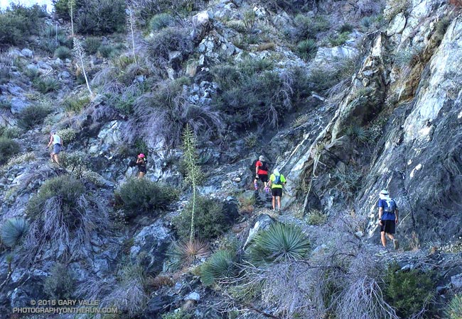
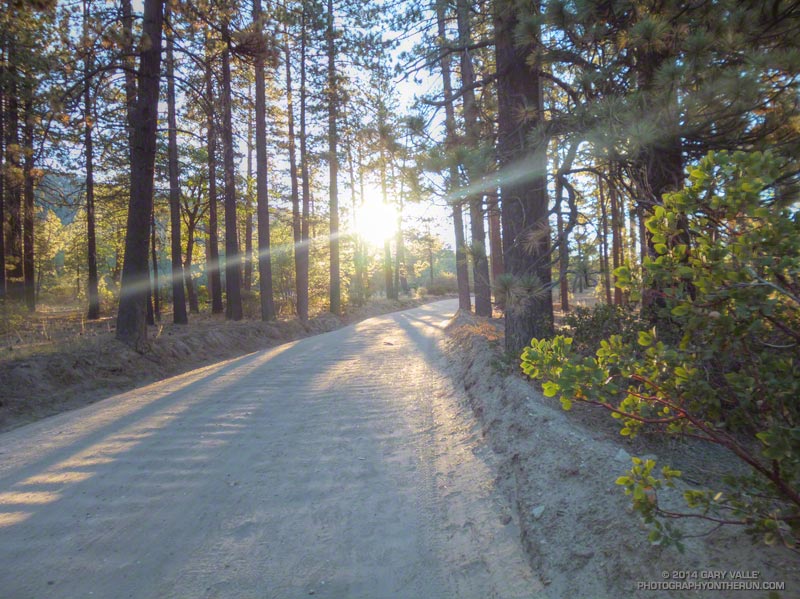
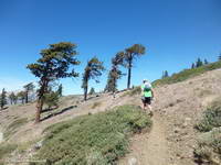
As I chugged up the Acorn Trail the eastern sky kept pace, becoming increasingly brighter with each stride. Dawn revealed a red-tinged layer of high clouds illuminated by a muted sun. This was good news. As late as Thursday afternoon the NWS forecast for the Los Angeles County Mountains on race day had been for typically hot AC100 weather:


.SATURDAY…SUNNY. HIGHS FROM 90 TO 100 AT LOW ELEVATIONS TO THE
UPPER 70S TO MID 80S AT HIGH ELEVATIONS. SOUTHWEST WINDS 15 TO 25
MPH IN THE AFTERNOON.
.SATURDAY NIGHT…MOSTLY CLEAR IN THE EVENING THEN BECOMING PARTLY
CLOUDY…

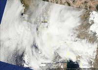
But even in Southern California in the dog days of Summer the weather forecast isn’t a given. One wildcard was the summer monsoon. A surge of subtropical moisture was forecast to move into Southern California over the weekend and it wasn’t clear just how much of Los Angeles County would be affected. Another wildcard was a low pressure wave that computer models showed rotating up into the Los Angeles area Saturday night. This feature would destabilize the airmass, increasing the chance of precipitation. As things turned out, both wildcards came into play.


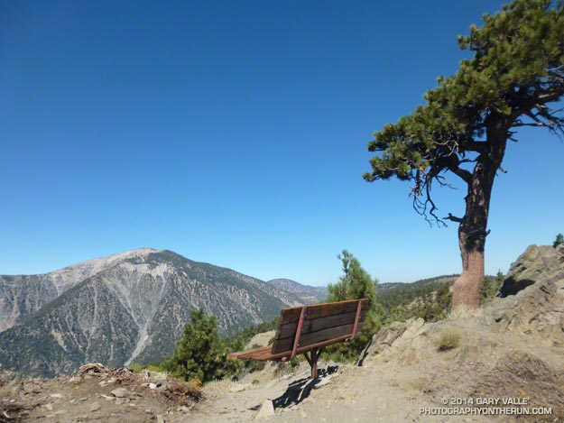
After topping out on the Acorn Trail and following the PCT to Inspiration Point the layer of high clouds continued to gradually thicken as I worked my way over to Vincent Gap, up Mt. Baden-Powell, and down to Islip Saddle. With the sun heavily shrouded, the temperature was a non-issue, neither too warm or cool, and perfect for running. At around 11:00 AM the Big Pines RAWS near Mountain High reached a high of 79 degrees and then dropped back down into the 60s between noon and 1:00 PM.

A bit past noon I ran across Hwy 2 and into the parking lot at Islip Saddle (mile 26). It looked and felt like it might start to rain at any time.  The wind blew in fits and starts — as it does before a thundershower — and a few rogue sprinkles dotted the windshield of my car. I skipped the ice-water shower planned for this checkpoint, expecting that Mother Nature would probably take care of that all on her own.

Rather than an indicator of how hot and challenging the day was going to be, the climb from Islip Saddle to the Mt. Williamson summit trail was straightforward and in some sections actually a little breezy and chilly.

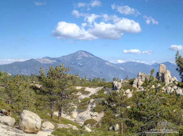
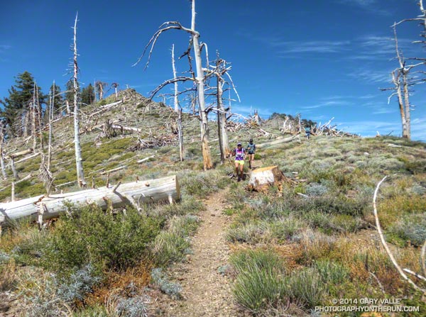
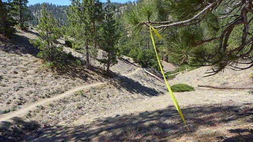
The somber skies accented the forms of the wind-shaped sugar pines along Kratka Ridge, and as I passed above Williamson Rock I wondered if ten years would be enough to get the climbing area and the closed segment of the Pacific Crest Trail open again. Running the final few yards into the Eagle’s Roost I was caught totally off-guard by the incredible aid station volunteers cheering, “Gary, Gary, Gary!”.


I didn’t think much about the weather between Eagle’s Roost and Cloudburst Summit. AC100 veterans had drilled into my head that the cutoff at Cloudburst was key. Make it through Cloudburst (mile 39) and you have a good chance of playing in the second half of the game.

With the cool weather the climb up Cooper Canyon was almost pleasant. The day before the high temperature at Chilao had been a warm 89 degrees, and the “in the sun” temp had been around 100 degrees. Race day it was much cooler and at a little before 3:00 PM, when I started up Cooper Canyon, the temperature at Chilao was in the low 70’s.

Of course there was a trade-off to all the subtropical clouds. About halfway between Cloudburst Summit and Three Points I heard a low rumbling to the east. I waited for it to transform into the muted roar of a jet flying overhead, but instead was treated to an even louder and more distinct rumble of thunder. As I ran down the PCT from time to time I would feel a large, cold drip of water on the back of a leg, and couldn’t quite tell if it was from my water bottle or the sky. The rumbles and raindrops continued on and off the remaining miles to Three Points.


At Three Points (mile 44) I debated stuffing my three ounce shell into my waist pack. Several times I’ve experienced the fury and might of a big thunderstorm and know how quickly balmy temperatures can turn frigid in a deluge of rain, sleet and hail. About a half-mile after leaving Three Points it started to shower, and I hoped that leaving my shell there wasn’t a mistake.  It continued to shower on and off over the next few miles, but gradually the rumbles of thunder decreased in frequency and so did the rain. (Had a strong cell developed in the Mt. Hillyer area it could have been a real problem, like it was for a number of runners in this year’s Tahoe Rim Trail 100.)

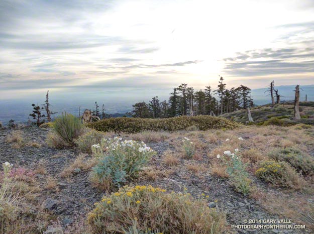
Another runner and I joined forces on the road up to Mt. Hillyer. Once we were through the aid station the main concern became getting down through Horse Flats and to Chilao before dark. We had headlamps, but not using them before Chilao was a benchmark we both wanted to make. Things still looked gnarly to the east. Beyond Mt. Waterman and Twin Peaks dark gray skies were decorated with obvious streamers of heavy rain. To the west a thin ribbon of cloudless sky brightened the horizon.

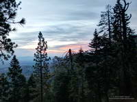
As we worked our way down to Horse Flats Campground and then over and down to Chilao the sun dropped lower and lower in the sky, eventually finding the horizon and illuminating the underside of the clouds with an increasingly saturated crimson red. There was just enough light to run as Dave and I pulled into the Chilao aid station (mile 54) and at least for the moment, it wasn’t raining.


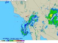
Judging from the rumble of thunder we heard just before leaving Chilao, the rain was not far behind. By the time Gary (my pacer) and I reached Poodle-dog Avenue on the way to the Charlton Picnic Area the showers were nearly continuous. The temperature was warm enough that it was a toss-up whether my rain shell helped or hurt. Here’s a NEXRAD radar animation of the rain from 7:00 PM to 10:00 PM Saturday evening as it swept across Los Angeles County. The red arrow is the approximate location of Shortcut Saddle.

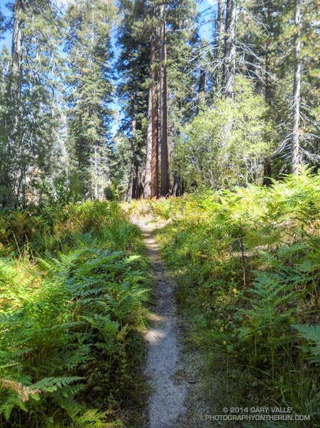
It was still raining at 11:00 PM when we crossed a very wet Hwy 2 at Shortcut Saddle (mile 60.5) and started the never-ending descent to the West Fork San Gabriel River. Eventually reaching the nearly dry river, we laughed and thought back to March 2003, when we kayaked this stretch of river. Record rainfall had occurred the day before and we were worried the river would be too high. After carrying 70-80 lbs. of kayak and gear down the Silver Moccasin Trail we discovered the flow was perfect, and were able to complete the whitewater run from West Fork to Cogswell Reservoir and Hwy 39 before sunset.

Working up the hill to Newcomb Saddle it felt like I was carrying a kayak and it was definitely past sunset. Ideal running weather or not, my legs were just not cooperating. I would have several months to think about the run and what I’ve might have done differently. So many things have to come together to run a hundred miles.

The showers would continue sporadically through the night. One heavier shower occurred at about 3:15 AM at Newcomb Saddle (mile 69), after I had slept for an hour and just as we were getting ready to leave the aid station. It didn’t last long and most of our hike down to Chantry Flats (mile 75) was rain free.

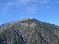
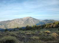
Showers and thunderstorms continued in the San Gabriels on Sunday. One runner told me that leaving the Sam Merrill aid station he experienced the strongest winds he could recall encountering in the San Gabriels. From his description it sounded like it could have been the outflow of a downburst associated with a convective cell. Though runners did see some showers, the heaviest rain was in the high country in the area of Mt. Baldy and Mt. Baden-Powell. Mt. Baldy recorded 4.38 inches of rain from Saturday evening to Sunday evening. This resulted in flash flooding and numerous problems. The Big Pines RAWS recorded 1.53 inches and Crystal Lake 2.09 inches of rain over the same period. Here are some rainfall totals from the NWS (PDF) from around the area.

As you might guess the cool temperatures and showery weather were generally a big help to runners. The finishing rate this year was 66%, compared to about 60% in 2012 and 60.5% in 2013.

Related post: Why the Angeles Crest 100?

Why the Angeles Crest 100?

Sitting on the bench at Inspiration Point, I gazed across mile deep Vincent Gulch to the towering northeast face of Mt. Baden-Powell. My eye traced the peak’s right-hand skyline from near Vincent Gap up, up and to a small step just below Baden-Powell’s summit. At that small step, marked by a gnarled and ancient Limber pine, was the 9,225′ high point of the Angeles Crest 100 course.

Tomorrow about 140 of us would pass this bench, descend to Vincent Gap, and then climb the switchbacks of Mt. Baden-Powell to that tree. Over the course of 100 miles, those that finished the AC100 would ascend the equivalent of nearly eight Mt. Baden-Powells and would descend the equivalent of around ten — a daunting task by any standard.

During this year’s AC100 training runs a question that has inevitable come up is “How many times have your run AC?” When I’ve responded that the AC100 would be my first attempt at running 100 miles the reaction has often been one of polite surprise and concern. Why at age 66 — or any age — would I choose such a challenging event as my first 100?

The answer is a simple one. My goal isn’t to run a 100 miles. If that were the goal I’m pretty sure I could pick an event with a less demanding course and click off the miles. My goal is to become fully enveloped in the experience of running 100 miles through a mountain range that I have enjoyed for more than 40 years.

Over that time I’ve run, hiked, climbed, skied, and kayaked the San Gabriel Mountains. I’ve soared above its peaks in a hang glider. I’ve worked on its trails. On every visit I try to learn more about its flora, fauna, geology and weather. Photography from its peaks and within its canyons is a passion.

This year my dream of running the AC100 ended at Newcomb Saddle. I could not have had better conditions for running the race or a better crew or pacers. Quads and mind blown, I felt I couldn’t continue. After sleeping an hour at Newcomb, and with the help of my pacer, I was able to hobble down to Chantry Flat.

It is one thing to know something intellectually and quite another to know it from personal experience. It was amazing and humbling. I learned a lot, and look forward to participating in the event again next year.

Many thanks to Hal Winton, Ken Hamada and everyone that helped to make the event happen. And a special thanks to the aid station personnel at Newcomb Saddle that did their best to get me moving before the cutoff!

Some related posts: Monsoon Weather for the 2014 Angeles Crest 100Crest of the Angeles, Mid January Trail Run from Islip Saddle to Mt. Baden-Powell, Mt. Wilson – Newcomb Pass – Chantry Flat Loop

Crest of the Angeles

Runners on the PCT west of Mt. Hawkins

Between Vincent Gap and Islip Saddle the Pacific Crest Trail follows one of the most scenic stretches of trail in Southern California, skirting the summit of Mt. Baden-Powell (9399′) and passing Mt. Burnham, Throop Peak and Mt. Hawkins before leaving the crest at Windy Gap (7600′), just east of Mt. Islip. It has long been a favorite of hikers and runners.

There are several ways this classic stretch of trail can be incorporated into a run or hike. Today we were doing the segment as part of a training run for the 2014 Angeles Crest 100 Mile Endurance Run. The AC100 starts at Wrightwood, California; then using parts of the PCT, Silver Moccasin, Gabrielino and several other trails, the AC100 works west through the peaks and canyons of the San Gabriel Mountains to Loma Alta Park near JPL.


The AC100 training runs, organized and supported by AC100 co-director Hal Winton, cover the 100 mile course in approximately 25 mile segments. With the help of AC100 Racebook editor/photographer Larry Gassan and a host of generous volunteers, “Uncle Hal” makes it happen and always seem to be where runners need him to be. Today’s training run was the fourth, and last, of the 2014 series.


Just a few days before we’d done the third AC100 training run from Chantry Flats to the finish at Loma Alta Park. Beginning at Mile 75 of the AC100, this difficult segment includes the Wintercreek and Idlehour climbs and some of the most technical trails on the course. As a result of the drought water wasn’t easily accessible at Idlehour Creek, so Hal and 2013 AC100 finishers Dave Tan and Rainer Schultz were at the “Cape of Good Hope” on Mt. Lowe fire road to provide much-needed water to thirsty runners.


This morning’s run from Wrightwood had begun with an ascent of the Acorn Trail — a climb that matches foot for foot the 2650′ elevation gain of the PCT up Baden-Powell and is every bit as strenuous. After climbing up the Acorn Trail we’d joined the PCT and followed it along spectacular Blue Ridge, past the top of Mountain High Ski Resort, to Angeles Crest Highway at Inspiration Point. From there it had taken less than an hour to reach Vincent Gap and Hal’s aid station. A quick stop to refill my hydration pack and I was back on the PCT and chugging up Baden-Powell.

Far too many switchbacks later, far too much of the peak remained. I was maxed out and doing my best to keep up with Skye’s brisk pace. Finally we rounded a corner and I could see the Wally Waldron tree a 150 yards ahead. Just 150′ in elevation from the top of Baden-Powell, the gnarled and weathered limber pine — estimated to be 1500 years old — stands sentinel at the juncture of Mt. Baden-Powell’s summit trail and the PCT.


I’d pushed the pace up the Acorn and Baden-Powell climbs and now was paying the penalty. My legs were toast. When I’d reached the Wally Waldron tree the decision whether or not to go to the summit of baden-Powell had been very easy — one trail led steeply up and the other gently down. As we turned west onto the PCT I told Skye I was going to have to take it easy for a bit. She had already started to pick up the pace and it didn’t take long for her to disappear into the forest on the trail ahead.

After a while I glanced at my watch and was surprised to see that it was already 3:00 pm. Because of the long shuttle to Wrightwood we hadn’t started running until 9:20 am. After skirting Baden-Powell, I’d run past Mt. Burnham, struggled up to the shoulder of Throop Peak and now was near Mt. Hawkins. Here, the beginning of the descent to Windy Gap is marked by a prominent Jeffrey pine that has been struck by lightning.


West of Mt. Hawkins the Pacific Crest Trail passes through a ghost forest of large trees burned in the 2002 Curve Fire. Recovery in the area is progressing well, and amid the dead trees are numerous pine and fir saplings. I ran this segment in mid-January and again at the end of May. Sometime between the two runs a large number of the dead trees had been blown down. During the May run it had been necessary to crawl over or work around a log jam of fallen trees. The trees likely blew down during a storm on February 28th, when Chilao recorded winds as high as 91 mph. That wasn’t necessary today, thanks to the expert trail work of PCTA volunteer Ray Drasher and his equine crew.


Most of the trail maintenance in the San Gabriels (and elsewhere) is now done by volunteers. One of the requirements to run in the AC100 is eight hours of trail work. This year AC100 entrants have worked on the Idlehour and Wintercreek Trails and will be working on the Gabrielino Trail below Newcomb Saddle in a couple of weeks. For more info about Hal and volunteering see the April 2014 issue of the VOLUNTEER TODAY newsletter (PDF).

Once through the ghost forest on Mt. Hawkins, it didn’t take long to get down to Little Jimmy Spring and from there over to Islip Saddle. It had been another tough training week in a series of tough training weeks. As I descended the final short switchbacks to the Islip Saddle parking area on Highway 2 I tried to visualize what it would be like on race day. How would I feel compared to today? Would I make here before noon? How hot would it be on Cooper Canyon? Would the cutoff at Cloudburst be a problem? Would I make it to Horse Flats before dark? On what trail would I be when sun rose for the second time during the run? All these and many other questions would be answered in just a few weeks.