Category Archives: trails|san gorgonio

Feeling a Little Like Fall on the Three Points – Mt. Waterman Loop

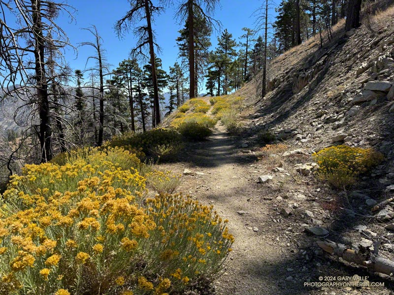
Rabbitbrush along the PCT east of Winston Peak.

Even with the warm weather, it was beginning to feel a little like Fall in the San Gabriel Mountains. Yellow goldenrod and red California fuchsia bloomed along the trail,  and the canyon live oaks were covered in green acorns.
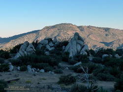
Mt. Pacifico (7124') from low on the Three Points - Mt. Waterman Trail.
Mt. Pacifico (7124′) from low on the Three Points – Mt. Waterman Trail.

I was back on the Three Points – Mt. Waterman Loop and having a better time of it than in June. The June run had been near the Summer Solstice, with in-the-sun temperatures reaching 100°F. Today’s run was a few days away from the Fall Equinox. Not only was the temperature about 10 degrees cooler, the sun was lower in the sky and less intense.

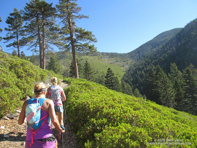
But much was the same as in June. There was still plenty of whitethorn on the first couple of miles of the Three Points – Mt. Waterman Trail — and a few prickly passages for anyone wearing shorts and short sleeves. Some trailwork had been done higher on the mountain, but a few fallen trees were still on the trail. Most of these were easy to step over, around, under, or through.
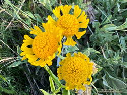
Late season Bigelow's sneezeweed at Waterman Meadow.
Late season Bigelow’s sneezeweed at Waterman Meadow.

There was very little monsoon rainfall this Summer, but consecutive wet rainy season and a tropical storm had already recharged the seeps and small creeks. The creeks were only slightly lower than in June, and the places that had been wet and muddy in June were still wet and muddy. At Waterman Meadow, a few late-season blooms of sneezeweed beamed yellow in the midst of the greens of the grass and ferns.

The high point of the Three Points – Mt. Waterman Trail is near the junction with the trail to the summit of Waterman and the trail that comes up from Highway 2. It’s at an elevation of about 7686′. Including detours to get around downed trees, the junction is a bit more  than 6 miles from Three Points. The junction marks the start of a nearly 2000′ descent over 4.7 miles to the PCT in Cooper Canyon.
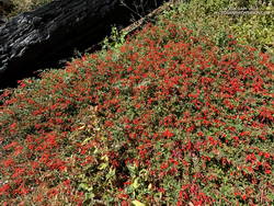
A dazzling display of California fuchsia along the Burkhart Trail.
California fuchsia along the Burkhart Trail.

This morning, I encountered no one on the Three Points – Mt. Waterman Trail and only one pair of hikers on the normally busy Mt. Waterman Trail. Buckhorn Campground was nearly empty. I topped off my water at a convenient faucet at the campground and then started down the Burkhart Trail.

The creek in the canyon below the Burkhart Trail happily bubbled and gurgled, its water easily outpacing me as I descended to the PCT. Some work had been done on the trail to help those hiking to Cooper Canyon Falls cross the muddy seeps. Near one seep, a patch of dazzling red California fuchsia contrasted sharply with the coal black of a tree burned in the Bobcat Fire.
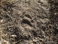
A black bear track on the Three Points - Mt. Waterman Trail.
Black bear track.

I wouldn’t say the trail has been abandoned, but it’s been quite a while since any trailwork has been done on the PCT between the Burkhart Trail and Cloudburst Summit. A mass of trees is still blocking the trail near the creek crossing at the bottom of Cooper Canyon. As expected following a fire, trees continue to fall on the trail. Parts of the trail along the creek or near seeps are overgrown with “Hey Bear!” willows.

The PCT in Cooper Canyon has been isolated by the 19-year closure to protect the critically endangered mountain yellow-legged frog. In December 2005, Angeles National Forest “temporarily” closed the Williamson Rock climbing area and the PCT between Eagle’s Roost and the Burkhart Trail. This Summer, the Forest Service extended the closure to at least December 31, 2026.

It’s difficult to accept that the Forest Service, conservation groups, and involved agencies have not agreed on a solution. Can’t the short stretch of the PCT that impacts frog habitat be rerouted? Only a few climbs at Williamson Rock directly impact the frog habitat. Does the entire climbing area need to be closed? Can’t bridges, walkways, and other structures be used to protect and even enhance frog habitat? There has to be solution. In 2005, I could not have imagined that 21 years later Williamson Rock would still be closed, and I might not have the opportunity to climb there again.
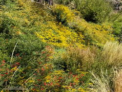
Goldenrod and California fuchsia cover a slope along the PCT in Cooper Canyon.
Goldenrod and California fuchsia along the PCT in Cooper Canyon.

On this run, it wasn’t necessary to stop at Cooper Camp to cool off. Although the temperature was in the 90s on the south-facing slopes traversed by the PCT, there was a bit of a cooling breeze. This and the lower sun angle made it far more pleasant than earlier in the year.

Continuing up the trail above Cooper Camp, I could see smoke from a flare-up on the north flank of the Bridge Fire. Closures related to the Bridge Fire will further isolate the Cooper Canyon segment of the PCT. Multi-year closures are common on the Angeles, and often the closures include popular trails that were not burned.

From Cloudburst Summit, it’s a little over five miles of (mostly) downhill to Three Points. Most of the running is on an old road bed. Although it can be tedious — especially when it’s hot — the segment is relatively fast-paced. Depending on the year, there are usually a couple of places to soak a hat and pour water over your head. But, as I learned one hot day, a rattlesnake may take exception to your intrusion!

Some related posts:
Bridge Fire Perimeter and Some Area Trails
Facing a Future of Runaway Wildfires in Southern California
Hot Weather on the Three Points Loop
Williamson Rock

What’s the Shortest Route From South Fork to San Gorgonio’s Summit?

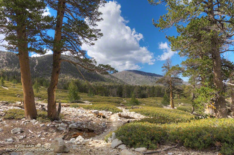
Spectacular afternoon on the Dry Lake Trail while running/hiking the Dollar Lake - Dry Lake keyhole loop on San Gorgonio Mountain.
Spectacular afternoon on the Dry Lake Trail.

I wondered what the hikers would think when they reached this part of the Dollar Lake Trail.

A few minutes before, we had all reached the junction of the Dollar Lake and Dry Lake Trails at the same time. They hadn’t done the peak before and were debating which trail to take. When I mentioned that the Dollar Lake Trail is the shorter route to the summit, that’s the route they chose.

I guessed there might be a few choice words directed my way. About a half-mile beyond the junction, there is a long switchback on the Dollar Lake Trail that seems to never end. It’s about twice as long as any switchback on the Dry Lake Trail or Sky High Trail. With the mountain at your back, it takes the disbelieving hiker farther and farther away from their goal. How could it possibly be the shortest way to the summit?

But it is. The Dollar Lake Trail route is shorter — by about two miles. Following are the estimated mileages from the South Fork Trailhead to Gorgonio’s summit via the Dollar Lake and Dry Lake routes*:

SGWA handout – Dollar: 9.4  Dry: 11.3  Difference: 1.9

My GPS tracks – Dollar: 9.8  Dry: 11.5  Difference: 1.7

Tom Harrison Maps – Dollar: 10.0  Dry: 12.0  Difference: 2.0

*The Dollar Lake route uses the South Fork, Dollar Lake, Divide, and Summit Trails. The Dry Lake route uses the South Fork, Dry Lake, Sky High, and Summit Trails.

The combined route — Dollar up and Dry down — is one of the best mountain trail runs in Southern California. It’s a favorite, and the route I was doing today.

This morning the sky was mostly clear, and the temperature was mild. Later in the day, there was a chance of a thunderstorm, but I expected to be off the exposed trails higher on the mountain well before thunderstorms had a chance to build.

The first cumulus clouds popped up over the mountain around 10:00 a.m. An hour later — as I was crossing the summit plateau — the clouds were more extensive but with little vertical development.

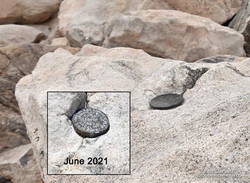
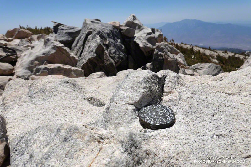
Defaced survey marker on the summit of San Gorgonio Mountain.

There were only a few people in the summit area. Some were on the west summit and some on the east. The twin summits are about 80 feet apart and nearly at the same elevation. Oddly, someone has defaced the survey marker on the west peak since the last time I was there — June 2021. With clouds all around, and 12 miles to go, I snapped a few photos and headed down.

I only saw one group of hikers on the Sky High Trail. They were working up the switchbacks at a good clip and would probably make the summit in an hour or so. Hopefully, the weather would hold for them!

It wasn’t until I was between the C-47 memorial and Mineshaft Saddle that I heard the first rumbles of thunder somewhere in the distance to the east or northeast.

As I continued down the mountain, I occasionally heard thunder in the distance but nothing nearby. There were some sizable cells to the east, but the weather behaved itself. At least where I was. I later heard it dumped at Onyx Summit, and flash flooding was reported at Joshua Tree.

For me, the weather was nearly ideal. Mild temperatures, light winds, and picturesque, sun-shielding clouds. It was short sleeves and shorts up and down. But on another day, it might not have worked out that way.

Here are a few photos taken along the way, and an interactive, 3D terrain view of the Dollar Lake – Dry Lake Loop.

Some related posts: San Gorgonio Mountain – June 2021; San Gorgonio Mountain Snow, Avalanches and Glaciers; San Gorgonio High Line

San Gorgonio Mountain – June 2021

GPS elevation marker on the summit of San Gorgonio Mountain

For the second time this month, I was crossing San Gorgonio’s summit plateau and relieved to be nearing the summit. Most of the uphill was done! My route was the same both times — South Fork, Dollar Lake, Divide, and Summit Trails up; then the Summit Trail, Sky High, Dry Lake, and South Fork Trails down. Here is an interactive, 3D terrain view of the route.

The changes along the South Fork Trail in just two weeks were remarkable to see. It may be Summer in the lowlands, but Spring was still in progress on the mountain. Withered-looking black oaks were now flush with leaves; newly sprouted ferns had unfurled, filling areas of the understory with bright green fronds; colorful wildflowers seemed to have appeared overnight.

Ferns and paintbrush along the South Fork Trail, in an area burned by the 2015 Lake Fire.
Paintbrush and ferns along the South Fork Trail

Over the past two weeks, trailwork continued in the area. The start of South Fork Trail was rerouted for a second time since the 2015 Lake Fire, avoiding a very steep, root-filled section. In a continuing battle, some of the dead trees that had fallen on the trail had been cleared.

Earlier in the month a few small patches of snow could still be seen on the mountain, but today it was nearly gone. Only one tiny, stubborn patch of snow remained on the crest, near the summit. Most of Southern California recorded below average precipitation this past year. According to OntheSnow.com, nearby Snow Summit recorded 121″ total snowfall in the 2020-2021 season. This compares to 110″ in the 2019-2020 season and 143″ in the wet 2018-2019 season. A paltry 36″ was reported in 2017-2018.

As I started up the final rocky hill to the top of San Gorgonio, a small group of hikers scrambled down from the summit. As was the case earlier in the month, the summit area was nearly empty. On an ascent in September 2019 — when wilderness permits were not required — I’d estimated 40-50 people on, or around, Gorgonio’s summit. The restoration of the permits seemed to have made a big difference.

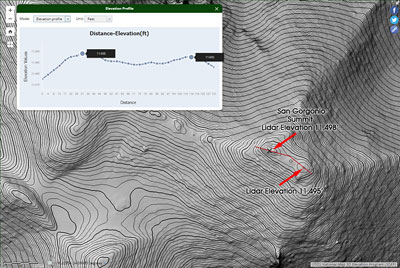
Relaxing on the summit, I looked over at another high point about 100 yards to the ESE. The traditional U.S.G.S. 1996 7.5′ San Gorgonio Mountain Quadrangle isn’t high enough resolution to show this secondary summit. From the official summit, the other point looks higher, and vice versa.

High resolution (1m) 3DEP Lidar data for the top of San Gorgonio Mountain
3DEP Lidar data for the top of San Gorgonio Mountain. Click for larger image.

Out of curiosity, following the run I checked the high resolution 3DEP Lidar data for San Gorgonio. It resolves the twin summits, and indicates the official (west) summit is about three feet higher.

In 1989, the “San Bernardino County Surveyors” determined the elevation of San Gorgonio Mountain to be 11,501.6 feet. They placed this small marker on summit. The USGS page Global Positioning Application and Practice discusses some higher precision GPS equipment and survey methods. The elevation of the mountain has probably shifted a little since that measurement was done.

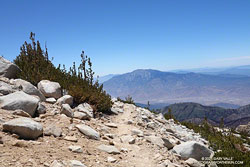
San Jacinto Peak from the Sky High Trail on San Gorgonio Mountain
San Jacinto Peak from 11,200′ on the Sky High Trail

After comparing notes with a runner doing the clockwise version of the route I was doing, I headed back down the Summit Trail to its junction with the Sky High Trail.

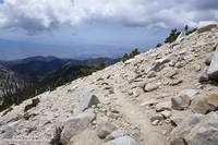
By their very nature, mountain trails are scenic, but the Sky High Trail is exceptionally so. Running down the Sky High Trail is what running in the mountains is all about. It is spectacular! That doesn’t mean it’s a cakewalk. The trail is rough, rocky, and crosses steep slopes. As with any trail on such terrain, snow on the trail can be a serious issue.

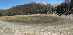
Dry Lake, San Gorgonio Wilderness, June 6, 2021
Dry Lake, June 6, 2021

The Sky High Trail ends at Mineshaft Saddle. From here, I picked up the Dry Lake Trail and continued down, down, down. Above Dry Lake, a section of trail pummeled by an avalanche in 2019 had been restored. Continuing, the trail winds down through a complex of glacial moraines above Dry Lake. and then follows the margin of a large moraine down to Dry Lake. The lake dried up early this year, and was already dry on June 6.

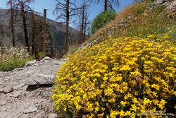
Golden yarrow along the Dry Lake Trail, San Gorgonio Wilderness
Golden yarrow along the Dry Lake Trail

It can be very warm in the afternoon on the Dry Lake Trail between Dry Lake and South Fork Meadows, but today gusty winds kept the temperature moderate. At South Fork Meadows, I gulped down a liter-bottle of water, enjoying the cool shade, and then finished the run.

Some related posts: San Gorgonio Mountain: Dollar Lake – Dry Lake Trail Run; San Gorgonio Mountain Snow, Avalanches and Glaciers; El Dorado & Apple Fire Perimeters and San Gorgonio Trails; After the Lake Fire: The Dollar Lake – Dry Lake Loop on San Gorgonio Mountain

San Gorgonio Mountain: Falls Creek Loop, August 2017

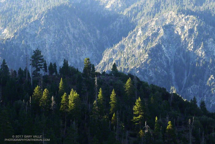
Morning sun on trees above Mill Creek Canyon.

I was lost in thought and working up one of less-used trails that ascends San Gorgonio Mountain — the Falls Creek Trail. For every 100 people that do the mountain from the Vivian Creek and South Fork trailheads, I’d guess one or two ascend it by the Momyer – Alger Creek – Falls Creek – Divide Trail route.

I was thinking about many things — a rattlesnake I’d almost stepped on here; the old Falls Creek trail that ascended directly from the valley; whether it would be cloudy on the summit; what wildflowers I might see; and a multitude of other thoughts. I was also thinking about tracks.

Falls Creek drainage on San Gorgonio Mountain.

It’s a habit of mine to check the tracks on a trail. In addition to identifying the animal tracks, it’s fun to try and guess who might be on the trail ahead. Is it one person or a group? If it’s a group, how many? How long ago were the tracks made? Most of the shoe tracks on the trail today were old, but I kept getting a glimpse of one track that looked like it could have been from the previous afternoon or early this morning. My impression was that it was a solo hiker.

I had not caught the “hiker” by Alger Camp, so either the mystery person was fast and still on the trail ahead, or they had left Alger Camp early, or they had hiked in the day before and had camped farther up the trail. Or maybe there wasn’t a mystery hiker.

Falls Creek Trail near the stream at Plummer Meadows.

There is some very good running between Alger Camp and the Falls Creek drainage. Captivated by the running and my surroundings, I’d pretty much forgotten about the mystery hiker. I’d passed the turnoff to Dobb’s Camp about 45 minutes before and was working up toward Plummer Meadows when a person suddenly emerged from the trees 25 yards to my right, and rushed toward me, shouting, “Sir… sir!” There was such urgency in their quest I was startled, and it took me a moment to realize the individual was a Forest Ranger.

The Ranger said something like, “I assume you have a wilderness permit?”

I assured the Ranger I did, and pulled off my pack.

“Where are you headed?”

I responded, “The peak.”

Falls Creek Trail above Plummer Meadows and below Dollar Saddle.

The Ranger then asked if I was coming back the same way. I explained that after doing Gorgonio, I would be running down the Vivian Creek Trail and then down the road to the Momyer trailhead. Scrutinizing my day use permit, the Ranger asked a few more questions, and then thanked me and sent me on my way.

I was a little later getting to Gorgonio’s summit than the previous Saturday, and it was a busy place. Where last week there had been one person on the summit, this week there were around a dozen. Summits are generally happy places and the conversation can be about just about anything. Today the main topics were Lumix cameras and hummingbirds.

Vivian Creek Trail about a mile from the summit of San Gorgonio Mountain.

By the time I was headed down there was a fairly extensive deck of clouds over the mountain. But today the clouds didn’t have the convective instability and vertical development of the previous week. There would be no showers or thunder; the clouds would just keep the temperature comfortably cool.

In some ways the run down the Vivian Creek Trail is more demanding than the climb up from Momyer. The legs have some miles on them and the trail is very rocky. Last Saturday I hadn’t used poles doing the Dollar Lake – Dry Lake loop from South Fork. This week I did use them on the way up, and I think my legs felt better on the descent as a result.

Vivian Creek Trail above Vivian Creek.

The most dangerous part of the loop might be the mile and a half run from the Vivian Creek Trailhead to the Momyer Trailhead on Valley of the Falls Drive. In some stretches there’s not much of a shoulder and the road’s busy enough on a weekend that passing cars sometimes need all of it.

Even with the little bit of road-running, I much prefer the Falls Creek loop to chugging up and down Vivian Creek. It’s a favorite I always enjoy!

Some related posts: After the Lake Fire: The Dollar Lake – Dry Lake Loop on San Gorgonio Mountain, San Gorgonio Mountain: Falls Creek Loop October 2015, San Gorgonio High Line

After the Lake Fire: The Dollar Lake – Dry Lake Loop on San Gorgonio Mountain

Dry Lake in the San Gorgonio Wilderness

The north side of San Gorgonio Mountain was closed in June 2015 when the Lake Fire burned approximately 31,359 acres of forest, chaparral, sage, pinyon and Joshua tree habitat at elevations ranging from about 10,700′ to 5350′. As a result of the determined efforts of firefighters, only one residence and some remote outbuildings were lost.

Of the 30,487 acres reviewed by the Burned Area Emergency Response (BAER) team 4,327 acres (14%) were categorized as Unburned; 17,100 acres (56%) as having Low soil burn severity; 8,420 acres (28%) as having Moderate soil burn severity; and 640 acres (2%)with High soil burn severity. (Note that soil burn severity isn’t necessarily synonymous with fire intensity and fire effects such as tree loss.)

I’d been keeping an eye on the Alerts & Notices section of the San Bernardino National Forest web site to see if the Lake Fire closure order would be renewed. I was curious to see the extent and impacts of the Lake Fire and how the area was recovering. Plus, the Dollar Lake – Dry Lake keyhole loop is an outstanding trail run — one of the best in Southern California. In addition to climbing San Gorgonio Mountain (11,499′), it encompasses some of the most scenic areas on the peak.

The area’s trails reopened July 20. The weekend prior to the reopening San Gorgonio Wilderness Association volunteers worked on the South Fork and Dry Lake Trails, clearing a number of large trees, removing debris and other hazards and improving the trail tread.

A week and a half after the opening I pulled into the South Fork parking lot on Jenks Lake Road, excited to get on the trail. There was a slight chance of thunderstorms in the forecast, and I hoped to be off the summit and on my way down by 10:30 or 11:00.

Most of the run is in the San Gorgonio Wilderness and a wilderness permit is required. Check a map, but the general sequence of trails is the South Fork Trail, Dollar Lake Trail, Divide Trail, Summit Trail, Sky High Trail, Dry Lake Trail and then back down the South Fork Trail to the trailhead. This Google Earth image shows the western part of the Lake Fire burn area in relation to San Gorgonio Mountain and some of the area’s trails.

On this particular run I also wanted to check out the Fish Creek Trail and the “use trail” down to Lodgepole Springs and Dry Lake, so rather than continuing down the Dry Lake Trail from Mineshaft Saddle, I turned right (east) and followed the Fish Creek Trail to Fish Creek Saddle.

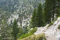
There were some downed trees and a lot of fire debris on the Fish Creek Trail. Extra care was required and I probably hiked as much of it as I ran. As I worked toward Fish Creek Saddle I could not tell how much of the canyon leading down to Lodgepole Spring had burned. The slopes on the southwest side of Grinnell Mountain had burned and some areas along the Fish Creek Trail had burned as well. Whether I descended to Lodgepole Spring from Fish Creek Saddle or returned to Mineshaft Saddle would be a judgment call.

Arriving at Fish Creek Saddle I was glad to see the forest was intact. The path down to Lodgepole Spring looked promising, but had not been used in some time. As it turned out most of the trees along the path had not burned. In places, runoff from the burned slopes above had resulted in some erosion and small flows of sandy soil. There were also the usual downed trees, but other than being a little challenging to follow, the path was generally OK.

I was nearly off the trail when the “chance of thunderstorms” forecast materialized into threatening gray clouds, a few sprinkles, and a couple of rumbles of thunder.

Here are a few photos taken during the run.

Some related posts: Running San Gorgonio: Dollar Lake – Dry Lake Variation, San Gorgonio Mountain: Dollar Lake – Dry Lake Trail RunLake Fire MODIS Fire Detections

San Gorgonio Mountain: Falls Creek Loop October 2015

Falls Creek Trail near Plummer Meadows on San Gorgonio Mountain

It was a little past noon and Downtown Los Angeles was about to hit a high of 100°F for the second consecutive day. From my vantage point I couldn’t quite make out Downtown; it was 80+ miles away, somewhere in the light haze to the west. Across Banning Pass Mt. San Jacinto loomed, massive and pyramidal, and down the spine of the range stood Mt. Baldy, surrounded by its siblings.

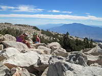
Patty and Ann on the summit of San Gorgonio Mountain.
Summit of San Gorgonio Mountain

Ann, Patty and I were enjoying the summit of 11,503′ San Gorgonio Mountain following a 13+ mile run and hike from the Momyer Creek trailhead in Forest Falls. Although it is nearly four miles longer than the Vivian Creek route and gains an additional 1000′ of elevation (6500′ vs 5500′), this superb alternative is a more runnable way up the mountain, with more of backcounty feel and alpine flavor.

Alpine terrain on the Divide Trail above Little Charlton - Jepson saddle
Alpine terrain above Little Charlton – Jepson saddle

It was cool on the summit, but I was still warm from running what I could of the final couple of miles up the peak. In that last stretch the trail contours around Jepson Peak, passes the Vivian Creek and Sky High Trail junctions, and then works its way up to the blocky summit of Gorgonio — the highest point in Southern California.

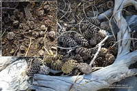
Cones of the Lodgepole pine are much smaller than cones of the Limber Pine
Lodgepole and Limber Pine cones.

Despite the record-setting hot weather, the temperature on the way up the mountain had been pleasant. Our pace had been conversational. Among other topics Ann told of her amazing experiences running the UTMB and Patty talked about photography and her trip to Zion. I spoke of lapse rates & compressional heating, Chinquapin nuts, and Lodgepole & Limber pines . At least for me, the miles passed with distracted ease.

The 31,359 acre Lake Fire overran San Bernardino Peak Divide in the area of Shields Peak.
The Lake Fire burned over the divide near Shields Peak.

From the switchbacks above Plummer Meadows you could see where the Lake Fire overran San Bernardino Peak Divide in the area of Shields Peak. The 31,359 acre Lake Fire started the afternoon of June 17 near the Forsee Creek trailhead southwest of Jenks Lake and burned a huge swath through the San Gorgonio Wilderness. The fire burned to within 0.4 mile of the summit, near the C-47B “Gooney Bird” crash site on the Sky High Trail. Here is a Google Earth view from the west along the crest of the San Bernardino Peak Divide showing part of the burn area and another view along the divide from the east. Much of the north and east side of Gorgonio is within the Lake Fire Closure Area.

Mill Creek Canyon from the Vivian Creek Trail

After about 15 minutes on the summit it began to get chilly and it was time to head down. The descent of the Vivian Creek Trail is as much of a challenge as the ascent of Falls Creek. Although I’ve run it many times, I conveniently forget just how convoluted, rocky, and technical it is. Part way down a double-fall of huge trees completely blocked the trail. One tree had broken on impact and the route choice was to either squeeze through the fracture or go the long way around.

We had become spread out on the descent, but were now running together on Valley of the Falls Drive. This 1.4 mile stretch on pavement connects the Vivian Creek trailhead to the Momyer Creek trailhead, completing the 24 mile loop. A short distance past the Fire Station we reached the gravel parking area. No longer obscured by trees, the view opened to a panorama of mountains that looked impossibly rugged and tall. Had we really just been up there?

My legs would answer that question following the two  hour drive home.

Some related posts: Falls Creek Loop August 2013, Falls Creek Loop 2012