Category Archives: trails|smmc open space

Rainy Morning on Rocky Peak Road

Steam rises from Rocky Peak Road near Fossil Point.

It was nice to start a run in the rain and see a few mud puddles along the way! Southern California has had so little rain the last several months that any rain is something to celebrate. Since the start of the water year on July 1, the official weather station for Los Angeles at USC has recorded only 1.48 inches of rain. This is more than 5 inches below normal for the date, and depending on the rain received the next three days, the July 1 to January 31 rainfall total could be the 5th driest since recordkeeping began in 1877. (Downtown Los Angeles recorded only 0.02 inch over the three days, and according to a NWS statement issued February 1, July 1 to January 31 was the 5th driest on record.)

Unless you are particularly fond of mud, Rocky Peak Road is usually a good choice for a run if it’s raining, or has rained recently. Perched on a ridge on the border between Los Angeles and Ventura counties in Rocky Peak Park, its sandy soils are generally well drained. Except for a few short sections of road, mud isn’t too much of an issue unless you run beyond “fossil point,” the high point of the road at about mile 4.8. Here there is an outcrop of fossil scallop shells.

Related posts: San Fernando Valley from Rocky Peak, Chumash-Las Llajas LoopSunset Snow Shower

Will Rogers – Temescal Loop

Mountain biker on the Will Rogers segment of the Backbone Trail in the Santa Monica Mountains

I paused for a moment on a narrow section of the Backbone Trail that zig-zags down a steep, eroded slope and then crosses a bridge over a narrow gorge before continuing down Rogers ridge. Below, a hiker stopped on the bridge to contemplate the canyon, and a mountain biker briefly walked his bike and then cranked up the switchbacks past me.

It had rained the day before, and the cold front had resulted in a chilly, puffy cloud, postcard kind of day with breezy panoramic views of the San Gabriel Mountains, Downtown, Century City, Santa Monica, Palos Verdes, and the Pacific Ocean.

The 7 mile segment of the Backbone Trail from Temescal Ridge fire road down to Will Rogers State Historic Park is one of my favorite (mostly) downhill stretches of trail in the Santa Monica Mountains. Over much of its length, the grade is not too steep, the footing consistent, and the running outstanding.

My usual route for this run starts the same as for the Trippet Ranch Loop and Garapito Figure 8 runs, going up to the Hub from the end of Reseda Blvd. From the Hub it’s about 0.6 mile along Temescal Ridge Fire Road to the point where the Backbone Trail takes off to the left from the road.

Once at Will Rogers, the Rivas Canyon Trail can be used to connect to Temescal Gateway Park, and then the Temescal Falls or Ridge trail used to connect with Temescal Ridge Fire Road and return to the Hub. (Mountain bikers use other routes.)

Overall the route is about 21 miles long, with about 3500′ in elevation gain/loss. Here’s an interactive, 3D terrain view of the Will Rogers – Temescal trail run from a more recent post.

Related post: Will Rogers – Rivas Canyon – Temescal Canyon Trail Run

Musch Trail Mule Deer

Mule deer along the Musch Trail near Trippet Ranch in Topanga State Park

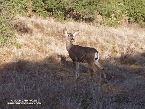
About ten feet in front of me, there was a flash of brown as a large animal leaped across the trail. In the balloon of time that accompanies a surge of adrenalin, I thought of the possibilities. The last time an animal startled me, I was running on a dirt road through ten foot tall chaparral in the Simi Hills. In that case a large bob cat had bolted from the brush.

Lingering in my mind was a trail runner’s recent encounter with a mountain lion while running at Whiting Ranch in Orange County. The last place I had seen mountain lion tracks was on a muddy nature trail, not far from where I was now. That was more than a year ago. It had rained overnight, but so far I had only seen tracks of coyote, dogs and deer.

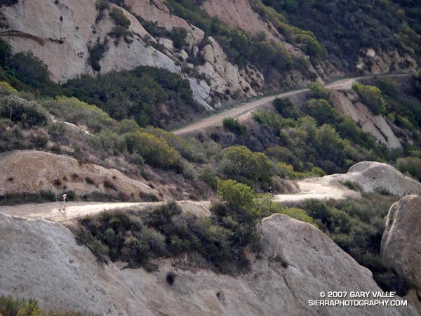
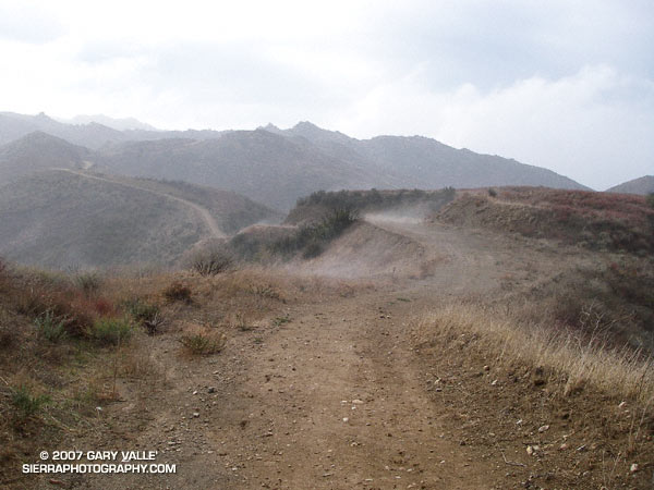
Today, I was on the Musch Trail, doing one of my favorite cool weather runs — an approximately 12.2 mile, fire roads out, trails back course from the end of Reseda Blvd. to Trippet Ranch, in Topanga State Park.

As time warped back to normal, I saw the animal wasn’t a bob cat or mountain lion, it was a mule deer. A doe had stopped just a few feet from the trail. That was unusual. Also, it was strange that her full attention wasn’t on me. Instead, she seemed concerned about something behind her, uphill from the trail. I stood quietly and watched.

She appeared to be evaluating the situation, and after about 15 seconds seemed to calm. Still alert, another 15 seconds passed, and following some unseen cue, a six or seven month old fawn was suddenly at her side.

Now her big ears, and more of her attention, were focused on me. With the fawn at her side, she obviously didn’t like being out in the open. She scented the ground, checked her fawn, and then looked back up the hill. I couldn’t see any more deer from my position, but they could easily be hidden in the surrounding cover. Almost a minute and a half after the encounter began, the doe and fawn moved into the brush.

Slowly moving a few feet along the trail, I glanced up the hill and discovered two more members of the group, waiting for me to pass. I continued walking down the trail, and after few yards, picked up the pace, and resumed my run.

Here’s a Google Earth image and Google Earth KMZ file of a GPS trace of the route.

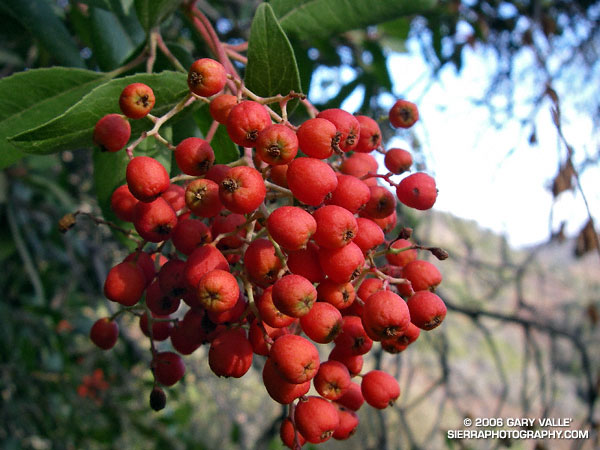
Related posts: Christmas Berry, Mountain Lion Saga, Ferns Along the Garapito Trail.

Chumash-Hummingbird Loop

Oak, grass, and clouds in Simi Valley, California.

The Chumash and Hummingbird trails are popular trails in the eastern Simi Valley, north of the 118 Freeway. These trails ascend the steep western flank of the Santa Susana Mountains to Rocky Peak fireroad. A scenic loop can be created using these trails and a connection between the Chumash and Hummingbird trailheads down in the valley. There are a few ways to do this, and the loop has proved popular.

The Chumash trailhead is on Flanagan Dr., off of Yosemite, and the Hummingbird trailhead is on Kuehner Dr. just north of the 118 Frwy. Currently, no official trail connects these trailheads. To connect them via city streets (Yosemite, E. Los Angeles Ave., Kuehner) is a long detour on pavement and doesn’t make sense from a trail-running or hiking point of view.

For many years a more direct, unofficial route has been used to connect the two trailheads. Most of the route is on dirt roads through undeveloped property. Using this route the length of the Chumash-Hummingbird loop works out to about 9.2 miles with about 1700′ of elevation gain. It’s an excellent hike, run or ride with great scenery and views.

For a number of years access to the Hummingbird Trail from Kuehner Dr. has been across property that is now being developed. A chain link fence has been in place along Kuehner for some time. Apparently, at the north end of this chain link fence there is a conservation easement that allows access to the Hummingbird Trail  via a corridor adjacent to the (private) Hummingbird Ranch property. It was necessary to use this access easement when I ran this loop last weekend.

The property on the west side of Kuehner is also being developed. As I understand it, Mt. Sinai Dr. will eventually connect to Kuehner and a small parking lot will be built for trail users. Hopefully, some provision will also be made to officially connect the Chumash and Hummingbird trailheads and preserve this scenic loop.

The photograph of the oak is from a run of the loop on April 28, 2005.

Update 12/26/06 – Mike Kuhn, the director of the Rancho Simi Trailblazers, sent me the following information regarding the Hummingbird trail easement:

“At the top of Kuehner Drive is a cul-de-sac at the gate to the Hummingbird’s Nest Ranch. The white plastic fence marks the boundary of the ranch. There is a corridor of land owned by the park district along the white plastic fence down to the creek and hence to the usual crossing of the creek.”

He also said that a trail connection between Chumash and Hummingbird is in the planning stages, and encourages all trail users to be patient while the construction at Kuehner is underway.

Related post: Lower Stagecoach – Hummingbird Loop

Christmas Berry on the Garapito Loop

Photo of the berries of toyon,  Christmas berry (Heteromeles arbutifolia)

A photo of the berries of Toyon (Heteromeles arbutifolia) taken on the Garapito Loop trail run on Thanksgiving Day. Also called Christmas berry, the plant is protected by a California law.

The Garapito Loop is a pleasant 7.5 mile figure eight course that starts at the south end of Reseda Blvd. at Marvin Braude Mulholland Gateway Park, goes up to near Eagle Rock via Fire Road #30 and Eagle Rock Fire Road, and then returns via the Garapito and Bent Arrow Trails. Here’s a Google Earth image of a GPS trace of the route and a 3D, interactive view of a slightly longer variation of the loop that visits Eagle Rock.

Also see: Ferns Along the Garapito Trail

Balance Rock

Balance Rock above Echo Cliffs.

My plan had been to run out the Mishe Mokwa Trail to the Backbone Trail, and then head west towards Sycamore Canyon. I needed to be back in the Valley before noon, so about an hour out I would head back. Running past Echo Cliffs, I tried to pick out some of the steep climbing routes, and contemplated delicately perched Balance Rock. Sections of the trail facing into the morning sun are already warm, but shaded areas are cool and pleasant. Unlike the hot weather at the end of July, it isn’t like running in Death Valley.

By the time I reached the idyllic, oak-shaded area at Split Rock, I’d pretty much forgotten about Balance Rock and was trying to recall the trail choices ahead. But as I rounded a corner, I couldn’t help but notice a small spur trail marked with a sign announcing “Balance Rock – Not a NPS Maintained Trail.”

The last couple of times I had been on the Mishe Mokwa trail, I’d been on long point to point runs, and couldn’t be impulsive. Not so this time – so I hung a right and went to check out the rock. Here is a closer view.

The rocks of this area owe their striking appearance to a dramatic geologic history. The Dibblee geology map indicates that Boney Mountain, Echo Cliffs, and the summit of Sandstone Peak are exposures of 16.1 to 13.1 million year old Conejo Volcanics, probably deposited as volcanic talus and debris-flows.

After taking a few photos, I returned to the Mishe Mokwa Trail, and jogged up to the Backbone Trail. Out of time, I had no choice but to turn east on the Backbone Trail and return to the car. On the way back I did take a few extra minutes to run up the short spur trail to the summit of 3111 ft. Sandstone Peak, the highest point in the Santa Monica Mountains.

The Mishe Mokwa – Sandstone Peak loop has much to recommend it. In terms of scenic value per mile, the approximately 6 mile loop is hard to beat. This National Park Service PDF provides additional information and a trail map of the Circle X Ranch area.

Note: The mileage figure does not include the side trip to Balance Rock. The use trail to the rock – at least the one I followed – was brushy in a few spots.