Category Archives: weather

Increasing Clouds

Pt. Mugu State Park from the Chamberlain segment of the Backbone Trail

The last couple of days I’d been checking the weather models to try and get an idea of when the cold front might reach Pt. Mugu State Park. Projections ranged from around 10:00 AM to about 1:00 PM.

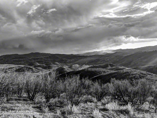
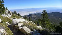
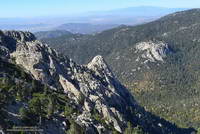
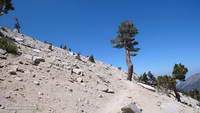
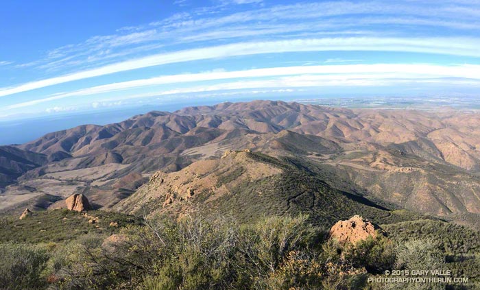
A group of us were doing an annual end of the year trail run and scramble over Boney Mountain to the Backbone Trail, and then returning by various routes to the Wendy Drive trailhead. Along the way there are great views of the Boney Mountain Wilderness, Channel Islands, Conejo Valley and Ventura Mountains, but you can’t see very far from inside of a cloud.

Runners on the crest of the western ridge of Boney Mountain.
Boney Mountain’s Western Ridge

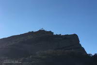
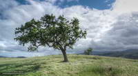
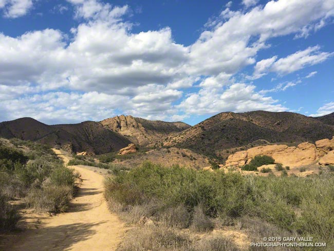
It turned out clouds would not be a problem. At least not the first half of the day. When I pulled into the parking area at Wendy Drive the front was little more than a white smudge on the western horizon. The sky was clear and it remained clear the entire time we worked up Boney’s Western Ridge. Everyone enjoyed scrambling up the gullies and rocks to the top of the mountain and then over to Tri Peaks.

View west from Sandstone Peak, the highest peak in the Santa Monica Mountains
Approaching cold front from Sandstone Peak

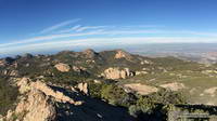
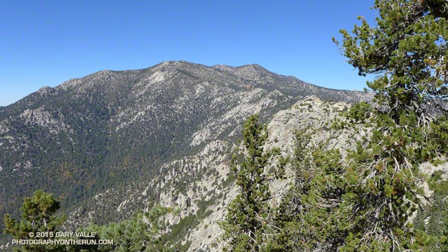
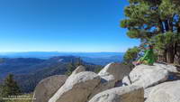
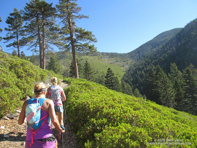
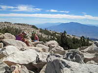
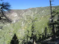
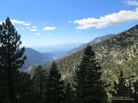
We’d reached Tri Peaks about 40 minutes ago. From there I’d run over to Sandstone Peak, the highest peak in the Santa Monica Mountains. From this panoramic vantage point I could see the front was still well to the west, near Santa Barbara. This gave me some time. I was prepared for rain, but didn’t want to miss the wonderful scenery running down the Chamberlain Trail, over to Serrano Valley, and through Serrano Canyon.

Sycamore Canyon near the Danielson Multi-Use Area.
Increasing clouds near Danielson Ranch

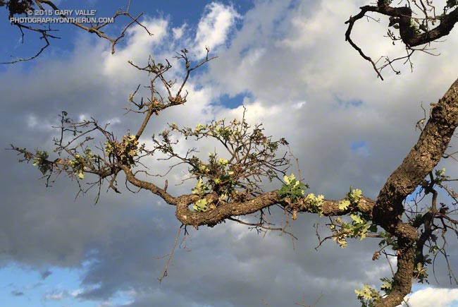
Over the remainder of the run I watched as cirrus clouds ahead of the front gradually muted the sun, mid-level clouds began to develop over the peaks, and the wind became more gusty and fitful. Later in the run the clouds started to lower and thicken and the temperature dropped. Eventually it began to smell like rain.

Cold front moving into Pt. Mugu State Park
Here comes the rain!

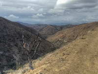
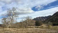
As I crested the hill on Danielson Road I felt a cold drop of rain on my arm and then another on the back of a leg. Clouds covered the sky, and to the west showers draped the ridges and filled the canyons. The front and I were racing the last mile to the trailhead, and I knew who had won.

Waiting for Rain: El Nino and the 2015-16 Southern California Rainfall Year

Thunderstorm over the Santa Monica Mountains

Due in part to El Nino and the Madden-Julian Oscillation (MJO) Southern California jump-started the 2015-16 rain season with above average rainfall in July and September.

Last year the NWS changed the WATER Year to October 1 – September 30, but the RAINFALL Year remains July 1 – June 30, as it’s been for decades.

Below is the monthly tabulation of rainfall for Downtown Los Angeles (USC) for the 2015-16 Rainfall Year, along with what is considered normal for the month.

Downtown Los Angeles Rainfall
Month Rainfall Normal
July 0.38 0.01
August T 0.04
September 2.39 0.24
October 0.45 0.66
November 0.01 1.04

So far this rainfall year Downtown Los Angeles (USC) has recorded 3.23 inches. Even with November as dry as it’s been we’re still more than an inch above normal for the rainfall year — about 1.46 inches above normal as of November 25.

Over the next couple of weeks the medium range models and other tools aren’t especially bullish on our chances for a good, soaking rainstorm in Southern California. Longer term guidance suggests an improving chance of precipitation as December progresses, and above average precipitation in January and February. We’ll see!

The title photo is from November 3. It shows a band of thunderstorms that moved southward across the San Fernando Valley and into the Santa Monica Mountains. The band produced cloud to ground lightning strikes and some heavy showers. Saddle Peak is in the distance on the left. The shower activity in the distance on the right is in the area of Kanan Rd. and the 101 Frwy.

New Leaves on Drought-Stressed Valley Oak

Drought-stressed valley oak sprouting leaves following summer rains in Southern California

Sprouting new leaves as if recovering from a wildfire, this drought-stressed valley oak at Ahmanson Ranch benefited from the unusual amount of rain in Southern California during July and September.

Hilltop valley oak at Ahmanson Ranch, photographed in April 2011, prior to the drought in Southern California
Valley oak at Ahmanson Ranch

Between July 1 and October 1, the Cheeseboro RAWS, located on a hilltop about two miles away, recorded more than two inches of rain.

Here’s what the tree looked like in 2011, before the drought.

Update January 15, 2021. “The Tree” died in the Spring of 2020, when Ahmanson was closed due to COVID-19. Although scorched in the Woolsey Fire, it never recovered from the 2011-2015 drought, and that appears to have been the primary cause of death.

Some related posts: Ahmanson Valley Oaks Battling Drought, It Was So Muddy (Again) That…, A Two Mud Run Summer and Wet Winter Outlook for Southern California

San Jacinto Peak and Tahquitz Peak Trail Run

San Jacinto area peaks from near Tahquitz Peak

Summits that can be accessed by trail are usually busy places, especially in good weather. That was certainly the case this morning. Each of us had encountered someone we knew on or near San Jacinto’s rocky summit.

It seemed everyone on the peak was doing a different adventure. One hiker mentioned he had run out of food at Wellman Divide. That seemed strange until he explained he was doing the “8000 Meter Challenge” — ascending Baldy, Gorgonio and San Jacinto consecutively in 24 hours. The 8000 meters refers to the (approximate) cumulative gain and loss when doing the three peaks. In round numbers Baldy via the Ski Hut would be about 2375 meters of gain+loss, Gorgonio via Vivian Creek 3350 meters and San Jacinto via the Tram about 1500 meters. If you skip the Tram and do San Jacinto from Idyllwild the gain+loss is about 2680 meters.

The Coachella Valley from the Wellman Divide Trail about a half mile from the summit of San Jacinto Peak.
Coachella Valley from near the summit of San Jacinto Peak

An ultrarunning friend that reached the summit shortly after we did was doing Cactus to Clouds to Cactus (C2C2C). This arduous route starts in Palm Springs at an elevation of about 460 feet and climbs all the way to the summit of San Jacinto at about 10,834 feet. Including a couple of short downhills along the way, the total elevation gain is around 10,800 feet. Round trip that works out to about 6600 meters of gain+loss.

Tahquitz Peak and the mountains beyond, from Wellman Divide
View from Wellman Divide

Ann, Telma and I were doing a route I’ve enjoyed for many years — ascending San Jacinto from the Tram and then running down to the fire lookout on Tahquitz Peak. The route has excellent running and (on a clear day) hundred-mile vistas. The views of Tahquitz and Suicide Rocks bring to mind many fine days spent with friends at these superb rock climbing areas.

When we got our wilderness permit at the Long Valley Ranger Station the ranger had warned us about 45 mph winds and cold temps on the summit. The strong winds had been forecast to moderate before sunrise and the forecast was spot on. The weather on the summit was near perfect — warm in the sun and cool in the shade with light winds.

Tahquitz Peak Fire Lookout

After ascending San Jacinto we returned to Wellman Divide and then descended the Wellman Divide Trail and PCT to Saddle Junction. From Saddle Junction it is only a couple of (mostly uphill) miles to Tahquitz Peak. This Google Earth image shows my GPS track from Wellman Divide to Tahquitz Peak and back.

Osborne Fire Finder at the Tahquitz Peak Fire Lookout
Osborne Fire Finder

A dozen or so hikers were enjoying the warm sun and great weather at the lookout. As always, the fire lookout host was friendly and informative, answering questions about the lookout’s equipment and surrounding landmarks. Want to become a volunteer host? Check this page.

Tahquitz Rock and Suicide Rock rock climbing areas from the South Ridge Trail
Tahquitz & Suicide Rocks

My usual return route from Tahquitz Peak is to go back to Saddle Junction and then follow the Willow Springs Trail to Hidden Lake Divide. With the Willow Springs Trail closed due to the 2013 Mountain Fire it’s necessary to climb back up to Wellman Divide and then descend to the Tram from there. This adds about a mile and 800′ of gain to the usual route. Although we had descended it earlier in the day, the trail going up to Wellman Divide had a different feel to it, and the out and back wasn’t nearly as onerous as I thought it might be.

About an hour after topping out at Wellman Divide we were back at the Long Valley Ranger Station and not long after that on the Tram and headed down the mountain. I smiled as the decades-old recording in the tram car began, “You’ve had a great day…”

Some related posts: Summery San Jacinto; Smoky Tahquitz Peak, Room With a View, Mountain Weather, Hitting the (Big) Hills of Southern California

Afternoon Clouds

The Chumash Trail, Simi Valley, California

Wow, there have been some spectacular afternoons recently! That’s the Chumash Trail yesterday.

The Chumash Trail is one of Simi Valley’s best trails. It’s tough and technical, and has great views. From bottom to top it’s about 2.6 miles with an elevation gain of about 1150 feet.

San Gorgonio Mountain: Falls Creek Loop October 2015

Falls Creek Trail near Plummer Meadows on San Gorgonio Mountain

It was a little past noon and Downtown Los Angeles was about to hit a high of 100°F for the second consecutive day. From my vantage point I couldn’t quite make out Downtown; it was 80+ miles away, somewhere in the light haze to the west. Across Banning Pass Mt. San Jacinto loomed, massive and pyramidal, and down the spine of the range stood Mt. Baldy, surrounded by its siblings.

Patty and Ann on the summit of San Gorgonio Mountain.
Summit of San Gorgonio Mountain

Ann, Patty and I were enjoying the summit of 11,503′ San Gorgonio Mountain following a 13+ mile run and hike from the Momyer Creek trailhead in Forest Falls. Although it is nearly four miles longer than the Vivian Creek route and gains an additional 1000′ of elevation (6500′ vs 5500′), this superb alternative is a more runnable way up the mountain, with more of backcounty feel and alpine flavor.

Alpine terrain on the Divide Trail above Little Charlton - Jepson saddle
Alpine terrain above Little Charlton – Jepson saddle

It was cool on the summit, but I was still warm from running what I could of the final couple of miles up the peak. In that last stretch the trail contours around Jepson Peak, passes the Vivian Creek and Sky High Trail junctions, and then works its way up to the blocky summit of Gorgonio — the highest point in Southern California.

Cones of the Lodgepole pine are much smaller than cones of the Limber Pine
Lodgepole and Limber Pine cones.

Despite the record-setting hot weather, the temperature on the way up the mountain had been pleasant. Our pace had been conversational. Among other topics Ann told of her amazing experiences running the UTMB and Patty talked about photography and her trip to Zion. I spoke of lapse rates & compressional heating, Chinquapin nuts, and Lodgepole & Limber pines . At least for me, the miles passed with distracted ease.

The 31,359 acre Lake Fire overran San Bernardino Peak Divide in the area of Shields Peak.
The Lake Fire burned over the divide near Shields Peak.

From the switchbacks above Plummer Meadows you could see where the Lake Fire overran San Bernardino Peak Divide in the area of Shields Peak. The 31,359 acre Lake Fire started the afternoon of June 17 near the Forsee Creek trailhead southwest of Jenks Lake and burned a huge swath through the San Gorgonio Wilderness. The fire burned to within 0.4 mile of the summit, near the C-47B “Gooney Bird” crash site on the Sky High Trail. Here is a Google Earth view from the west along the crest of the San Bernardino Peak Divide showing part of the burn area and another view along the divide from the east. Much of the north and east side of Gorgonio is within the Lake Fire Closure Area.

Mill Creek Canyon from the Vivian Creek Trail

After about 15 minutes on the summit it began to get chilly and it was time to head down. The descent of the Vivian Creek Trail is as much of a challenge as the ascent of Falls Creek. Although I’ve run it many times, I conveniently forget just how convoluted, rocky, and technical it is. Part way down a double-fall of huge trees completely blocked the trail. One tree had broken on impact and the route choice was to either squeeze through the fracture or go the long way around.

We had become spread out on the descent, but were now running together on Valley of the Falls Drive. This 1.4 mile stretch on pavement connects the Vivian Creek trailhead to the Momyer Creek trailhead, completing the 24 mile loop. A short distance past the Fire Station we reached the gravel parking area. No longer obscured by trees, the view opened to a panorama of mountains that looked impossibly rugged and tall. Had we really just been up there?

My legs would answer that question following the two  hour drive home.

Some related posts: Falls Creek Loop August 2013, Falls Creek Loop 2012