Category Archives: weather

Waterman Mountain Cool

View east from Mt. Waterman to Mt. Baldy

Weekend highs in California were down 30-40 degrees from the searing temps earlier in the week. After dealing with the heat, my jaw dropped when I read Sunday’s NWS forecast for the Eastern Sierra:

 .SUNDAY…PARTLY SUNNY. A CHANCE OF SNOW SHOWERS AND A SLIGHT
 CHANCE OF RAIN SHOWERS IN THE MORNING…THEN A CHANCE OF
 THUNDERSTORMS AND SNOW SHOWERS IN THE AFTERNOON. SNOW LEVEL ABOVE
 9000 FEET IN THE MORNING. HIGHS 40 TO 52 IN THE HIGHER ELEVATIONS…
 AROUND 59 NEAR 8500 FEET. WEST WIND AROUND 10 MPH SHIFTING TO THE
 SOUTH IN THE AFTERNOON. CHANCE OF PRECIPITATION 40 PERCENT.
 
Now that is great August weather forecast!
 
I couldn’t get to the Sierra, but I could do a run in the Angeles High Country — and I was willing to bet the upper level trough that was producing unsettled weather in the Sierra would also result in a cool, Autumn-like day in the San Gabriel Mountains.

And it did! Compared to my midweek runs, running up the Mt. Waterman trail was like going for a swim in a high mountain lake. Just spectacular!

Rocky Peak Heat

Simi Valley from Rocky Peak

Simi Valley and the Pacific Coast from Rocky Peak Road

What better way to recover from the Bulldog 50K than running Ahmanson and Rocky Peak on two of the hottest days of the year?

Yesterday, Pierce College in Woodland Hills hit a scorching 111°F, and then today 109°F. At the start of today’s run it was still over 100°F on Rocky Peak, but extra (ice) water, and a bit of a breeze kept things mostly reasonable.

No matter the weather, you’ll always see someone else on Rocky Peak!

Some related posts: Rocky Peak Rainstorm, Snow on Oat Mountain

Cooler Climes

Paintbrush on the Vincent Tumamait Trail

Paintbrush on the Vincent Tumamait Trail

Thursday afternoon the temperature in Woodland Hills hit 107°F. Friday was 103°F, and Saturday 104°F. Weekdays I run in the afternoon, and after running in that heat, I needed to escape to cooler climes. One way to beat the broiling temps was to head for the high country.

There are several higher elevation areas within a couple hours drive of Los Angeles. My favorites are Mt. Baden-Powell (9399′), Mt. Baldy (10,064′), Mt. Pinos (8831′), Mt. San Jacinto (10,834′) and San Gorgonio Mountain (11,499′).


Mariposa and paintbrush
Today the choice was Mt. Pinos. It had been a few weeks since I’d run there, and the driving time to the Chula Vista parking lot on Mt. Pinos is about the same as that to Islip Saddle in the San Gabriels. Also, it’s usually cooler running between Mt. Pinos and Mt. Abel, than between Islip Saddle and Mt. Baden-Powell.

It was a little breezy and chilly up on Mt. Pinos, Sawmill Mountain and Mt. Abel. What a change from during the week. At the start of the run the temperature was about 40-50 degrees cooler than my last run at Ahmanson Ranch.

I did an extended version of the usual 14.5 mile out and back course on the Vincent Tumamait Trail. This variation drops down to Lilly Camp (6600′) on the North Fork Trail before continuing to Mt. Abel. The side trip adds about 6 miles and 1700′ of gain. It was a bit warmer down at Lilly Meadow Camp, but the air conditioning kicked back in once I returned to the main trail.

Some related posts: Running Hot & Cold, Up & Down Mt. Baldy’s South Ridge, Vincent Tumamait Trail, Autumn Trail Running on Mt. San Jacinto, San Gorgonio High Line 2009

La Nina Looming

Pacific Crest Trail Near Mt. Burnham

Pacific Crest Trail Near Mt. Burnham, in the San Gabriel Mountains

At an elevation of 9000′ the weather was sensational. Skies were partly cloudy, accentuating the terrain, and hinting of a thunderstorm later in the day. I was on the Pacific Crest Trail between Mt. Burnham and Mt. Baden-Powell, about 8 miles into a 18 mile run in the San Gabriel Mountains.


Remarkably, there was still a small patch of snow along the trail. According to seasonal summaries in Your Guide to Snowfall, the 2009-2010 season in Southern California was the best since the big Winter of 2004-2005. But it wasn’t necessary to check the snow history to know the snowfall had been above average. All that was needed was to look around, and the mountains told the story.

The remnants of snow were only part of the tale. Broken and downed trees told of strong Winter winds, and the stalks of red snow plant of a cool Spring. Now springs flowed freely and once dry seeps were damp and green. Wildflowers bloomed in profusion. Squat bumblebees waddled from flower to flower, and hummingbirds darted from patch to patch of scarlet bugler.


It had been a good Winter. Sugar pines were heavy with pine cones, and new growth decorated the limbs of the white firs. The growth of tree seedlings in the Curve Fire burn area seemed to have accelerated, and the protracted process of forest replacement was underway.

Southern California’s erratic weather demands that plants and trees be opportunistic. In time they have learned that an El Nino Winter is often followed by one that is dry, and La Nina looms.

Running Hot & Cold

Mt. Baldy from the summit of Mt. Baden-Powell

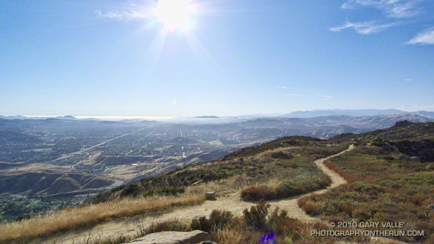
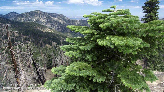
Mt. Baldy fron the summit of Mt. Baden-Powell

Yesterday, Woodland Hills topped the 90° mark for the first time this year. But somebody forgot to tell the local mountains about the warmup. This morning, I was about a mile into an out and back trail run from Islip Saddle to Mt. Baden-Powell, and with the wind chill, it felt like the temp was in the 40’s.

It was chilly in running shorts, and I debated pulling some warmer clothes from the pack. In addition to a short-sleeve shirt, I did have on a pair of pull-on long sleeves. For the moment that seemed to be enough. Rounding a corner, the trail leveled, and up ahead I could see a hiker headed my way. Based on the time, I figured he was descending from Little Jimmy Campground. We exchanged greetings, and as we passed, he commented, “you know there’s a lot of snow on the trail.”


Snow on the crest near Mt. Baden-Powell
This Spring the weather in California has been dominated by a series of cool troughs, slowing the snow melt and in some cases adding to it. It its May 27th Summary of Snow Water Content, California Cooperative Snow Surveys reported the statewide snowpack at nearly twice the normal amount for the date. Squaw Valley reopened for Memorial Day weekend; and with over 100 inches of snow since April 1, Mammoth Mountain plans to operate through July 4.

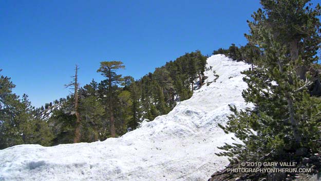
On the shaded, north facing slopes of Mt. Islip there was more snow than I’d seen since the Spring of 2005.  It couldn’t be avoided. However, the route was well-traveled, and where there was snow, dirt-covered steps eased the way. I had picked up a short length of downed fir, and it worked OK as a crude ice axe, or if you prefer, a stubby trekking pole. It enabled me to move a little faster, and had the added benefit of keeping my upslope hand out of the snow.


Seedling Jeffrey Pine in ghost forest
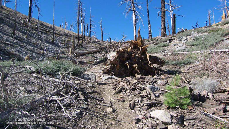
It didn’t take long to reach Windy Gap (7588′), and soon I was working up the trail to the gap above Windy Gap. Here the trail winds through a ghost forest of old growth trees, burned in the 2002 Curve Fire. Recovery has been slow, and it was heartening to see a young Jeffrey pine in the midst of all the deadwood. It also gave me a sobering perspective of the time that was going to be required for the recovery of the forests decimated by the Station Fire.

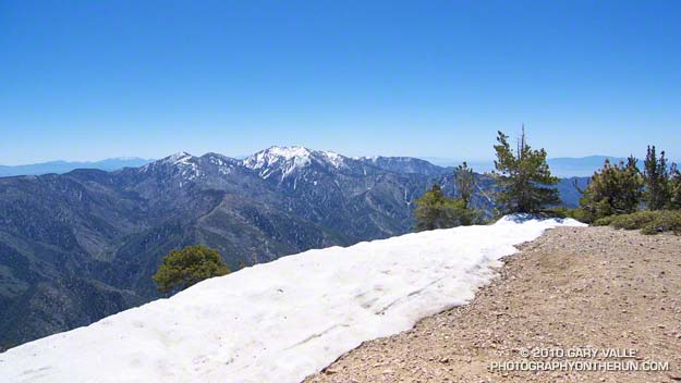
The trail climbs up to the crest of the San Gabriels near peak 8426, about a mile east of Windy Gap. From here it more or less follows the prominent divide all the way to Mt. Baden-Powell (9,399′). It’s the “more or less” part that’s key in a snowy year. The shaded north side of the divide may be completely snowbound, while the crest and south side are snow free. The way the ridgeline is oriented, storm winds create deep bands of snow along and just north of the crest. In places the trail can be buried in several feet of snow.


Snow on the crest east of Mt. Burnham
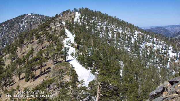
On the east side of Mt. Hawkins I checked out a tree that had been struck by lightning, and then continued along the ridge. The wind was little more than a breeze now, and the temperature comfortable. I pulled off my running sleeves, and then followed the trail across the warm, south facing slopes of Throop Peak. Sometimes on the trail, and sometimes on the crest, I descended to a saddle and then climbed up and over Mt. Burnham (8997′).

On the summit of Mt. Baden-Powell there was almost no wind. The sun was warm and the air clear. Across Vincent Gulch Mt. Baldy gleamed alpine white, its summit ridges still heavy with corniced snow. Many miles to the east, snow could also be seen on San Gorgonio Mountain, and Mt. San Jacinto. A Clark’s nutcracker complained raucously from the top of a Lodgepole Pine, and I assured the bird that I would be leaving the summit soon.

Some related posts: San Gabriels High Five, Islip Saddle – Mt. Baden-Powell Out & Back

May… or March?

Eagle Rock From Eagle Springs Fire Road

Eagle Rock From Eagle Springs Fire Road

Is it May or March? With all the blustery weather systems that have been moving through Southern California, it’s been hard to tell.


Today I had planned to head back to the high country of the San Gabriels, but instead decided to take advantage of the spectacular weather and do a rambling 24 mile run in the Santa Monica Mountains.

It was a good choice. Early in the run growing mountains of silver-lined cumulus towered above the Hub, and a brisk wind tempted me to pull the sleeves from the pack. Wildflowers lined the trails, and the chaparral teemed with color, sound and scent. It was a long run kind of day.

Note: Later in the day I talked to a runner who had been at Lake Arrowhead early in the morning. He said it had been snowing down to 3000 ft! According to the NWS, record low temperatures for today were set at Lancaster (41°), San Luis Obispo (38°), and Sandberg (28°).