Category Archives: southern california

Running to the Temescal Canyon Cascade From the Top of Reseda (Two Ways)

Temescal Canyon Cascade

The Temescal Canyon “waterfall” is an immensely popular cascade, most often accessed from Temescal Gateway Park using the Temescal Canyon Trail. Judging from the number of people on the trail, a loop incorporating the Temescal Canyon and Temescal Ridge Trails is also very popular.

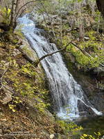
Even though many refer to it as a waterfall, it’s not a dramatic river-wide fall, such as Nevada Fall in Yosemite. Picture a Japanese garden with a gurgling little stream, cascading down through rocks into a pool, surrounded by an artistic arrangement of plants and trees. There’s even the requisite bridge to complete the composition. It would be meditative if it were not so popular.

Cloud-shrouded view northwest from Temescal Peak to the Cathedral Rocks/Hub area. (Thumbnail)
Cloud-shrouded view of the Cathedral Rocks/Hub area.

Over the past few weeks, I’ve run from the Top of Reseda (Marvin Braude Mulholland Gateway Park) to the Temescal Canyon Cascade two ways — a 15-mile out-and-back and a 21-mile loop.

The out-and-back route from the Top of Reseda was one of those “I’ll just go a little bit farther” runs. It had rained the day before and the NWS forecast called for a chance of showers in the morning and then showers likely in the afternoon.

High Point (Goat Peak) from Temescal Ridge. (Thumbnail)
High Point (Goat Peak) from Temescal Ridge.

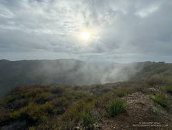
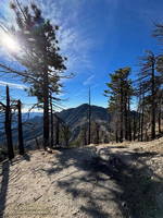
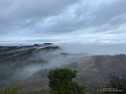
With the weather unsettled, I didn’t have a particular plan in mind. When I started the run, it looked like it might rain at any time, so I decided to run to Temescal Peak, and then play it by ear from there. Once on Temescal Peak, the weather seemed to be holding, so I continued to Temescal Lookout. From the Lookout, Green Peak was just a “little bit further,” and in a few minutes, I was standing on top.

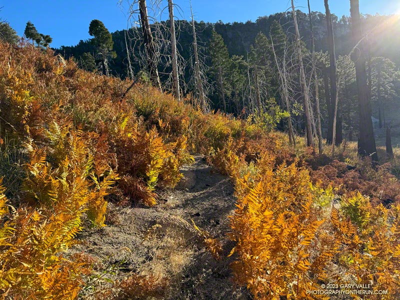
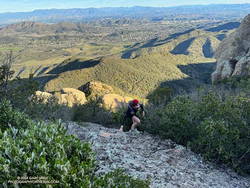
I continued to be drawn down Temescal Ridge in this fashion, and before I knew it was at the junction of the Temescal Ridge and Temescal Canyon Trails. From there, it was only a half-mile down to the cascade.

Scrambling up Boney Mountain's Western Ridge (aka Mountaineer's Route) on an adventure run to Sandstone Peak. (Thumbnail)
Scrambling up Boney Mountain’s Western Ridge

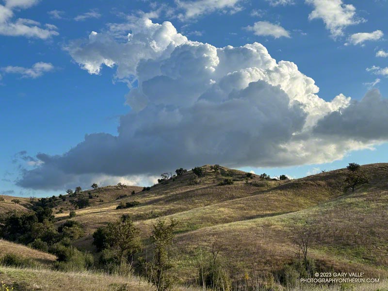
Two weeks later, I was back at the Top of Reseda. It had rained an inch and a half in Downtown Los Angeles a couple of days before, and a well-advertised multi-day rain event was forecast to begin the following day.

The previous weekend, a friend and I had climbed/run to Sandstone Peak from Wendy Drive. Temps in the sun reached into the 80s, and maybe I talked too much and ate and drank too little. On the way back, I hit the wall near the turn onto the Upper Sycamore Trail.

Cootamundra wattle (Acacia baileyana) in Will Rogers State Historic Park. (Thumnbnail)
Cootamundra wattle at Will Rogers.

This morning, I had no idea how my legs were going to feel. My loosely defined plan was to run out the Rogers Road segment of the Backbone Trail from the Top of Reseda and see. If the legs held up, I’d continue to Will Rogers State Historic Park. If not, maybe I’d do Goat Peak or something else.

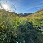
The temperature was in the 40s most of the way down to Will Rogers. With the cool weather, it seemed my running was back to normal. From Will Rogers, I headed over to Rivas Canyon, where I found Sierra Club volunteers hard at work on the Rivas Canyon Trail. This enjoyable trail links Will Rogers to Temescal Canyon and is a key part of the loop.

Cactus and agave along the Rivas Canyon Trail. (Thumbnail)
Cactus and agave along the Rivas Canyon Trail.

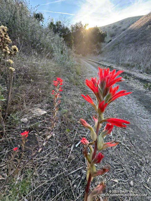
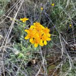
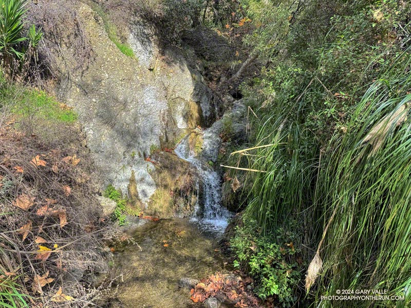
Once down in Temescal Canyon, there was a constant stream of hikers going up the Temescal Canyon Trail to the cascade. With the recent rain and good weather, the cascade had more water and more people than on the run in January. A large group rested near the bridge, and hikers hustled and bustled up and down the trail. The little cascade gurgled and burbled in the morning sun, glistening bubbles popping up beneath the plunging stream and then disappearing as they wandered downstream.

Soon, I was chugging up the trail toward its junction with the Temescal Ridge Trail, retracing my steps from two weeks before.

Some related posts:
Will Rogers – Rivas Canyon – Temescal Canyon Trail Run
Go Figure: An Extended Version of the Will Rogers – Temescal Canyon Loop
Sandstone Peak from Wendy Drive

Spring Wildflowers in December?

Paintbrush blooming in mid-December in Cheeseboro Canyon in Southern California near Los Angeles
Paintbrush blooming in mid-December in Cheeseboro Canyon

The paintbrush above, and the following Spring-blooming wildflowers were photographed on December 14,2023, on a trail run from the Victory Trailhead of Upper Las Virgenes Canyon Open Space Preserve. With the exception of the black mustard, the wildflowers were found along a half-mile stretch of dirt road connecting upper Las Virgenes and Cheeseboro Canyons.

The false Spring was the result of rain from Tropical Storm Hilary in August, an extended period of wetter than normal weather, and somewhat warmer Fall temperatures. The Water Year that ended September 30, 2023 was the seventh wettest on record for Los Angeles and Calendar Year 2023 was the sixth wettest.

Some related posts:
– A Second Spring at Ahmanson Ranch
– Seventh Wettest Water Year in Los Angeles Results in Rarely Seen Trail Conditions
– Looking For Local Impacts of Tropical Storm Hilary


I Stop for Cumulus Clouds

Cumulus cloud - Photography by Gary Valle'

On my way to upper Las Virgenes Canyon from the Victory Trailhead of Ahmanson Ranch, I had to stop running and marvel at the intricacy and beauty of this cumulus cloud.

The cloud developed as another weak trough was passing through Southern California. For a few weeks the long-range outlooks have been advertising a change to a wetter weather pattern, but the expected transition keeps being delayed.

More posts from the category Nature & Clouds.

Chumash Rock and Clouds

Chumash Rock and Clouds - Photography by Gary Valle'
Chumash Rock and Clouds

“Chumash Rock” is prominent rock formation seen from the Chumash Trail in the eastern Simi Valley.

As I discovered in a January 2006 adventure, it is not an easy rock formation to reach.

The title photo was taken in mid-November while doing the Chumash – Las Llajas Loop. The clouds over the Ventura County foothills and mountains from the Las Llajas Canyon – Rocky Peak Road connector were just as beautiful.

Three Points Loop Following the Reopening of Angeles Crest Highway

Bracken fern turning color at Waterman Meadow is a sure sign of Autumn.
Waterman Meadow

I was beginning to wonder if I would get a chance to do the Three Points Loop around Mt. Waterman this year. Angeles Crest Highway had been closed from Red Box to Vincent Gap for many months, and CalTrans projected it might not open until Thanksgiving.

That’s why Friday (November 3) I was excited to hear Angeles Crest Highway had reopened between Upper Big Tujunga Rd. and Islip Saddle.

Alpenglow on the San Gabriels' Front Range peaks.
Alpenglow on the San Gabriels’ Front Range peaks.

At dawn, a couple days later, I pulled into the Three Points parking lot, put on some sunscreen, grabbed my pack, and set out to see what was happening on the Three Points loop around Mt. Waterman.

I’d done the loop many times and in many situations — clockwise, counterclockwise, after the Station Fire closure, after the Bobcat Fire closure, with snow at the higher elevations, in hot weather and in cold. When the trails are in good shape and the weather isn’t too hot, the 20-mile loop is an outstanding trail run. Today, it was a challenge just to complete the loop.

Gilia along the Burkhart Trail. November 2023.
Gilia along the Burkhart Trail.

In many areas of Southern California, a wet 2022-2023 rainy season and Tropical Storm Hilary’s rain produced two seasons of Spring-like growth. One of the effects of the rain was the growth of wildflowers usually seen in the Spring, including seep monkeyflower, golden yarrow, gilia, grape soda lupine, and little paintbrush. It was strange to see a bumblebee buzzing from flower to flower of a Grinnell’s penstemon at 7250′ on Mt. Waterman in November.

At lower elevation, sections of Three Points – Mt. Waterman Trail (10W04) were overgrown with mountain whitethorn — requiring several “grin and bear it” passages. Higher, long stretches of the little-used path were covered with a second season of grass. This made route-finding difficult, particularly where the trail descends to the Twin Peaks Trail junction.

Twin Peaks from the Buckhorn - Mt. Waterman Trail.
Twin Peaks from the Buckhorn – Mt. Waterman Trail.

It was an intriguing puzzle to solve, and eventually I made it to the junction of the summit trail and the trail down to Angeles Crest Highway, near Buckhorn (10W05). The trail down to Buckhorn sees much more use than the trail from Three Points and is much better defined. Besides a couple of downed trees, the run down was one of the more enjoyable parts of the loop. The trail is usually very busy, but I didn’t encounter anyone coming up the trail.

As expected, Buckhorn Campground was closed and no water was available. It was a warm day — around 75 degrees — but with the November sun low in the sky, not as warm as 75 degrees in July. If I needed more water, there were several places I could refill.

Cooper Canyon Falls, November 2023.
Cooper Canyon Falls (video)

The Burkhart Trail (below Buckhorn) was the only place I encountered a few hikers. They were returning from Cooper Canyon Falls. When I got down to the PCT and saw how much water was in the creek, I did the short side trip to the falls and took this video snapshot. It’s unusual for the falls to be flowing this time of year.

After checking out the falls, I resumed my westward journey on the PCT. Within feet of the creek crossing, an ugly tangle of fallen trees completely blocked the trail. This was just the first of several problems on the PCT between the Burkhart Trail junction and Cooper Canyon Camp. There were the usual downed trees, but there were also several sections of badly overgrown trail. These green thickets were generally adjacent to the creek, where the trail had been (or still was) wet.

Willows along the creek near Cooper Canyon Trail Camp.

Needing water, and to empty the debris from my shoes, I stopped for a few minutes at Cooper Canyon Trail Camp. Several campsites are nestled in a pleasant area along the creek. With Angeles Crest Highway open, I thought I might see someone here, but like Buckhorn Campground, it was empty.

After reaching Cloudburst Summit, the remainder of the run was more or less usual for the loop. There was some Poodle-dog bush and a small rockslide along the PCT on the way to Camp Glenwood, but neither were an issue. The run was more challenging than usual — and a bit slower — but it had been (mostly) fun and fascinating to work through it.

Here are a few photos taken along the way.

Some related posts:
After the Bobcat and Station Fires: Three Points Loop Around Mt. Waterman (Slideshow, 3D Terrain Maps)
Cool Weather, Old Trees, Grape Soda Lupine and a Restored Trail
Lemon Lilies, Tree Rings and More Heat Training on the Three Points Loop
Three Points Loop Adventure – July 2020

Seventh Wettest Water Year Results in Spring-Like Scenery Along L.A. Area Trails

California fuchsia along Fire Road #30 in Topanga State Park
California fuchsia along Fire Road #30, near the Hub.

Downtown Los Angeles (USC) finished the 2022-2023 Water Year with 31.07 inches of rain, making it the seventh wettest on record in Los Angeles. The rainfall total includes about three inches of rain from former Hurricane Hilary as it moved through Southern California as a rare tropical storm and post-tropical cyclone.

Canyon sunflower blooming out of season along Fire Road #30 in Topanga State Park.
Canyon sunflower blooming out of season along Fire Road #30.

The effects of all that rain can be seen on just about any trail in Southern California. It has resulted in a false Spring in many areas, with greening hills, out-of-season wildflowers, flowing creeks, and profuse growth throughout the area.

This morning, I returned to the Top of Reseda and Topanga State Park to do a variation of the Trippet Ranch Loop and continue exploring and enjoying the unusual conditions.

After running up to the Hub, this variation does an out and back to Temescal Peak and Temescal Lookout. After returning to the Hub, the route continues on Eagle Springs Fire Road down to Trippet Ranch. From Trippet Ranch, it works back to the Top of Reseda using the Musch and Garapito Trails and connecting sections of fire road. This interactive, 3D terrain map shows a GPS track of the trail run.

Dodder growing on laurel sumac in October 2023 on the Musch Trail in Topanga State Park.
Dodder growing on laurel sumac on the Musch Trail.

Visiting Temescal Peak and Temescal Lookout increases the run’s mileage from 12.5 miles to 16. On a clear day, the runner is rewarded with far-reaching views of the coast, West L.A., Downtown, and the surrounding mountains.

While most of the roads and trails on this route are frequently used and in decent condition, the Garapito Trail has been overgrown all Summer. As of October 8, it was still overgrown. Some people I’ve encountered on the trail were OK with this, but others haven’t been so happy. If desired, the trail can be bypassed by continuing to the Hub on Eagle Rock Fire Road and retracing your route back to the Top of Reseda.

Here are a few photos (and notes) taken on the run.

Some related posts:
A Second Spring at Ahmanson Ranch
Lake Vista Ridge, the Forest Trail, and September Wildflowers
Looking For Local Impacts of Tropical Storm Hilary