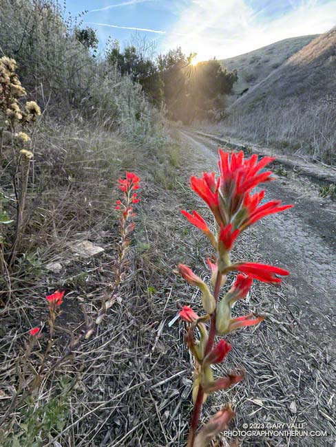
Paintbrush blooming in mid-December in Cheeseboro Canyon
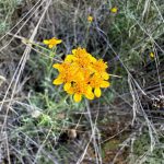
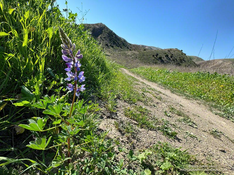
The paintbrush above, and the following Spring-blooming wildflowers were photographed on December 14,2023, on a trail run from the Victory Trailhead of Upper Las Virgenes Canyon Open Space Preserve. With the exception of the black mustard, the wildflowers were found along a half-mile stretch of dirt road connecting upper Las Virgenes and Cheeseboro Canyons.
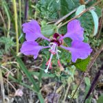
Elegant Clarkia.
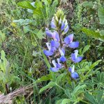
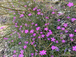
Lupine.
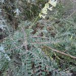
Milk vetch.
Golden yarrow.
Invasive black mustard and mallow.
The false Spring was the result of rain from Tropical Storm Hilary in August, an extended period of wetter than normal weather, and somewhat warmer Fall temperatures. The Water Year that ended September 30, 2023 was the seventh wettest on record for Los Angeles and Calendar Year 2023 was the sixth wettest.
I was beginning to wonder if I would get a chance to do the Three Points Loop around Mt. Waterman in 2023. Angeles Crest Highway had been closed from Red Box to Vincent Gap for many months, and CalTrans projected it might not open until Thanksgiving.
That’s why Friday (November 3) I was excited to hear Angeles Crest Highway had reopened between Upper Big Tujunga Rd. and Islip Saddle.
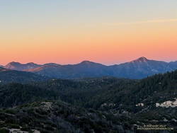
Alpenglow on the San Gabriels’ Front Range peaks.
A couple days later, at dawn, I pulled into the Three Points parking lot, put on some sunscreen, grabbed my pack, and set out to see what was happening on the Three Points loop around Mt. Waterman.
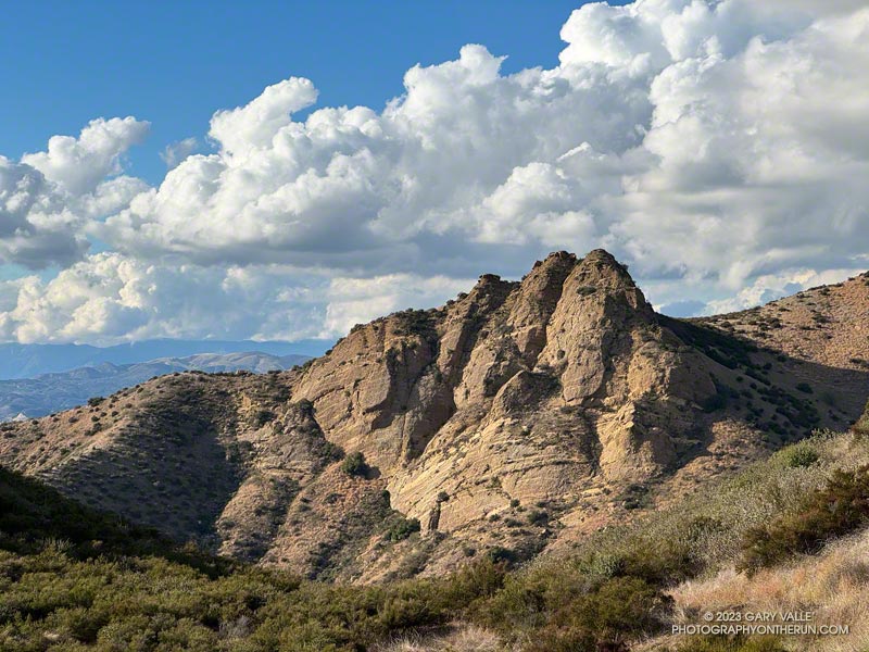
I’d done the loop many times and in many situations — clockwise, counterclockwise, after the Station Fire closure, after the Bobcat Fire closure, with snow at the higher elevations, in hot weather and in cold. When the trails are in good shape and the weather isn’t too hot, the 20-mile loop is an outstanding trail run. Today, it was a challenge just to complete the loop.
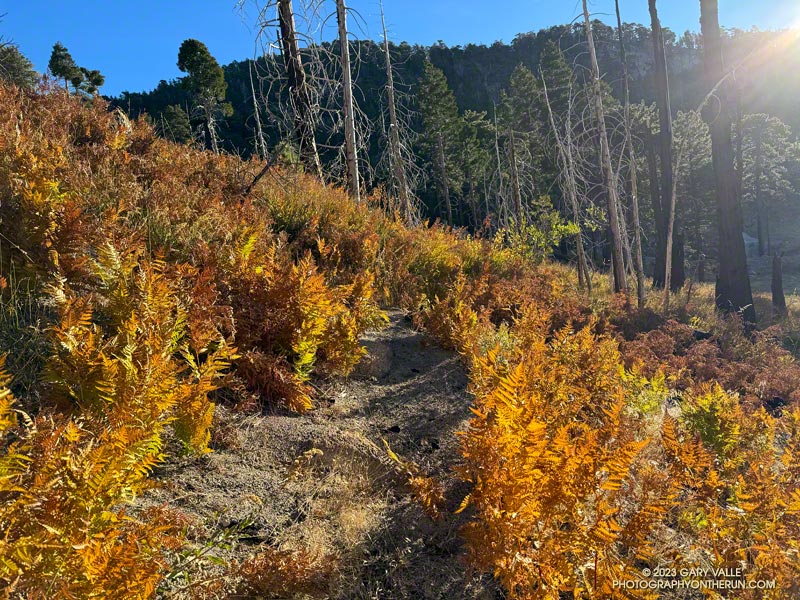
At lower elevation, sections of Three Points – Mt. Waterman Trail (10W04) were overgrown with mountain whitethorn — requiring several “grin and bear it” passages. Higher, long stretches of the little-used path were covered with a second season of grass. This made route-finding difficult, particularly where the trail descends to the Twin Peaks Trail junction.
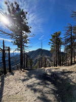
Twin Peaks from the Buckhorn – Mt. Waterman Trail.
It was an intriguing puzzle to solve, and eventually I made it to the junction of the summit trail and the trail down to Angeles Crest Highway, near Buckhorn (10W05). The trail down to Buckhorn sees much more use than the trail from Three Points and is much better defined. Besides a couple of downed trees, the run down was one of the more enjoyable parts of the loop. The trail is usually very busy, but I didn’t encounter anyone coming up the trail.
As expected, Buckhorn Campground was closed and no water was available. It was a warm day — around 75 degrees — but with the November sun low in the sky, not as warm as 75 degrees in July. If I needed more water, there were several places I could refill.
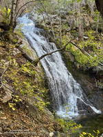
Cooper Canyon Falls (video)
The Burkhart Trail (below Buckhorn) was the only place I encountered a few hikers. They were returning from Cooper Canyon Falls. When I got down to the PCT and saw how much water was in the creek, I did the short side trip to the falls and took this video snapshot. It’s unusual for the falls to be flowing this time of year.
After checking out the falls, I resumed my westward journey on the PCT. Within feet of the creek crossing, an ugly tangle of fallen trees completely blocked the trail. This was just the first of several problems on the PCT between the Burkhart Trail junction and Cooper Canyon Camp. There were the usual downed trees, but there were also several sections of badly overgrown trail. These green thickets were generally adjacent to the creek, where the trail had been (or still was) wet.
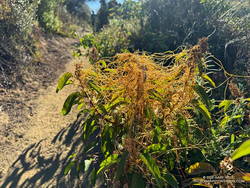
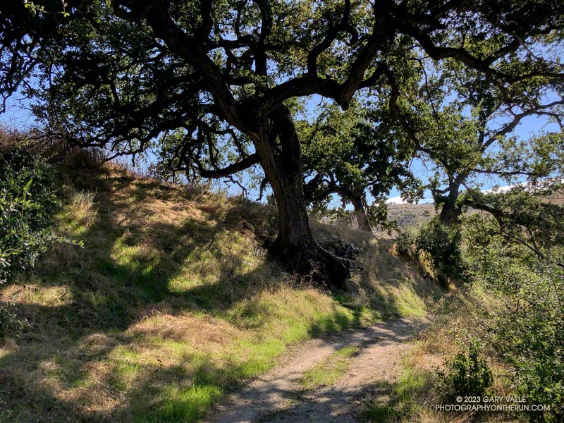
Willows along the creek near Cooper Canyon Trail Camp.
Needing water, and to empty the debris from my shoes, I stopped for a few minutes at Cooper Canyon Trail Camp. Several campsites are nestled in a pleasant area along the creek. With Angeles Crest Highway open, I thought I might see someone here, but like Buckhorn Campground, it was empty.
After reaching Cloudburst Summit, the remainder of the run was more or less usual for the loop. There was some Poodle-dog bush and a small rockslide along the PCT on the way to Camp Glenwood, but neither were an issue. The run was more challenging than usual — and a bit slower — but it had been (mostly) fun and fascinating to work through it.
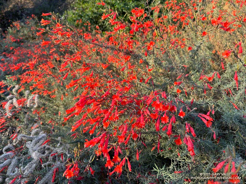
California fuchsia along Fire Road #30, near the Hub.
Downtown Los Angeles (USC) finished the 2022-2023 Water Year with 31.07 inches of rain, making it the seventh wettest on record in Los Angeles. The rainfall total includes about three inches of rain from former Hurricane Hilary as it moved through Southern California as a rare tropical storm and post-tropical cyclone.
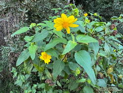
Canyon sunflower blooming out of season along Fire Road #30.
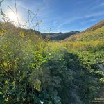
The effects of all that rain can be seen on just about any trail in Southern California. It has resulted in a false Spring in many areas, with greening hills, out-of-season wildflowers, flowing creeks, and profuse growth throughout the area.
This morning, I returned to the Top of Reseda and Topanga State Park to do a variation of the Trippet Ranch Loop and continue exploring and enjoying the unusual conditions.
After running up to the Hub, this variation does an out and back to Temescal Peak and Temescal Lookout. After returning to the Hub, the route continues on Eagle Springs Fire Road down to Trippet Ranch. From Trippet Ranch, it works back to the Top of Reseda using the Musch and Garapito Trails and connecting sections of fire road. This interactive, 3D terrain map shows a GPS track of the trail run.
Dodder growing on laurel sumac on the Musch Trail.
Visiting Temescal Peak and Temescal Lookout increases the run’s mileage from 12.5 miles to 16. On a clear day, the runner is rewarded with far-reaching views of the coast, West L.A., Downtown, and the surrounding mountains.
While most of the roads and trails on this route are frequently used and in decent condition, the Garapito Trail has been overgrown all Summer. As of October 8, it was still overgrown. Some people I’ve encountered on the trail were OK with this, but others haven’t been so happy. If desired, the trail can be bypassed by continuing to the Hub on Eagle Rock Fire Road and retracing your route back to the Top of Reseda.
It’s been about a month and a half since Tropical Storm Hilary soaked Southern California with record-setting rainfall.
The unusual amount of Summer rain has resulted in a second Spring at Ahmanson Ranch, with some plants behaving as if it were March or April.
Not only are plants growing as if it were Spring, some are flowering. The lupine pictured above usually blooms at Ahmanson Ranch in March, April, and May. Now, as a result of T.S. Hilary’s rain, it’s flowering in October!
Those plants that usually flower in the Fall, such as telegraph weed, vinegar weed, and common sunflower, are much more widespread than usual.
Spring-like conditions are present in many areas of Southern California. On Sunday, I ran the Phantom Trail in Malibu Creek State Park. Some sections were so overgrown that it was challenging just to navigate the trail, much less run it. Ticks were also a problem.
Update September 8, 2023. The new grass from T.S. Hilary’s rain is coming in nicely at Upper Las Virgenes Canyon Open Space Preserve (Ahmanson Ranch).
Tropical storms are a different kind of weather beast than usually seen in Southern California. The warmer air associated with such storms can carry much more water and produce unusually high amounts of precipitation.
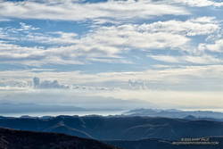
The first hints of Hilary approaching Los Angeles.
The rain resulting from Tropical Storm Hilary shattered many daily and monthly records. Over decades of record keeping, most stations in the greater Los Angeles area had previously measured only a trace of rain on August 20 or 21, or at best, a few hundredths of an inch. Some stations had never recorded any rain on these days.
The highest rainfall amounts occurred where the precipitation was enhanced by mountainous terrain. The northeast-facing slopes of the eastern San Gabriel Mountains, near Wrightwood, were ideally positioned in Hilary’s circulation to enhance rainfall. The Big Pine RAWS recorded over 6 inches of rain for the storm, Lewis Ranch slightly over 7 inches, and Lytle Creek nearly 10 inches.
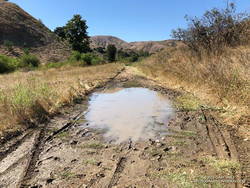
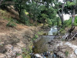
This crossing of Las Virgenes Creek was about the same as before Hilary.
Curious to see some of the local impacts of the storm, I ran at Ahmanson Ranch on August 22 and then a few days later at Malibu Creek State Park.
My West Hills weather station, about three miles from Ahmanson Ranch’s Victory Trailhead, recorded 3.86 inches of rain for the storm. After an initial technical hiccup, the Cheeseboro RAWS, overlooking Las Virgenes Canyon, recorded 3.52 inches of rain. This and other data suggest rainfall amounts in the Ahmanson area of at least 3.5 – 4.5 inches.
My Ahmanson run started at the Victory trailhead, went out East Las Virgenes Canyon, through part of Las Virgenes Canyon, and then up to Lasky Mesa. With that much rain, I was sure I would be wallowing in the mud and wading the creek crossings. But my shoes didn’t even get muddy!
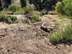
Dry streambed of Las Virgenes Creek, north of the Las Virgenes Trailhead
As Hilary moved northward in California, the counterclockwise circulation of the storm increased the rainfall in the Santa Monica Mountains. Automated RAWS stations in Topanga, the Malibu Hills, and in Malibu Canyon recorded 4.0 to 4.5 inches of rain during the storm. CNRFC gridded precipitation data indicated higher amounts in some parts of the range.
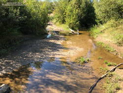
Las Virgenes Creek in Malibu Creek State Park, about 5 miles downstream of Ahmanson Ranch.
On August 27, I ran the Bulldog Loop in Malibu Creek State Park. The run started at a small parking area at the junction of Malibu Canyon & Piuma Roads. As I was running up the Tapia Spur Trail, I wondered if State Parks had — as a precaution — removed the seasonal bridge across Malibu Creek on the Crags Road Trail. On August 19, the day before Hilary drenched the area, the bridge had been in place for the Bulldog Ultra. If it wasn’t removed, did Malibu Creek get high enough to damage it?
Once again, I need not have worried. The bridge was just fine, and the reeds in the water near the bridge suggested only a modest increase in streamflow.
It’s unusual for the slopes along Bulldog fire road to be this green in Summer!
It looked like Malibu Creek State Park received more rain than Ahmanson Ranch. There was slightly more erosion on the dirt roads and some small sluffs/slides, including one tree that slid onto Mesa Peak Mtwy fire road. A tree had also fallen near the beginning of the Forest Trail.
Back at Ahmanson on August 31, things were drying out, but it was beginning to look like Spring. Grass was sprouting all over Ahmanson Ranch. It will be interesting to see if the grass survives the inevitable heat and grows enough to turn the hills green. The little bit of rain and cooler weather over Labor Day weekend will help. Some out-of-season wildflowers could also result from a false Spring.
Yesterday, I did a run in Topanga State Park, and the story was much the same. There was some minor erosion on the fire roads, but none of the larger sluffs and slides seen during the rainy season. There was no new damage to the Musch or Garapito Trails. It did look like the flow had increased on Garapito Creek with Hilary’s rain, and there was a still little water in the mainstem of the creek.