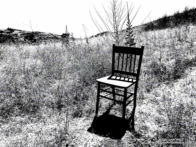
It was a little past 3:00 in the afternoon when I passed this straight-backed wooden chair along an Ahmanson Ranch trail. The Tempe thermometer clipped to my pack read over 100 degrees.
It gets REALLY hot at Ahmanson Ranch (Upper Las Virgenes Canyon Open Space Preserve). In the direct sun the temperature can be 10°F-15°F hotter than in the shade, and there is very little shade at Ahmanson. In-the-sun temperatures of 100°F or more are common in the Summer but can occur just about any time of the year.
There are two weather stations I use to get an idea of the weather conditions at Ahmanson Ranch — the Cheeseboro RAWS and Valley Circle Estates Weather Underground station. Weather station thermometers are usually shielded from the direct sun by a white, ventilated enclosure. The Cheeseboro RAWS includes a measurement of the “Fuel Temperature.” This is generally a better indication of the temperature experienced by a runner, hiker, or rider in the direct sun.
Update on July 29, 2023. Rounding the temperature to whole degrees, my West Hills weather station recorded a high of 100°F, or higher, for 15 consecutive days this July (7/13/23 to 7/27/23). The station is about three miles from the Victory Trailhead at Ahmanson Ranch.
Snow in the lee of the West Ridge of Mt. Baden-Powell.
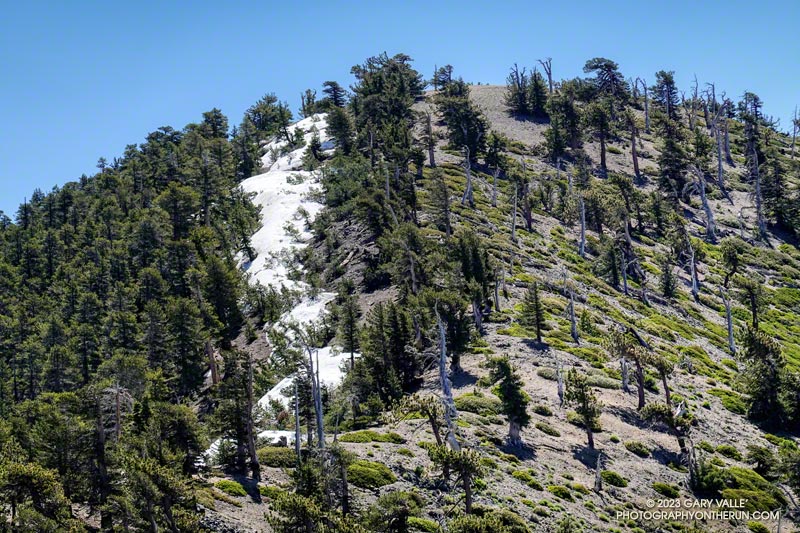
You might not see it from the Los Angeles side of the mountains, but there is still some snow on the higher, north-facing slopes of the San Gabriel Mountains.
During and after storms, snow-laden southerly winds dump their load on the backside of the crest, creating deep drifts, cornices, and compacted slabs of snow. This snow is often the last to melt, not only because it doesn’t face the sun, but because there is more of it.
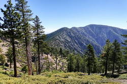
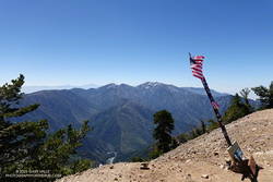
Mt. Burnham, Peak 9086, and Mt. Baden-Powell from near Throop Peak.
This morning, I was doing an out-and-back from the Windy Gap Trailhead in the Crystal Lake Recreation Area to Mt. Baden-Powell. The Windy Gap Trail climbs 1730′ in 2.6 miles, joining the PCT at Windy Gap. From there the trail follows the spine of the San Gabriels past Mt. Hawkins, Throop Peak, and Mt. Burnham to Mt. Baden-Powell.
I usually do this run from Islip Saddle, but with Angeles Crest Highway (Highway 2) closed between Red Box and Vincent Gap, the Islip Saddle trailhead isn’t accessible.
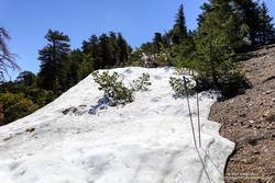
Snow at about 9100′ on the west side of Mt. Baden-Powell.
Whether you start at Crystal Lake or Islip Saddle, the length of the run is about the same — a bit over 16 miles. The main difference is that the Windy Gap Trailhead is about 800′ lower in elevation. On the plus side, the Windy Gap Trail is very scenic; on the minus side, it faces south and can bake in the midday sun.
On today’s run, I encountered the first snowbanks at an elevation of 8870′, near the Dawson Saddle Trail junction. Out of curiosity, I tried to follow the trail and soon realized that was a mistake. I was more or less forced to skirt the downhill side of a lengthy and deep drift — it being too steep and icy to cross directly.
Mt. Baldy from the summit of Mt. Baden-Powell. July 9, 2023.
For the remainder of the run, I switched to the early season tactic of staying on the crest when the trail deviated onto shaded, north-facing slopes. These areas might have significant snow on the trail. This only happens in a few places, such as when the PCT works around Mt. Burnham. There is a use trail that ascends the west ridge of Mt. Burnham, and then returns to the PCT.
The conditions today are reminiscent of those found here in early July 2005. July 3rd of that year there was still snow on the summit of Baden-Powell, and there was deeper snow in the areas where there was snow today. We had a lot of storms this rain season, but in Rain Year 2004-2005 Downtown Los Angeles (USC) recorded about 9 inches more rain than during the 2022-2023 rain year!
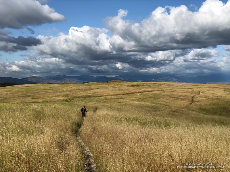
Brett was down for a few days, and as an initial run we did a loop from the Victory Trailhead of Ahmanson Ranch, through part of Las Virgenes Canyon, up onto Lasky Mesa, and then back to the trailhead.
Upper Las Virgenes Creek still flowed. Valley oaks were full with new leaves. The green grasses of the rain season had finally turned, and rare May cumulus clouds were painted on postcard skies.
According to preliminary NWS reports, Downtown Los Angeles (USC) recorded average monthly temperatures well below normal in November 2022 and January thru March 2023. March was particularly cool, with an average high of about 64 degrees and an average low of about 50 degrees.
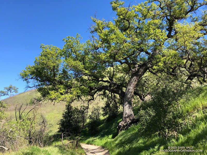
Besides high heating bills, Southern California’s unusually cold Winter affected several seasonal processes, one of which was when the valley oaks at Ahmanson budded and grew new leaves.
The leaves of valley oaks at Ahmanson Ranch typically turn in mid-December, and the trees usually begin to leaf out during the latter half of February. Depending on the tree’s microclimate, the emergence of new leaves may vary by a week or more.
Valley oaks in Las Virgenes Canyon in early April 2023.
The earliest I’ve photographed a valley oak at Ahmanson sprouting new leaves was February 3, 2015. Last year, a valley oak had new leaves on February 10, 2022.
The latest I’ve seen valley oaks sprouting new leaves is this year — from about March 20, 2023, in favored locations to April 4, 2023, in cooler areas such as Las Virgenes Canyon.
Prior to this year, the latest I’ve photographed a valley oak at Ahmanson with new leaves was March 9, 2009.
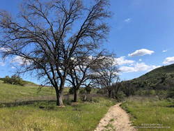
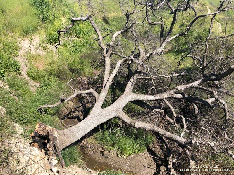
When I rounded the corner on the Lasky Mesa Trail, I could hardly believe my eyes. The Ahmanson Blue Oak was gone. Where there had been a sprawling oak, there was nothing.
Crossing an eroded section of trail and walking over to the edge of the old roadbed, I looked down the slope. Much like this valley oak along Rocky Peak Road, the entire Ahmanson blue oak had fallen from its hillside perch near the bottom of the canyon.
Oaks in the oak-grasslands of Upper Las Virgenes Canyon Open Space Preserve have had a tough time with climate change. The five-year drought from July 2011 to October 2016, increasing temperature, and the 2018 Woolsey Fire have combined to kill a large number of trees.
This blue oak was one of very few found at the southern extent of its range.
I like splashing through streams as much as anyone does, but today I wanted to try and keep my shoes and socks dry. This Winter that’s been surprisingly hard to do.
Weekdays, I often run from the Victory trailhead at Ahmanson Ranch over to Las Virgenes Canyon and back. But it had rained in the Los Angeles area for four days straight. There was just no question that Ahmanson was going to be wet and muddy, and Las Virgenes Creek would be too wide to jump. I’d have to wade the creek crossings — again.
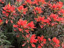
Paintbrush (Castilleja affinis) along Rocky Peak Road
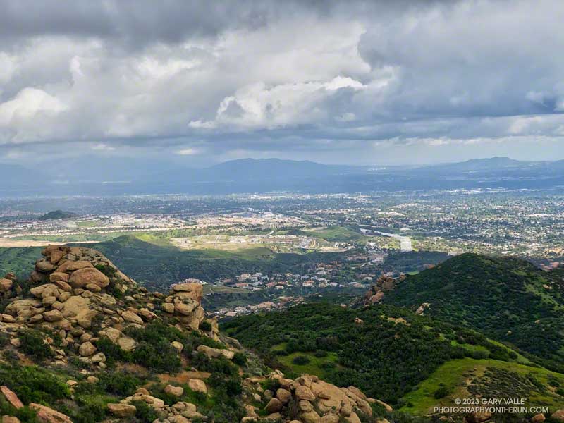
That’s why this afternoon, I was doing an out-and-back run on Rocky Peak Road from the 118 Frwy trailhead. As a result of the area’s sandstone geology, Rocky Peak Road is usually a pretty good place to run during periods of wet weather. For one thing, there are no creeks to cross. Plus, the rocky and sandy road doesn’t have many areas of “glob on your shoes” mud. It also has excellent views of the San Fernando and Simi Valleys and surrounding mountains.
My turnaround point today was the top of the Chumash Trail, which is a little less than four miles from the Rocky Peak trailhead. I sometimes continue past the Chumash Trail another mile to Fossil Point.
Today, there was one short, muddy stretch that could be mostly avoided and a few large mud puddles I could walk around. At the end of the run I didn’t have to switch shoes to drive home!