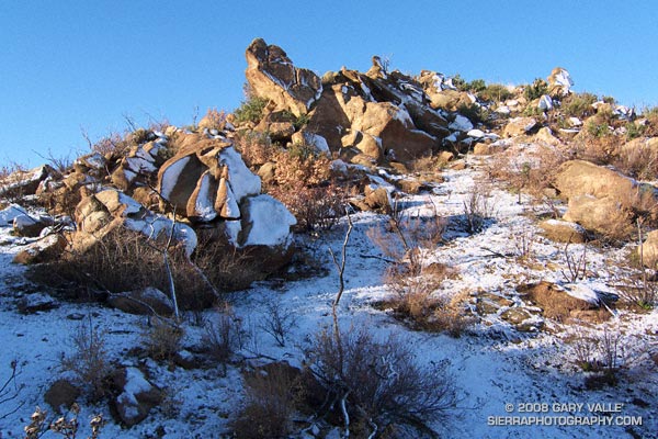
Rocks and snow at the top of the Chumash Trail, near its junction with Rocky Peak fire road, in Rocky Peak Park.
From Thursday’s run in the snow.

Rocks and snow at the top of the Chumash Trail, near its junction with Rocky Peak fire road, in Rocky Peak Park.
From Thursday’s run in the snow.
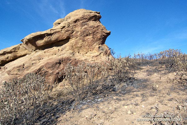
This weather worn sandstone boulder is a familiar landmark to those who do the Chumash Trail. It’s a little less than a mile up the trail, and is at the point where the trail turns east and continues its climb along a cobble strewn divide. The chaparral here and elsewhere along the Chumash Trail was burned last week by the western front of the Sesnon fire.
In the areas bordering the Chumash Trail, the Sesnon Fire appears to have been much less intense than the 2003 Simi Fire. In the case of the Simi Fire, it had been about 15 years since the area was burned, the fuel load was moderately high, and the fire intensity was such that nearly all plant materials were consumed down to the mineral earth.
Recovery from the Simi Fire has been primarily through the slow processes of basal-sprouting and seed germination. Just prior to the Sesnon Fire, common chaparral plants such as chamise, yerba santa, toyon and holly-leaved cherry had recovered about 70% to 90% of their 2003 size.
The recency of the Simi fire appears to have reduced the fuel load available to the Sesnon Fire. In many cases grasses and other annuals (many invasive) were consumed, but adjacent chaparral shrubs were only scorched. Many of these shrubs look like they will probably be able to recover through foliage replacement, rather than crown-sprouting. One exception might be laurel sumac, which appears to have been less fire tolerant.
Update 12/23/08. Only a small percentage of the scorched Yerba Santa are recovering through direct foliage replacement. Most of these plants are recovering through the process of crown sprouting.
In addition to reducing the fire danger, a little light rain would help jump start the recovery process. Computer weather models have been hinting at a change in the weather around November 1, and now seem to be converging on the possibility of a shower in Southern California around Halloween, followed by a front and some rain later in the weekend. That’s still a week away, so we’ll have to see!
Here’s a Google Earth image and Google Earth KMZ file of the perimeters of the Sesnon and Simi Fires, as well as GPS traces of some of the trails in the area.
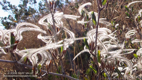
Plumed achenes of curl-leaf mountain mahogany (Cercocarpus ledifolius) on the Chumash Trail. From Tuesday’s run.
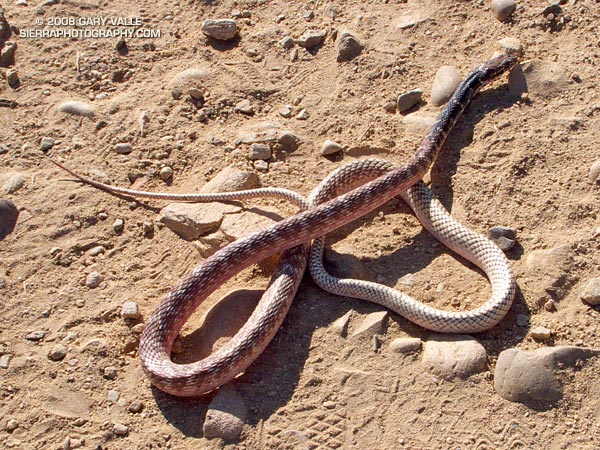
Encountered this red coachwhip/racer (Masticophis flagellum piceus) as I was running down the Chumash Trail today. It was a long snake — at least 5′.
In June 2005, I found a California striped racer (Masticophis lateralis lateralis) on the Chumash Trail that appeared to have suffered some sort of fatal trauma. It was a much smaller snake than the red racer.
Note: There was a handwritten notice posted at the Chumash trailhead warning of a mountain lion sighting on July 18, 2008. I haven’t been able to obtain any additional details.
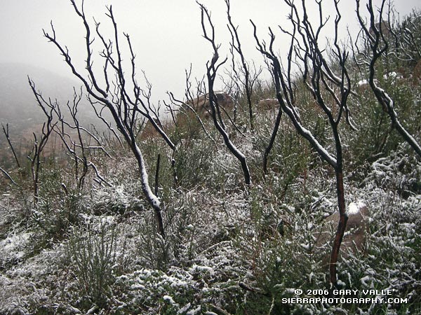
Snow highlights skeletal fingers of burned chaparral along the Chumash Trail in eastern Simi Valley. The chaparral was burned in the 2003 Simi Fire. More info and a couple of additional photos can be found in my Coyote Oak Journal entry Chaparral Snow.
Related post: Chumash Trail Rocks & Snow (December 2008)
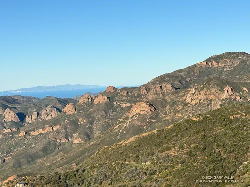
The Backbone Trail between Encinal Canyon and Mishe Mokwa is one of the must-do sections of the 68-mile trail. Engineered to be multi-use, this exceptionally scenic stretch of the Backbone Trail is popular with riders, hikers, and runners alike.
It’s also a pretty good place for a trail run after rainy weather like we’ve had this February. Although the parking lot at the Encinal Trailhead was quite wet this morning, the Backbone Trail was in decent shape most of the way to the Mishe Mokwa trailhead. There were a few muddy and wet spots, but it was generally easy to work around them. And I didn’t have to change my shoes before driving home.
The out & back run worked out to about 21-miles, with a surprisingly moderate gain/loss of about 2500′. The weather and visibility were excellent. Striking rock formations and the Channel Islands could be seen from one side of Etz Meloy Mtwy fire road, and snow on Alamo Mountain and other Ventura County peaks from the other side.
On the way back, as I was working up the long hill on the northwest side of Triunfo Lookout, a descending mountain biker commented that a large group of bikers were at “the corner.” The overlook at this prominent switchback has a wide-ranging view of Mishe Mokwa, Boney Mountain, and Sandstone Peak, and some prefer to turn around here. This variation is about 3.5 miles shorter (round-trip) than dropping down into the canyon and going all the way to Mishe Mokwa.
Explore the scenery and terrain on the Backbone Trail of this out-and-back trail run and hike from Encinal Canyon to Mishe Mokwa using our high resolution, interactive, 3D viewer. The imagery is so detailed, it’s almost like being there! To change the view, use the control on the upper right side of the screen, the CTRL key and your mouse, or touch gestures. Track and placename locations are approximate and subject to errors. Poor weather, and other conditions may make this route unsuitable for this activity. Here’s an elevation profile of the route.
Some related posts:
– Encinal Canyon to Mishe Mokwa Out and Back Trail Run
– Kanan to Mishe Mokwa and Back
– Kanan to Mishe Mokwa to Wendy Drive
– Night Training for the Backbone Ultra