At the moment, all of the wildflowers mentioned in my previous post can still be found, but the earliest bloomers — such as goldfields — are gradually going away.
Invasive mustard has become very prevalent, not only in the Kenneth Fire burn area, but throughout Upper Las Virgenes Canyon Open Space Preserve. It is picturesque when blooming, but fields and slopes covered in mustard increase the fire hazard when the stalks and leaves dry out under the hot summer sun.
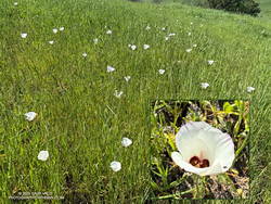
At first glance you might think there aren’t any wildflowers at Upper Las Virgenes Canyon Open Space Preserve (Ahmanson Ranch). The grasses, mallow, mustard and other invasives tend to crowd them out, but the wildflowers are there.
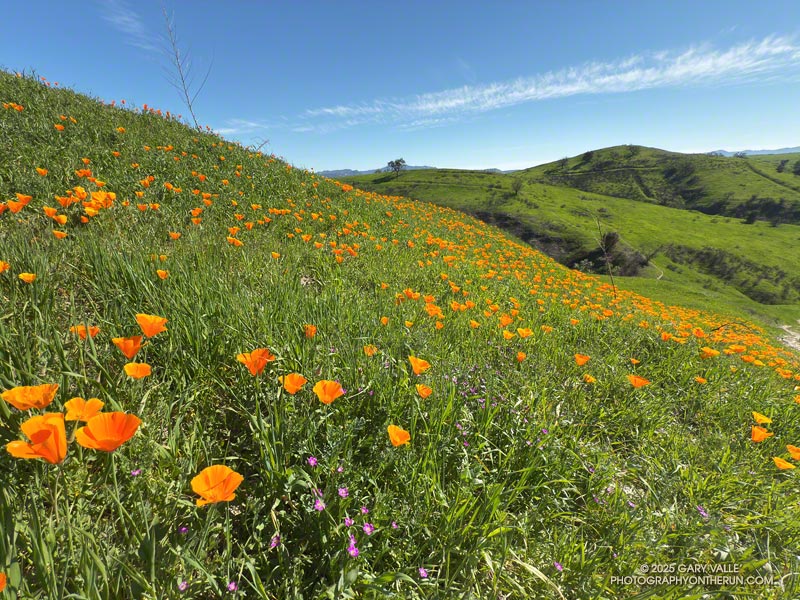
As seen in the title photo, there are a few nice patches of California poppies. Unless you have a sharp eye, you probably won’t see them from the parking lot. They like warm, west-facing slopes. If it’s early morning or chilly, their blossoms will be tightly furled to protect against the cold.
Red maids is another vibrantly-colored wildflower. Its rose-lavender blossoms stand out from the green of the grasses. Small patches of the flowers can be seen just about anywhere at Ahmanson in late Winter and early Spring.
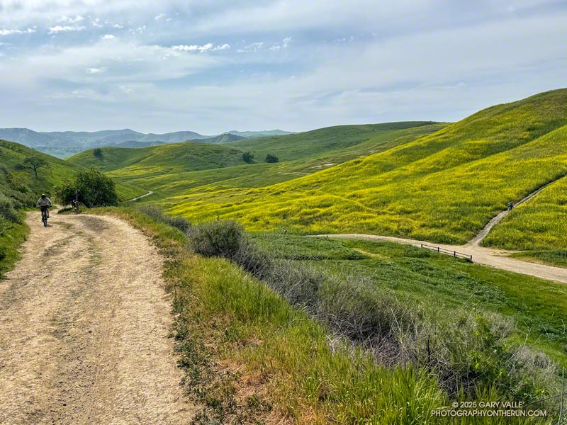
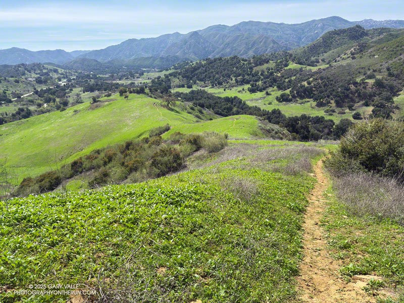
In a 2013 post, I suggested that the Cistern/Phantom Trailhead on Mulholland Highway might be the best trailhead to start the Bulldog Loop.
More than 10 years and a lot of trail running miles later, I still prefer to do the Bulldog Loop from that trailhead. More than that, most of the trail runs I do in Malibu Creek State Park are from the Cistern/Phantom Trailhead.
There are two key reasons — the scenery is spectacular and the route options endless. Over the past year, I’ve run from the Cistern/Phantom Trailhead a dozen times, on routes ranging from 2 to 23 miles.
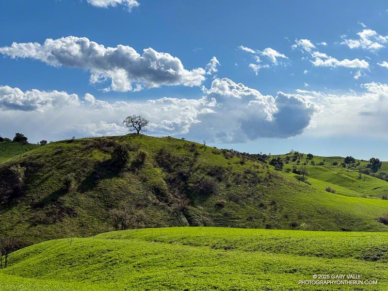
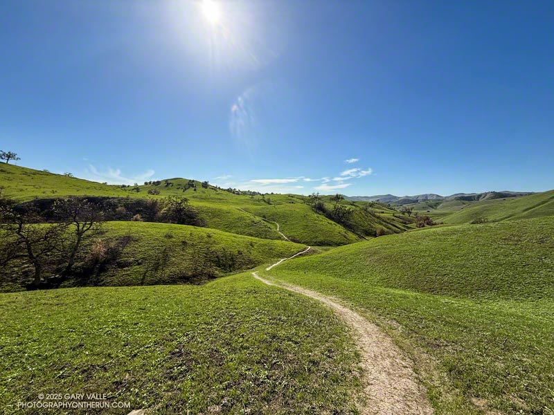
Two of those runs were this March. One was on March 9. I’d done the Bulldog Loop several times recently, so the idea was to do a Bulldog-length run, without doing the Bulldog Loop. It was a “follow my nose” run that included Reagan Ranch, Malibou Lake overlook, Crags Road, Tapia Spur Trail, Grasslands Trail, Talepop Trail, Las Virgenes Trail, Liberty Canyon Trail, and Phantom Trail. It turned out to be about 17 miles, with an elevation gain/loss of about 2400′.
I enjoyed that run so much, I came back a week later and did a similar run. But this time the route included the Bulldog Loop. The idea was to use established trails and do the longest loop I could in Malibu Creek State Park, without repeating any part of the route. The run turned out to be about 23 miles, with around 4200′ gain/loss.
As I worked up the Old Boney Trail, I looked for anything blooming. The empty seed pods from last year’s bigpod Ceanothus bloom were still present on many plants, but not a flower was in sight.
Lack of rain will do that. Although today’s run was after Southern California finally received some rain, the first few months of the rain season had been ridiculously dry. From July 1, 2024, to January 24,2025, Downtown Los Angeles recorded only 0.16 inch of rain — tying 1962-1963 for the driest start to the Rain Year on record.
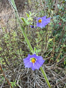
Purple nightshade – just about the only early bloomer on 20+ miles of trail.
Very early in the run, I came across some disturbing tracks on the Old Boney Trail. I first saw them on Danielson Road, and they continued on Old Boney all the way to Blue Canyon. From the tracks, I could see they powered directly up the hills and sped through the straightaways.
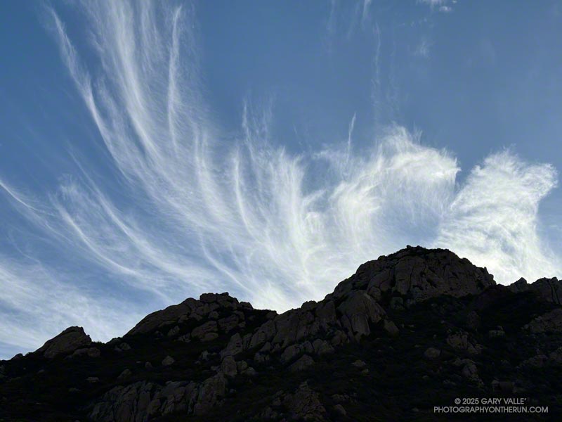
Usually, when I do the long climb out of Upper Sycamore on the Old Boney Trail, it’s to do the Western Ridge (Mountaineer’s Route) on Boney Mountain. This morning, the combination of crags, clouds, and early morning light on Boney Mountain looked especially inviting. I almost turned up the use trail that ascends the ridge. Resisting the impulse, I continued on the Old Boney Trail — past the Fossil, Blue Canyon, and Chamberlain Trails — to the Serrano Valley Trail and Serrano Valley.
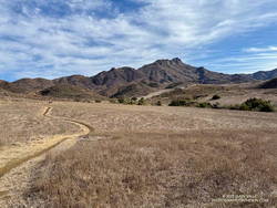
Serrano Valley – February 2025
It had been over a year since I’d been to Serrano Valley. It is one of the prettiest spots in the Santa Monica Mountains. It has a “big sky” feel that I always enjoy. When combined with a run down Serrano Canyon, the experience is exceptional.
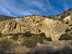
One of the interesting things to see in Serrano Canyon is a large landslide scar on the north side of the canyon, about a half-mile from Sycamore Canyon. The trail goes over the foot of the slide. Some boulders near the trail contain fossils, similar to those found on the Fossil Trail.
As the landslide scar came into view, something had changed — there was a “new” rockslide in the middle of the old landslide scar. When I stopped to take a photo, I could hear rocks and debris trickling down the slope. This suggested the slide was still active and might be very recent. When did it happen?
New rockslide on an old landslide scar in Serrano Canyon.
The last time I’d photographed the landslide scar was in February 2022. At that time, this new rockslide hadn’t occurred. I also checked Google Earth. The most recent Google Earth imagery of the landslide scar was from April 21, 2023. It didn’t show the rockslide. Then I checked Sentinel 2 satellite imagery, but that wasn’t high enough resolution to determine the date of the rockslide. High resolution imagery of a relatively small, non-urban area would be required, and it would need to have been taken after April 21, 2023.
After failing to find a suitable image using various services that provide free or low cost imagery, I contacted the Vexcel Data Program. They were kind enough to provide an answer — the new rockslide was not in imagery from September 23, 2023, but was present in an image from October 12, 2023.
The new rockslide occurred about 16 months ago, a month or two after Tropical Storm Hilary passed through Southern California. For the 24-hour period ending at noon on August 21, 2023, the weather station at nearby Circle X Ranch recorded about 3.9 inches of rain.
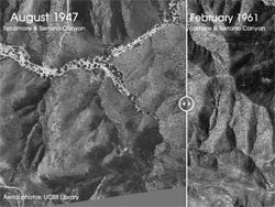
While searching for imagery of the landslide scar, I stumbled onto UCSB Library’s collection of aerial photography. It contains more than 2.5 million images dating back to the 1920s. Curious to see the quality of the photos, I picked a 1:12,000 scale image from November 1936 that was more or less centered on the landslide scar. The quality of the image is excellent — but where was the landslide? I had assumed the Serrano Canyon Landslide to be an ancient feature. How old is it?
Serrano Canyon before the landslide (1947) compared to after (1961). Click!
Continuing down Serrano Canyon, I stopped at Sycamore Canyon to get some water and decide where I was headed next. Option A was to turn south on Sycamore Canyon Road, go up the Fireline Trail to Overlook Fire Road, and then return to Wendy Drive via Hell Hill, Wood Canyon, Two Foxes, Sycamore Canyon, and Upper Sycamore. Including what I’d already done, that would be about 24 miles. Option B was to turn north on Sycamore Canyon Road and go directly to the Two Foxes Trail, etc. That would be about 20 miles.
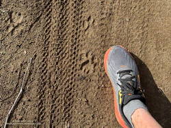
Mountain lion tracks along Sycamore Canyon Fire Road
Today, I opted for Option B. That turned out to be an exciting choice. Just before the turn onto Wood Canyon, there was a sequence of mountain lion tracks along the east side of Sycamore Canyon Road. To better show its size, I superimposed the track on top of my shoe. The shoe is about 4.5 inches wide at the center of the track. There were also deer tracks along the road.
Here is a high resolution, interactive, 3D terrain view of the Old Boney – Serrano Valley Loop from Wendy Drive. Two options are shown. The map can be zoomed, tilted, rotated, and panned. To change the view, use the control on the upper right side of the screen. Track and placename locations are approximate and subject to errors. Poor weather, and other conditions may make this route unsuitable for this activity.