From mid Summer into Fall, the vibrant yellow flowers of rabbitbrush add a refreshing hit of color to the greens, grays, and browns of the San Gabriel Mountains.
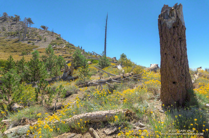
The title photo was taken along the PCT, at an elevation of about 8600′, near Mt. Hawkins. The area was burned in the 2002 Curve Fire. Here, and elsewhere in the burn area, new trees — now in their teens — are slowly replacing some of the trees lost in the fire.
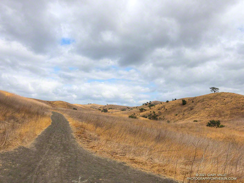
Hikers, riders, and runners reveled in the unseasonably cool afternoon temperatures at Ahmanson Ranch (Upper Las Virgenes Canyon Open Space Preserve) yesterday.
According to the NWS, the high temperature of 75 degrees at Woodland Hills (Pierce College) was the lowest for the date on record. The temperature at the Cheeseboro RAWS didn’t reach the 70s until around 1:30 p.m., and finally hit 75 around 4:30 p.m. Earlier in the day, the station recorded 0.03 inch of light rain.
I took advantage of the cooler weather to do an out and back trail run from the Victory Trailhead to Cheeseboro Canyon. The nine mile run has an elevation gain/loss of around 1000′. Except for a couple of hills, it’s a relatively fast-paced route, particularly on the way out to Las Virgenes Canyon. There are two creek crossings in Las Virgenes Canyon. These dried up earlier this year, but in some years the crossings have enough water to get your shoes wet.
It’s not a good run to do when it’s hot, and in the Summer Ahmanson is almost always hot. In-the-sun temperatures are typically above 100 degrees, and sometimes reach 110 degrees or more. More than once I’ve encountered people on Ahmanson area trails that misjudged the conditions and were out of water. And sadly, dogs are especially susceptible to heat.
Here’s an interactive, 3D terrain view of the run. The map can be zoomed, tilted, rotated, and panned. To change the view, use the control on the upper right side of the screen. Track and placename locations are approximate and subject to errors. Poor weather, and other conditions may make this route unsuitable for this activity.
Those that recreate at Ahmanson will recognize the title photo as East Las Virgenes Canyon, about 1.1 mile from the Victory Trailhead. This is where a trail/road to Lasky Mesa forks off the main road.
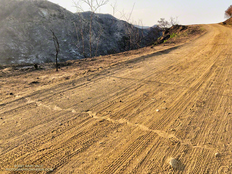
The rattlesnake track above was one of several snake tracks on Eagle Springs Fire Road this morning. This area, which is below Eagle Rock in Topanga State Park, was severely burned in the May 2021 Palisades Fire.
The last time I was on this part of the North Backbone Trail it was bitterly cold and very windy. Today it was just very windy. Even though the air temperature was in the 70s, the “wind chill” was enough that I was considering grabbing the sleeves and shell from my pack.
I stopped in the lee of a sprawling, stunted lodgepole pine and enjoyed a moment of relief, shielded from the wind. But there wasn’t that much mountain above me, and I resumed zig-zagging up the final steep stretch of trail. Climbing a little higher, I could see the trail sign that marks the top of the North Backbone Trail.
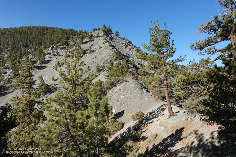
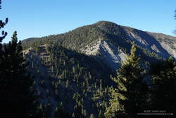
Point 8555 and Pine Mountain from the PCT
Mt. Baldy from Wrightwood is a more difficult variation of the North Backbone Trail route. Instead of driving to the North Backbone Trailhead on East Blue Ridge Road (F.R. 3N06), you run/hike to the trailhead using the Acorn Trail and a short stretch of Blue Ridge Road or the PCT. (The dirt road is slightly shorter, but you don’t have to dodge off-road vehicles when on the PCT.)
Including Pine Mountain (9648′) and a short detour to the top of Dawson Peak (9575′), the regular North Backbone route is about 8 miles long and gains/loses around 4700′. Starting in Wrightwood at the small parking area on Acorn Drive ups those totals to around 15 miles, with a 6800′ gain/loss.
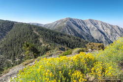
Rabbitbrush along the North Backbone Trail, between Pine Mountain and Dawson Peak
A mix of hikers and trail runners were scattered across the broad summit of Mt. Baldy (10,064′). The wind wasn’t as strong on the summit as it had been on the North Backbone. Smoke from the Western wildfires reduced the visibility, but the air quality and view were still pretty good.
Like many mountains, the adventure didn’t end on the top of the peak. The elevation gain on the way back to Wrightwood is significant, and much of the downhill demands close attention — especially on tired legs. I squeezed the water bladder in my pack and tried to estimate how much was left. The day was just going to get warmer, and I hoped it was enough to get me back over Dawson Peak and Pine Mountain. On the way up, I’d stashed a small water bottle near the North Backbone Trailhead, and that would help on the final few miles.
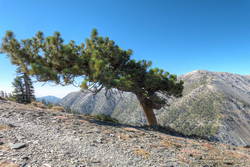
Windswept Jeffrey pine near Dawson Peak
Other than initially running past my water stash, the descent went well. Once on the PCT I could run normally — well, more or less normally — and it didn’t take long to get over to the Acorn Trail.
When doing the AC100 and related training runs, I’d run/hiked up the Acorn Trail a number of times, but I’d never run down it. After all the rough trail on the North Backbone, it was great to be able to cruise down through a forest of pine and fir on a well-groomed trail! Here’s an elevation profile of the route.