Category Archives: snow

Out and Back Trail Run from Islip Saddle to Mt. Baden-Powell – July 2024 Update

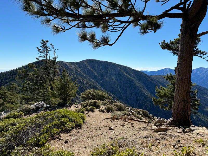
Mt. Baden-Powell from the PCT near Throop Peak.

Update July 22, 2024. The Poodle-dog bush along the PCT near Islip Saddle has been cleared by Gary Hilliard and the AC 100 Trail Team!

When I reached the summit of Mt. Baden-Powell (9,399′), it was empty, save an opportunistic raven who was evaluating the chances that the Larabar I was eating might fall to the ground.

On top, the heat of the strong Summer sun was offset by a cooling breeze. There was still a few thin ribbons of snow in the chutes on Mt. Baldy. With the excellent visibility, San Jacinto Peak could be seen in the notch between Mt. Baldy and Dawson Peak, and San Gorgonio Mountain was sharply visible to the left of Pine Mountain.
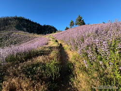
Poodle-dog bush (Eriodictyon parryi) along the PCT just east of Islip Saddle. (thumbnail)
Poodle-dog bush along the PCT just east of Islip Saddle.

Other than a few people at Little Jimmy hike-in camp, I saw no one on the way up from Islip Saddle. A quarter-mile from the trailhead, there was an astonishing display of Poodle-dog bush along the PCT. In 2011, when a large part of Angeles National Forest reopened following the Station Fire, I developed an extensive rash after bushwhacking through Poodle-dog on overgrown trails. After that experience I’ve been more careful around the plant, and haven’t had a bad case since.

Trees were across the trail in a few places. Most were fairly easy to bypass, but a couple were “inconvenient,” such as this big log, about 0.75 mile east of Windy Gap.
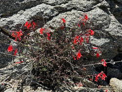
Bright red beaked penstemon (Penstemon rostriflorus) along the PCT above Windy Gap. (thumbnail)
Bright red beaked penstemon along the PCT above Windy Gap

As I worked up the switchbacks above the log, to the southwest I could see the observatory and towers on Mt. Wilson. As a result of the damage to Chantry Flat in the Bobcat Fire, Mt. Wilson was on the Angeles Crest 100 Mile course last year, and will be again this year. As the raven flies, Mt. Wilson was only about 16 miles away, but for someone running the AC100, the miles along its challenging course would total well over 50!

For several years I’ve been following the regrowth of conifers in four places along the PCT that were burned in the 2002 Curve Fire. What has been underscored in my informal study is a) trees take a long time to regrow, and b) frequent fires in an area are particularly devastating. Stand #1 (1.5 miles east of Islip Saddle on the PCT) was recovering nicely from the 2002 Curve Fire when it was burned in the 2020 Bobcat Fire. This comparison shows the result. The other three stands continue to recover well, with south-facing Stand #4, west of Throop Peak, growing particularly vigorously.
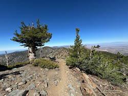
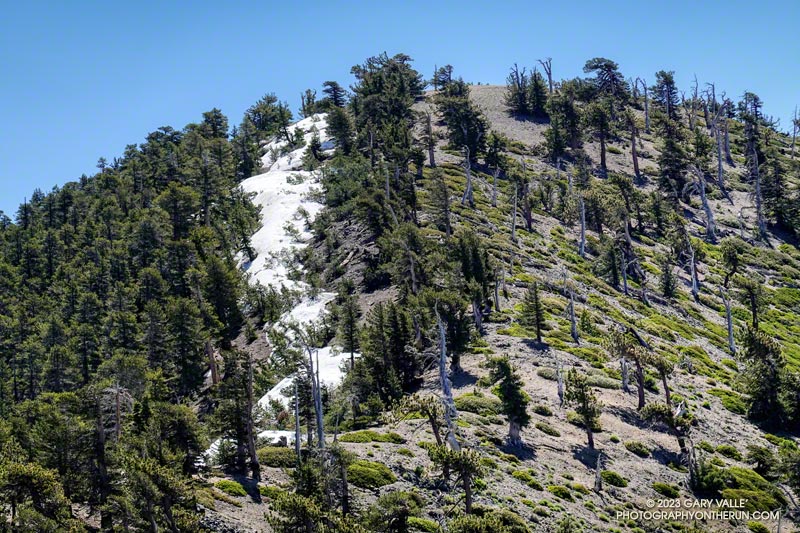
View WNW along Mt. Baden-Powell's west ridge. (thumbnail)
Limber pine (left) along Mt. Baden-Powell’s west ridge.

Ascending the final 400′ of gain on Baden-Powell’s west ridge, I was surprised to see a couple of small patches of snow remained on the north side of the ridge. The snowpack here was nowhere near as big as in 2023, but it was still pleasing to see that a little of the white stuff survived until July.

No out and back to Baden-Powell is complete without a quick stop at Little Jimmy Spring. Today, the water from spring was so cold it was painful to hold my hand in the water flowing from the pipe!

Some related posts:
It’s Mid-July And There Is Still Snow in Los Angeles County!
A Cool and Breezy Out and Back Trail Run from Islip Saddle to Mt. Baden-Powell
Contact Dermatitis from Eriodictyon parryi – Poodle-dog Bush
Regrowth of Trees Along the PCT Following the 2002 Curve Fire

It’s Mid-July And There Is Still Snow in Los Angeles County!

Snow in the lee of the West Ridge of Mt. Baden-Powell.

You might not see it from the Los Angeles side of the mountains, but there is still some snow on the higher, north-facing slopes of the San Gabriel Mountains.

During and after storms, snow-laden southerly winds dump their load on the backside of the crest, creating deep drifts, cornices, and compacted slabs of snow. This snow is often the last to melt, not only because it doesn’t face the sun, but because there is more of it.

Mt. Burnham, Peak 9086, and Mt. Baden-Powell from near Throop Peak.

This morning, I was doing an out-and-back from the Windy Gap Trailhead in the Crystal Lake Recreation Area to Mt. Baden-Powell. The Windy Gap Trail climbs 1730′ in 2.6 miles, joining the PCT at Windy Gap. From there the trail follows the spine of the San Gabriels past Mt. Hawkins, Throop Peak, and Mt. Burnham to Mt. Baden-Powell.

I usually do this run from Islip Saddle, but with Angeles Crest Highway (Highway 2) closed between Red Box and Vincent Gap, the Islip Saddle trailhead isn’t accessible.

Snow on the west ridge of Mt. Baden-Powell. July 9, 2023.
Snow at about 9100′ on the west side of Mt. Baden-Powell.

Whether you start at Crystal Lake or Islip Saddle, the length of the run is about the same — a bit over 16 miles. The main difference is that the Windy Gap Trailhead is about 800′ lower in elevation. On the plus side, the Windy Gap Trail is very scenic; on the minus side, it faces south and can bake in the midday sun.

On today’s run, I encountered the first snowbanks at an elevation of 8870′, near the Dawson Saddle Trail junction. Out of curiosity, I tried to follow the trail and soon realized that was a mistake. I was more or less forced to skirt the downhill side of a lengthy and deep drift — it being too steep and icy to cross directly.

Mt. Baldy from the summit of Mt. Baden-Powell. July 9, 2023.

For the remainder of the run, I switched to the early season tactic of staying on the crest when the trail deviated onto shaded, north-facing slopes. These areas might have significant snow on the trail. This only happens in a few places, such as when the PCT works around Mt. Burnham. There is a use trail that ascends the west ridge of Mt. Burnham, and then returns to the PCT.

The conditions today are reminiscent of those found here in early July 2005. July 3rd of that year there was still snow on the summit of Baden-Powell, and there was deeper snow in the areas where there was snow today. We had a lot of storms this rain season, but in Rain Year 2004-2005 Downtown Los Angeles (USC) recorded about 9 inches more rain than during the 2022-2023 rain year!

Here is a short slideshow of some photos taken on the run. I’ve also included a few photos from the run to Baden-Powell in 2005 for comparison.

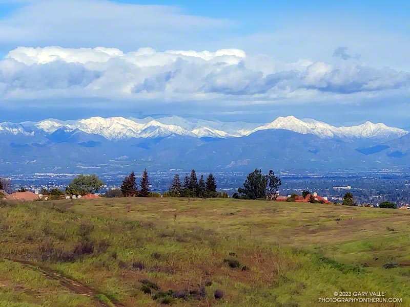
Snow-Covered San Gabriel Mountains From Lasky Mesa

Snow-covered San Gabriel Mountains from Lasky Mesa in Upper Las Virgenes Canyon Open Space Preserve (Ahmanson Ranch)

It had rained another inch overnight, and my shoes were soaked from the wet grass along the trail. Seeking some relief from the 20 mph northwest wind, I descended a single-track trail to an old paved road east of the ranch house on Lasky Mesa.

Motivated more by staying out of the wind than anything else, I did two sets of hill repeats on different sections of the road. Then, on tired legs, I jogged up to Lasky Mesa and was greeted by an Arctic blast. The temperature had dropped to the mid-40s, and the wind was blowing a steady 20 mph, gusting to around 30 mph. I didn’t need a wind chill chart to tell me the effective temperature was in the 30s.

I was so focused on dealing with the cold I wasn’t paying much attention to my surroundings. Deciding to do one more hill, I rounded a corner, and the brilliantly sunlit, snow-covered San Gabriel Mountains came into full view. It was just jaw-dropping!

Here is a wider view of most of the Front Range of the San Gabriels, white with snow.

Some related posts: Chasing Rainbows at Ahmanson Ranch, Looking for Snow on Topanga Lookout and Saddle Peak

Looking for Snow on Topanga Lookout and Saddle Peak

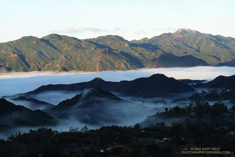
Castro Peak snow and Malibu Creek fog following 3-day storm in February 2023.
Castro Peak snow and Malibu Creek fog.

The paved turnout where I usually park at the Stunt Road trailhead was covered with mud, rocks, and debris. And near the entrance of Calabasas Peak fire road, two large boulders had been dragged to the shoulder to clear the road.

Following another big storm in a Winter of big storms, I was doing the Topanga Lookout Ridge Loop — curious to see what I could see. Nearby Stunt Ranch Reserve had recorded over 10 inches of rain the past three days, and there had been numerous reports of low elevation snow.

Here’s a slideshow of what I found.

Some related posts: Snow on Oat Mountain, Looking for Snow in the Santa Monica Mountains, Topanga Lookout Loop Plus Saddle Peak

Chasing a Sunrise, Taking a Moonshot, Los Padres Snow, and a Dark Line in the Sky

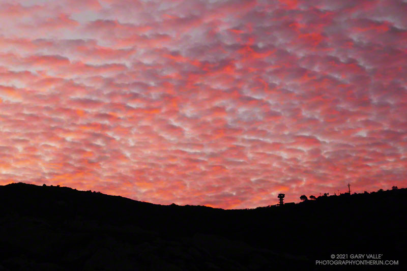
Colorful sunrise in the eastern Santa Monica Mountains

I was running up Calabasas Peak Mtwy fire road trying to get a better view of the eastern sky, but the view in that direction was blocked by a steep hillside. The road turned to the northeast up ahead, and I hoped the best moments of a rapidly-evolving sunrise would not be lost.

A couple of breathless minutes later, I rounded a corner and was rewarded with an unobstructed view of a vivid, pink-red-orange mackerel sky. Focusing on the ridgeline near Topanga tower, I shot several sets of bracketed photos.

Handheld snapshot of the Moon, using a Lumix ZS100
Handheld snapshot of the Moon. Click for larger image and more info.

Excited by the sunrise, I continued up the fire road, scanning my surroundings for another photo. My eye settled on the gibbous moon. High in the sky, it’s bright face was subdued by a thin veil of pinkish-gray cloud. I’d previously experimented with handheld shots of the Moon using my running camera — a Lumix ZS100. Zooming to an equivalent focal length of about 250mm, I held my breath, steadied the camera the best I could, and took a few shots. Here’s one of the images — cropped and sharpened — with enough detail to see craters, maria, and some other lunar features.

At the bottom of Topanga Lookout Ridge there were several bigberry manzanita bushes covered with flowers. A hummingbird was up before sunrise, buzzing about the blossoms, busily drinking the precious nectar. Although it had rained a couple days before, this rain year there had been little rainfall, and a corresponding scarcity of early season wildflowers.

As I climbed higher on the ridge, the mountains northwest of Los Angeles came into view, white with snow from the recent storm. The snow-covered peaks are south of Mt. Pinos and Frazier Mountain, in the area of San Raphael Peak, McDonald Peak, Sewart Mountain and Snowy Peak.

Contrail shadow near Los Angeles
Contrail shadow.

Like snow on a mountain, there is a purity in the form and appearance of clouds. When a long, dark streak appeared across a layer of high clouds, it was hard to miss. In this case, the dark line appears to be the shadow of a contrail of a jet flying above the clouds. At the time LAX was reporting scattered clouds at 19,000′ and 23,000′, with a broken layer of clouds at 28,000′. Given the height of the clouds and orientation of the contrail, it may have been from a flight from San Diego to San Francisco.

Topping out on the ridge, I smiled when I saw the masked couple dancing on the Lookout, and continued west toward Saddle Peak.

Some related photos: An Early Morning Dance at Topanga Lookout, Fallstreak Hole, Rainbow Colors in Cirrus Clouds Over Los Angeles

Hard Winter

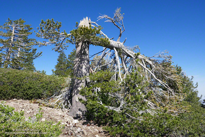
Broken lodgepole pine near Throop Peak

The out and back to Mt. Baden-Powell from Islip Saddle has become a springtime running ritual for me. Sometime in April, May or June, I like to get back to the high country, and see what there is to see — including whether there’s any snow left on Baden-Powell or Mt. Baldy.

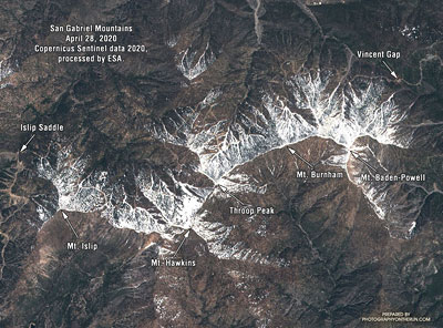
Satellite imagery of snow along the crest of the San Gabriel Mountains, April 28, 2020.
Snow in the San Gabriel Mountains, April 28, 2020. Click for larger image.

Sentinel satellite imagery showed a lot of snow along the crest at the end of April, but hot weather and dry winds in May accelerated the melt. By early June most of it was gone. It didn’t seem likely I would see any today.

I hadn’t seen any snow along the trail this morning. I’d run past Little Jimmy Camp, Windy Gap, Peak 8426, and was now at an elevation of about 8700′, near Mt. Hawkins. Above me, I could hear the excited voices of a couple of hikers near its summit. Thinking they might be part of a group, I looked up the trail toward the crest.

Something was missing… Where was it? Usually prominent on the skyline at this point, the “Mt. Hawkins Lightning Tree” was gone. I walked up the trail to look for the familiar landmark. The trunk of the lightning-scarred Jeffrey pine had been snapped like a twig. The crown of the tree lay 50 yards down the steep slope, jammed against two trees.

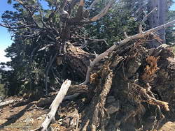
Jeffrey pine near Mt. Burnham, toppled by Winter winds.

It must have been a hard Winter. Several other live trees along the crest between Mt. Hawkins and Mt. Baden-Powell were either blown down or broken in half. In some cases, the damaging winds appeared to be from the south side of the crest and in others from the north. December 2019 was stormy in Southern California, particularly around Christmas. Weather data suggests this might have been when most of the damage was done.

Today, only two large trees blocked the trail. One, on the west side of Mt. Burnham, was easy to go under or around, but the other, west of Throop Peak, was a bit more of a challenge. Given the brush on either side, climbing over the tree worked for me. Some others had detoured well above or below the tree.

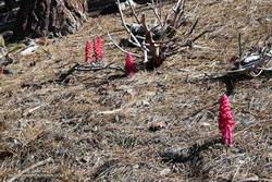
Snow plant along the PCT near Throop Peak.

Surprise, surprise! It turned out there were a couple of small patches of snow on the north side of the crest near Baden-Powell. These were the remnants of an area of wind-deposited snow on the lee (north) side of the crest between Mt. Baden-Powell and Mt. Burnham. Large drifts can collect here, and in a heavy snow year, can persist into July. The deposition area can be seen in the Sentinel satellite image.

With its long views, sub-alpine elevation, and weather-worn limber and lodgepole pines, Baden-Powell is a rewarding summit. Just a few miles to the southeast, Mt. Baldy looms above a mile-deep canyon. If the visibility is good, San Jacinto Peak and San Gorgonio Mountain can be seen beyond Mt. Baldy, many miles in the distance.

The distance from Islip Saddle to Mt. Baden-Powell (9,399′), and back, is about 16 miles. The cumulative elevation gain is about 3800′. Here’s an interactive, 3D view of the out and back route.

Trail note: I ran into a “misplaced” hiker that didn’t know what trail they were on or where they started. Take the time to familiarize yourself with the adventure you have planned!

Some related posts: Mt. Hawkins Lightning Tree (2008), No Worries About Snow Flurries (2019), Mid January Trail Run from Islip Saddle to Mt. Baden-Powell (2014), Snowless San Gabriels (2007)