Category Archives: trees

A Trail That Doesn’t Go Anywhere

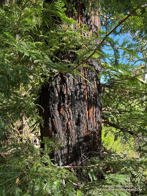
Coast redwood in Malibu Creek State Park scorched by the 2018 Woolsey Fire
Coast redwood scorched by the 2018 Woolsey Fire

Jogging east on the Forest Trail, I stopped to take in the sights and sounds of the early morning. A chorus of bird songs filled the canyon, oblivious to the roar of a passing jet. There was the familiar “honking” of Canada geese and the happy improvisations of a spotted towhee, but also several other birds I could not identify.

Curious to see what Merlin Bird ID would find, I started the app and watched as it matched the songs of a red-winged blackbird, yellow warbler, ash-throated flycatcher, northern house wren, and yellow-breasted chat.

Continuing along the trail, I rounded a corner where some fallen trees had been cleared and was surprised to see someone else hiking toward me.

“You know this trail doesn’t go anywhere,” He commented.

I told him I knew, but I just liked being on the trail.
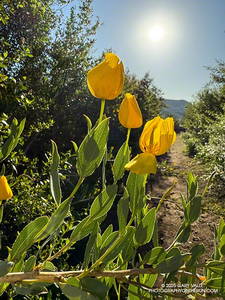
Bush poppy along the Lake Vista Trail in Malibu Creek State Park. (thumbnail)
Bush poppy along the Lake Vista Trail

That’s the thing, a trail doesn’t have to “go somewhere.” If you are open to what it tells you, a trail can take you on a journey beyond its start and end. On a trail, you can explore and experience the wonders of Nature and all that is around you.

The Forest Trail is one of the special trails of Malibu Creek State Park. I often include it when doing more well-known and popular routes, such as the Bulldog Loop and Phantom Loop.

Earlier, I’d used the Cistern, Lookout, and Yearling Trails to run through Reagan Ranch to the parking area near Mulholland Hwy and Lake Vista Drive. Frost covered the grass near the top of the Cage Creek Trail. I’d dressed for what the temperature would be later in the morning, and my hands complained of the cold.

From the parking area off Lake Vista Drive, an indistinct trail leads south along a fence line and private property to a steep SCE service road. The dirt road can be followed to the western trailhead of the Lake Vista Trail. Once on the trail, it’s about a tenth of a mile up to a pretty overlook of Malibou Lake.
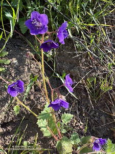
Parry's Phacelia along the Lake Vista Trail in Malibu Creek State Park. (thumbnail)
Parry’s Phacelia along the Lake Vista Trail

From the overlook, the Lake Vista Trail winds in and out of ravines on the north side of “Lake Vista Butte” as it descends to the Deer Leg Trail. This stretch of trail is home to one of the largest populations of hummingbird sage I have seen on a local trail. The aromatic, distinctly-colored, large-flowered member of the Mint Family stands out along the trail. Also blooming on the Lake Vista Trail were bush poppy, stinging lupine, and Parry’s Phacelia.

Back on the Forest Trail, I continued to count the coast redwoods that survived the 2011-2015 drought and the 2018 Woolsey Fire. In July 2016, I counted about sixteen redwoods, some of which were multi-trunked. At that time only one tree appeared to be dead. Today, I counted six surviving redwoods.

There are three solitary trees and three multi-trunked clusters of trees. Two of the solitary trees appear to be those originally planted in the Century Lake area more than 100 years ago. One old redwood is on the Crags Road Trail, near the start of the Forest Trail, and the other is on the north side of the Forest Trail, as it nears Century Lake.

A very young, naturally germinated redwood is found near the east end of the Forest Trail. The three multi-trunked family groups appear to be intermediate in age and could also be naturally germinated.

Some related posts:
Forest Run
Lake Vista Ridge, the Forest Trail, and September Wildflowers
Redwoods, Raptors, and the Phantom Loop
Malibu Creek State Park Redwoods: Fighting the Drought
The Malibu Creek State Park Redwoods Are Dying

Upper Las Virgenes Canyon Open Space Preserve (Ahmanson Ranch) After the 2025 Kenneth Fire

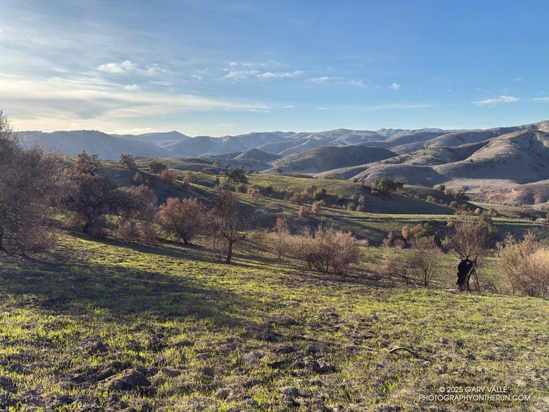
Ahmanson Ranch after the 2025 Kenneth Fire

The Kenneth Fire started at about 2:30 PM on January 9, 2025, near the Victory Trailhead of Upper Las Virgenes Canyon Open Space Preserve (Ahmanson Ranch). The Los Angeles Fire Department issued an alert about the Kenneth Fire at 2:39 PM.

According to the CAL FIRE Kenneth Fire Incident Page, the fire burned 1,052 acres, and was contained on January 12, 2025. The Kenneth Fire is the third significant fire to affect this area in the last 20 years — the other two being the 2005 Topanga Fire and 2018 Woolsey Fire.

At about the time the fire started, a personal weather station near the Victory Trailhead recorded the wind from the ENE at about 11 mph, gusting to 22 mph. At this station, the wind moderated somewhat over the course of the afternoon and early evening, but picked back up overnight.

The vegetation within the burn area is oak savanna — a plant community characterized by grassland and scattered oaks. In the case of Ahmanson Ranch the oaks are valley oaks and coast live oaks. The last known blue oak in the Preserve died in the Winter of 2022-23.

Taking into account their respective populations, the percentage of valley oaks destroyed by the Kenneth Fire far exceeded the percentage of coast live oaks. As the climate has warmed, the mortality rate of valley oaks in the southern part of their range has been increasing and their range retreating northward.

Although the wind was not as strong as it was on January 7-8, it was exceptionally dry. Prior to January 2025, Downtown Los Angeles only recorded 0.16 inch or rain for the Rain Year starting July 1 and  Water Year beginning October 1. As of January 9, the period July 1, 2024 to January 9, 2025 was tied with 1962-63 as the driest on record.

Here are some photos and notes from recent runs in Upper Las Virgenes Canyon Open Space Preserve (Ahmanson Ranch) following the 2025 Kenneth Fire.

Some related posts:
2025 Kenneth Fire Perimeter and Some Area Trails
Very Dry Start to the Downtown Los Angeles 2024-2025 Rain Year
After the Woolsey Fire: Ahmanson Ranch
The Topanga Fire, Part I: Rain, Wind and Fire

Turning California Sycamore Along Malibu Creek

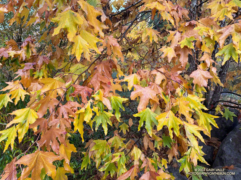
Turning California Sycamore Along Malibu Creek. Photography by Gary Valle'

Multihued leaves of a turning California sycamore near the seasonal bridge on Malibu Creek. The photograph was taken on a recent run of a variation of the Bulldog Loop.

Related post: Reagan Ranch at Sunrise

California Black Walnut Along the Phantom Trail

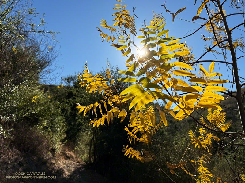
California Black Walnut Along the Phantom Trail

A California black walnut lends a little Fall color to the chaparral on the Phantom Trail in Malibu Creek State Park.

From a run of the Phantom Loop, starting at the Cistern Trailhead on Mulholland Highway. Here’s an interactive 3D-terrain view of the 7-mile route.

Some related posts:
Spring Fever Running the Phantom Loop in Malibu Creek State Park
Ladyface Via the Phantom Trail and Heartbreak Ridge
Bulldog Loop Plus the Phantom Loop

Facing a Future of Runaway Wildfires in Southern California

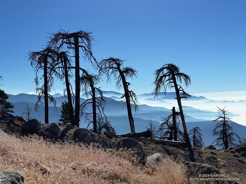
A group of Jeffrey pines on Mt. Waterman killed by the Bobcat Fire with smoke from the Bridge Fire in the distance.

It was a sobering sight. I had stopped at a point on Mt. Waterman burned by the Station Fire in 2009 and the Bobcat Fire in 2020.

To the east, smoke from the Bridge Fire filled the canyons and clung to the ridges between Mt. Baldy and the East Fork San Gabriel River. A group of skeletal Jeffrey pines, once full and green, stood starkly in the foreground.

Another devastating fire had stormed through the San Gabriel Mountains, destroying homes and ravaging the forest and all that lives within. Not far away, the Line and Airport Fires were also burning, the extent of the three fires totaling over 117,500 acres.

Conventional methods of land and fire management usually do not prevent the rapid spread of a fire when forest or weather conditions are extreme — and extreme conditions are now the norm.

Incremental changes to long-established policies will not be enough to prevent runaway wildfires. Novel approaches must be considered, researched and evaluated. New tools and technology, including AI, need to be more widely applied. The hesitancy to spend money proactively must be overcome.

Today, it is difficult to do a hike or run of more than a few miles in the foothills or mountains of Southern California without passing through an area that has been burned in the past 25 years. In 50, 100, or 200 years what will the outdoor experience be? Will conifers only exist in widely scattered stands? Will the ecology be forever compromised?

Every effort must be made to mitigate the impacts of runaway wildfires and preserve the nature and ecology of our open space areas and wildlands.

Some related posts:
Bridge Fire Perimeter and Some Area Trails
After the Bobcat and Station Fires: Three Points Loop Around Mt. Waterman
After the Station Fire: Pine Seedling Along the Mt. Waterman Trail
Waterman Mountain: Fallen Trees, Forest and Ferns
After the Station Fire: Three Points – Mt. Waterman Loop

Back to Baden-Powell – August 2024

Thumbnails of a few photos from the 16-mile out-and-back trail run to Mt. Baden-Powell from the Islip Saddle Trailhead.Above are thumbnails of a few photos from the 16-mile out-and-back trail run to Mt. Baden-Powell from the Islip Saddle Trailhead. Click on an image for a larger photo and more information.

I plucked a currant from the bush and popped it into my mouth. In some years, the red berries are little more than a desiccated bit of pulp. This year’s crop was plump, flavorful, and almost could be described as juicy.

Almost two months had passed since I’d been on the PCT between Islip Saddle and Mt. Baden-Powell. Not a lot changed in the routine of the city in those seven weeks. The street sweeper still came by on Wednesday mornings, the trash was picked up each Friday, and the neighborhood looked pretty much the same as it did at the end of June.

But a lot happens along a mountain trail in seven weeks. The Poodle-dog bush was now wilted and brown. Currants and elderberries had ripened. Rabbitbrush, the messenger of Fall, was blooming, its yellow replacing the pastel purple of Grinnell’s beardtongue. Chinquapin bushes were covered in spiny, green nut burs. Pendulous, resin-coated cones hung from the ends of the long limbs of the sugar pines.

Angeles Crest Highway was still closed between Islip Saddle and Vincent Gap. Gone was the noise of vehicles on the road below, replaced by the sound of the wind in the trees and the occasional outburst of a Clark’s nutcracker.

At the saddle near Mt. Hawkins, I stopped to photograph the stump of the Mt. Hawkins lightning tree. Perhaps weakened by one or more lightning strikes, this Jeffrey pine lost its crown during the Winter of 2019-2020. Now without bark, it’s easy to see that lightning followed the spiral grain of the tree. This tree has a right-hand spiral grain.  When viewed from above, it is twisted counterclockwise.

Once again, the visibility from the summit of Mt. Baden-Powell was excellent. San Gorgonio (57 miles) and San Jacinto (72 miles) could be seen far to the east.

It was windy and cool at higher elevation. The National Weather Service’s Wind Chill Temperature formula doesn’t apply to temperatures over 50°F, but with bare arms and legs, it can be surprisingly chilly when there is a strong wind and the temperature is in the 60s. Had I not been pushing the pace, I would have needed to pull the sleeves and shell from my pack.

Here is an interactive, high resolution, 3D terrain view of the out and back from Islip Saddle to Mt. Baden-Powell. An alternative start at the Windy Gap Trailhead in the Crystal Lake Recreation Area is also shown. Starting at this trailhead adds about 800′ of elevation gain. The map can be zoomed, tilted, rotated, and panned using the navigation control on the right. Track and placename locations are approximate and subject to errors. Poor weather and other conditions may make this route unsuitable for this activity.

Some related posts:
Out and Back Trail Run from Islip Saddle to Mt. Baden-Powell – July 2024 Update
Mt. Hawkins Lightning Tree
It’s Mid-July And There Is Still Snow in Los Angeles County!