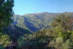
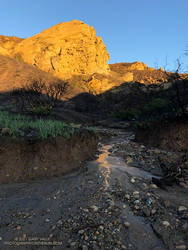
The nasal bellowing of a bullfrog shook the morning, but didn’t disturb the mirror-like surface of Century Lake. I had paused along the Forest Trail in Malibu Creek State Park to take in my surroundings. Here and there glimmers of sunlight reflected from the base of the reeds along the opposite shore. Birds called, flowers bloomed and Nature continued to work in its wonderous way.
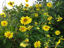
Canyon sunflower along the Lookout Trail.
My run had started at the Cistern Trailhead on Mulholland Highway and then wandered about the Reagan Ranch area. The Lookout and Yearling Trails had been thick with mustard and badly overgrown. The plants had been wet with dew, and my black sleeves and shorts had been liberally sprinkled with the bright yellow flowers. A few ticks had also hitched a ride, but were removed before they could bite.
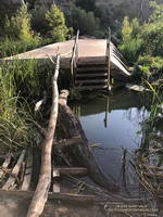
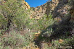
It had been a relief to get back to the Cage Creek Trail and descend to the Crags Road Trail and Malibu Creek. The logs extending across the creek from the washed out bridge had been rearranged, making it easier to cross.
Log crossing across Malibu Creek on the Crags Road Trail, near the Forest Trail junction.
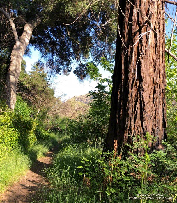
No other trail in the Park is quite like the Forest Trail. The trail isn’t part of a loop, doesn’t connect to other trails, and is only a half-mile long; but it feels like a trail you might find in Big Sur, Santa Cruz or the Bay Area. The forest is comprised primarily of coast live oak, California bay, and sycamore, but at several spots along the trail you’ll find coast redwoods.
Coast redwoods are not endemic to Southern California. All but one of the Forest Trail redwoods were planted over 100 years ago. The trees were severely impacted by the 2011-2015 drought, and only a few have survived. Even so, they are easy to spot — the large, deeply-furrowed, copper-brown trunk of a coast redwood is unmistakable.
Note: There is some poison oak along the Forest Trail, and this year some was protruding onto the trail.
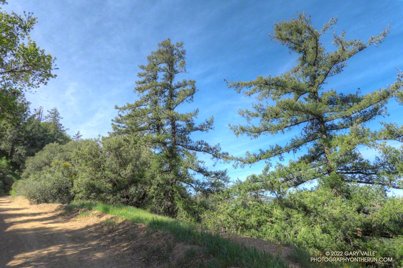
Bigcone Douglas-fir along East Canyon Mtwy fire road.
I hadn’t seen a hiker, runner, or mountain biker since turning off East Canyon Mtwy fire road. That was about 2 miles ago. I checked my watch — it read 18 miles. Had I’d made a wrong turn?
Today’s plan was to do the first 25 miles of the Santa Clarita Ultra & Trail Runs 50K. A week ago I’d run the first (blue) and third (yellow) sections of the course, and today’s run would theoretically combine the first (blue) and second (orange) sections.
Oat Mountain from the Towsley Canyon Loop Trail
So far, the run had gone well. It had started with an extended version of the popular Towsley Canyon Loop in Ed Tavis Park. After climbing up oil-rich Wiley Canyon to a view point at an elevation of about 2450′, the course descended a series of long switchbacks, and passed through a gap in Towsley Canyon known as the Narrows. A mile down the canyon from the Narrows I’d used segments of the Elder Loop and Taylor Loop trails to run over to Lyon Canyon.
After switching from a bottle to a pack, I’d run on the Old Road over to the East Canyon Trailhead. From there the course followed East Canyon and Sunshine Canyon fire roads to Mission Point. The climb up to Jones Junction gains about 1300′ in 3 miles, then it’s another 1.5 miles over to Mission Point (2771′), the high point on the course.
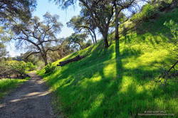
Green along the Taylor Loop Trail.
One of the highlights of the run up East Canyon was the very healthy-looking Bigcone Douglas-firs higher on the road. Now relegated to the cooler climes of steep, north-facing mountain slopes, the species used to be far more widespread in Southern California.
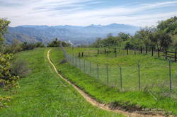
On the way to Mission Point, the views of the San Fernando Valley from the crest were outstanding, and gave a perspective of the Valley I had not seen before. Apart from having to detour along fence lines bordering private property, and continuous gunfire in a section of the canyon that is near a popular gun club, the run to Mission Point was excellent.
Detour around private property on the way to Mission Point.
Returning from Mission Point there was another part of the course I needed to do — an out and back on Weldon Mtwy. Which brings me back to mile 18 of today’s run. After turning off East Canyon Mtwy on what I thought was Weldon Mtwy, I had expected the fire road to loose elevation relatively quickly. But that wasn’t happening.
Instead of running down a canyon, I was running along a ridge — a long ridge. Below and to my right was what looked like a landfill. Below and to my left I could see the Old Road and Santa Clarita. They seemed a long way down.
Mission Point, Three Trees and the San Fernando Valley.
There were several ways I could have checked where I was — my watch has maps; my phone had maps; and I had a map in my pack. But I wasn’t in trouble and was already two miles down this road — whatever it was. If I wasn’t on Weldon Mtwy, it would still be a trail I hadn’t done.
After a couple of “I’ll just go a little farther down and see what I can see” episodes, I eventually turned around and headed back up the fire road. When I got back to East Canyon Mtwy, I checked the yellow pole marking the junction of the fire roads — it was marked “WELDON.” Later, I checked my track and found I had turned around a half-mile from the Newhall Pass Trailhead. Now I know.
Overall, I’d enjoyed the course, and decided I would register for the 50K. But registration closed early, and now I see the event has been postponed until November. Oh well, I still got to run in a new area and check out some interesting trails!
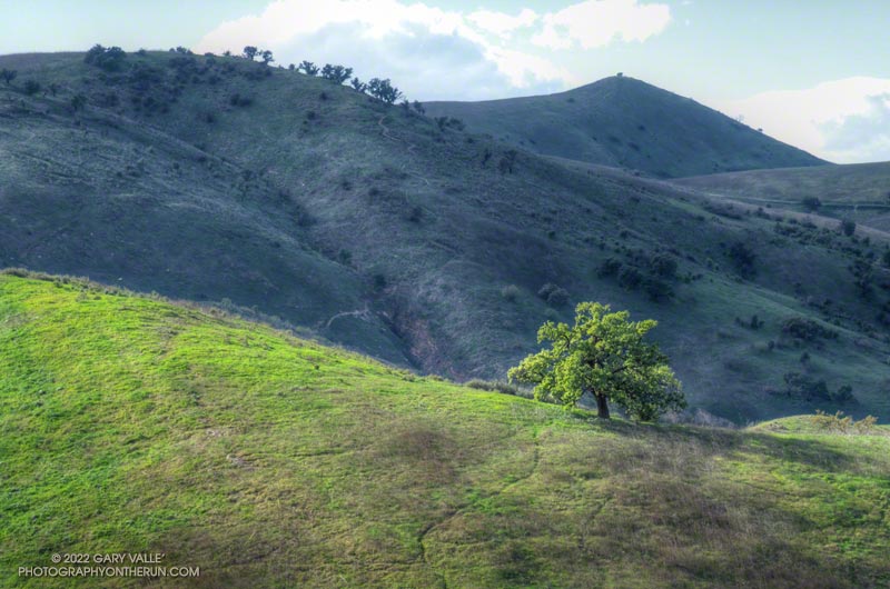
Revitalized by December’s copious rainfall and temperatures in the mid-80s in February, this valley oak at Ahmanson Ranch has produced a lush crown of new leaves.
(Officially named Upper Las Virgenes Canyon Open Space Preserve, most users refer to the open space area as Ahmanson Ranch, or simply, Ahmanson.)
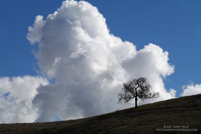
The cumulus cloud towered overhead, its size accentuated by a lone oak on the skyline. An extraordinary series of December rainstorms were finally over. The year 2021 would end with Downtown Los Angeles (USC) having recorded the third highest amount of December rainfall on record.
I was running from the Victory Trailhead of Upper Las Virgenes Canyon Open Space Preserve (aka Ahmanson) to Las Virgenes Canyon. With about 5 inches of rain in the area over the past two days, I was curious to see how upper Las Virgenes Creek was flowing.
Update January 4, 2022. Did the Garapito Trail again this weekend as part of a longer run through Santa Ynez Canyon. The debris from the fallen oak tree was much easier to get through this time. Some people coming down the trail after me had a small saw, and said they were planning to work on it.
Update December 31, 2021. It turns out that a lot more rain was on the way! Los Angeles recorded 9.46 inches of rain this month, making it the third wettest December on record, going back to 1877. This puts Los Angeles at 10.40 inches for the Rain Year to date, which is about 237% of the normal.
It had rained the past three days, including Christmas. Today was the 26th, and Downtown Los Angeles (USC) had recorded nearly 150% of the rainfall normally recorded in December. And more was on the way.
Early morning light on Eagle Rock.
I clicked START on my Garmin as I passed the gate at the Top of Reseda. It was about twenty minutes before sunrise. The temperature was around 40 and the eastern sky was brightening with the advancing sun. As I worked up the initial trail to dirt Mulholland, thousands of lights twinkled across the San Fernando Valley.
The chaparral was soaked with overnight rain; and befitting the Holiday season, was ornamented with thousands of silvery water drops.
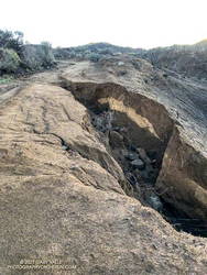
I took my usual route, turning off Mulholland onto Fire Road #30, and then following it to the Hub. From the Hub, Eagle Springs Fire Road led down to Eagle Springs, then beneath the sunlit face of Eagle Rock to Eagle Rock Fire Road and the top of the Musch Trail. In the Palisades Fire burn area there was some significant erosion along the fire road where the runoff wasn’t controlled.
I’d be doing the Musch Trail later in the run, but for now continued down Eagle Springs Fire Road toward Trippet Ranch.
Erosion along Eagle Springs Fire Road.
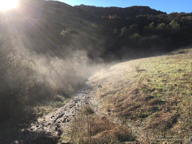
Mud — slippery, cake-on-your-shoes mud — isn’t normally much of an issue until past the Musch Trail and on the steeper downhill that leads to the top of the Santa Ynez Trail and Trippet Ranch. Today there were some slippery spots, but it wasn’t too bad. Remarkably, I didn’t see anyone until I reached the Trippet Ranch parking lot.
My return route from Trippet Ranch was mostly on trails, beginning with the Musch Trail. There are usually a few muddy sections on the Musch Trail after a good rainstorm. Today, one wet, muddy section of trail was steaming in the morning sun. Once I was on the steep climb up to Eagle Rock Fire Road, most of the significant mud was left behind.
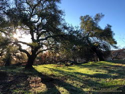
Oaks along Eagle Springs Fire Road, above Trippet Ranch.
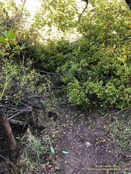
At the top of the Musch Trail, I turned left on Eagle Rock Fire Road and worked up past Eagle Rock and over to the top of the Garapito Trail. I run this trail often, and know it well. Winding down through decades-old chaparral, I became lost in thought, immersed in the outdoor experience, and enjoying every aspect of the trail.
That couldn’t be. Had I somehow turned onto a use trail? Nope, I was on the right trail.
Garapito Trail blocked by fallen oak.
That’s when I noticed the “brush” was the top branches of a large oak. The fallen tree had COMPLETELY blocked the trail. I took a quick look around for an alternate route and didn’t see anything obvious. Working through the mishmash of foliage and branches was a bit like bushwhacking through dense manzanita. With some effort, and some rock climbing moves, I eventually emerged on the other side of the mass. The fallen tree was part of an old, multi-trunked oak that has been collapsing over a period of weeks.
The remainder of the run was uneventful, but enjoyable. Continuing up the Garapito trail to Fire road #30, I crossed the fire road and picked up the Bent Arrow Trail. This connects to dirt Mulholland, which leads west to the Top of Reseda.
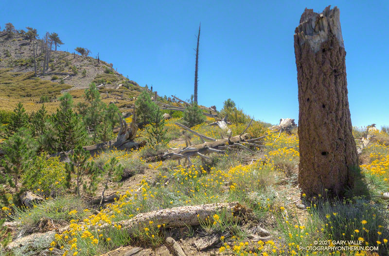
From mid Summer into Fall, the vibrant yellow flowers of rabbitbrush add a refreshing hit of color to the greens, grays, and browns of the San Gabriel Mountains.
The title photo was taken along the PCT, at an elevation of about 8600′, near Mt. Hawkins. The area was burned in the 2002 Curve Fire. Here, and elsewhere in the burn area, new trees — now in their teens — are slowly replacing some of the trees lost in the fire.