Category Archives: photography

Mt. Pinos Adventure Run to Mesa Spring

Mesa Spring Trail near the top of San Emigdio Mesa
Mesa Spring Trail near the top of San Emigdio Mesa.

For many that enjoy the outdoors, there is an insatiable desire to go where we have not been, learn what we do not know, and discover what we have not experienced.

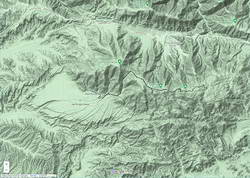
Each time I’ve done the out and back trail run from Mt. Pinos to Mt. Abel, I’ve been curious about the Mesa Spring Trail. The trail leaves the Tumamait Trail at Puerto del Suelo, a saddle about 0.6 mile east of Mt. Abel Road, and descends to a campsite at a spring on the margin of San Emigdio Mesa. The mesa is the large alluvial fan shown on this Google Terrain Map overview.

The Mesa Spring Trail is part of an old trail shown on the USGS 1903 Mt. Pinos topo map. The old trail was part of a route that connected the Cuyama River to the historic El Camino Viejo a Los Ángeles. It followed Dry Canyon, went over Puerto del Suelo, and to the valley that is now the Pine Mountain Club. Like so many trails, it must have evolved from a hunting and trade route.

Google Terrain map showing San Emigdio Mesa and my route from Mt. Pinos

The Mesa Spring Trail is usually accessed from the West Tumamait Trailhead on Mt. Abel Road. But it occurred to me that starting at the East Tumamait Trailhead on Mt. Pinos might be an enjoyable way to do a longer out and back run. The Mesa Spring Trail looked like it might be similar to the North Fork Trail — a little less used and a bit more remote.

I left the Chula Vista parking area a little before 7:00 a.m. and started chugging up the road to the East Tumamait Trailhead at the Mt. Pinos Condor Observation Site. I planned to skip the usual side trips to Sawmill and Grouse. The spring was at a much lower elevation, and I wanted to get there before the temperature sizzled.

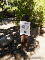
Once on the Vincent Tumamait Trail, it took a little over an hour to reach the top of the Mesa Spring Trail. The junction is marked with a new sign and tree branches on the ground. It is about 5.7 miles from the Mt. Pinos parking area.

Plant communities change dramatically with elevation.
Plant communities change dramatically with elevation. This Jeffrey pine forest is at about 7000′.

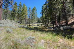
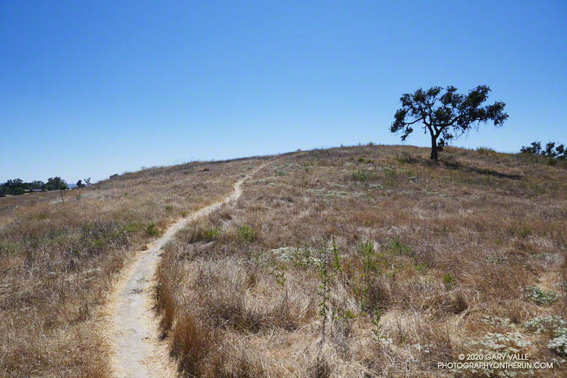
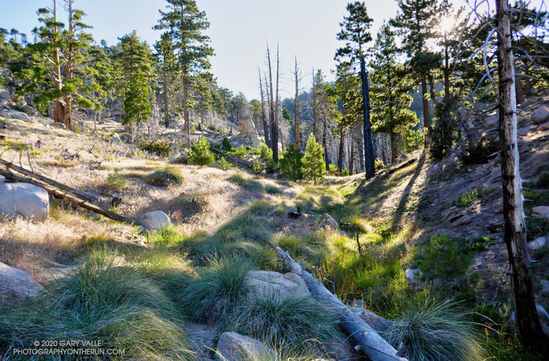
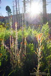
The first couple of miles down from the junction, the trail more or less follows the drainage. About 10 minutes from the junction, a large pine tree had fallen and completely blocked the trail. I worked around the right (west) side of the tree, where some orange fence posts had been placed. A few minutes beyond the collapsed tree, the trail wandered around the right side of a pretty meadow and then back to the “V” of the dry stream.

For the next mile or so, the trail followed a typical down-canyon route. On the way down, there were some spots where I stopped, turned around, and made a mental note of what the trail did. It wasn’t so much a matter of getting lost, as it was not wasting time at an ambiguous spot on the way back.

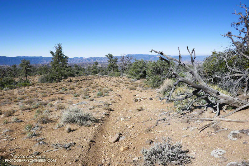
About 2.3 miles down from the saddle, the trail climbed out of the canyon, taking a counterintuitive turn to the right. After reaching a ridgeline, the trail turned back left and continued downhill. But its wanderings were not over. The trail was working across the gullies at the top of the San Emigdio Mesa. It went up, down, and around, but eventually did go to Mesa Spring. There were “ducks” marking the route, but it really helped to have looked at a map and have a general idea of where the trail would go.

Mesa Spring is on the northern margin of San Emigdio Mesa.

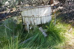
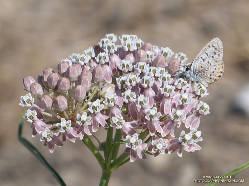
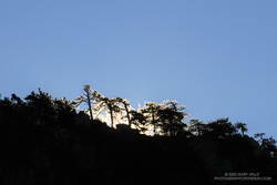
Mesa Spring is a pretty green spot in a group of pinyon pines. As I neared the spring, I saw some coyote-like ears bobbing through the sagebrush, and not long after that, a deer bounded through the trees. At the spring, a squirrel leaped from the edge of the water-filled cistern to a nearby tree and various birds flittered in the pines. I heard a trickle of water near the cistern’s base but planned to get water at Sheep Camp, later in the run.

With its bounty of pinyon pine nuts, acorns, juniper berries, game, and more, San Emigdio Mesa provided vital resources for the local Chumash.

Although the Mesa Spring Trail continues down the mesa, the spring was my turnaround point. I had waited for a day when the weather was better for this run. A weak low-pressure trough moving through to the north had stirred up a little wind and taken the edge off the recent heatwave. It had been cool on the crest, but at 6000′ it was already hot in the sun. It was time to get moving, and in a few minutes, I was retracing my steps and headed back to Mt. Pinos.

With a stop at Sheep Camp, the run & hike worked out to about 20 miles, with an elevation gain of around 4700′. Here are a few photos taken along the way, and an interactive 3D view of the trail run.

Some related posts: Mt. Pinos to Mt. Abel Out & Back – Plus Sawmill Mountain, Grouse Mountain and Sheep Camp, Up, Down and Around on Mt. Pinos’ Tumamait and North Fork Trails

Acmon Blue Butterfly on Narrow-leaved Milkweed

An Acmon Blue butterfly on narrow-leaved milkweed on Lasky Mesa. August 6, 2020.

An Acmon Blue butterfly on narrow-leaved milkweed on Lasky Mesa.

From a run in Upper Las Virgenes Canyon Open Space Preserve (Ahmanson Ranch) on August 6, 2020.

Some related posts: Painted Lady Butterflies in Upper Las Virgenes Canyon Open Space Preserve, Checkerspot Along the Garapito Trail, Tiger Swallowtail on Snow Plant

Southern California Trail Running Temps

Hot weather on an Ahmanson Ranch Trail.
Another hot day on a Southern California trail.

If today’s forecasts hold, it looks like Southern California could be in for a multi-day bout of very hot weather. Not only is the weekend forecast to be hot, but next week could be hot as well.

With the addition of Southern California Edison’s 480+ weather stations to existing NWS, RAWS, APRSWXNET/CWOP, and other networks, it’s now possible to find the temperature near many trails and trailheads in Southern California.

Below are MESOWEST links that will display maps with the temperatures recorded in the last hour. You’ll need to click the “View Profile Without Logging In” button to display the map. It isn’t necessary to join MESOWEST to display the map.

Stations in the Los Angeles/Oxnard CWA – generally Los Angeles County north to San Luis Obispo County

Stations in the San Diego CWA – generally Orange, Riverside and San Bernardino Counties south to San Diego County

In most cases wind, solar, and humidity/dewpoint data are available as well as temperature. Some stations include precipitation and fuel temperature. You may need to drag the map to see a particular station. Click on a station icon for more info.

In addition to the online weather stations, the ALERTWildfire Cams and AirNow Fire & Smoke Map websites are also helpful in assessing conditions.

For official reports, forecasts and warnings, check the NWS web site.

Related post: Run to the Cheeseboro Remote Automated Weather Station

Explosive Growth of the Lake Fire

Development of Lake Fire pyrocumulus cloud over 10 minutes
Growth of the Lake Fire in just 10 minutes.

Lake Fire pyrocumulus cloud at about 4:21 p.m.
Lake Fire pyrocumulus cloud at about 4:51 p.m.

The photographs above show the rapid development of the pyrocumulus clouds associated with the Lake Fire, near Lake Hughes. The timestamps are approximate.

According to the Lake Fire incident page, the fire was first reported on August 12th at 3:40 p.m.

The photographs were taken during a run at Sage Ranch Park. This is the location of the Sage Peak1 and Sage Peak2 ALERTWildfire cams.

Related post: Did Lightning Start the 2002 Curve Fire?

Red-tailed Hawk Encounter

The piercing gaze of a red-tailed hawk near the entrance to Upper Las Virgenes Canyon Open Space Preserve
The piercing gaze of a red-tailed hawk.

Sometimes the behavior of wildlife is difficult to explain.

I’d just finished my run at Ahmanson (Upper Las Virgenes Canyon Open Space Preserve) and was walking back to my car. I was about halfway between the dirt parking lot and entrance gate when suddenly, a large hawk swooped directly in front of me.

Incredibly, I was looking down on the bird! Banked to the left, it was below waist-level and turned around me like I was a pylon at an air race. It was so close I felt I could have reached out and touched its wing.

Time slowed as the bird flew past. I was awed by its size and studied the pattern of highlight-tinged brown feathers across its wings and back.

It landed on a wall to my left, about 15 feet away. I slowly removed my camera from my pack and, holding my breath, took a few photos.

It looks like it might be the same red-tailed hawk that carried a gopher snake to the top of a light pole here in April 2019.

Update November 16, 2020. I’ve been encountering an unusual number of red-tailed hawks this Fall, or maybe encountering the same hawk several times. See Another Red-tailed Hawk Encounter for additional photos.

Update August 14, 2020. I’ve replayed this encounter a number of times, and think I have a plausible explanation. As events unfolded there was a bit of commotion behind me, and after the hawk landed, some cawing off to my right. I suspect the hawk was being chased by a crow, and I was a convenient shield that could be used to break up the chase.

Some related posts: The First Snakes of Spring, Kestrel Encounter, A Raven Story

Three Points Loop Adventure – July 2020

Approaching Waterman Meadow on the Three Points - Mt. Waterman Trail
Approaching Waterman Meadow on the Three Points – Mt. Waterman Trail

You know what they say about making assumptions. Did the Three Points loop around Mt. Waterman today (July 25), and assumed that water would be available at Buckhorn Campground. In a normal summer that would be a reasonable assumption, but this has been anything but a normal summer.

Running down through the campground, I thought it was strange that many of the spaces were empty. Following the signs that said, “Day Use Parking,” and then “Burkhart Trail,” I stopped at a spigot across from some restrooms.

Routine water tests were pending after Buckhorn Campground opened. July 25, 2020.
Routine water tests were pending.

Surprise, surprise! The stapled-on Forest Service sign said, “Non-potable water. Please boil water for a minimum of 5 minutes before using.”

Later, I talked to a ranger and learned that the campground had just reopened on Friday! He said routine tests on the water system had to be completed before the water could be deemed potable.

So I had a choice to make. I was doing the loop counterclockwise, which put Buckhorn at about mile 9 of a 20-mile loop. The second half of the loop — on the PCT — can bake on a hot day, with the climb out of Cooper Canyon being especially blistering.

Morning sun crests a ridge on Waterman Mountain.

So far, the run had gone well. The Mt. Waterman Trail between Three Points and the turn off to Twin Peaks had been in excellent shape. No trees had blocked the trail, and the wildflowers and ferns at Waterman Meadow had been extraordinary. Like last year, a rejuvenated spring about 0.5 mile west of the Twin Peaks junction had water. (Not aware of the situation at Buckhorn, I didn’t top off my water.)

Beyond the Twin Peaks junction, there were some toppled trees. These were probably blown down by the same Winter storms that broke and toppled trees along the crest between Throop Peak and Mt. Baden-Powell, and between West Fork and Mt. Wilson. A few of the trees had fallen across the trail, but none were a problem.

Lesser paintbrush at Waterman Meadow.
Paintbrush and ferns at Waterman Meadow.

As usual, the run down the Mt. Waterman Trail to Highway 2 was excellent. A lot of people were enjoying the hike to the peak, but no more than is typical for that trail in the summertime.

Which brings me back to Buckhorn and my water problem. I could have shortcut the loop by skipping Cooper Canyon and running directly to Cloudburst Summit on Highway 2. That would have shortened the loop by 5 miles. But the day wasn’t super-hot, and there were several places where water could be used for cooling — even if I couldn’t drink it.

Reconfirming how much water I had left, I squeezed the Camelbak(TM) in my pack, and then started running down the Burkhart Trail into Cooper Canyon.

By maintaining a comfortable pace, and using seeps for cooling, my water lasted until I was within sight of the Three Points parking lot. This probably wouldn’t have been the case on a hot day.

Here are some photos taken along the way, and a Cesium interactive 3D view of the route.

Some related posts: Lemon Lilies, Tree Rings and More Heat Training on the Three Points Loop; Pine Seedling Along the Mt. Waterman Trail; Three Points Loop Twice