Category Archives: photography|landscape

San Gorgonio Mountain: Falls Creek Loop August 2013

Plummer Meadows on the Falls Creek Trail

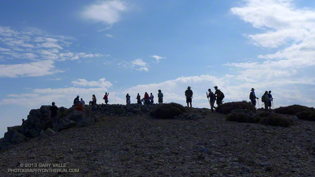
Sitting on the summit of Gorgonio I shook hands with Cole and said “Hi” to his friends. They had run up Gorgonio from the Fish Creek trailhead and we were comparing notes. He’d asked how far I’d run from Momyer. I told him “about 13” and commented that I was surprised by the amount of water in the creeks. He commented, “There’s no water on the way up from Fish Creek.” I looked down, and in his pack was a gallon jug of water. One gallon of water weighs 8.3 pounds, but put it in your pack and it feels like a hundred!

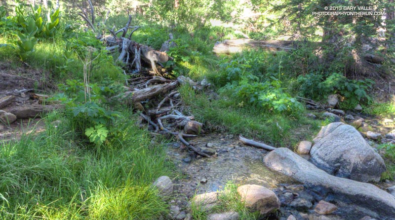
Other than a Southern Pacific rattlesnake encounter and a finicky UV pen the ascent from Momyer had gone well. Alger Creek had enough water I had to pick my way across the creek, and the small streams below Saxton Camp and at Plummer Meadows had more than adequate water for filtering. The creeks were lined with with ferns and flowers and there was little hint of the past year’s meager snowpack and rainfall.

One reason might be that the on-again, off-again summer monsoon had been on much of the latter part of July. This resulted in 0.04 inch of rainfall in Downtown Los Angeles July 26 — enough for a record — and rainfall totals of over two inches in some mountain areas. The Fawnskin RAWS, at Big Bear Lake recorded 1.3 inches of rain over the period July 20-26.


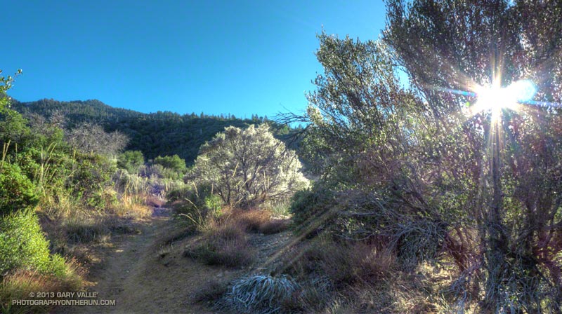
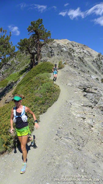
The encounter with the rattlesnake had been dicey. After an hour of steep climbing on the Momyer Trail I’d turned east onto the Alger Creek Trail and was running at about 7200′ on a more or less level stretch of trail in an area of gray rocks. Earlier the possibility of a rattlesnake had flitted through my mind, but I’d become lost in a reverie of early morning sun, tall pines, cool temperatures and easy terrain.

The dark gray Southern Pacific rattlesnake might as well have been invisible. As I began an elongated stride over a large gray rock, something moved just beyond the rock. My brain registered “SNAKE!” and then a microsecond later “RATTLESNAKE!!” Adrenalin turned my already elongated stride into an awkward leap that carried me just over the moving reptile.

The snake had been sunning itself on the trail and was as startled as I was. In a panicked movement it wriggled onto a flat rock on the side of the trail and stopped. My momentum had carried me a few feet past the snake and I turned as quickly as I could to try and get a photo. Rattlesnake for sure — heavier body, triangular head with BIG venom glands. When I took a couple of steps toward the snake to get a shot, it said “no way” and slithered into an opening in the talus.


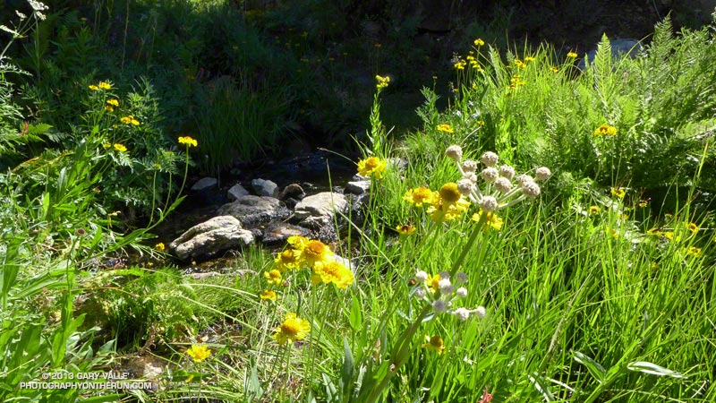
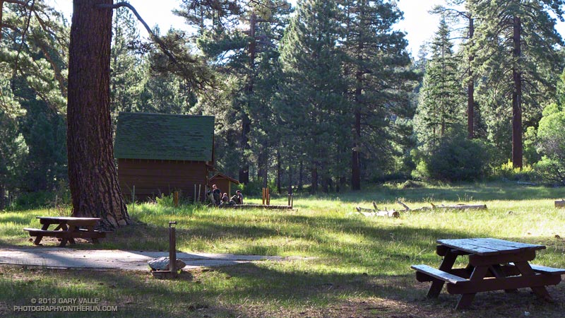
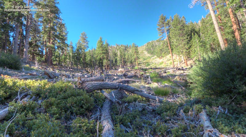
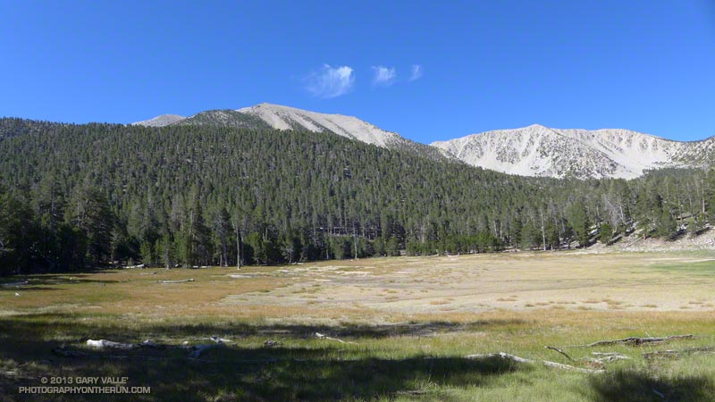
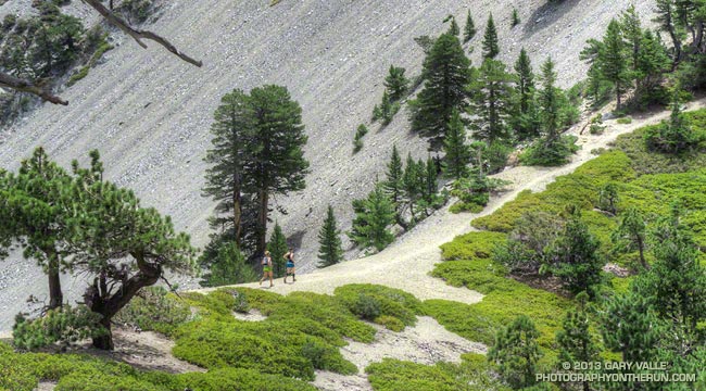
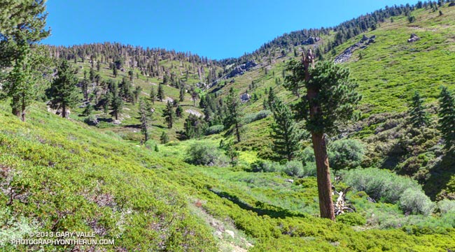
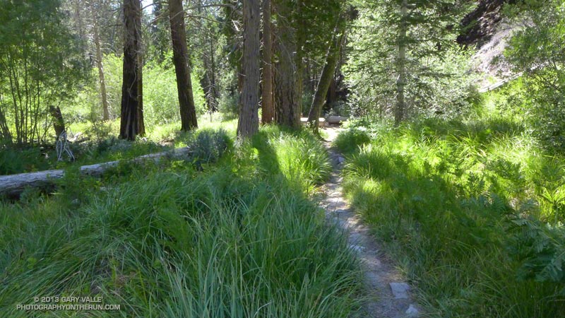
The title photo was taken at Plummer Meadows. The spot is a favorite, and the water source has never failed me. It looked no different today than in any other year. Although the stream is small, the flow was good. The area along the stream was lush and green and decorated with yellow sneezeweed, white ranger’s buttons and magenta fireweed. Tracing the path of the stream up the drainage, it lead to High Meadow Springs; about 1000′ higher and just below the divide.

The pine in the foreground of the photo is interesting. The upper part of its trunk was snapped off some years ago, probably by an avalanche in a very big snowpack year. Given the age of the tree, the big winter of 1968-69 (44 years ago) seems like the most likely candidate.

According to the California DWR report “California High Water 1968-69” during the period January 18-27, 1969, Lake Arrowhead recorded 25.66 inches of precipitation. Given the south-facing aspect and the 9000′-10,500′ altitude of the Plummer Meadows drainage, 30-40+ inches precipitation — much of it in the form of snow — is a possibility. The DWR report indicates that Mt. Baldy (village) recorded 41.6 inches of precipitation during the period January 24-27, 1969! Additional heavy precipitation was recorded in February. This could have translated to 25 feet or more of snow.

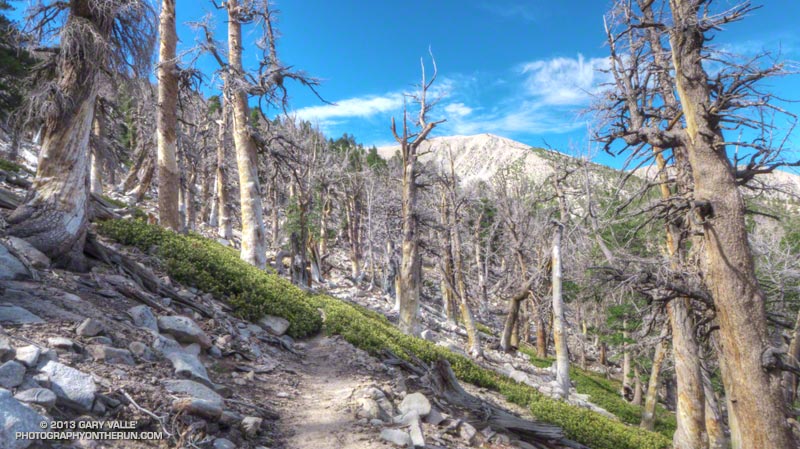
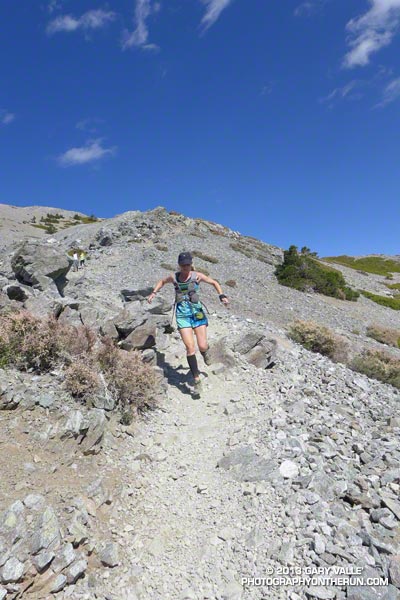
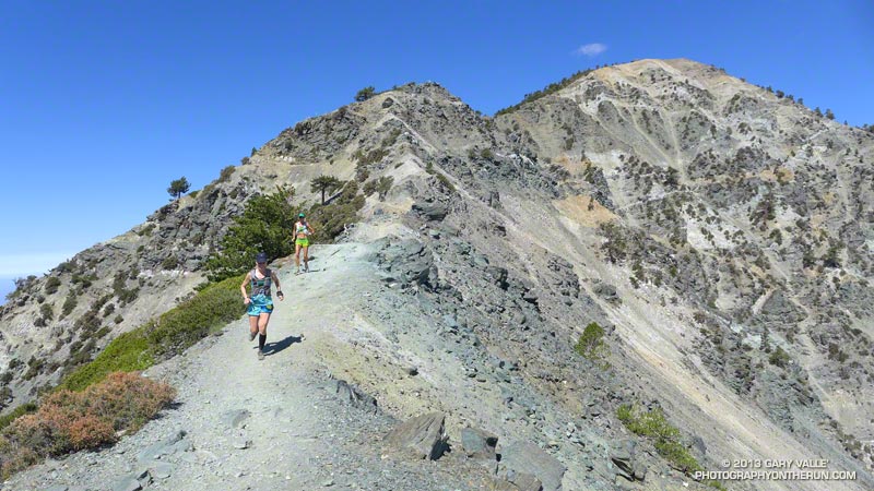
From Plummer Meadows the trail climbs about 1000′ over 1.5 miles to Dollar Lake Saddle. Much of the climb is on a well-shaded, northwest-facing slope that can be quite cool. There is a stand of limber pines along this section of trail.


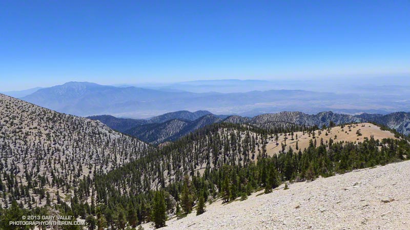
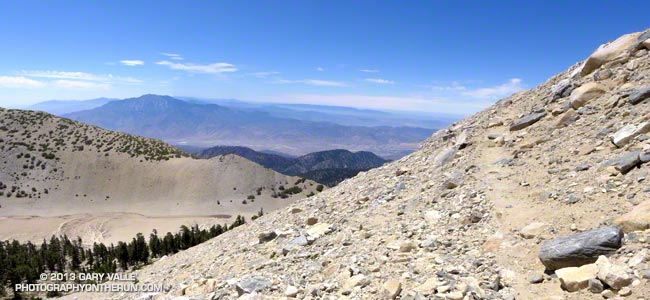
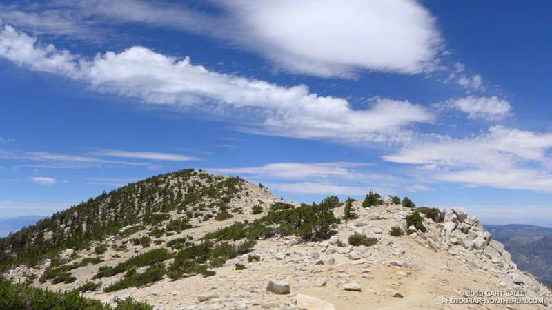
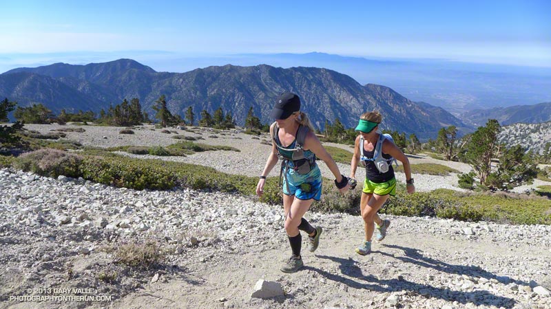
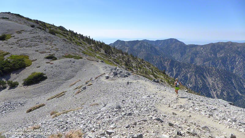
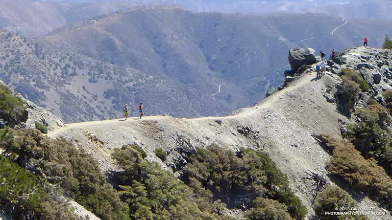
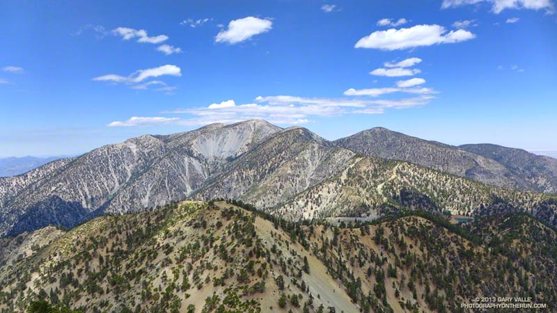
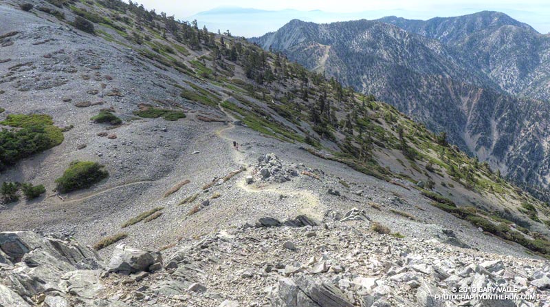
The stretch from Dollar Lake Saddle to the summit is outstanding with far ranging views along and to either side of the divide. I had expected to see a pall of smoke from the Silver Fire and while the visibility wasn’t perfect, it could have been much worse. Including stops for photos and a wilderness permit check it took about an hour and a half to get to the summit from Dollar Lake Saddle. This is about normal for me and I was glad to still have some legs after doing the peak from South Fork the previous week.


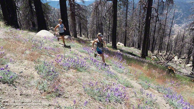
How do the three trail runs I’ve done on San Gorgonio compare? Outside of the Sierra, I don’t think there is a better mountain run in Southern California that can be done as day trip than the Falls Creek Loop. The South Fork Dry Lake – Dollar Lake loop is also excellent, but the downhill running on the Dollar Lake Trail isn’t quite as good as on the Vivian Creek Trail. The Highline/Divide loop is the most adventurous and includes the most running above 10,000′, but sections of the trail below the divide are usually overgrown and you have to go off the Divide Trail to get water.

San Gorgonio Mountain: Dry Lake – Fish Creek Saddle – Dollar Lake Loop

Sky High Trail on San Gorgonio Mountain

Sky High Trail a Mile from the Top of San Gorgonio Mountain

Time flies when you’re having fun, and except for kayaking the upper Santa Ana River and a ski ascent or two, the last time I’d been on the north side of San Gorgonio was before Poopout Hill closed in 1988. Curious to refresh my memory of the area and compare a South Fork trail run to those on the Forest Falls side of the mountain, I started thinking about what would be an interesting route to do.


Running in shorts and short sleeves, I’d left the South Fork trailhead about 7:30 and was now about a half-hour into the run. Up ahead was the turn-off to Poopout Hill and not far beyond that the wilderness boundary. I’d been doing a mix of fast hiking and running and enjoying the morning. A black-capped chickadee had stopped on a branch to say hi, and a Steller’s jay was complaining loudly from the top of a pine. Earlier I’d passed Horse Meadows, an iconic scene with sunlight filtering through the trees, green meadows and rustic brown cowboy cabins.


About a quarter mile past Poopout Hill my jaw dropped as I rounded a corner and was suddenly in a sizable avalanche path. A tumult of interleaved  firs and pines lay in a hundred yard wide swath that extended thousands of vertical feet up the mountain.

This avalanche likely occurred within a few days of January 23, 2010, following (or during) a multi-day rain and snow event in Southern California. Over the seven day period from January 17 to January 23, the rain gauge at Mill Creek recorded 7.82 inches of precipitation. According to a NWS report, Mt. Baldy recorded 7′ of snow at the 8600′ level. The source area of the avalanche appears to have been in a cirque near peak 10,230.


Working up the hill toward South Fork Meadows I stopped to chat with a Ranger, who checked my wilderness permit and mentioned a group of day hikers had left South Fork very early and were ahead of me.

At the Dry Lake/Dollar Lake fork at South Fork Meadows I turned left onto the Dry Lake Trail. I already heard water, so one question was answered — there was plenty of water at South Fork Meadows. Comments on the Water Info Collector had said Lodgepole Spring was low, but “flowing OK,” so the plan was to top off my water there.


Dry Lake was indeed dry, but the meadow in its place and backdrop of sculptured mountains was still impressive. The next stop was Lodgepole Spring; I just had to find the use trail leading to it. This was one of those situations where it’s important to note the details of the topography. There are two areas that people camp at Dry Lake (noted on a sign) and the use trail is in the drainage above the second, more southerly camp.


After talking to some campers I followed the trail around the east side of Dry Lake and into the primary camping area.  After working up the drainage a couple tenths of a mile I found a small spring flowing out of some willows. Rather than taking the time to use a UV pen, I used a makeshift cup to fill a one liter  collapsible water bottle with a built-in filter. Hopefully that, and what was left in my pack, would get me up to the peak and back down to South Fork Meadows.


The “use” trail from Lodgepole Spring was not too difficult to follow and it took about 30 minutes to get up to Fish Creek Saddle. The trail between Fish Creek Saddle and Mineshaft Saddle more or less follows the 9880′ contour line and was reasonably runnable. It passes through an area of lodgepole pines killed by the mountain pine beetle.


In a few minutes I rejoined the regular Dry Lake route at Mine Shaft Saddle and started up the increasingly scenic Sky High Trail. About a mile up the trail from Mine Shaft Saddle is wreckage and a memorial to the personnel of a Douglas C-47 that crashed in a snowstorm on December 1, 1952. The C-47B “Gooney Bird” was a military version of the venerable DC-3 airliner.

The Sky High Trail earned its name as it switchbacked up to 11,000′, and wrapped around the south side of Gorgonio’s summit. From the  airy trail there are stunning views past The Tarn to Banning Pass and Mt. San Jacinto. The Sky High Trail joined the Divide Trail a little east of the Vivian Creek Trail junction and in a couple of minutes I was jogging east across the summit plateau to the blocky summit of San Gorgonio Mountain.

According to the Trail Mileage Handout (PDF) from the San Gorgonio Wilderness Association the descent from the summit by way of Dollar Lake Saddle and the Dollar Lake Trail is about 10.7 miles — which is a little shorter than the 11.4 miles listed using the regular Dry Lake route. (Mileage doesn’t include the side trip to Lodgepole Spring.) Even so, I think the Dry Lake route is the preferred route from South Fork Meadows. It’s more scenic and aesthetic.


The running was technical, but good down to Dollar Lake Saddle. Below Dollar Lake Saddle the trail was often very rocky. This lightning-scarred pine was on one of the last switchbacks before South Fork Meadows. I was happy to get down to South Fork Meadows, get some water, and get onto a better trail! By about 3:30 pm I was back at the car and enjoying an ice cold bottle of water.

Some related posts: Falls Creek Loop 2012, San Gorgonio High Line 2009

Chamberlain Rock

Chamberlain Rock on the Chamberlain Trail segment of the Backbone Trail

The large split rock on the Chamberlain Trail segment of the Backbone Trail is a familiar landmark to those that run and hike the trail. It marks the half-way point on the 3 mile, 1600′ climb from the Old Boney Trail junction to the Tri Peaks Trail junction.

The rock is volcanic in origin and part of a volcanic sequence known as the Conejo Volcanics. According to the Dibblee geologic map of the area the material of which the rock is composed was probably deposited as a lahar (volcanic debris-flow) about 16.1 to 13.1 m.y. ago.

Here’s a link to a couple of videos of lahars on YouTube. After watching the violently churning rocks and debris in the videos it’s easy to see why the rocks embedded in this volcanic matrix are broken into angular pieces and full of stress fractures.


There is a memorial plaque on the rock in tribute to Henry Chamberlain. A 1991 Los Angeles Times article characterized Chamberlain as a wealthy Los Angeles industrialist and rancher.

Mt. Baldy Take Two

Runners on the trail to Telegraph Peak

What better place to be running on a hot July day in LA than the highest point in Los Angeles County — Mt. Baldy! Last Saturday I’d done the Ski Hut loop on Mt. Baldy (officially Mt. San Antonio), and today I was doing another variation of the loop, this time with Skye and Ann.

Note that I use the term “with” here somewhat loosely. They’ve been training for the TransRockies Run this August, and putting in a lot of time and miles on the trails. How much? Today’s run was just part of a 90+ mile, 22,000′ gain week for Ann.

Even though both of them had done hilly 23-24 mile runs the day before, I still had to try and find ways to slow them down:

“You know the route-finding on the next section of trail is a little tricky…”

or

“Let me get a little ahead so I can get a photo of you guys coming up the trail…”

or

“I’m not sure I got that rock out of my shoe. Can you guys hang on for a second…”

or

“Pleaseee slooow dooownn…”


On the way up we did a variation of the Ski Hut/Baldy Bowl Trail that goes to the site where two Grumman F6F-5N Hellcat fighters crashed in a snowstorm March 21, 1949. Seeing the wreckage was a somber reminder of just how unforgiving mountain weather can be. It also brought to mind the image of a similar big-engined, vintage, single-prop fighter doing a spectacular, banked, high speed pass (just) over the summit of Mt. Baldy not long after I’d crossed the Run-to-the-Top finish line a few years ago. Today there wasn’t going to be a problem with the weather, or for that matter, anything else.

After topping out on Baldy we ran over to West Baldy and back, and then continued down the Devil’s Backbone Trail to the Notch. The running from the Baldy-Harwood saddle down to and along the Devil’s Backbone is scenic and technical, and just about as good as mountain trail running gets.

We refilled our hydration packs at the Notch restaurant and then continued on to Thunder Mountain and Telegraph Mountain. The view of Baldy from Telegraph was excellent and it was easy to see Baldy Bowl and the route of the Ski Hut/Baldy Bowl Trail. We’d already done most of the 6000′ of elevation gain we would do today, and about 3000′ of the loss. Now on the 6.5 mile descent from Telegraph to Manker Flat we’d get to do the other 3000′.

Here are few additional photos from the run. Click the image for more info and a larger image.


Near the Top


Descending Baldy


Above Harwood Saddle


Devil’s Backbone


Devil’s Backbone


Baldy Peaks

Mt. Baldy Ski Hut Loop

Hikers on the summit of Mt. Baldy

As might be expected on a holiday weekend, it was busy on Mt. Baldy. Hikers and runners were doing the peak by all the regular routes — the Ski Hut/Baldy Bowl, Devil’s Backbone, Bear Canyon/South Ridge and North Backbone trails.


I did a variation of the Ski Hut loop. This loop starts at Manker Flat (about 6160′) and ascends Mt. Baldy (10,064′) via the Ski Hut/Baldy Bowl Trail and then descends the peak using the Devil’s Backbone Trail and ski area service road. Along the way I also ran over to West Baldy (9988′) and Thunder Mountain (8587′). This variation is about 14.5 miles with 5000′ gain/loss vs 10.5 miles and 3900′ gain/loss for the basic loop. If you throw in Telegraph Peak, it adds another 3.5 miles and 1000′ of gain/loss.

The weather was spectacular with just enough clouds to make the sky interesting. Temps were comfortably cool on top, and although warmer down at the Notch, OK for running over to Thunder.

Some related posts: Back to Baldy, Mt. Baldy Run Over the Top, South Ridge Relic, Up & Down Mt. Baldy’s South Ridge

Three Points Loop Twice

Ann and Skye on trail 10W04, between Mt. Waterman and Three Points

Did the 20 mile Three Points – Mt. Waterman Loop a couple of times this month. The first time was during a heat wave similar to what we’re going through now. It was one of those days when you drive to the trailhead early in the morning, open the car door, and the “brisk” mountain air is a surprising 75 or 80 degrees. After doing the run I checked the temperatures recorded at nearby Chilao, and by 9:00 a.m. the temperature was already at 90°F.


The title photo is of Ann and Skye on trail 10W04, between Mt. Waterman and Three Points. Here’s another photo of them in an area covered with bracken fern on a section of the trail that burned in the 2009 Station Fire. It doesn’t look like it, but they are on a trail!

Last weekend I did the loop again, and the temperature was about 15 degrees cooler. What a difference!

Some related posts: Three Points – Mt. Waterman Loop, Southern Pacific Rattlesnake on the Burkhart Trail, Three Points Loop Plus Mt. Waterman