Running along Coyote Ridge in the Marin Headlands.
NPS maps of the Marin Headlands and the Presidio can be downloaded from the NPS Golden Gate National Recreation Area Maps page.

Running along Coyote Ridge in the Marin Headlands.
NPS maps of the Marin Headlands and the Presidio can be downloaded from the NPS Golden Gate National Recreation Area Maps page.
Note: The Mt. Disappointment Endurance Run is now the Angeles National Forest Trail Race.
The plan earlier in the week had been to do a day trip to the Sierra Saturday or Sunday and run the Cottonwood – New Army Pass loop, but computer models had shown a monsoonal flow developing, and a look at a satellite image Friday afternoon confirmed the forecast. Friday evening Whitney Portal was hit by a flash flood with water and mud reported up to waist deep in the campground. Runoff from the t-storms was increased by rain melting higher elevation snow, and by the ground already being wet from the prolonged melt of this year’s record-setting snowpack.
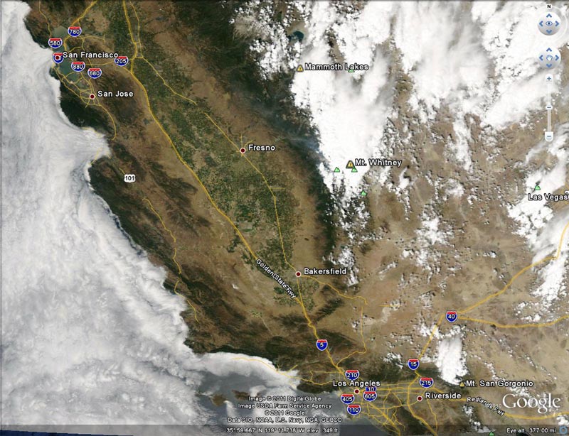
Computer forecasts indicated thunderstorms would likely continue in the mountains and deserts of Southern California through the weekend. Saturday I ran a few miles in the morning and then around lunchtime checked the weather in the Sierra. Strong thunderstorms had developed in the Southern Sierra, and a flash flood warning had been issued for the eastern slopes of the Sierra in the vicinity of Cottonwood Lakes Basin. Time to switch to plan B.
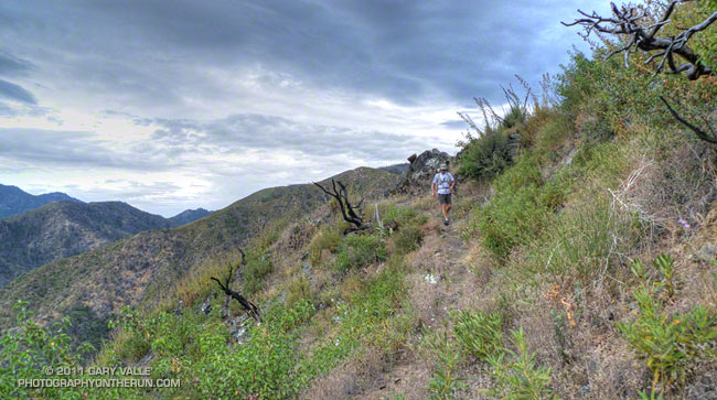
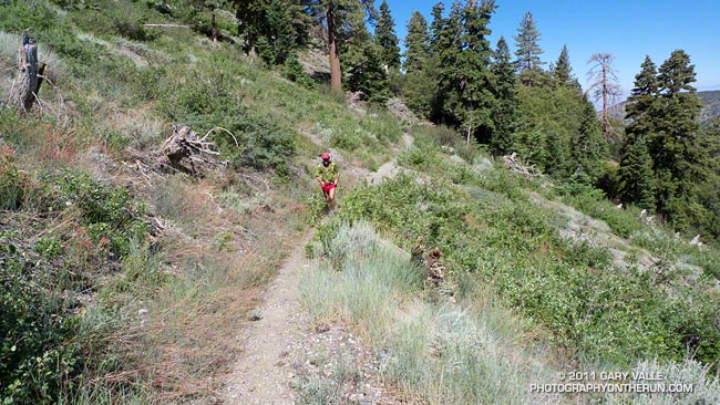
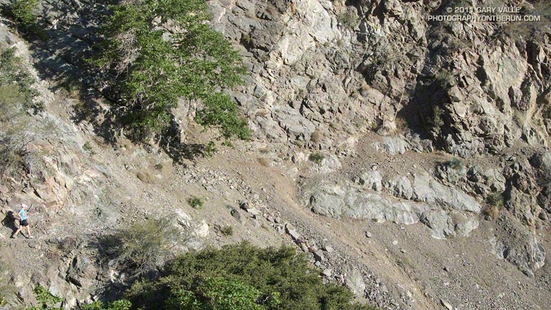
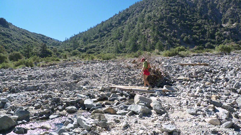
Plan B was to do a training run on the Mt. Disappointment 50K course. Mt. D is a figure-8 course, where each loop of the eight contributes about 16 miles and 3000′ or so of elevation gain/loss. Earlier this July there was a training run from Mt. Wilson on the Valley Forge – West Fork – Kenyon Devore part of the eight. Today we did another part of the figure-8 starting at Shortcut Saddle, running down the Silver Moccasin Trail to West Fork, then up to Newcomb Saddle, and then completed the loop to Shortcut on Edison Road. In the 50K, this loop would start at West Fork, but the sequence of trails would be the same.
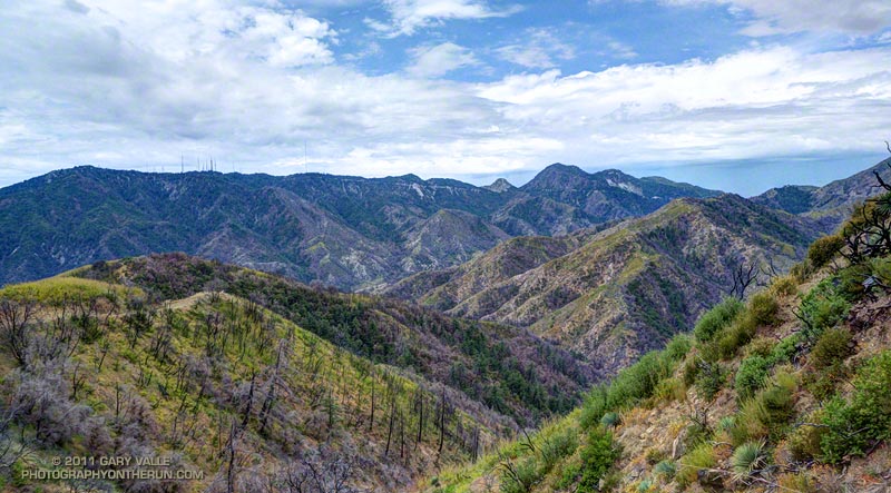
Along with the race-ending climb up Kenyon Devore to Mt. Wilson, the climb out from the West Fork San Gabriel River to Shortcut Saddle on Edison Road is one of the more “memorable” sections of the Mt. Disappointment course. At least Kenyon Devore has some shade. Even on a blustery Spring day the 5.5 mile climb up Edison Road (2N23) can be a warm one, and in direct sun in the heat of Summer it can be downright scorching. Not so today — a layer of monsoon clouds, a fresh breeze, and an occasional drop or two of rain kept the temperature on the ascent disturbingly reasonable.
The run worked out great, but may have been a bit misleading in terms of preparing for Mt. D. It’s unlikely we’ll have a giant sun shade for the race like we did today!
Note: Weather stations on Mt. Wilson and at Clear Creek can be used to get an idea of what temperatures are running in the vicinity of the race course. Note that the temeprature specified is measured in the shade. In my experience the “fuel temperature” is a better indicator of the temperature in the sun. The fuel temperature is included in the Clear Creek listing.
Some related posts: Mt. Disappointment 50K 2011 Training Run, Mt. Disappointment 50K 2010 Notes
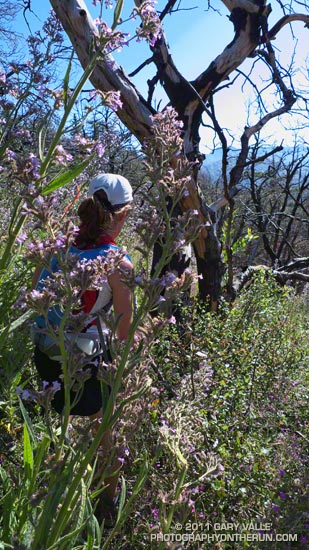
In a real-world test of Poodle-dog bush* exposure, during a recent training run at Mt. Wilson, approximately 30 runners ran a mile-plus section of trail overgrown with the plant. Reactions varied from none at all, to at least one runner who had a strong reaction similar to my first bout with Poodle-dog bush several weeks ago.
Here are some runner comments:
“I can’t believe it, but I had very little reaction. Just a few little bumps. You saw how careful I was trying to be. Maybe not man-handling it helps.”
“Not much sleep for the last two days…arms, legs, and abdomen burn way worse than Poison Oak. By nightfall the blisters break and ooze.”
“I finally had a mild reaction today, red rashes that turned into very small blisters…”
“Absolutely nothing happened, I’m either not allergic to it, or the soap & brush took the top layers of skin off and the poison with it.”
“I’ve got the stuff in my left eyelid (I must have rubbed my eye after hand contact with T. while carefully trying to part it as I inched my way down VF); I’ve got it on my stomach at waist band and lower, and I’m waiting for my legs, although I may get lucky there.”
Since I’d had a strong reaction before, I expected the worst. Fortunately, my reaction was relatively minor. Like several other runners, I had a same-day irritation/inflammation along the waistband of my running shorts. In addition, the top of one ankle and a small area on the inside of one arm developed a very mild rash. It was barely noticeable and cleared up completely in about five days.
There are several possible reasons I didn’t have a strong reaction this time. Even though contact was unavoidable, I walked in areas where the Poodle-dog bush was the densest, and I attempted to avoid the plant as much as possible. This time around my legs and arms were not covered with the sticky goo from the plant. Even so, as soon as I was out of the area with Poodle-dog bush, I stopped at a creek and washed off my legs and arms. I also washed again at the end of the run.
Another reason I might have reacted differently is the age of the plants. As Poodle-dog bush matures, the lower leaves wither and fall. (This gives the plant the appearance of the groomed tail of a poodle.) There’s anecdotal evidence that as the plant dries out the almost microscopic hairs that cover the leaves, stems and flowers are easily broken and shed, and can contribute to the irritation/inflammation the plant causes. It seems plausible that these hairs could be an irritant, or might even act like a minuscule time-release capsule of the plant’s active compounds.
Note: The trail was the Valley Forge Trail. Trail work is scheduled on this trail the next two weekends.
*The taxonomic name for Turricula parryi (Poodle-dog bush) has changed to Eriodictyon parryi. The Jepson Manual: Vascular Plants of California, Second Edition (2012) has returned Turricula to the genus Eriodictyon, as originally described by Gray. According to the Wikipedia entry for Turricula (April 11, 2012), “… molecular phylogenetic analysis carried out by Ferguson (1998) confirms that Turricula should be treated as a separate genus within a clade (Ferguson does not use the term “subfamily”) that includes Eriodictyon, and also the genera Nama and Wigandia; Eriodictyon is the genus to which Turricula is closest in molecular terms, and is its sister taxon.” I use “Turricula” and “Poodle-dog bush” interchangeably as a common name.
Some related posts: Contact Dermatitis from Turricula parryi (Poodle-dog Bush), Getting Over Poodle-dog Bush Dermatitis, Poodle-dog Bush Along the PCT Near Islip Saddle
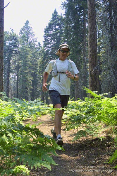
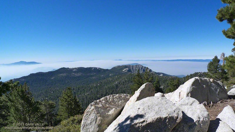
It had been about four months since I’d been to the summit of Mt. San Jacinto. Last time there had been several feet of snow, and the summit had been an inhospitable place with frigid temperatures and buffeting winds. Not so today. Short sleeves and running shorts were the attire of the day, and the weather was more like Malibu Beach than the summit of a 10,000 foot peak.
I was running with Craig Kinard, a long-time backpacker, but relatively new convert to trail running. With the help of Team CrossFit Academy, Craig discovered he likes to run up mountains, and has done well in both the Baldy Run to the Top and Mt. Wilson trail races. Next month he’s planning to run his first ultra — the Mt. Disappointment 50K.
Today we were doing an approximately 20 mile course from Long Valley (8400′), near the top of the Palm Springs Tram, up to San Jacinto Peak (10,834′), then down to the historic Tahquitz Peak Fire Lookout (8,828′). From the Lookout we would return to the Tram by way of Hidden Lake Divide. Totaling about 4000′, the ups and downs would be good training for the 6200′ of elevation gain in this year’s Mt. Disappointment race.
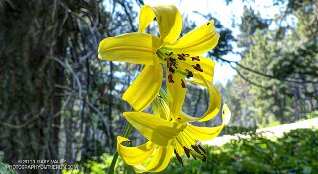
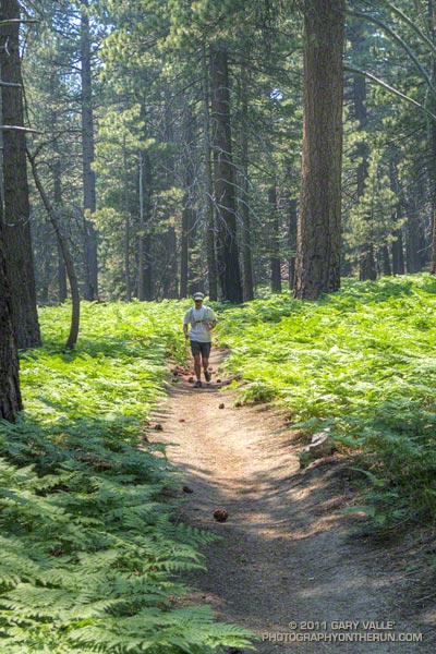
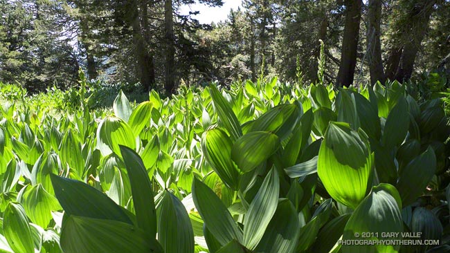
Winter snow translates to Summer water, and its beneficial effects could be seen in everything from the new growth on the chinquapin to the healthy green of the pines. Wellman Cienega was a green wonderland of ferns and corn lily, and near Skunk Cabbage Meadow bright yellow lemon lilies were sprinkled among the bracken and old growth Jeffrey pines. In places western azalea bloomed in profusion, its sweet fragrance mixing with the smells of damp earth and sun-warmed pine needles.
Smoke from the Eagle Fire remained trapped below a strong inversion most of the morning, and for a while views of Tahquitz Peak were crisp and clear. As temps warmed the inversion weakened and there was a flare-up on the Eagle Fire. By the time we reached Tahquitz Peak Lookout, a smoky haze had moved into the area.
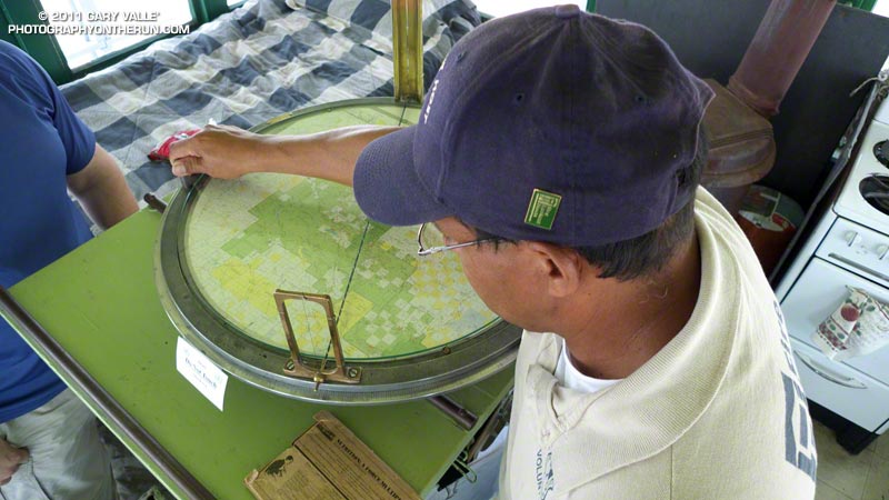
At the fire lookout volunteer host Joe Mendoza described the history of the tower and demonstrated the use of the Osborne Fire Finder. Using an earlier sighting he plotted the location of the fire and showed us it was in the vicinity of Warner Hot Springs. He also showed us the “hot seat” used in lightning storms. Thanks Joe!
It was an outstanding run! Here’s a Cesium browser View of a GPS trace of the route, and an elevation profile generated in SportTracks.
Here are a few additional photographs:
 Toro & Tahquitz Peaks 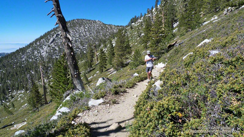 Near Miller Peak 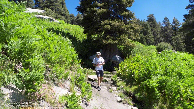 Wellman Cienega |
 Corn Lily 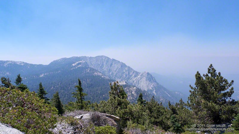 Tahquitz Peak & Rock  Near Tahquitz Peak |
Some related posts: Room with a View, Autumn Trail Running on Mt. San Jacinto, Mountain Weather
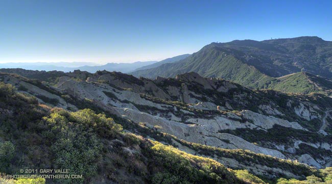
Rock Formations Along Calabasas Peak Fire Road
There are several good trail runs that start at the trailhead for the Secret Trail on Mulholland Highway in Calabasas. All are a mix of single track trail and dirt road. The longer options listed incorporate segments of the Backbone Trail. Mileages and elevation gain/loss are approximate.
Following yesterday’s Mt. Disappointment training run, I was looking to do something without a huge elevation gain (Kenyon Devore was plenty) and not too long. The out and back to Stunt Road was the perfect run for the day.
Some related posts: Secret Trail to Calabasas Peak, A Long Run Kind of Day, Tapia Bound
Some runs in the San Gabriels are more adventurous than others, and I’d mentioned to Devy that on this run we would likely have to deal with rock slides, washed out sections of trail, an annoying amount of bugs, and warm — if not hot — temperatures. We might even run into a bear. Devy is the owner of Andes Adventures, and having cut his trail running teeth exploring Peru’s Cordilleras Blanca and Huayhuash, his response was “sounds like fun, let’s go!”
The loop is a favorite, combining sections of the High Desert National Recreation Trail and Pacific Crest Trail. The route starts at Islip Saddle (6650′), descends to South Fork Campground (4560′), then climbs all the way back up the summit of Mt. Baden-Powell (9,399′). From Baden-Powell it returns to Islip Saddle on the PCT. It’s 23.5 miles of scenic single track trail with a cumulative elevation gain/loss of around 5700′. Done as part of a normal week of running, and with stops along the way, it usually takes about the same time to do this course as a hilly 50K race.
The South Fork and Manzanita trails are part of the High Desert National Recreation Trail. The 5.25 mile long South Fork Trail descends the rugged canyon of the South Fork of Big Pine Creek. Due to the tortured geology of the area — the San Andreas fault zone is nearby — the trail is in a constant state of change. Each time I’ve run it, its condition has been a bit different. It has many rocky sections, and at various points along the trail it is necessary to cross the debris from small rock slides.
According to the nearby Valyermo RAWS the temperature was around 80 degrees when we rolled into South Fork Campground. Not too bad. It would be near 100 later in the day, and it’s not uncommon for temps to hit the 90’s here by 8:00 or 9:00 in the morning. The (unmarked) Manzanita segment of the High Desert National Recreation Trail starts on the east side of the campground and in about 5.6 miles leads to Vincent Gap (6565′).
The news of the day was the condition of the Manzanita Trail. Sections of this trail have been washed out for several years, and after December’s record-setting rainfall it seemed the trail could only be worse. Surprise, surprise, the trail was mostly repaired! We didn’t even have to use tree roots for handholds!
Vincent Gap is at about mile 11 on the route, and about 2200′ into the 5000′ climb up Baden-Powell from the desert. As you might expect on a nice Summer weekend the PCT up Baden-Powell was very busy. In part because we wanted to save some for the outstanding running between Baden-Powell and Islip, and in part because we couldn’t go any faster, the pace was pretty leisurely going up the peak.
Ah… the water at Little Jimmy Spring… Like last week, still so cold I thought it was going to give me an ice cream headache.
Related post: Islip Saddle – Mt. Baden-Powell South Fork Loop