Category Archives: photography|trail running

Mt. Baldy Take Two

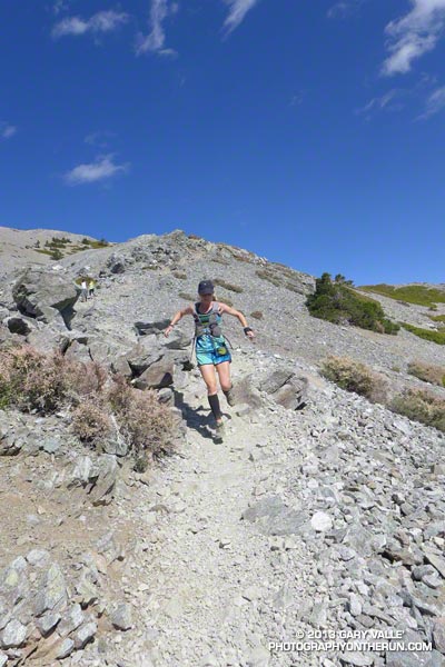
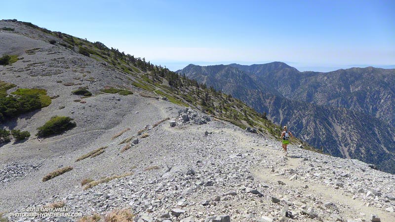
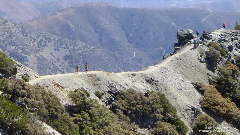
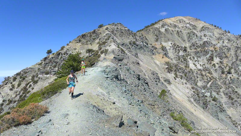
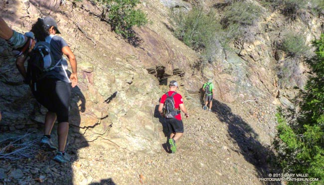
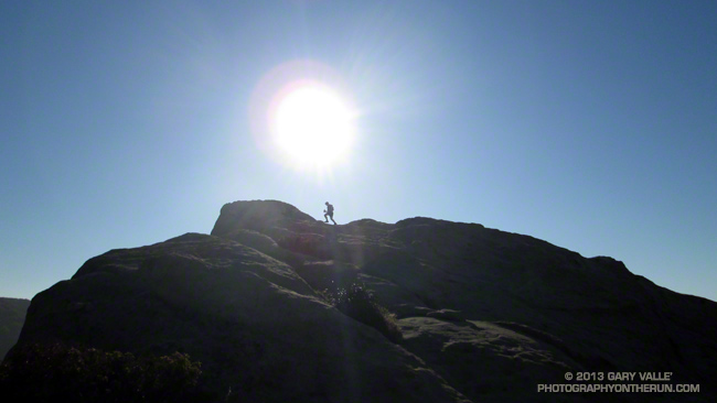
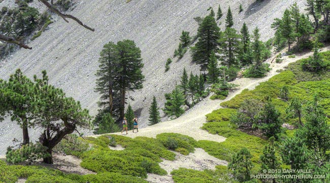
Runners on the trail to Telegraph Peak

What better place to be running on a hot July day in LA than the highest point in Los Angeles County — Mt. Baldy! Last Saturday I’d done the Ski Hut loop on Mt. Baldy (officially Mt. San Antonio), and today I was doing another variation of the loop, this time with Skye and Ann.

Note that I use the term “with” here somewhat loosely. They’ve been training for the TransRockies Run this August, and putting in a lot of time and miles on the trails. How much? Today’s run was just part of a 90+ mile, 22,000′ gain week for Ann.

Even though both of them had done hilly 23-24 mile runs the day before, I still had to try and find ways to slow them down:

“You know the route-finding on the next section of trail is a little tricky…”

or

“Let me get a little ahead so I can get a photo of you guys coming up the trail…”

or

“I’m not sure I got that rock out of my shoe. Can you guys hang on for a second…”

or

“Pleaseee slooow dooownn…”
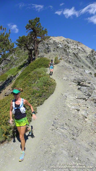


On the way up we did a variation of the Ski Hut/Baldy Bowl Trail that goes to the site where two Grumman F6F-5N Hellcat fighters crashed in a snowstorm March 21, 1949. Seeing the wreckage was a somber reminder of just how unforgiving mountain weather can be. It also brought to mind the image of a similar big-engined, vintage, single-prop fighter doing a spectacular, banked, high speed pass (just) over the summit of Mt. Baldy not long after I’d crossed the Run-to-the-Top finish line a few years ago. Today there wasn’t going to be a problem with the weather, or for that matter, anything else.

After topping out on Baldy we ran over to West Baldy and back, and then continued down the Devil’s Backbone Trail to the Notch. The running from the Baldy-Harwood saddle down to and along the Devil’s Backbone is scenic and technical, and just about as good as mountain trail running gets.

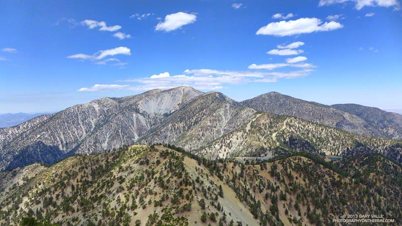
We refilled our hydration packs at the Notch restaurant and then continued on to Thunder Mountain and Telegraph Mountain. The view of Baldy from Telegraph was excellent and it was easy to see Baldy Bowl and the route of the Ski Hut/Baldy Bowl Trail. We’d already done most of the 6000′ of elevation gain we would do today, and about 3000′ of the loss. Now on the 6.5 mile descent from Telegraph to Manker Flat we’d get to do the other 3000′.

Here are few additional photos from the run. Click the image for more info and a larger image.
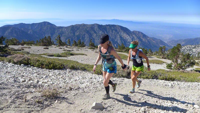


Near the Top


Descending Baldy


Above Harwood Saddle


Devil’s Backbone


Devil’s Backbone


Baldy Peaks

Three Points Loop Twice

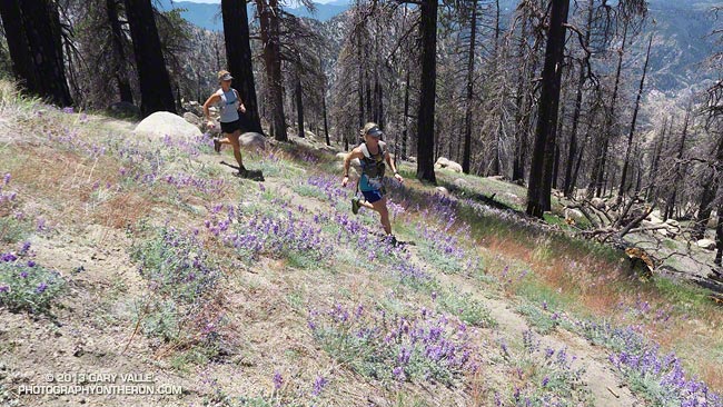
Ann and Skye on trail 10W04, between Mt. Waterman and Three Points

Did the 20 mile Three Points – Mt. Waterman Loop a couple of times this month. The first time was during a heat wave similar to what we’re going through now. It was one of those days when you drive to the trailhead early in the morning, open the car door, and the “brisk” mountain air is a surprising 75 or 80 degrees. After doing the run I checked the temperatures recorded at nearby Chilao, and by 9:00 a.m. the temperature was already at 90°F.


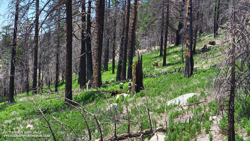
The title photo is of Ann and Skye on trail 10W04, between Mt. Waterman and Three Points. Here’s another photo of them in an area covered with bracken fern on a section of the trail that burned in the 2009 Station Fire. It doesn’t look like it, but they are on a trail!

Last weekend I did the loop again, and the temperature was about 15 degrees cooler. What a difference!

Some related posts: Three Points – Mt. Waterman Loop, Southern Pacific Rattlesnake on the Burkhart Trail, Three Points Loop Plus Mt. Waterman

After the Springs Fire: A Run Through Pt. Mugu State Park

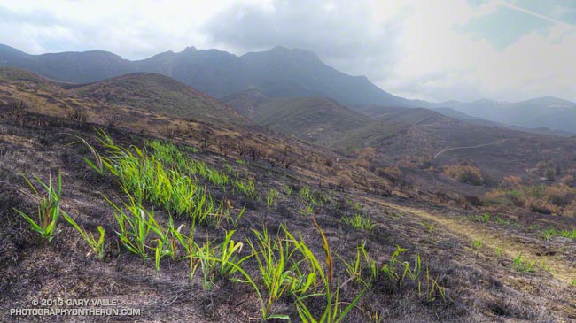
New growth in Pt. Mugu State Park following the Springs Fire

As we rounded a corner on the Old Boney Trail, Ann spotted a deer bounding through a thick, unburned section of brush. Its behavior was unusual — the deer was a few hundred yards away and in heavy cover. We soon saw the reason — a large coyote was trailing the animal and probably had been doing so for time.

We were in the middle of a 25 mile Odyssey through Pt. Mugu State Park, about three weeks after the Springs Fire ravaged much of the park’s 14,000 acres.

Already the process of recovery was underway. Tufts of green were sprouting in many areas. Yucca was beginning to regrow and a few yucca scorched in the fire were blooming. In addition to the deer and coyote described above, over the course of the run we would see another deer; fresh raccoon, bobcat, fox and rodent tracks; a lizard, grasshoppers, many birds, a bee’s nest, and fresh mountain lion scat.

Here is a slideshow of some photos from the run.

Some related posts: Springs Fire Burn Severity, Springs Fire 2013

San Francisco Sights Trail Run

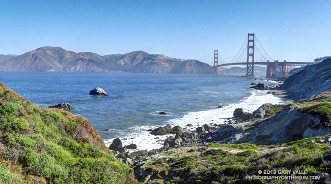
Golden Gate Bridge from the Batteries to Bluffs Trail

The Presidio of San Francisco is a favorite of local and visiting runners. One of innumerable route variations, this 7.5 mile run is jam-packed with iconic sights and memorable points of interest.

Brett and I started the run near the Chestnut gate of the Presidio. The first stop was the Letterman Digital Arts Center, the headquarters of Industrial Light and Magic and LucasArts. You can grab a cup of coffee at the Starbucks here, and then stop by the Yoda Fountain. Statues of motion picture pioneer Eadweard Muybridge and TV pioneer Philo T. Farnsworth are also on the grounds.


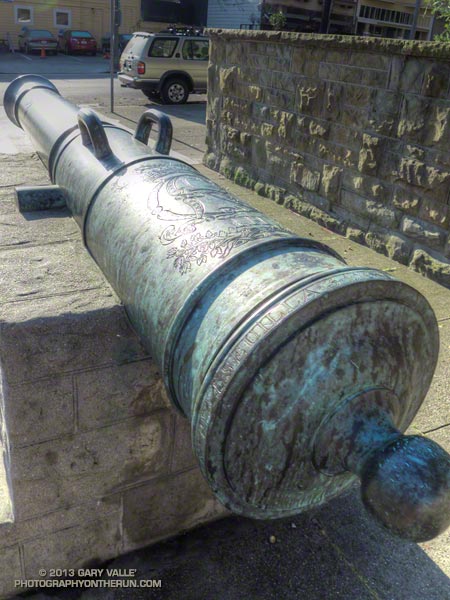
Circling around to the Letterman complex entrance we returned to the Presidio gate at Lyon & Lombard, which is flanked by two 18th century bronze Spanish cannon. The 6-inch caliber (24-pounder) cannon are marked with the ornate cipher of King Carlos III.  The information imprinted on the breech ring indicates they were cast two days apart in Seville in December 1783. Even older Spanish cannon can be found at the Officers Club and elsewhere in the Presidio.

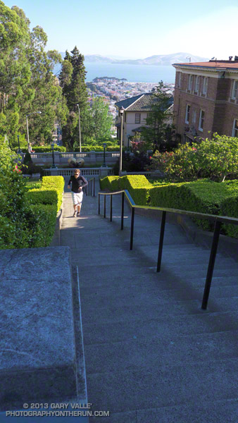
Turning right (south) we ran a few blocks up Lyon Street to the popular Lyon Street steps. There are two groups of steps, the first set being steeper than the second. One of San Francisco’s most exclusive neighborhoods, Pacific Heights, borders the steps.


If you check online you’ll see counts of the Lyon Street steps ranging from around 241 to 291. Brett & Amanda counted the steps by section on another occasion and counted 63, 62, 46, 60, and 60 steps — for a total of 291 steps. The curb in the middle near the basketball hoop was not counted.

From the top of the Lyon Street stairs we re-entered the Presidio at Broadway, crossed Presidio Blvd, and then continued west along West Pacific Avenue. Wood Line, the first of two Andy Goldsworthy pieces passed on the run, is below West Pacific Avenue and between Lovers Lane and Presidio Blvd.

In about a half-mile we picked up the Bay Area Ridge Trail near the Arguello Gate and the Presidio Golf Course Clubhouse. Although not included on our route today, Inspiration Point is nearby and can be visited using the upper Ecology Trail.


Following the Bay Area Ridge Trail we crossed Arguello Blvd and continued uphill a short distance to Andy Goldsworthy’s Spire. Today Spire pointed into a clear blue sky, but on other days it can be nearly lost in fog. Over time, the young cypress and pine trees surrounding Spire will grow to dominate the skyline and Spire will shrink until it becomes a lost thought from another time.

About a half-mile beyond Spire the northwest-trending Bay Area Ridge Trail turned west, near the connector trail to the National Cemetery Overlook. Following the trail we continued west, past Rob Hill Campground to Washington Blvd. and then joined the Coastal Trail at the Pacific Overlook.

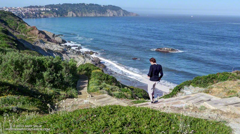
Here the iconic views of the Pacific shoreline and the Golden Gate begin. Taking advantage of the superlative weather, we ran down the Batteries to Bluffs Trail toward Marshall’s Beach and south to Battery Crosby, looping back up to the Coastal Trail and the Pacific Overlook.

The fantastic views continued as we ran north on the Coastal Trail, past Battery Geoffrey and other fortifications that protected the Golden Gate. Running under the Golden Gate Bridge we left the Coastal Trail (which crosses the bridge) and ran down the Battery East stairs to the Golden Gate Promenade.


Not that much bigger than a large container ship, Alcatraz looked like a huge tramp freighter out in the bay, steaming through the morning haze. Already late for breakfast, we tried to keep the pace up as we ran along the Promenade. At Crissy Field I paused for a moment to photograph Huru, one of Mark di Suvero’s huge steel sculptures.

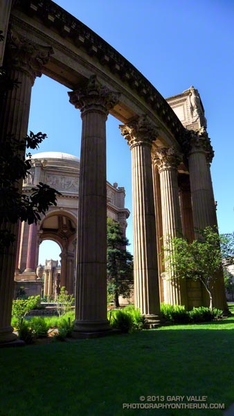
Leaving the shoreline at the marina, we crossed Marina Blvd. One more stop was on our itinerary — the Palace of Fine Arts. Built for the Panama Pacific International Exposition in 1915, and rebuilt in 1965-66, architect Bernard Maybeck’s vision was that of “a Roman ruin, mutilated and overgrown.”

Out of time, I took a few photos and we checked on the nest of the swans Blanche and Blue Boy, residents of the Palace’s lagoon. One swan was on the water, but the nest was empty. Later we learned that four cygnets had hatched just days before.

Here’s a slideshow of some photos from the run. This interactive Cesium browser View shows the GPS track of our route. Here also is a Park Service & Presidio Trust map of the Presidio (PDF).

Some related posts: Spire, Wood Line, Cooler Running, Inspiration Point – Golden Gate Bridge Loop

Trail Running Weather

Running Down the South Fork Trail from Islip Saddle

Just six days before I’d been sitting in my car at Islip Saddle debating whether to run. It had been COLD. The temperature had been about 35°F and the wind a steady 20 mph with higher gusts. It was cloudy and at times foggy, and it looked like rain, sleet or snow might begin at any moment.

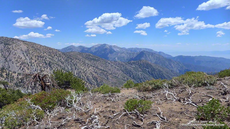
Mt. Baldy from Mt. Baden-Powell.

Today I was back at Islip Saddle and the temperature was definitely not in the 30s. On a scale of 1 to 10, today’s trail running weather was going to be a 9 or 10. At least here in the San Gabriel Mountains the weather was going to be a 9 or 10. Down in the valleys the temps would hit the mid-90s in some locations.

We were doing the Islip Saddle – South Fork Camp – Vincent Gap – Mt. Baden-Powell loop, one of my favorite adventure runs in the San Gabriels. Because this loop starts by running down to the high desert heat is often a factor, and an early start desirable.

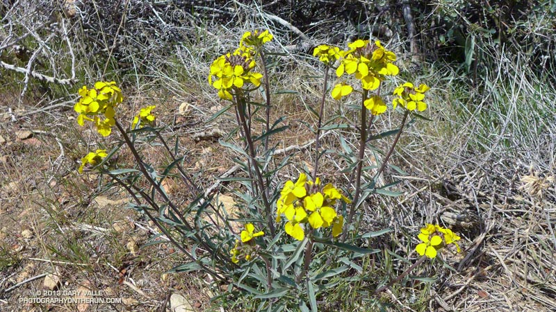
Western wallflower (Erysimum capitatum), a member of the Mustard family
Western wallflower along the Pacific Crest Trail.

Running down the South Fork Trail it felt like it was going to be a great day for the run, and by the time we were chugging up the Manzanita Trail toward Vincent Gap, there was no doubt about it. There was a cool, down-canyon breeze, and even in the sun the temperature was pleasant. The hatch of gnats that usually follows Spring showers wasn’t happening and all in all the conditions were as good as I’ve had on the loop.

Here is a slideshow with a few photos from the run, and here are an interactive Cesium browser View and an elevation profile of the run.

Some related posts: Heat Wave, San Gabriel Mountains Running Adventure, Bear Cubs on the South Fork Trail, Islip Saddle – Mt. Baden-Powell South Fork Loop

Backbone Ultra 2013

Joey Morrison on top of Eagle Rock during the 2013 Backbone Ultra

Joey “Threw it on the Ground” Morrison, who whole-heartily embraced the spirit of the Backbone games, was momentarily transformed into the iconic coyote runner while on the top of Eagle Rock.

The Coyote Backbone Trail Ultra was a phenomenal experience and a fantastic running event. The work required to pull it off is beyond comprehension. Many thanks to Chris Scott, Howard Cohen, Mike Epler, Gretchen Garrnet, Manley Klassen and everyone that helped make it happen — especially Lynette Brody (California State Parks) and Catharine Beverly Bishop (NPS). Also a BIG thanks to the aid station personnel, the safety crews, the EMTs, the communications staff, the trail sweeps and the huge number of volunteers that contributed to the event. The runners that I met along the way were exceptional people as well as superb athletes. I feel fortunate to have participated.

After Kanan I had to focus on getting from one aid station to the next, and finishing the run!

Here’s  an interactive, 3D terrain view of the 2013 Backbone Trail run from my GPS track.