Category Archives: running

Cold Spring – Romero Loop

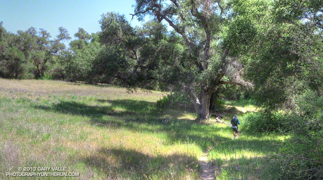
Forbush Canyon Trail in the Santa Barbara Back Country

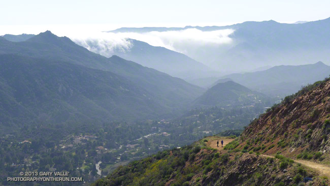
This is an adventurous loop that starts and ends at the Cold Spring trailhead, low on the slopes of the Santa Ynez Mountains in the Santa Barbara Front Country. The route climbs the Cold Spring Trail to Camino Cielo on the crest of the range, and then descends to Forbush Flat and Blue Canyon in the Santa Barbara Back Country.

The Front Country views on the Cold Spring Trail are spectacular, and the Back Country segment from Forbush to Blue Canyon has a classic, isolated character, accentuated by grassy flats, sprawling oaks, gurgling springs and unique geology. Montecito Peak (3214′) can be climbed on the way up the Cold Spring Trail and depending on how much time you spend on the summit, adds about 15 minutes.
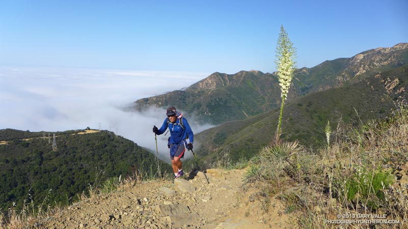


I was running with Kevin Young, whom I’d met during the Backbone Ultra. Kevin is long-time resident of Santa Barbara and this is just one of the challenging routes in his backyard. As is the case with many trail runs, the mileage of this loop — about 22 miles — isn’t the best indicator of its difficulty. Many variations of the loop are possible, but one thing they all have in common is lots of elevation gain.

Thanks to the marine layer it was cool along the immediate coast, but inland temps were hot. When we started the run the temperature at the Montecito RAWS was 60°F. A few hours later when we were climbing out of Blue Canyon on the memorably steep Romero Trail the in-the-sun temperature at nearby Los Prietos was around 100°F.


Having done this loop a number of times, Kevin knew it was longer than it looked, and had stashed some goodies at the Romero trailhead. You might think 100 oz. of water would be plenty for 16 miles. On a different day it might be, but today we both ran out of water part way down the Romero Trail. Neither one of us had particularly fresh legs. Kevin was training for a 100 miler later in May and had run 20 miles the day before.

The PB & J sandwich at Romero hit the spot, but after drinking a 16 oz. recovery drink, half of a large bottle of water, and some Gatorade, I wondered if I had overdone the fluids. Nope — it actually helped a lot and my running attitude improved considerably.

Kevin’s route back to the Cold Spring trailhead from Romero initially followed the Nine Trails course on the Edison Catway, but after reaching the Buena Vista Trail continued down to Park Lane. Here we picked up the Old Pueblo Trail, and then worked across to the McMenemy Trail. We followed the McMenemy Trail to the Hot Springs Trail, which we took down to Mountain Drive. From the Hot Springs trailhead it was about a mile on Mountain Drive back to the Cold Spring trailhead. Even though it had a lot of up and down, this part of the run turned out to be surprisingly cool and enjoyable.

For maps of the area see the Santa Barbara Hikes web sites.

Here’s a slideshow with a few photos from the run. We did this run last Sunday, April 28.

Springs Fire 2013

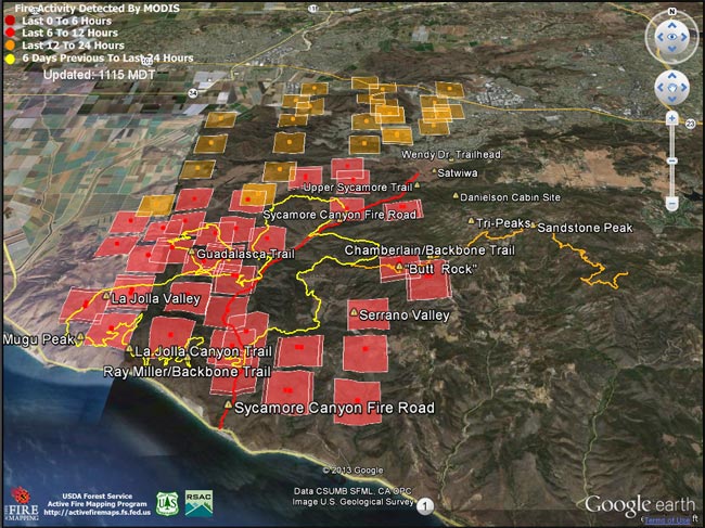
Springs Fire MODIS fire detections as of 05/03/13 1115 MDT

Update May 13, 2013. According to the CAL FIRE website the Springs Fire was 100% contained on May 11 at 24,251 acres. The interactive Google Earth browser view of the Springs fire perimeter has been updated with the fire perimeter from GEOMAC timestamped 05/07/13 0348. This is a 3D view that can be zoomed, rotated and tilted. Placemark locations are approximate. GPS tracks from various runs have been added to mark many of the area’s trails. The red track is Sycamore Canyon Fire Road. Requires Google Earth plugin.

Today SMMNRA announced that some areas closed by the Springs Fire will reopen tomorrow morning. Rancho Sierra Vista in Newbury Park will partially reopen, the Sandstone Peak and Mishe Mokwa trailheads will reopen, and the Backbone Trail east of the Point Mugu State Park boundary will reopen. Also, see the SMMNRA news release After the Fire: 3 Things You Can Do to Help Nature Recover and the SMMNRA Photostream on Flickr.

Previous snapshots:

Springs Fire fire perimeter from GEOMAC timestamped 05/06/13 0555.

Springs Fire fire perimeter from GEOMAC timestamped 05/03/13 2345.

Springs Fire MODIS fire detections as of 05/04/13 1315 MDT with GEOMAC fire perimeter timestamped 05/03/13 2345.

Springs Fire MODIS fire detections as of 05/04/13 0800 MDT.

Springs Fire MODIS fire detections as of 05/03/13 2215 MDT.

Springs Fire MODIS fire detections as of 05/03/13 1700 MDT.

Springs Fire MODIS fire detections as of 05/03/13 0845 MDT.

MODIS Google Earth fire data is from the USDA Forest Service Remote Sensing Applications Center Active Fire Mapping Program web site. Fire perimeter is the most recently available from the GEOMAC website at the time this post was updated.

The following additional information was included with the MODIS fire detections KML file:

This KML displays the MODIS fire detections at a spatial resolution of 1km for the past 6 hours, 6-12 hours, 12-24 hours, and the previous 6 day period. Each 1km MODIS fire detection is depicted as a point representing the centroid of the 1km pixel where the fire is detected. The 1km footprint of the MODIS pixel for each detection is also displayed.

KML file generated by the USDA Forest Service Active Fire Mapping Program.

Disclaimer: Although these data have been used by the USDA Forest Service, the USDA Forest Service shall not be held liable for improper or incorrect use of the data described and/or contained herein. The information contained in these data is dynamic and is continually updated. This disclaimer applies both to individual use of the data and aggregate use with other data. The USDA Forest Service reserves the right to correct, update or modify this data and related materials without notification.

Snow, Sadie and Mt. Baden-Powell

View southwest from Sadie Hawkins past Twin Peaks to Mt. Wilson
View Southwest from Middle Hawkins past Twin Peaks to Mt. Wilson

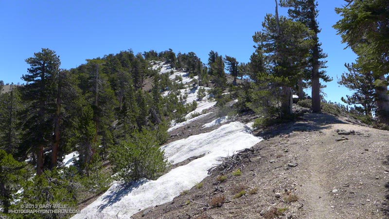
The snow was rock hard and covered with lodgepole pine needles and other debris. Having experience climbing snow and ice I can usually deal with a little early season snow, but I could see no way to safely cross this patch. The snow was steep and icy, the runout long and the risk high. My usual tricks for crossing short stretches of snow were not going to work.

Snowfall had been sporadic in Southern California over the Winter and this was the earliest in the Spring I had tried to do the out and back from Islip Saddle to Mt. Baden-Powell. I had thought there might be some patchy snow on the north-facing slopes at the higher elevations, but I hadn’t expected it to be an issue.


Borrowing from river paddling philosophy, you never run (or hike, or ride) the same trail twice. I knew it was going to be an interesting day when a bighorn sheep darted from the trailhead at the beginning of the run. I’d followed bighorn tracks from Islip Saddle up the PCT for about a quarter mile to an overlook of Hwy 39 and Twin Peaks.

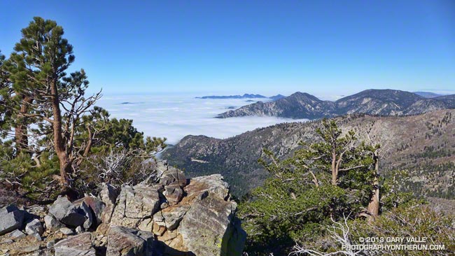
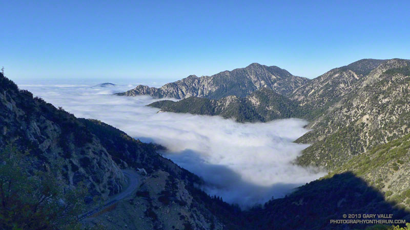
The view from the overlook had been spectacular. Marine layer stratus filled the canyon, nearly immersing Triplet Rocks on Twin Peak’s elongated east ridge. The stratus was evidence of a strong onshore flow, but above Islip Saddle a strong — and cold — wind was blowing almost directly out of the north. It had been cold enough that I pulled on my extra sleeves, ultralight shell and light gloves.

The wind was unrelenting and seemed to work its way around every corner and into every canyon. At Windy Gap and the other wind gaps along the crest the wind was funneled and accelerated, and I wondered if this would be the day I would see or hear one of the huge ghost trees from the Curve Fire crash to the ground.


At times I go where my camera takes me, and about a half-mile west of Mt. Hawkins it took me off the PCT and onto the Hawkins Ridge Trail. There are three peaks along this ridge —  Middle Hawkins, Sadie Hawkins and South Mt. Hawkins. It had been years since I’d done these peaks, and today it looked like there might be some good views from the ridge.

The Hawkins Ridge Trail was warm and mostly sheltered from the wind and I continued down the trail a little further than necessary before leaving it and scrambling up to the summit of Middle Hawkins. Warmed from the steep climb I had returned to the PCT and continued toward Baden-Powell.


Near the junction of the PCT and Dawson Saddle Trail there had been patches of snow mixed in with the chinquapin and limber pines, but it hadn’t been until the PCT skirted north around Mt. Burnham that the trail was blocked by snow. I abandoned the attempt to cross the icy patch and headed up the steep slopes of Mt. Burnham to the crest.

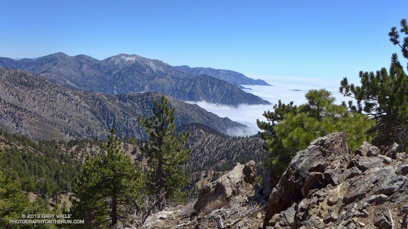
It was still cold and windy when I reached the summit of Mt. Baden-Powell, but a sparkling day with Mt. Baldy to the southeast across Vincent Gulch, San Jacinto Peak and San Gorgonio area peaks in the distance to the southeast, the Sierra to the north, and miles of stratus to the south. After spending a few minutes on the summit I retraced my steps back down the crest and the PCT to Islip Saddle, making the requisite stop at Little Jimmy Springs along the way.

Some related posts: San Gabriels High Five, La Nina Looming, Running Hot & Cold, Toward Triplet Rocks

Unwinding from the Backbone Ultra

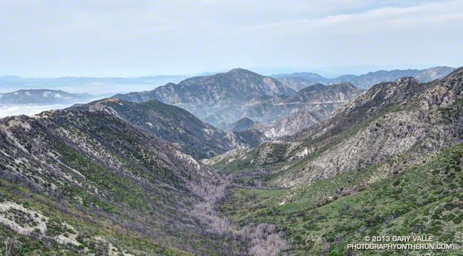
Bear Canyon
Bear Canyon

Doing a moderate run in the San Gabriels and climbing a few peaks was a great way to unwind from the excitement of doing the 68 mile Backbone Ultra last weekend.

I felt good. I’d run more or less normally in the week following the event — depleted, but without any physical issues. In part that can be attributed to how Coyote Cohorts runs their events. It was basically a long training run in the company of a great bunch of runners and the help of incredible volunteers. Amazing! The long hours of training also really helped, particularly the back-to-back runs following 50Ks and the back-to-back night/day training runs. My shoes — Hoka Mafate 2s — also helped, reducing the impact of all the miles.

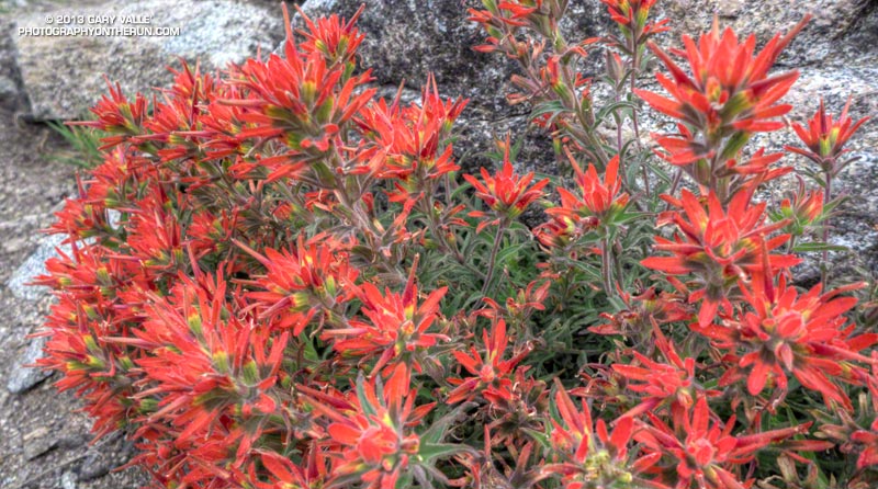
Paintbrush on the San Gabriel Peak Trail near Markham Saddle.
Paintbrush on the San Gabriel Peak Trail

One of the reasons for doing today’s run was to check how Poodle-dog Bush and some other plants are faring in this low rainfall water year. Since July 1 Downtown Los Angeles has recorded only 5.14 inches of rain. Unless we can manage to wring about a half-inch of rain from the heavens before June 30, this water year will go down as the fourth driest since record-keeping began in 1877. The driest water year on record was in 2005-2006 (3.21 inches). Assuming we don’t get that 0.48 inch of rain, three of the four driest water years have occurred since 2000.

Something I noticed on the Backbone run and recent training runs in the Santa Monica Mountains is that plant growth and flowering has been surprisingly robust given the amount of rainfall. This was also the case today on today’s run — the manzanita on the San Gabriel Peak Trail was covered in blossoms and bees, and the nightshade and paintbrush along the trail also seemed to be doing well.

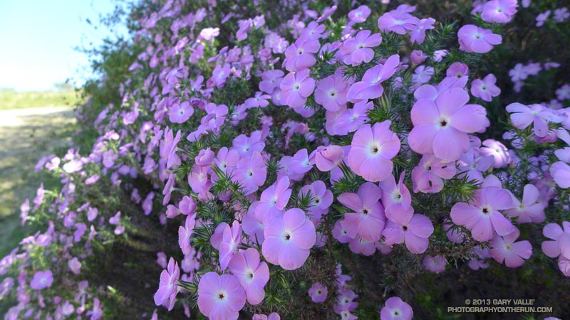
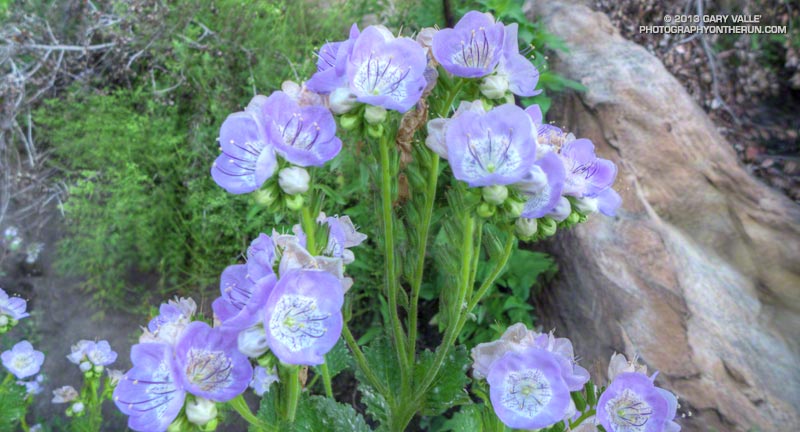
Prickly phlox along Calabasas Peak Mtwy.

What about the Poodle-dog bush, aka Turricula? It looked about the same as last year at this time — just starting to come out of Winter dormancy. Last year we had above average rainfall in April and it really seemed to spur the growth of Poodle-dog bush. This year maybe we’ll see what an extended period of dry weather does to it. Last year some of the Poodle-dog died before the rain in April.

Here’s a short slideshow of a few photos from today’s run in the San Gabriel Mountains, as well as some photos of plants and flowers on recent runs in the Santa Monica Mountains.

Backbone Ultra 2013

Joey Morrison on top of Eagle Rock during the 2013 Backbone Ultra

Joey “Threw it on the Ground” Morrison, who whole-heartily embraced the spirit of the Backbone games, was momentarily transformed into the iconic coyote runner while on the top of Eagle Rock.

The Coyote Backbone Trail Ultra was a phenomenal experience and a fantastic running event. The work required to pull it off is beyond comprehension. Many thanks to Chris Scott, Howard Cohen, Mike Epler, Gretchen Garrnet, Manley Klassen and everyone that helped make it happen — especially Lynette Brody (California State Parks) and Catharine Beverly Bishop (NPS). Also a BIG thanks to the aid station personnel, the safety crews, the EMTs, the communications staff, the trail sweeps and the huge number of volunteers that contributed to the event. The runners that I met along the way were exceptional people as well as superb athletes. I feel fortunate to have participated.

After Kanan I had to focus on getting from one aid station to the next, and finishing the run!

Here’s  an interactive, 3D terrain view of the 2013 Backbone Trail run from my GPS track.

Hikers on Calabasas Peak Motorway

Hikers on Calabasas Peak Motorway

The 1.6 mile hike (one way) from Stunt Road to the rocky overlook at the top of Calabasas Peak Motorway fire road is very popular and has some great views along the way. Some stretches of the road are steep, but there are also some moderate sections and even a short flat stretch to catch your breath.

The route gains about 800 vertical feet to the viewpoint. Although many turnaround here, even better views can be had from the nearby summit of Calabasas Peak. Continuing to the peak adds about a half-mile (round trip) and around 100′ of elevation gain.

From this afternoon’s run on the Secret Trail.

Some related posts: Calabasas Peak From Saddle Peak, Secret Trail Variations