Category Archives: running|adventures

Mt. Wilson Rim Trail – Kenyon Devore Trail Loop

Big cone Douglas-fir on the Rim Trail near Mt. Wilson

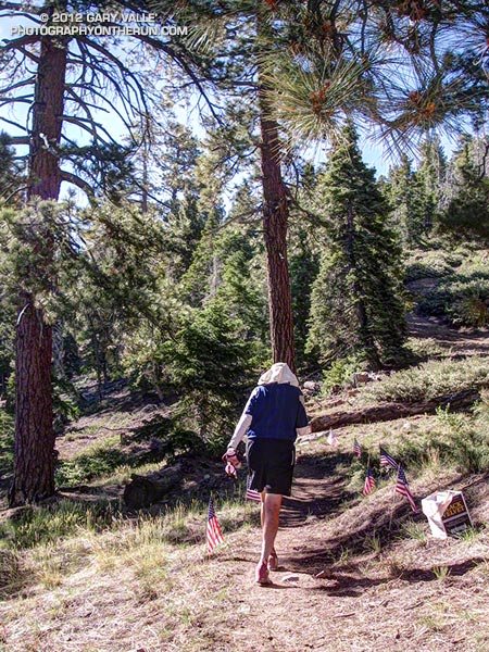
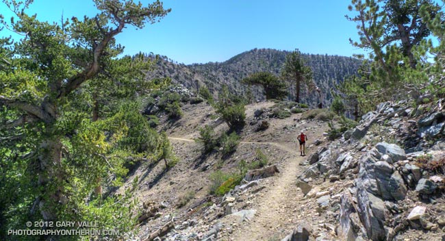
Brett was down for Father’s Day weekend and one of the things we wanted to do was get in a couple of good trail runs. He’s heard me talk (a lot) about the Mt. Disappointment 50K and how it ends. Basically you run 27 hilly miles with over 3600′ of elevation gain, THEN finish the race by doing a 5 mile, 2650′ climb from West Fork up the Gabrielino & Kenyon Devore Trails to the top of Mt. Wilson.

This final climb tells the 50K tale. If you’ve trained well and run a good race a middle-of-the-pack runner might gain 15-20 minutes on this leg. If not, you could easily lose an hour or more. In any case you put everything you have left into this climb. An elevation profile and some stats for Kenyon Devore are included in the post Hitting the (Big) Hills of Southern California.

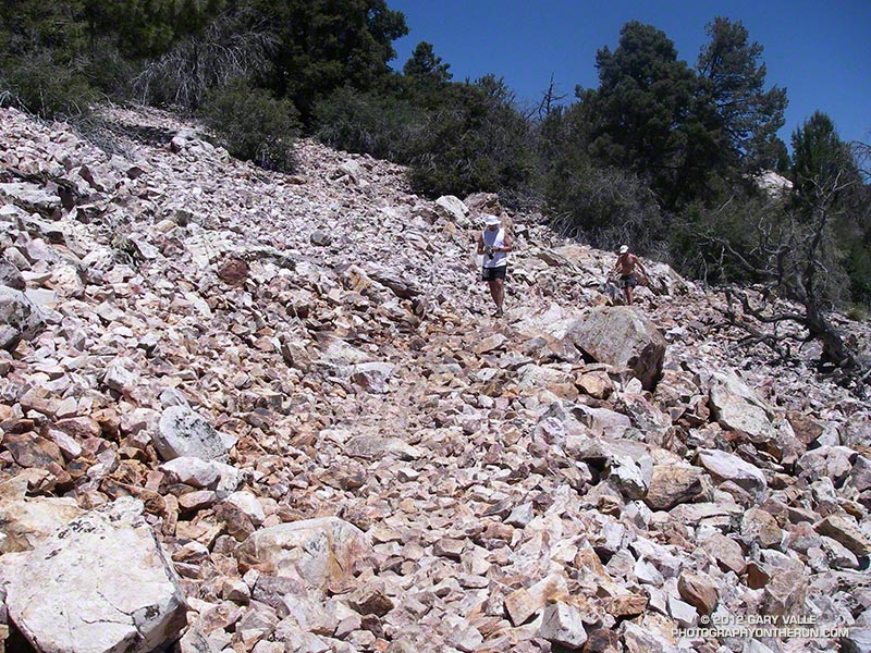
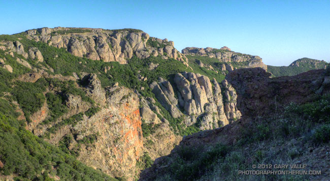
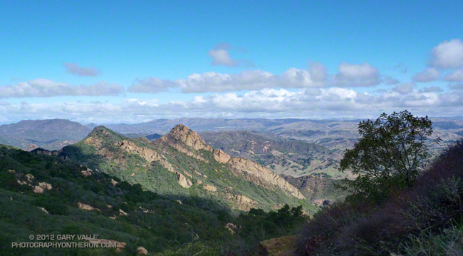
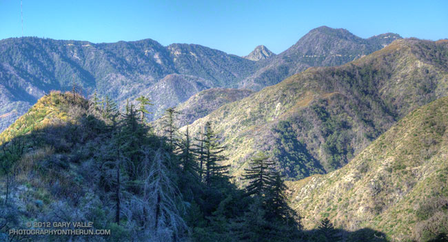
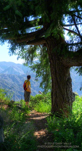
There are several ways to incorporate Kenyon Devore into a loop, but I could only think of two that didn’t involve running on Mt. Wilson Road. One option was a 22 mile/5000’gain loop from Shortcut Saddle to Mt. Wilson and back. That wasn’t going to happen because just five days before I’d run the Holcomb Valley 33 Mile race. Instead we opted to start on top of Mt. Wilson and use the Rim Trail, Gabrielino Trail and Rincon – Red Box Road to get to West Fork. This would pare down the loop to a manageable 12 miles and 3000′ of gain.


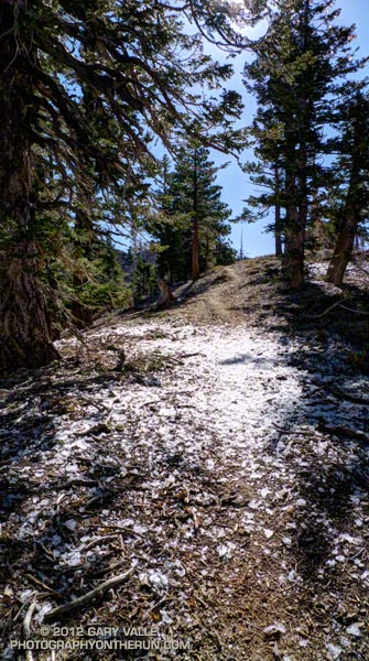
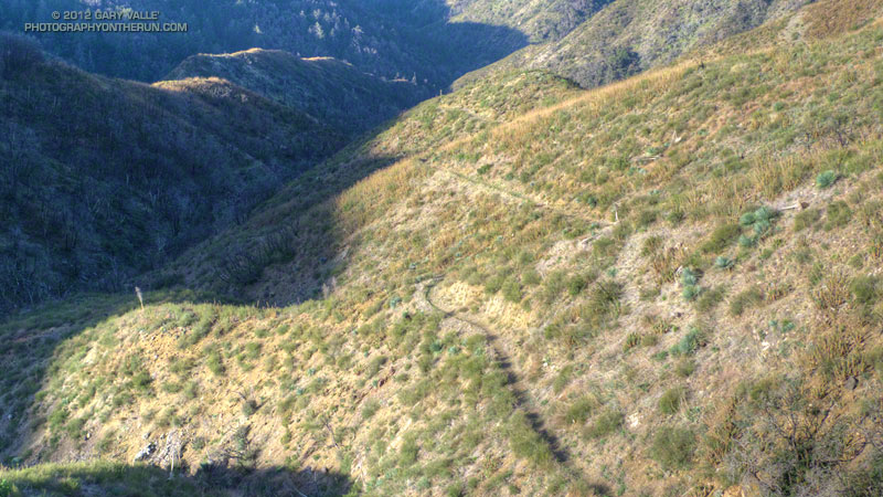
Other than a “few” gnats, a lot of poison oak and some Turricula (Poodle-dog bush), the Rim Trail was in good shape and the running excellent. Once away from the observatory complex the trail has an adventurous, backcounty feel. The trail was in good enough condition that Brett enjoyed running it in the KomodoSport LS.

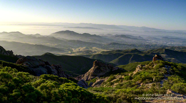
The day was going to be a scorcher and I was glad that much of the Rim Trail was on the shaded, north side of the crest. The Gabrielino Trail and Rincon – Red Box Road were also relatively cool and in the shade. With no race clock ticking away, we stopped at West Fork and ate some blueberries and PB&J. So far the route had been down, down, down; but in a few minutes it was going to go up, up, up.


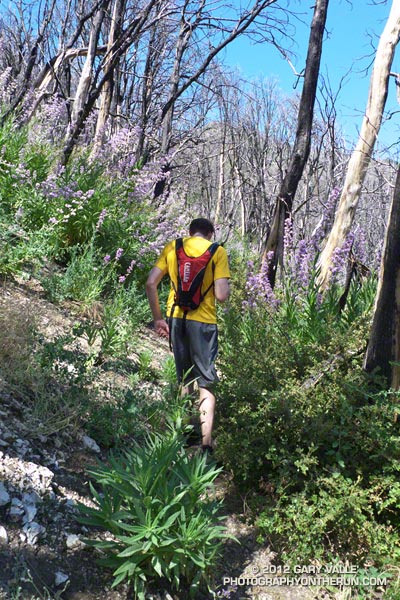
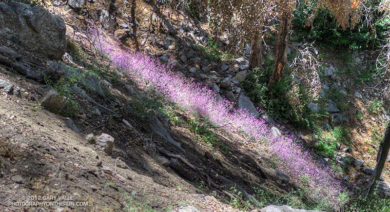
One of the surprises of the day was how much the Turricula (Poodle-dog bush) had grown along the Gabrielino and lower Kenyon Devore Trails since I had been here in early March. A rain gauge near here (Opids Camp) recorded nearly seven inches of precipitation from March 25 to April 26. This appears to have promoted the growth of the Turricula. In a very dry rain season the rain and snow had been much needed. It rejuvenated the streams and vegetation, and the area looked much as it would if the seasonal rainfall had been normal.

The Turricula could not be avoided in some places, but that will be remedied in a couple of weeks when Gary Hilliard’s Mt. Disappointment Endurance Run volunteer trailwork group works on this section of the Gabrielino Trail and the Kenyon Devore Trail.

Update June 21, 2012. Although my contact with Turricula on this run was very limited, I did have a mild reaction, mainly on my arms. There was very slight inflammation and the “prickly” itching that is characteristic of Turricula. The itching became noticeable about a day after exposure and persisted for 4-5 days. Although mild, the reaction was stronger than occurred following several similar encounters last year. One difference was the exposure to poison oak on the Rim Trail earlier in the run. It’s possible that there was a cross reaction. This was observed in animal testing, but not in (limited) human tests. However, my reaction following this latest encounter was much, much milder than my first bout of Turricula, which resulted from wading through large patches of the young Poodle-dog plants on miles of overgrown trail. That first very strong response may have also involved a cross reaction with poison oak.


With the Summer Solstice approaching and the Sun so high, the temperature difference between sunny and shaded sections of trail was remarkable. About the time we were on Kenyon Devore the Clear Creek RAWS recorded a fuel temperature — the temperature of a wood dowel in direct sun — at a scorching 104°F. Brett did well on the climb and could have zoomed ahead. I had not recovered from Holcomb and struggled a bit on the exposed and steep sections of trail. Higher on the trail there was a breeze and more shade and that helped. It also helped pouring water over my head at the creek crossing!

It was great to show Brett Kenyon Devore, and what better way to sharpen the appetite for one of his superbly prepared dinners!
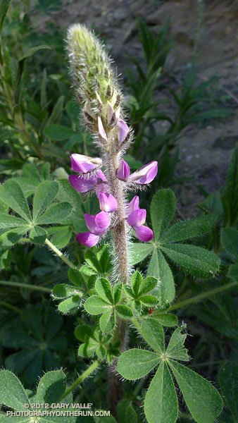
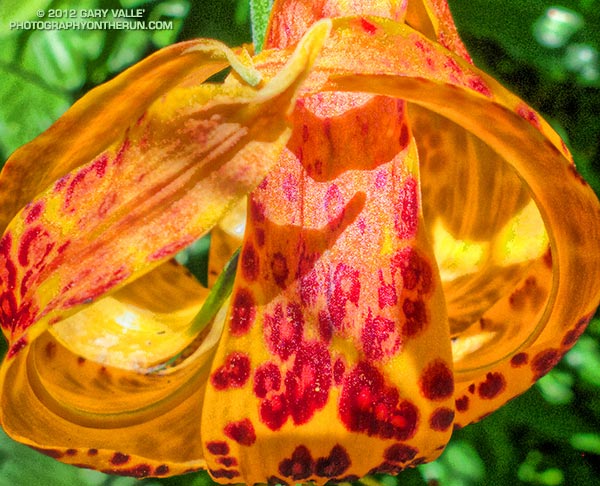


Humboldt Lily


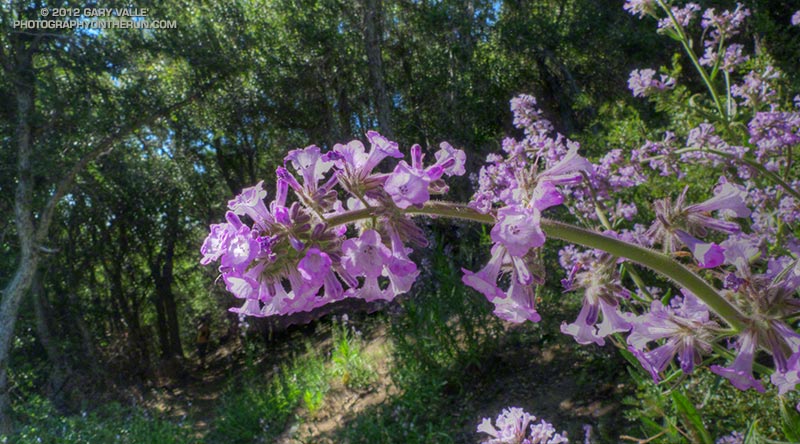
Turricula (Poodle-dog Bush)
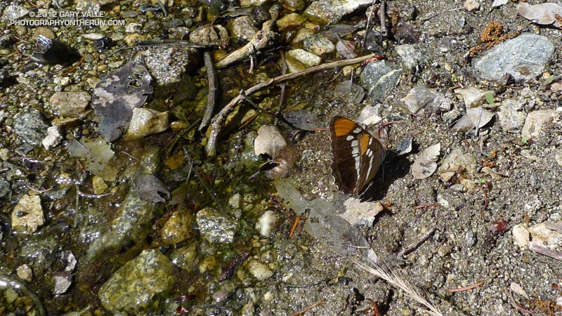


California Sister

Holcomb Valley 33 Mile Trail Run 2012

Holcomb Valley 33 Mile Trail Run

When a race changes organizers sometimes you’re just not sure what you’re going to get. No worries! It seemed Tom Spiegel and Team Big Bear made every effort to maintain the quality and character of an event that for 15 years was superbly organized by Gary & Pam Kalina.

Although the temperature recorded at Fawnskin was several degrees warmer than last year the temperature on the course was cooler. Jorge Pacheco took advantage of the nearly ideal conditions and flew through the 33 mile course in a record time of 4:11:19!

Of the 118 runners that started the 33 mile this year 93 finished. Half the runners ran faster than the median time of 7:21:32 and half slower. The times for the middle third of the runners ranged from about 6:50 to 8:00.

Here’s an interactive Google Earth flyover of the Holcomb Valley 33 Mile Run that can be viewed in most browsers. (Google Earth plugin required.) Distances specified are based on my GPS traces from the past three years, and were calculated in SportTracks. Distances and placemark locations should be considered approximate. Here’s an elevation profile of the course.

Only the event director and core group of volunteers really know how much work goes into putting on an event. There are innumerable tasks that have to be coordinated and completed, and myriad (usually) minor problems that have to be resolved. The works starts months in advance of the event, and may not end for weeks after the event. The reward is in the smiles of the participants and knowing you have done the best job possible. Thank you Pam & Gary Kalina for organizing the Holcomb Valley Trail Runs for so many years.

Some related posts: Holcomb Valley 33 Mile Trail Run 2011, Holcomb Valley 33 Mile Trail Run 2010

Following are a few photos from this year’s run.


Cougar Crest View


Road Running


Horse Ranch


Leaving Aid #2


Talus on the PCT


Belleville

Raining Rime

Fallen rime around a white fir

As I ran across the ice my footfalls made a loud crunch, crunch, crunch. Nearby a barrage of rime cascaded from a white fir. Friday’s cold system had rimed the trees along the crest, and now the ice was thawing, shedding from the branches and creating a patchwork of white beneath the trees. The ice wasn’t dense but I still didn’t want a large chunk falling on my head!

The cutoff upper level low that moved into Southern California Friday really cooled things down. The Big Pines RAWS (6917′) recorded an overnight low of 26°F Friday night. It was even colder in the Sierra. A snow sensor at 11,400′ in the Kern River headwaters recorded an overnight low of 12°F. Most of yesterday the temperature at Big Pines was in the 40s.


I was running on one of the most scenic segments of trail in the mountains of Southern California — the Pacific Crest Trail between Mt. Hawkins and Mt. Baden-Powell. There are three trail runs I like to do that include this stretch: Inspiration Point to Islip Saddle on the PCT, the Islip Saddle – South Fork – Baden-Powell Loop, and the route I was doing today, the Out and Back to Mt. Baden-Powell from Islip Saddle.

Warmer weather was forecast today, but this morning it had been cool and blustery at Islip Saddle. The temperature in the sun-warmed — but windy — parking lot had been around 43°F. In the shade of Mt. Islip at the start of the run the temperature felt like it was in the 30s. It had taken a while to warm up chugging up the first long hill.

It was the first time this season I’d been on this stretch of trail and I wondered if any well-shaded patches of snow had managed to survive on the north side of the crest near Mt. Baden-Powell. I doubted it. The Mt. Waterman ski area never opened this year, and there had already been several periods of warm weather. There would probably be some remnants of snow on the north side of Mt. Baldy.


It was PCT season. Islip Saddle is at about the 386 mile mark on the Pacific Crest Trail and PCTers hiking the trail from the Mexican border to the Canadian border usually do this section of trail sometime in May. There were a number of PCTers on the trail, including a couple of guys that appeared to be fast-packing the PCT. Their packs looked light, and they were really booking on the downhill west of Mt. Hawkins. (For well done, downloadable PDF maps of the PCT — with notes — check out Halfmile’s Pacific Crest Trail Maps and GPS Information.)

Although chilly at the start, the weather was near perfect for running and I had expected to see at least a couple of groups of runners training for the AC100. There were only about six or seven long run weekends remaining before this hundred miler. I did see one AC100 runner — twice. He was on day two of a three day Memorial Day training stint that would total some 90 miles. Now that is serious training!

Boney Mountain Eclipse Run

Narrative about 2012 solar eclipse

Some things in nature are supposed to be constant. The ground shouldn’t move; a mountain that is here today should be here tomorrow; and if skies are clear and blue, the sun shouldn’t grow mysteriously dim.


Imagine the consternation of our early ancestors, keenly attune to nature, feeling the sun dim and then looking for a cloud they could not find. There is still much of them in us. When the earth shakes or the sun fades, even moderately, we can’t help but react at the most visceral level.

While ee still can’t predict an earthquake with any certainty, we can predict eclipses. Fred Espenak’s NASA Eclipse Web Site includes maps and tables for several millennia of solar and lunar eclipses. Using the web site’s JavaScript Solar Eclipse Explorer you can find the solar eclipses that will be (or have been) visible at a particular location, as well as the type of eclipse, it’s magnitude, and when it will start, end, and reach its maximum. In 2002 I used the Eclipse Web site to plan a trail run to coincide with the June 10 solar eclipse. This afternoon I was doing another eclipse run — the north side loop on Boney Mountain.


Perched on rocky ledge on the western ridge of Boney Mountain, I watched as the light on the landscape became increasingly muted. At the eclipse’s maximum almost 80% of the sun’s area would be obscured and about 85% of its width. The descending veil was tangible. I could not only see it, I could feel it. Even though I understood what was occurring, and that it would not last, ancestral fears were welling up and whispering, “Something is wrong…”


As the time of maximum eclipse approached, bird songs increased as if it was dusk. The wind, which had been blowing in fits and starts began to blow steadily from the west. The temperature dropped another degree or two.

Once the eclipse’s maximum had passed, I continued to work up the ridge, enjoying the extraordinary light. I hoped my wife was getting some good shots of the eclipse in our backyard. Many eclipse viewers are so focused on the sky, they don’t notice the spectacular lensed images projected on the ground and elsewhere by sunlight filtering through trees. The gaps between the leaves of a tree work like a giant pinhole lens, with a focal length of many feet. In the case of the trees in our backyard this produced images of the eclipsed sun 10 inches or more in diameter. Lensed eclipse images were also projected by  sunlight filtering through the chaparral on Boney Mountain.

I topped out on the western ridge around 7:10 and jogged up to the high point between the western and eastern ridges. Across the way three fellow eclipse watchers were on Tri-Peaks, and it sounded like there was a party over on Sandstone Peak. Even with the sun low on the western horizon, you could feel its intensity returning. Only about one-third of the sun was now obscured, and minutes before sunset — about 7:43 — the eclipse would end.


Marine layer haze and long shadows were filling the valleys as I began the second half of my eclipse adventure — running down the eastern ridge and trying to reach the trailhead before it was pitch black. Much of the route was illuminated by the setting sun, and I was able to get past most of the technical running and down to the Danielson cabin site before it became difficult to see. Once on Danielson road the bright western sky provided enough light to run. I made good time down to the creek in Upper Sycamore Canyon and then pushed up the road to Satwiwa. Just enough light remained to run the connecting single track back to the Wendy Drive trailhead.

Surprise on the Bulldog Loop

Brents Mountain, Malibu Creek State Park

BIG. That was my first impression when I saw the animal loping across the road. Quite a bit bigger than a coyote or bobcat, with a long black-tipped tail. It was a mountain lion, and it was reacting to me before I’d even seen it. Had I rounded the corner a couple seconds later, I never would have known it was there.


I was on Castro Mtwy fire road, between the top of the Bulldog climb and Corral Canyon Road. Just a few seconds before I’d been kneeling on the ground photographing snow pellets (graupel) along a road cut. I’d just started to run again when I saw the lion. It was 40-50 yards away and crossing the road left to right, diagonally down the road. It seemed interested in avoiding me, and I reinforced this idea by clapping my hands and yelling. It was moving at a speed that fit the situation — faster than a walk or trot, but by no means wasting energy or overly concerned. I watched as, like a ghost, it disappeared into the thick chaparral along the south side of the road.

I didn’t want to overreact. Although we usually don’t see them, anyone that runs in the open space areas of the West has likely been watched by a mountain lion. Attacks are extremely rare and often have extenuating circumstances. Even for someone that spends a lot of time outdoors, there are much higher risks in their lives, such as driving to the trailhead. And there are other risks on the trail. Two of my trail running friends have been run down by startled deer, and I was nearly trampled when I spooked a band of horses grazing in a natural cul-de-sac!

In this particular set of circumstances I didn’t think it would be any more dangerous to continue down the road than to retreat. If the animal was interested in me it wouldn’t matter which direction I went. The Corral Canyon parking area was about a half-mile away, and chances were good there would be hikers there.

But it was going to be unnerving to pass the spot where the lion had gone into the brush. For sure I was not going to run past the spot — as any owner of a cat knows, that can elicit a response. Had I seen a stout stick or branch nearby I would have grabbed it. Not only for defense, but to look bigger.

I jogged down the road a little further and stopped. On max alert and facing the threat, I walked past the point where the lion had entered the brush. Once past this point, I began to walk a little faster, constantly checking the road and brush to the side and behind me. After about 50 yards I transitioned to a slow jog, and sometime after that resumed my normal downhill pace, all the time being very wary of any sound, noise or motion behind me.

One car was parked at Corral Canyon, but its owner was nowhere to be seen. Still on edge, I continued on the Backbone Trail into the rock formations east of the parking area, and then past the rock gateway onto Mesa Peak Mtwy fire road. The farther I got from where I’d seen the lion the better I felt. I really didn’t think the lion was interested in me, but was still glad to have the Corral Canyon parking area between me and the cat.


As I ran along Mesa Peak fire road, I started to calm down. I had just passed the “Morrison” caves and rock spiral and was rounding a corner when, without warning, there was a blur of brown from the left. Three deer bounded across the road just feet away. Put my heart back in my chest!

Deer are very common in Malibu Creek State Park, but I normally see them in the grasslands down in the valley. This morning I’d seen deer tracks going up Bulldog. Whenever I see deer tracks it’s a reminder there might be a mountain lion in the area. That was certainly the case this time!

Related post: Mountain Lion Saga

After the Station Fire: Shortcut – West Fork – Newcomb Saddle Loop

Mt. Wilson area peaks from the Silver Moccasin Trail

Did the “back 25K” of the Mt. Disappointment 50K course this morning, plus a couple of bonus miles on the Gabrielino Trail and the bottom of the Kenyon Devore Trail. Like last Sunday’s run, today’s run was in a part of Angeles National Forest that was closed by the 2009 Station Fire and reopened last May.


This loop was part of the Mt. Disappointment 50M course in 2007, 2008 and 2009, and the 50K course in 2010 and 2011. Today I started the loop at Shortcut Saddle, running down the Silver Moccasin Trail to West Fork, then up to Newcomb Saddle, and then completed the loop by returning to Shortcut on Edison Road. In the 50K, the loop starts at West Fork, but the sequence of trails is the same.

Because of increased foot traffic and our dry Winter, last year’s trailwork on the Silver Moccasin Trail held up well. Most of the trail between Shortcut Saddle and West Fork was in great shape and very runnable. There were a couple of trees across the trail, but these were easy to work under, over or around.


The reason for the side trip on the Gabrielino Trail was to check out the bottom of the Kenyon Devore Trail. This section of trail was severely burned in the Station Fire, then overrun by a debris flow and overgrown by Turricula (Poodle-dog bush). The Mt. Disappointment 50K/50M volunteer trailwork group has worked many hours here, as well as on the rest of the Kenyon Devore Trail, the Valley Forge Trail and the Silver Moccasin Trail. The trail had seen a lot of traffic and was in good shape.

As was the case last week, there was still Turricula along the trails and roads, but for the most part it was easy to avoid.

The last time I’d run up Edison Road was last August during the 2011 Mt. Disappointment 50K. Temps were about 25-30 degrees warmer that day. With the cooler weather I actually enjoyed the climb and was able to run more of it. A lot of work was being done on Edison Road and I chuckled as I passed each “No Loitering” sign posted along the road. I hoped I wouldn’t be doing too much of that in the 2012 Mt. Dis 50K.