Category Archives: running|adventures

After the Station Fire: Three Points – Mt. Waterman Loop

Scorched Jeffrey Pines on the South Side of Waterman Mountain

Scorched Jeffrey Pines on the South Side of Waterman Mountain

It was very odd to run up the Mt. Waterman Trail on the Sunday of a 3-day Memorial Day weekend, and see no one. And hear nothing, except the wind in the trees, the distant call of a jay, and the periodic drone of a contractor’s truck working on the highway. That’s because — surprise, surprise — Angeles Crest Highway was closed a little east of Three Points and on to Islip Saddle. CalTrans Road Conditions had only listed the Winter closure from Islip Saddle to Vincent Gap. Based on the number of cars parked at the closure, not many people knew about it.


I hadn’t known about it until I saw the Ranger’s truck and closed gate from the Pacific Crest Trail. I was doing a loop from Three Points up the PCT to the Burkhart Trail, then up to Buckhorn, over Mt. Waterman, and back down to Three Points. Part of this loop — from Mt. Waterman to Three Points on Trail 10W04 — had just reopened, and like last weekend I wanted to see how recovery from the 2009 Station Fire was progressing.


The conditions were much better on this loop, than last week’s. Although within the initial Station Fire Closure area, and closed for eight months, 11 of the first 13.5 miles of the loop were not burned in the Station Fire. This mostly unburned stretch opened in late May 2010 and is described in the post Three Points to Waterman Mountain, the Long Way.


The remaining six miles of the loop, which winds in and out of the shallow canyons on the south side of Mt. Waterman, was in the burn area. Conditions along the trail appeared to generally correspond to BAER burn severity maps and images. At the higher elevations, fingers of the fire had run up the steep slopes, burning understory and scattered Jeffrey pines and incense cedars, while leaving other areas untouched.


At lower elevation, particularly in the chaparral and pine at the head of the north branch of Devils Canyon, the fire effects were more severe. The chaparral is recovering, but numerous Coulter and Jeffrey pines appeared to have been killed, and their replacement will be a slower process. This area is traversed by the last two miles of Trail 10W04, leading to Three Points.

There was very little, if any, damage from runoff and the trail was generally in good shape. The trail was slightly overgrown in spots, particularly at lower elevation, but was nothing like the Gabrielino Trail between Switzer and Red Box. There was some Turricula (Poodle-dog bush) at lower elevation, but for the most part it was fairly easy to avoid. Some pine needle covered sections of trail were indistinct, but it was like that before the fire.


From a trail running perspective, it is still a very “runnable” course with varied terrain and much to see and enjoy. Cooper Canyon Falls is very short side trip from the PCT’s junction with the Burkhart Trail. The side trip to the summit of Mt. Waterman (8038′) adds about two miles to the loop.

Some related posts: Three Points – Mt. Waterman Loop, Three Points Loop Plus Mt. Waterman

After the Station Fire: Red Box – Bear Canyon – Gabrielino Loop

Recovering chaparral and bigcone Douglas-fir in Bear Canyon 19 months after the Station Fire

Recovering Chaparral and Bigcone Douglas-fir in Bear Canyon

Most Southern Californians have direct experience with wildfire and its effects. Wildfires are often described as being a “natural part of the ecosystem,” but in Southern California wildfire is anything but natural. Urbanization, land management policies and firefighting practices shape fire frequency, behavior, intensity and effects — often with unexpected and tragic consequences.


According to InciWeb, the Station Fire started on Wednesday August 26th, 2009 at approximately 03:30 p.m. and was fully contained at 7:00 p.m. on Friday, October 16, 2009. Two firefighters were killed in the arson caused blaze, numerous homes and structures were lost, and 160,577 acres burned. The fire was the largest recorded in Angeles National Forest since it was established in 1892 and the 10th largest fire in California since 1933.

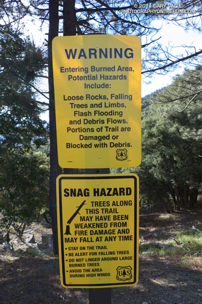
In January 2011 the Station Fire Closure was updated and extended to January 2012. At that point, it looked like it might be a long time before any substantial part of the closure area would be opened to the public. But with increasing public pressure to open more of the Forest, Angeles National Forest reopened about half of the Station Fire Closure area earlier this week. Today I did a run/hike in the newly opened area to see first-hand how recovery from the fire, and subsequent debris flows and flash floods, is progressing 19 months after the fire was contained.

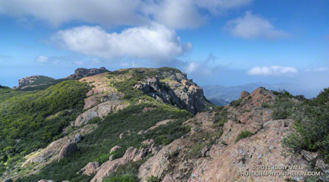
The first areas I wanted to check were Bear Canyon, and upper Arroyo Seco from Switzer Falls to Red Box. I’d done loops through these areas in April 2009, a few months before the Station Fire, as well as in March 2007 and November 2005. Because Mueller Tunnel was closed, I couldn’t do the same loop as in 2009, but I could bypass the tunnel using the Mt. Disappointment Trail, and then drop down into Bear Canyon from the Mt. Lowe Truck Trail. From there the loop could be completed by following the Gabrielino Trail from near Switzer Falls, back to Red Box. After checking with the Forest Service that all of the trails were open, the loop was a go!


I’d done all the sections of the loop on previous runs, and was familiar with the trails and terrain. My intent was to follow the routes of pre-existing trails as closely as possible. Just in case, I took a paper map; and as a backup and source of extra info, I loaded my GPS with the track points of the trails. It turned out the GPS did help a couple of times to follow missing or overgrown sections of trail, but there was also more than one instance when blindly following the GPS would have led me in the wrong direction.


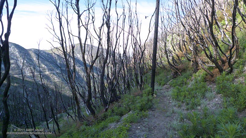
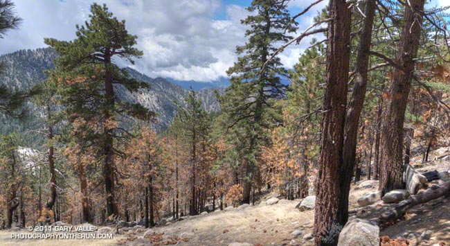
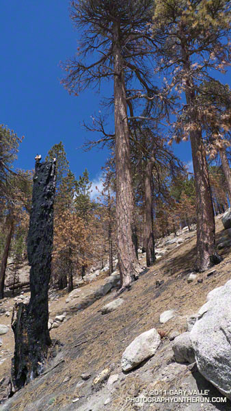
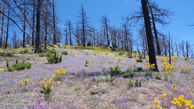
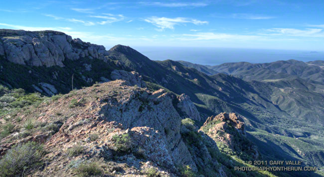
At around 7:30 I left an empty Red Box parking lot and started running up the Mt. Wilson road. About 0.4 mile up the road I turned onto the San Gabriel Peak/Mt. Disappointment Trail and began working up toward the saddle between the two peaks. Nearly all of the trail to the saddle was unburned. The robust mix of chaparral and forest towered overhead, and a few minutes later I felt some anguish as I crossed the saddle and entered the burn area.

There was a little more debris than normal on the rocky stretch of the Mt. Disappointment Trail that crosses the west face of San Gabriel Peak, but the trail was mostly runnable, and it didn’t take long to get down to the Mt. Lowe Truck Trail fire road. At Markham Saddle a DANGER sign marked the closure of the road to Mueller Tunnel.


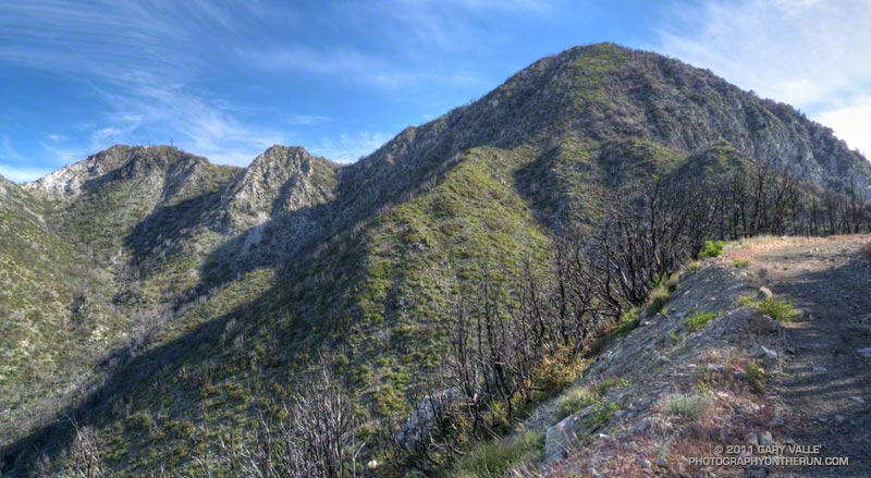
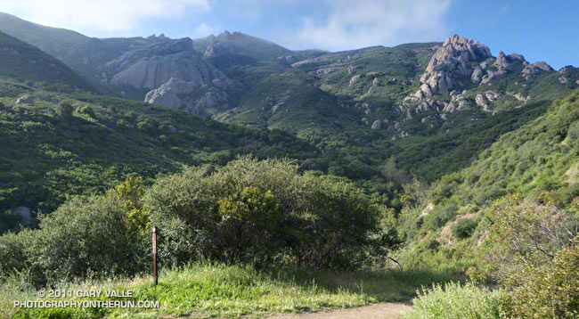
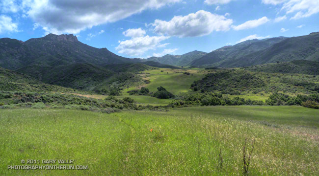
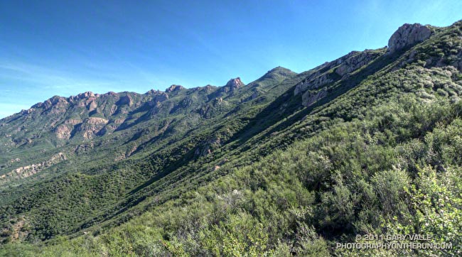
Turning in the opposite direction, I started running down the fire road, and after a short distance, stopped to take photos of the Bear Creek drainage. It looked to be in pretty good condition, considering. The side canyons didn’t have the runnels and debris flows I’d seen in upper Arroyo Seco on the drive up Hwy 2. I’d be getting a closer look at those channels later in the run.


At the hairpin turn west of Mt. Lowe I left the fire road and picked up the trail that leads down the ridge to Tom Sloan Saddle. It had taken about an hour and a quarter to get to this point, and I suppressed an overly optimistic thought that I might reach Red Box by noon or so.

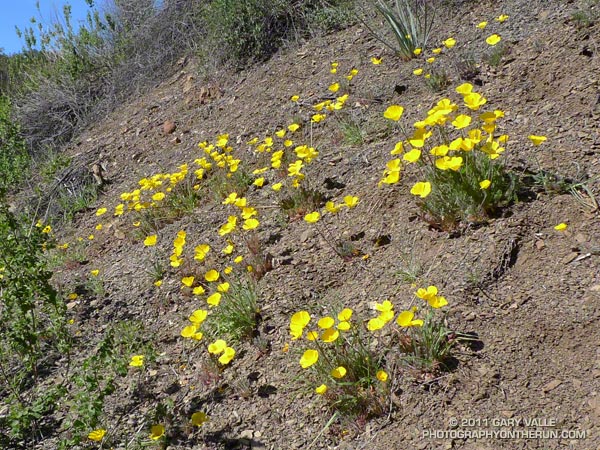
As would be expected with little or no use, two seasons of growth, and a wet winter, sections of the trail were really overgrown. The upper part of the Bear Canyon Trail was also significantly overgrown, and in a couple of places difficult to follow. It helped that animals had used the trail, though their path through the grass was indistinct. Trails are valuable resources that can be lost through prolonged closure and disuse.


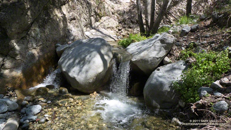
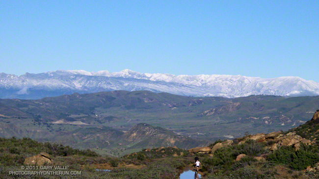
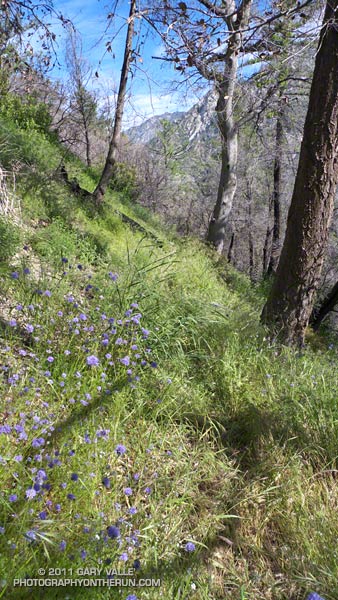
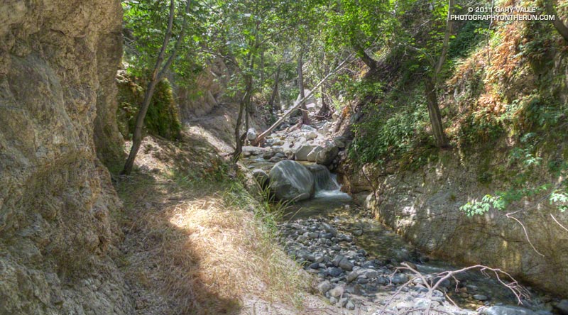
Once down to Bear Creek, the character of the canyon was much the same as before the fire. Bear Canyon is one of the more wild and isolated places in the San Gabriel Mountains that can be accessed by trail. Not far beyond the old cabin site, I paused by the creek and absorbed the sounds, smells and scenery of this special place.


The creek was incised in places, and there was other evidence of moderately high flows in the two years since I had been there. Very little remained of the use trail. The remnants of the old Tom Sloan trail are still there, but these are few and far between. There were more fallen trees, and a ton of poison oak. It was time consuming to try and dance around the poison oak, and about halfway through the canyon I gave up trying. Bear Camp appeared to be unscathed, and looked much like it did in 2009.


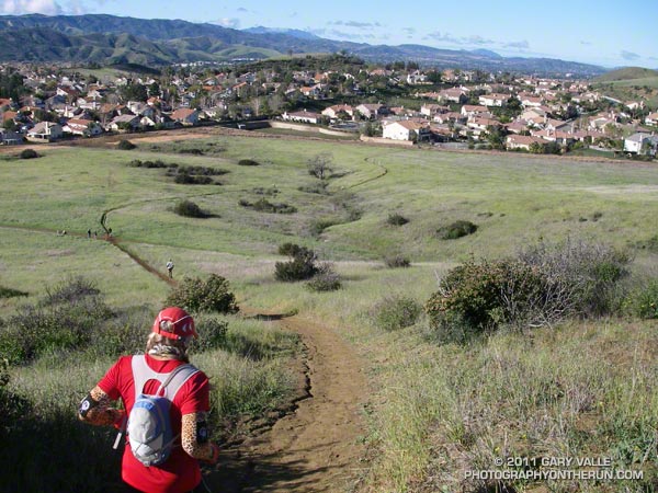
It took twice as long to work through Bear Canyon as in 2009, and I was happy to get to Bear Creek’s confluence with Arroyo Seco. Except for a couple of fallen trees, it was straightforward getting back to the Gabrielino Trail and to the Switzer Picnic Area. The bridge at the picnic area was littered with flood debris. The high water likely occurred during our record-setting December 2010 rain event.

It was a close call, but no doubt due to the efforts of firefighters, Switzer Picnic Area appeared to have survived almost unscathed. The Forest Service has made a number of improvements to the facilities. According to a Forest Service press release, the picnic area will remain closed until sometime in June, while construction is completed.


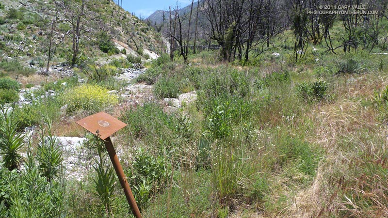
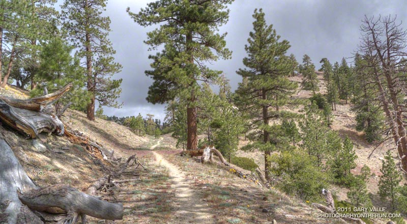
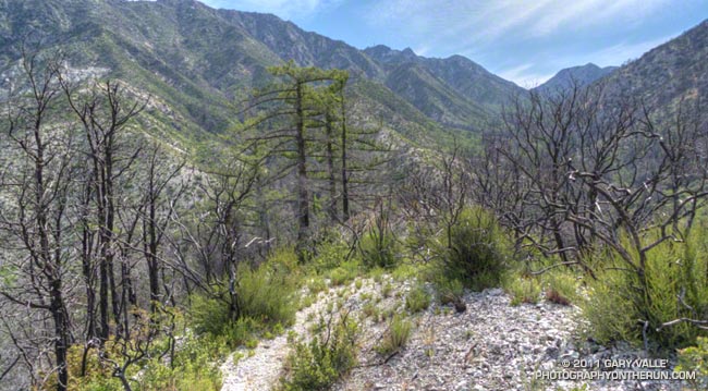
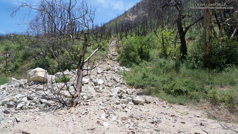
The first two miles of the Gabrielino Trail above Switzer really took it on the chin. The fire effects there were very pronounced, and of all the trails in the loop, that segment was the most severely affected. Flash flooding and debris flows have swept the canyon, obliterating sections of trail. The rest is very overgrown. Virtually every tributary canyon is now incised with debris flow runnels, up to several feet deep.


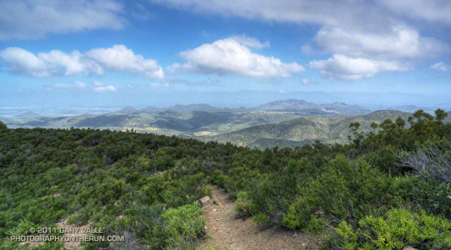
Once away from the canyon bottom and on the old road bed the trail was still overgrown, but was generally in better shape and easier to follow. The last mile to Red Box was nearly in the same condition as before the fire, and the last half-mile (where some trailwork had been done) even better!

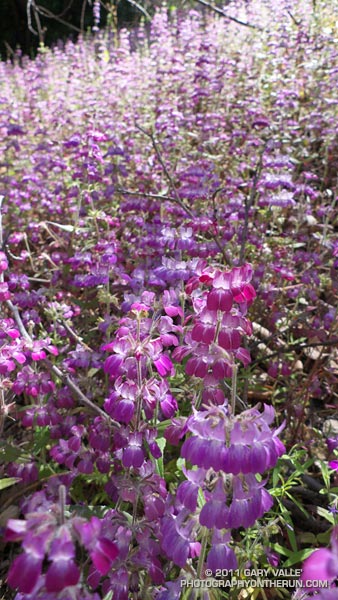
In the last decade I’ve followed the recovery and studied aspects of several fires including the 2002 McNally Fire, 2002 Curve Fire, 2003 Simi Fire, 2005 Topanga Fire, 2006 Day Fire, 2007 Corral Fire and 2008 Sesnon Fire.  Even after having observed it many times, I continue to be amazed at the resilience of fire-adapted ecosystems. As long as the fire recurrence interval isn’t too short, nature seems to do a pretty good job of recovery.

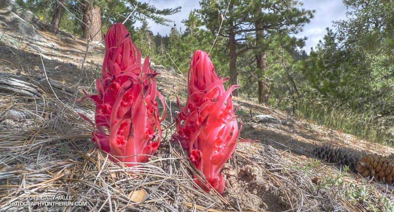
Related post: Contact Dermatitis from Turricula parryi – Poodle-dog Bush

Wow, What a Great Day for a Trail Run!

Ridge near summit of Tri Peaks

The Wendy Dr. trailhead in Newbury Park is a gateway to some of the most scenic and spectacular trail runs in the Santa Monica Mountains. Runs, hikes and rides on the extensive and diverse network of trails can range from a few minutes, to many miles and hours.

Today my run was of the “few hours” variety. The weather in Pt. Mugu State Park was perfect for a longer run — partly cloudy, light winds, and the temperatures ranged from the high 40s in the morning to the high 60s midday.

La Nina or El Nino, rain seasons as wet as the 2010-11 season are relatively rare. The wet weather produces a cascade of effects, resulting in conditions that might not be seen again for years. Streams that had not run for years were flowing; numerous wildflowers were blooming; the chaparral and other plant communities, and their inhabitants, were flourishing. I did not want to miss anything.

With that thought in mind, my route took me up and over Boney Mountain and Tri Peaks to the Backbone Trail, and then down the Chamberlain Trail and Old Boney Trail to the Serrano Valley Trail. After running through resplendent Serrano Valley, I continued down Serrano Canyon, crossing the creek 15 times, all the while trying to avoid the lush growth of poison oak along the trail. Even the miles returning up Sycamore Canyon were enjoyable, and involved a few stream crossings. The Upper Sycamore Trail and Danielson Road led back to Satwiwa and the trailhead.

On this particular day it was as fine a trail run as I have done, and probably the most scenic loop I’ve done in the Santa Monica Mountains.

Some related posts: Western Rim of Boney Mountain, Conejo Valley Sun and Boney Mountain Clouds

Here are a few additional photographs from the run:


Boney Mountain NW Ridge


Chamberlain Trail


Serrano Valley Loop Trail
                  
Fuchsia Flowered Gooseberry


Puffball


Hummingbird sage

Looking for Snow in the Santa Monica Mountains

View from Sandstone Peak, the highest point in the Santa Monica Mountains

Perhaps the only thing more difficult than forecasting rain in Los Angeles is forecasting snow in Los Angeles. A NWS Winter Weather Advisory issued Friday evening for the Santa Monica Mountains Recreation Area forecast the snow level to drop overnight from above 3000′ to between 1000′ and 1500′. Snow accumulations from 1 to 3 inches were expected.

When getting ready for a run on those searing 100 degree days at Ahmanson Ranch, I look longingly at the Lasky Mesa snow photos from 1943 displayed in the information kiosk at the Victory Trailhead. Would that rare snow scene be repeated? If so, I wanted to see it. I’m a skier from way back, but snow in the hills near my Los Angeles area home is an altogether different thing.

Last weekend it looked like we might get some snow on the higher parts of Rocky Peak Road for the Bandit 15K/30K/50K trail runs. There was some snow on Oat Mountain, but not down to Rocky Peak. The Rocky Peak area is about 500′-1000′ higher than Lasky Mesa, so snow there isn’t quite as rare. The last time I ran in the snow on Rocky Peak Road was in December 2008, and before that in March 2006.


Snow is an iffy thing in the Los Angeles area. The ocean is the dominant moderating influence. Storms generally bring in air warmed by the ocean, and the coldest air often doesn’t move in until after most of the precipitation has ended. To get low elevation snow, the timing and conditions have to be just so. Whether it snowed or not, it looked like it would be an interesting weather day, so I planned to get up early and do a morning run.

At dawn the lack of snow on the local foothills made it plainly evident that all the ingredients required for very low elevation snow had not come together.  Overnight there had plenty of snow — four feet of it at 7500′ at Mt. Baldy — just not much low elevation snow. (Later in the day post frontal convection would produce some isolated showers of icy snow in the east San Fernando Valley and La Crescenta.)

On the off chance there had been a dusting of snow at the higher elevations of the Santa Monica Mountains, I decided to do the Mishe Mokwa – Backbone Trail loop and check out the conditions on 3111′ Sandstone Peak, the highest peak in the range.


What a great morning for a trail run! When I started the loop, it was partly cloudy and the temperature at the Mishe Mokwa trailhead (el. about 2100′) was a chilly 37 degrees. The ground was soaked, and the chaparral wet with rain. Streams filled every gulch and gully, and the gorge along Echo Cliffs roared with runoff. Level sections of the Mishe Mokwa Trail were nearly one continuous puddle. Two creek crossings — one at Split Rock and another near the Backbone Trail — were wide enough to require wading.

Running the rocky trail with care, it took a little under an hour to reach the Backbone Trail junction. As I puffed up the trail toward Sandstone Peak, each exhalation was visible. I found myself reveling in each frosty cloud, as it would hang briefly in the morning sun, and then dissipate.

Although I could see no snow, it was cold enough that I thought there was a chance there might be some residual snow in the shade on the northwest side of the peak. Rounding the corner, I started up the makeshift stairs at the beginning of the spur tail leading to the summit. On top it was cold, windy, wet and spectacular, but — sigh — there was no snow.

Note: The rain from this storm pushed the water year rainfall total for Downtown Los Angeles to above the 100% mark. Although this might seem unusual in a La Nina influenced rain season, during two of the strongest La Ninas in the past 60 years — 1955-56 and 1973-74 — Los Angeles recorded 99% and 106% of normal rainfall.

Bandit 50K 2011 Notes

50K runners climbing up Rocky Peak road.

50K Runners Returning from the Rocky Peak Trailhead

Cool temps, clearing skies, and snowy vistas greeted runners doing the 2011 edition of the Bandit trail races at Corriganville Park in Simi Valley, California.

If you’re going to have a trail race after a rainstorm, Rocky Peak is the place to do it. Rain gauges in the area recorded as much as two inches of rain in the 48 hours leading up to the race, and for a while it looked like there might be a dusting of snow on the highest points of the course. Except for a couple of short muddy sections, and having to dodge a few mud puddles, the dirt roads and trails were in good shape.

This year the race was expanded to include a 50K. This new option doubled the fun on the Chumash-Las Llajas loop of the 30K course, running the loop twice, and also took a short sightseeing trip down to the Rocky Peak trailhead at Santa Susana Pass. The 30K course was the same as last year, but the 15K course was shortened from last year’s 16K or so to 15K.


The 50K course is a tough one, including about 7 miles of technical single track trail, 22 miles of fire road, and a mile of paved road. The elevation gain/loss is about 5400′, which is a little more than the Bulldog 50K course, and a little less than the original Mt. Disappointment 50K course. Here’s an elevation profile of the Bandit 50K course.

There are several difficult stretches on the 50K course. Just a mile into the race runners have to deal with a very steep climb — an 800 foot ascent in just one mile. In my mind it’s the most important mile on the course, and how hard you push here can have a big effect on how you feel over the next 28 miles! There are a couple of other long climbs. The 2.3 mile climb from the Rocky Peak trailhead to the top of the Rocky Peak grade gains over 1000′, and the gain over the 1.75 miles from the Las Llajas split to the highpoint at Shells/Fossil Point is 800′. Runners doing the 50K get to do the Las Llajas to Shells climb twice.


One of the toughest sections for me was the run up Las Llajas Canyon on the second Chumash-Las Llajas loop. This section starts at about mile 19 and ends at the Las Llajas split, where the road forks right and up through the oil fields. For the most part the grade is not steep, but the miles are deceptively long and grueling. Also tough on tired legs is the very technical plunge back down to Corriganville at the end of the race.

Congrats to 50K winners Chris Price and Nancy Ishizawa. Clearly enjoying the day, Chris flew through course in a remarkable time of 4:12:51, averaging 8:28 minute miles. In the 30K Marcelo Mejia set a new course record with a blazing time of 2:52:31. On a slightly shorter course than last year, Fernando Ramirez and Jen Todd put down fast 15K times. For all the results and race photos, see the Bandit web site.

All in all it was fantastic day for a run! Many thanks to the race organizers — Randy & Sarita Shoemaker, Larry Lee, and Todd Baker — and all the volunteers and sponsors for an outstanding event!

Here are a few additional photos. Click for a larger image and description:


Start of 800′ Corriganville Climb


Running Up from Rocky Peak Trailhead


Snow on Ventura Mountains


15K Runner Headed Back


Descending Chumash


Casey’s Water Cache

Western Rim of Boney Mountain

Western rim of Boney Mountain

The plan had been to do a run similar to last week’s Serrano Valley run, with more of an emphasis on distance, than elevation gain. As I worked up the long switchbacks on the Old Boney Trail I debated the benefits and disadvantages of more — or less — elevation gain. Just two weeks before the Bandit 50K would additional elevation gain hurt or help in that hilly race?


It really didn’t matter. Now was now, and the race was a distant two weeks away. The route up the westernmost of Boney Mountain’s two north ridges was one of my favorites — especially when the weather was clear and the views from the mountain were far reaching. I’d done the Old Boney Trail last week. This week I’d hang a left at the ridge and go up and over the peak.

Anticipating a warm day I’d left my pull-on sleeves in the car. Bad choice. Strong Santa Ana winds scoured the ridge, and the weak morning sun was lukewarm at best. The thick chaparral and tall rock formations provided some protection from the wind, but from time to time the trail would emerge onto a rocky prominence or exposed ridge and remind me just how cold 60 degrees can be!


Contrary to experience, the wind moderated a little as I worked up the ridge. It was still very windy, but the buffeting winds I’d expected at the saddle north of Tri Peaks didn’t happen. Even so, it felt great to work around the east side of Tri Peaks and into the full sun on the south side of the peak! The change in the “feels like” temperature must have been 25 degrees! It would be shorts and short-sleeves comfortable for the remainder of the run.

As it turned out the elevation gain going up and over Boney Mountain and down the Chamberlain Trail wasn’t that much more than the up, down, up route along the Old Boney Trail — and the running was oh so good down the recently repaired Chamberlain/Backbone trail!

Some related posts: Boney Mountain Morning, Conejo Valley Sun and Boney Mountain Clouds