There seems to have been some carryover from the wet rainy season we had in 2016-17 to this year. The 2017-18 rain season was very dry — the third driest on record at Downtown Los Angeles — but seeps at Waterman Meadow, along the Burkhart Trail below Buckhorn were still wet. In general plant growth along trails has been more than I expected in such a dry year.
Old growth Jeffrey pine killed in the 2009 Station Fire. Click for a closer view.
Wet and dry periods can be seen in the growth rings of the large Jeffrey pine along the Three Points – Mt. Waterman Trail just west of the Twin Peaks Trail junction. A more careful count of its rings totaled about 500. No matter how careful the count, because of the various anomalies that occur with tree rings, some form of crossdating is usually required to confidently assess the age of a tree. Even so, it is clear this was an old tree.
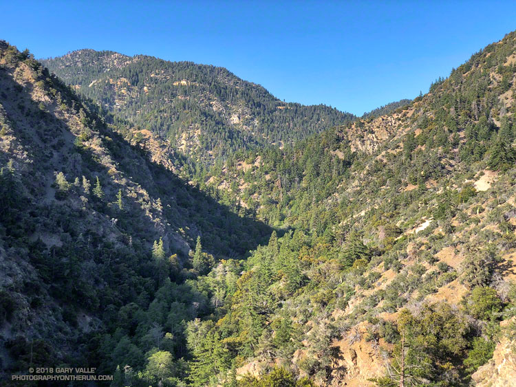
The first few miles of the loop were gloriously cool, but by the time I reached Cooper Canyon and was working up to Cloudburst Summit on the PCT, the sun beat down on me in a familiar refrain.
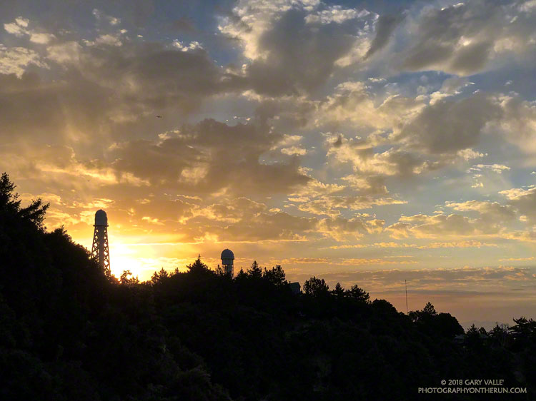
It was “déjà vu all over again” for the 12th running of the Angeles National Forest Trail Race on Saturday. When the sun rose over Mt. Wilson Saturday morning, the temperature was already in the 80s and monsoon clouds were scattered across the eastern sky. We all knew it was going to be a hot day. The only question was how hot?
Following weeks of seasonable — and often cool — weather, temps began to ramp up Thursday. On Friday many daily and some all-time record high temps were set around the Los Angeles area. Van Nuys set an all-time record high of 115°F. Downtown Los Angeles set a new daily record of 108°F and Woodland Hills set a new daily record of 117°F.
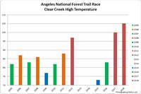
The high temperature recorded at Clear Creek for each of the ANFTR/Mt. Disappointment races. Click for a larger image.
The record-breaking heatwave continued race day with temps on the ANFTR course surpassing the torrid temps of 2017. The Clear Creek RAWS recorded hourly temperatures as high as 100°F and hourly fuel temps as high as 123°F. The highest temperature measured at Clear Creek was 105°F — five degrees higher than last year’s race.
Once again, despite the heat, there were some AMAZING performances. In the 60K, first and second place in both the Mens and Womens division finished only a couple minutes apart. Mario Martinez’s 6:41:25 just edged Rupert Romero’s 6:43:27, and Katie Asmuth’s 7:29:11 was just ahead of Teresa Kaiser’s 7:32:21. Chase Coffey ran the 50K in 4:25:26, which I believe is the fastest time for the normal 50K course. (In 2009 we ran all the way to Red Box on Mt. Wilson road.) Ana Suchey was the top woman in the 50K with a time of 6:04:30. In the 25K Victor Martinez bested the record he set last year, running the course in 2:07:27. Jennifer Sunahara was first among the women, with a time of 2:58:29. Not all the great performances were from the fastest runners. Sa Il Hong, age 80, completed the 50K in fine form.
Many thanks to Gary and Pam Hilliard and all the ANFTR staff and volunteers! It wasn’t just hot for the runners! And those setting up the event and marking the course had to endure Friday’s record-setting temps, spend a warm night on the mountain, and then work in the heat again on Saturday!
Note: The temperature in a commercial weather station is measured inside a white, ventilated instrument housing, several feet off the ground. Mid-day temperatures in the sun, in the summer, with a cloudless sky will be much warmer than this. Some stations, such as Clear Creek, also measure the fuel temperature — the temperature of a pine dowel in direct sun about a foot off the ground. According to the NWS (and common sense) exposure to full sunshine can increase heat index values by up to 15°F. In my experience the fuel temp gives a better indication of the actual temperature a runner can experience in the sun, especially on exposed mountain slopes facing the sun.
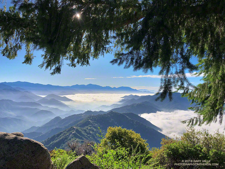
This morning’s run from Mt. Wilson started with striking views of the Southern California’s mountains from the Rim Trail. An extensive marine layer heightened the contrast between the highlands and the lowlands, with peaks such as Mt. Baden-Powell, Mt. Baldy and Monrovia Peak standing starkly above the ocean of clouds. Beyond Mt. Baldy, San Gorgonio Mountain could be seen, more than 75 miles distant.
A section of the Rim Trail between Mt. Wilson and Newcomb Pass.
The Rim Trail connects Mt. Wilson (5710′) to Newcomb Pass (~4100′). A trail and firebreak between Mt. Wilson and Newcomb Pass are shown in the 1934 “Advance Sheet” for the the first USGS 1:24000 map of the area, the Mt. Wilson Quadrangle. The route of the trail depicted in the finalized 1939 edition of the map is essentially the same as the Rim Trail today.
The somewhat primitive and adventurous character of the Rim Trail makes it a favorite. Most often I run the Rim Trail as the first leg of a loop that follows the Gabrielino Trail down to Chantry Flat and then returns to Mt. Wilson on the Upper Winter Creek and Mt. Wilson Trails.
Poodle-dog bush .
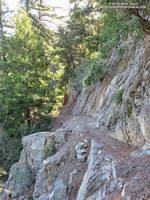
There is still some Poodle-dog bush along the Rim Trail and also on the connector trail between the top of the Kenyon Devore Trail and the Mt. Wilson Trail parking lot. As long as you see it, it is easily avoided. Poodle-dog bush is a fire-follower — in this case from the 2009 Station Fire — that can cause contact dermatitis. Here’s a closer look at the flowers.
Today, instead of turning right at Newcomb Pass toward Chantry Flat, I turned left on the Gabrielino Trail, . This leads down to Devore Camp — an isolated trail camp along the W.F. San Gabriel River. (Think creek!) From Devore Camp the Gabrielino Trail is followed up-canyon to West Fork Camp and then to the Kenyon Devore Trail. The Kenyon Devore Trail is then used to get back up to Mt. Wilson. There are other variations as well.
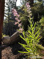
Blackberry along the Gabrielino Trail
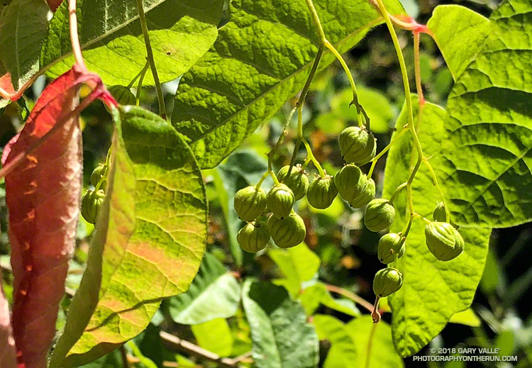
While the Gabrielino Trail between Spruce Grove and Chantry Flat is one of the most used in the range, the Gabrielino Trail between Newcomb Pass and West Fork is a rustic trail that sees far less use. On previous outings, I had not seen anyone on this segment of the trail. Today, I was surprised to find a backpacker at Devore Camp. I had to laugh when the first thing he said was, “Man, there is a lot of poison oak around here!”
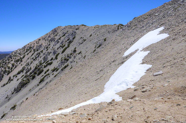
Given that Southern California has had way below average precipitation this rain year, I was a little surprised to find a few widely scattered patches of snow on San Gorgonio Mountain this past Saturday.
The patch of snow in the title photograph was at 11,000′, about a mile from San Gorgonio’s summit. This Google Earth image from last year shows an overview of the area. There was a lot more snow last year, but the same patch — in a deposition area — is near the “San Bern” in the “San Bernardino Peak Divide Trail” label.
There was “shorts and short sleeves” weather for the entire run from the South Fork trailhead.
Given the choice of doing an out and a back run, or a loop, most of the time I’ll pick the loop. Loops encompass more terrain, incorporate more trails, offer more varied scenery, are more adventurous, and normally put you back where you started.
There are many excellent loops in the San Gabriel Mountains. Last week’s loop from Three Points around Mt. Waterman is a run I like to do a few times a year. Today’s run is another favorite — the Islip Saddle – South Fork – Mt. Baden-Powell loop.
This loop combines a demanding descent to the desert on the South Fork Trail with an arduous 5000′ ascent of Mt. Baden-Powell. From Baden-Powell the PCT is followed along the crest back to Islip Saddle. More info can be found in the related posts linked below.