Category Archives: trails|san gabriels

Red Box – Bear Canyon – Switzer’s Loop – Memorial Day Weekend 2023

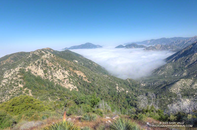
Marine layer pushing into Bear Canyon in the San Gabriel Mountains, near Los Angeles.
Marine layer pushing into Bear Canyon

The Red Box – Bear Canyon – Switzer’s Loop trail run is a favorite I’ve enjoyed doing for many years. Part of its attraction is the isolated, backcountry feel of Bear Canyon, particularly between Tom Sloane Saddle and Bear Canyon Trail Camp. It’s worth spending a few minutes at the old cabin site in the upper canyon to contemplate a lifestyle from an earlier century.
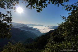
Early morning view from the Bill Reily Trail (aka Mt. Disappointment Trail).
Early morning view from the Bill Riley Trail (aka Mt. Disappointment Trail).

The descent of Bear Canyon is always adventurous in some way. Based on what I’d been seeing on other trails this year, I’d expected upper Bear Canyon to be a mess. I had braced myself for downed trees, washouts, and overgrown, hard-to-follow sections of trail.

But just a few minutes below Tom Sloane Saddle, a tree blocking the trail had been cleared, and the saw cuts were fresh! As I worked down the trail, I was excited to find more trailwork had been done. Branches or trees that had fallen across the trail had been cut. Some overgrown sections of trail had been trimmed. One washed-out section of trail looked like it had just been repaired. Someone had even trimmed a little of the poison oak that is so common along the trail.
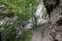
Bear Canyon Trail near Arroyo Seco

As I discovered when I encountered them lower in the canyon, the Bear Canyon Trail Crew had been hard at work, and they were working in the canyon again today!

The last time I was in Bear Canyon (April 2021), the creek had been nearly dry. This year there was plenty of water and plenty of stream crossings. Unlike several recent runs, I had my poles and was able to keep my shoes and socks mostly dry.
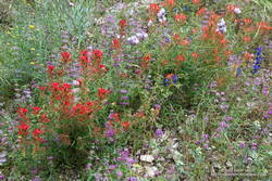
Trailside wildflower garden on the Bear Canyon Trail.
Trailside wildflower garden

I had debated whether to do this loop on Memorial Day Weekend. It passes through Switzer’s Picnic Area, one of the most popular day-use areas in Angeles National Forest. Many visiting Switzer’s do the hike down the Gabrielino Trail to see Switzer Falls, and many of those continue down the Bear Canyon Trail to the area below the falls.

Today, the two-mile stretch from below the falls to Switzer’s was as busy as expected. One issue I hadn’t anticipated was that some stream crossings were backed up like the Hillary Step on Everest. Other than wading, there was usually only one “dry” route across the stream. At one busy crossing, a hiker — clutching a dog under each arm — deftly balanced across a sequence of slippery rocks and branches, keeping his and his charge’s feet dry.
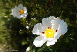
Crimson-spotted rock rose along the Gabrielino Trail between Switzer's and Red Box
Crimson-spotted rock rose along the Gabrielino Trail

Once past Switzer’s, things returned to normal. From Switzer’s, it’s about 4.5 miles up to Red Box, with an elevation gain of about 1350′. I had been on this section of the Gabrielino Trail about a month before and was curious to see if a mass of fallen trees blocking the trail had been removed.

The trees still needed to be cleared — Forest Service rules require a qualified sawyer to do that kind of work — BUT the remaining 2.5 miles of trail to Red Box were being trimmed and cleared by several dozen members of the Mt. Wilson Bicycling Association. I wondered why I wasn’t seeing any mountain bikers on the trail — they were all working on it!

Here’s an interactive, 3D terrain view of the Red Box – Bear Canyon – Switzer’s Loop. The map can be zoomed, tilted, rotated, and panned. To change the view, use the control on the upper right side of the screen. Track and placename locations are approximate and subject to errors.

Some related posts: Bear Canyon Loop – 2021, Red Box – Bear Canyon Loop Plus Brown Mountain, Bear Canyon Loop Plus Strawberry Peak
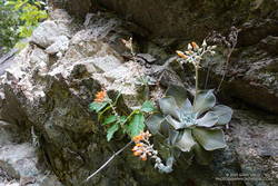
Canyon liveforever (Dudleya cymosa) in Bear Canyon.
Canyon liveforever.
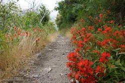
Paintbrush along the Gabrielino Trail between Switzer's and Red Box.
Paintbrush along the Gabrielino Trail.

Regrowth of Trees Along the PCT Following the 2002 Curve Fire

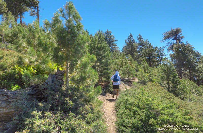
Young pines along the PCT about five miles east of Islip Saddle in an area burned by the 2002 Curve Fire
Tree regrowth along the PCT about five miles east of Islip Saddle

The Curve Fire started on Labor Day Weekend 2002, along Highway 39 in the San Gabriel Mountains. Between Mt. Islip and Throop Peak, the fire burned over the crest and down to Angeles Crest Highway. Between Throop Peak and Mt. Baden-Powell, the fire generally burned up to, but did not breach the crest.

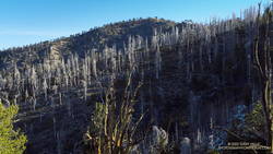
Dead trees on a ridge west of Mt. Hawkins that were burned in the 2002 Curve Fire

The Curve Fire killed many trees, including some large, old-growth trees. The most common species along the trail between Mt. Islip and Throop Peak are white fir, Jeffrey pine, sugar pine, and lodgepole pine. Incense cedar also grows in the area, and limber pine is found on and to the east of Throop Peak. Here is a cross-section of a tree along the PCT about 3.0 miles from Islip Saddle. It is representative of the older trees killed in the Curve Fire.

Prior to the Curve Fire, the FRAP geodatabase of California fires has no record of a large fire that burned along the crest of the San Gabriels between Mt. Islip and Mt. Baden-Powell. The FRAP record extends back to the early 1900s, when the San Gabriel Timberland Reserve became Angeles National Forest. A study of mercury levels in Crystal Lake and newspaper accounts suggest the possibility that a large fire occurred in this area in 1878, or about 124 years before the Curve Fire.

I’ve run and hiked the PCT between Islip Saddle and Mt. Baden-Powell for many years, so have had the opportunity to follow the regrowth of conifers where the Curve Fire burned over the crest. Studying conifer regrowth in this area can provide insights into regrowth in the 2009 Station Fire and 2020 Bobcat Fire burn areas, and in areas burned by more than one of these fires.

The locations of the stands are shown in this Google Earth image, along with the areas burned by the Curve and Bobcat Fires. Of these four areas, Stand #1 is the only one burned by the Curve Fire and Bobcat Fire.

Stand #1

A June 2020 photo of conifer regrowth after the 2002 Curve Fire. These trees were obliterated by the Bobcat Fire.

This stand of young Jeffrey pines looked very healthy in June 2020. The area is about 1.5 miles east of Islip Saddle on the PCT, at an elevation of about 7440 ft. At that time a tree adjacent to the trail stood well overhead.

I almost ran past this area in July 2022. I had to double-check the mileage on my watch. Where were the trees? Here is a comparison of the area before and after the Bobcat Fire.

The young trees were more vulnerable than the mature trees in the area. Eighteen years of Curve Fire regrowth were completely obliterated.

Stand #2

This area of young trees is between Windy Gap and Peak 8426, about 3.0 miles east of Islip Saddle on the PCT, at an elevation of about 7900 ft. Some old-growth Jeffrey pines were killed here. This is what the area looked like on May 30,  2010.

Now the size of the trees ranges from seedlings a few inches tall to this very robust Jeffrey pine that is well over head height.

Stand #3

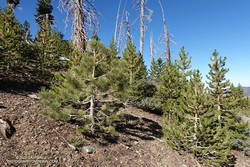
An assortment of young conifers growing along the PCT west of Mt. Hawkins in an area burned by the 2002 Curve Fire
An assortment of young conifers growing along the PCT west of Mt. Hawkins

This area of young trees is on broad ridge, west of Mt. Hawkins, about 4.2 miles east of Islip Saddle on the PCT. The Curve Fire ran down the ridge to Hwy 2, killing hundreds of trees. The elevation at the PCT is about 8500 ft.

Stand #4

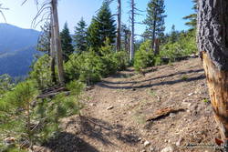
This area of young trees is on a south-facing slope, just west of Throop Peak, about 5.1 miles east of Islip Saddle on the PCT. The elevation is about 8900 ft. Because of its aspect, the new trees are taller than in the other areas photographed. Here’s what this area looked like in May 2012, June 2016, and July 2022.

Some related posts: Did Lightning Start the 2002 Curve Fire, 3D Terrain View of Bobcat Fire Soil Burn Severity and Some Angeles National Forest Trails

Rabbitbrush Along the PCT Near Mt. Hawkins

Rubber rabbitbrush (Ericameria nauseosa) along the PCT, near Mt. Hawkins

From mid Summer into Fall, the vibrant yellow flowers of rabbitbrush add a refreshing hit of color to the greens, grays, and browns of the San Gabriel Mountains.

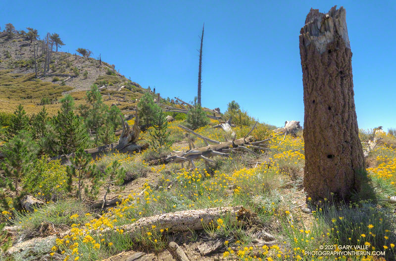
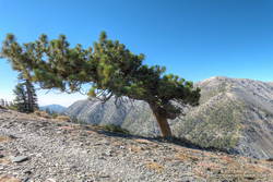
The title photo was taken along the PCT, at an elevation of about 8600′, near Mt. Hawkins. The area was burned in the 2002 Curve Fire. Here, and elsewhere in the burn area, new trees — now in their teens — are slowly replacing some of the trees lost in the fire.

Related post: Bumblebee Feeding on Rabbitbrush

Mt. Baldy from Wrightwood Via the Acorn and North Backbone Trails

North Backbone Trail below Pine Mountain on Mt. Baldy
North Backbone Trail below Pine Mountain.

The last time I was on this part of the North Backbone Trail it was bitterly cold and very windy. Today it was just very windy. Even though the air temperature was in the 70s, the “wind chill” was enough that I was considering grabbing the sleeves and shell from my pack.

I stopped in the lee of a sprawling, stunted lodgepole pine and enjoyed a moment of relief, shielded from the wind. But there wasn’t that much mountain above me, and I resumed zig-zagging up the final steep stretch of trail. Climbing a little higher, I could see the trail sign that marks the top of the North Backbone Trail.

Point 8555 and Pine Mountain from the PCT on the way to the North Backbone Trailhead
Point 8555 and Pine Mountain from the PCT

Mt. Baldy from Wrightwood is a more difficult variation of the North Backbone Trail route. Instead of driving to the North Backbone Trailhead on East Blue Ridge Road (F.R. 3N06), you run/hike to the trailhead using the Acorn Trail and a short stretch of Blue Ridge Road or the PCT. (The dirt road is slightly shorter, but you don’t have to dodge off-road vehicles when on the PCT.)

Including Pine Mountain (9648′) and a short detour to the top of Dawson Peak (9575′), the regular North Backbone route is about 8 miles long and gains/loses around 4700′. Starting in Wrightwood at the small parking area on Acorn Drive ups those totals to around 15 miles, with a 6800′ gain/loss.

Rabbitbrush along the North Backbone Trail, between Pine Mountain and Dawson Peak

A mix of hikers and trail runners were scattered across the broad summit of Mt. Baldy (10,064′). The wind wasn’t as strong on the summit as it had been on the North Backbone. Smoke from the Western wildfires reduced the visibility, but the air quality and view were still pretty good.

Like many mountains, the adventure didn’t end on the top of the peak. The elevation gain on the way back to Wrightwood is significant, and much of the downhill demands close attention — especially on tired legs. I squeezed the water bladder in my pack and tried to estimate how much was left. The day was just going to get warmer, and I hoped it was enough to get me back over Dawson Peak and Pine Mountain. On the way up, I’d stashed a small water bottle near the North Backbone Trailhead, and that would help on the final few miles.

Windswept Jeffrey pine near Dawson Peak

Other than initially running past my water stash, the descent went well. Once on the PCT I could run normally — well, more or less normally — and it didn’t take long to get over to the Acorn Trail.

When doing the AC100 and related training runs, I’d run/hiked up the Acorn Trail a number of times, but I’d never run down it. After all the rough trail on the North Backbone, it was great to be able to cruise down through a forest of pine and fir on a well-groomed trail! Here’s an elevation profile of the route.

Explore the scenery and terrain of this out-and-back trail run and hike from Wrightwood to Mt. Baldy using our high resolution,  interactive, 3D viewer. The imagery is so detailed, it’s almost like being there! To change the view, use the control on the upper right side of the screen, the CTRL key and your mouse, or touch gestures. Track and placename locations are approximate and subject to errors. Snow, ice, poor weather, and other conditions may make this route unsuitable for this activity.

Some related posts: Mt. Baldy North Backbone Trail, North Backbone Trail Revisited, Mt. Baldy Run Over the Top, Inspiration Point to the Pine Mountain Juniper and Pine Mountain

Red Box – Bear Canyon – Switzer’s Loop – July 2021

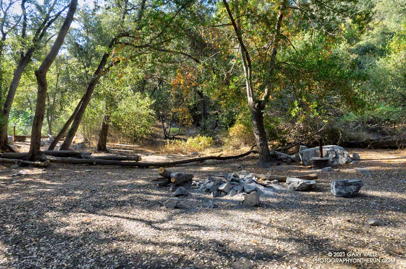
Bear Canyon Trail Camp. July 25, 2021
Bear Canyon Trail Camp

I’d decided to stay off the higher peaks because a combination of monsoon moisture and an upper level low was probably going to produce some thunderstorms in the high country. The action was forecast to stay east of of the Mt. Wilson area, but there was a chance there might be enough clouds to knock the temperature down a few degrees.

But a chance is just that, and the day dawned mostly clear and warm at Red Box. A few feathery high clouds had no effect on the sun, and as I jogged up Mt. Wilson road to the start of the Mt. Disappointment Trail, the temperature was already in the 80s.

Blazing star near the Mt. Disappointment Trailhead on Mt. Wilson Road
Blazing star near the Mt. Disappointment Trailhead.

I was doing a 15-mile version of the Red Box – Bear Canyon loop. The main trails that make up this version of the loop are the Mt. Disappointment Trail, San Gabriel Peak Trail, Mt. Lowe Fire Road, Upper Bear Canyon Trail, Bear Canyon Trail, and the Gabrielino Trail. Refer to a trail map for additional details.

As it turned out, the Bear Canyon Trail was in the best condition I’ve seen in years. Thank you Bear Canyon Trail Crew! While still rustic, the trail between the old cabin site and the trail camp was a bit more worn than usual, and a little easier to follow. In some years it can be much more difficult to navigate.

No one was camped at Bear Canyon Trail Camp. The condition of the creek was similar to 2018. There were a few small pools here and there, but almost no surface flow. In addition, strict fire restrictions are currently in effect. See Forest Order No. 05-01-21-04.

The dry conditions had one benefit — I didn’t have any issues with stinging nettle. There was still plenty of poison oak, but it was drying out and turning red. For the most part the poison oak could be avoided.

The Gabrielino Trail between Switzer Falls and Switzer’s Picnic area was as busy as usual, including one hiker walking their cat!

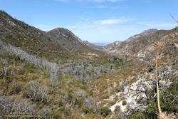
Arroyo Seco from the Gabrielino Trail, about 1.5 miles from Red Box
View down Arroyo Seco from the Gabrielino Trail, about 1.5 miles from Red Box

As I worked up the Gabrielino Trail above Switzer’s, I kept looking for those monsoon clouds. Temps in the sun on the exposed trail was in the high 90s, and it was a relief to finally get to the more shaded sections near Red Box.

Here’s an interactive, 3D terrain view of my GPS track of the Red Box – Bear Canyon – Switzer’s Loop. The map can be zoomed, tilted, rotated, and panned. To change the view, use the control on the upper right side of the screen. Track and placename locations are approximate and subject to errors.

Note: Heavy rain can produce flash flooding and debris flows in Bear Canyon and Arroyo Seco.

Some related posts: After the Station Fire: Back to Bear Canyon, Red Box – Bear Canyon Loop Plus Brown Mountain, Bear Canyon Loop Plus Strawberry Peak

Inspiration Point to the Pine Mountain Juniper and Pine Mountain

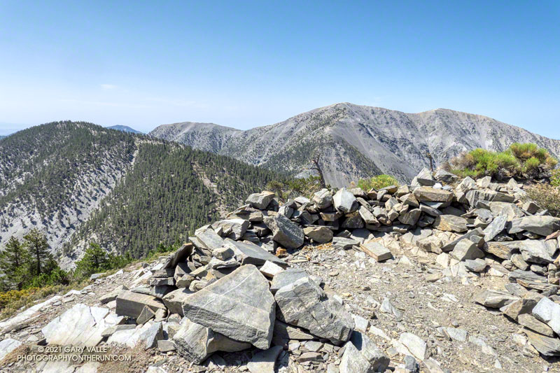
Dawson Peak and Mt. Baldy from Pine Mountain

This 17 mile trail run and hike is a longer version of the Inspiration Point to the Pine Mountain Juniper adventure run. Additional details and photos can be found in that post.

The adventure combines a seven-mile run on the PCT along Blue Ridge with a strenuous 1.5 mile, 1500′ climb up the North Backbone Trail to the summit of Pine Mountain (9648′). The Pine Mountain Juniper, estimated to be 800-1000 years old, is found at the 9000′ level of the North Backbone Trail.

Massive trunk of the Pine Mountain Juniper
Trunk of the Pine Mountain Juniper. Click for larger image.

On the way out I was glad to see the PCT had been rerouted around a steep, rocky stretch of trail below Mountain High West’s snow-making pond. I stayed on the PCT except for a very short section of dirt road between the top of the Acorn Trail and the overlook of the huge Wright Mountain landslide scar. The single track is more pleasant, and I didn’t have to worry about vehicles or their dust. I left the PCT when I was directly above the North Backbone Trailhead. A short path descended to the road.

The North Backbone Trail was as steep as it has always been. It’s not a constructed and maintained trail, but one that has evolved through use. Stretches of it are very steep, loose and rocky. The tree on Point 8555 that was struck by lightning in 2006 has finally fallen. There must be a lot of lightning activity here because a nearby pine had been recently struck by lightning.

The North Backbone Trail seems to be getting more attention these days. This adventure could be extended to include Dawson Peak and Mt. Baldy. A similar route was part of the 44-mile Big Pines Marathon — possibly the first mountain ultra in the U.S.