From a run last week above Bell Canyon.

From a run last week above Bell Canyon.
In short sleeves and shorts it was cold. The wind gusts were so strong that I could not hold the camera steady. Dropping down on one knee helped, but I still had to time the shots for the 10-15 mph “calm” between the 20-30 mph gusts.
After generating some rain and snow in Southern California, a blustery upper level low was finally exiting the area. Had I not known it had rained a couple days before, I’m not sure I would have been able to tell. The dessicated soil had quickly absorbed most of the moisture and the chaparral plants still looked drought stricken.
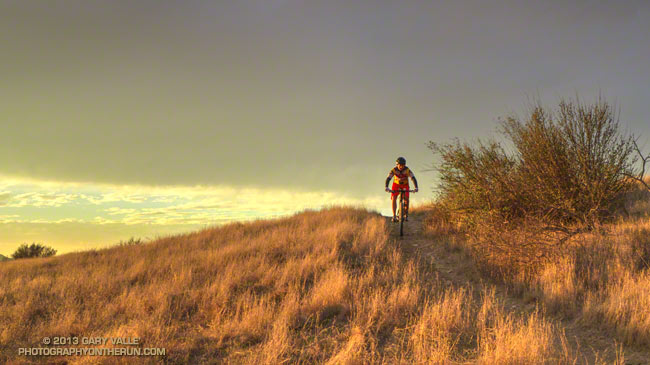
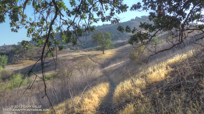
From today’s late afternoon run on Rocky Peak.
Today those instrumental in the acquisition of Ahmanson Ranch and supporters of the open space area gathered at the park — now Upper Las Virgenes Canyon Open Space Preserve — to celebrate its purchase. For more on the festivities see this article in the Simi Valley Acorn.
I’ve been running at Ahmanson Ranch for more than ten years and have spent hundreds of hours in the open space area. Following are a few photographs, stories and wildlife encounters from these runs.
– Northern Harrier Turning to Strike
– Red-winged Blackbird Song Spread
– Racing the Sun, Catching the Moon
– Coyote Tag and Coyote Tag II
– Southern Pacific Rattlesnake and Big Southern Pacific Rattlesnake
– September & October are Tarantula Months!
– Southern California Greenscape
– Lenticular Wave Clouds
– Signs of Winter
– King of the Hill
– Comet PanSTARRS and the Crescent Moon
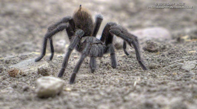
The title photograph is from a run at Ahmanson Ranch earlier this November.
Updated October 28, 2024.
Since 2005 these are the dates I’ve photographed a tarantula at Ahmanson Ranch (Upper Las Virgenes Canyon Open Space Preserve). The dates are sorted by month and day.
September 05 (2012)
September 08 (2006)
September 13 (2005)
September 19 (2007)
September 15 (2009)
October 3 (2012)
October 9 (2012)
October 11 (2006)
October 12 (2011)
October 12 (2023)
October 17 (2012) (2)
October 22 (2020)
October 23 (2013)
October 28 (2024)
If I see a tarantula, I always try to photograph it. Over the years there may be one or two that scurried into the grass and brush before I could snap a photo.
I did not see a tarantula at Ahmanson during the period 2014 – 2019. There was a five year drought in 2011 – 2015 and the Woolsey Fire was in November 2018. The routes and frequency I run at Ahmanson have not changed appreciably since 2005 .
Autumn is when maturing male tarantulas (Aphonopelma spp.) wander about in search of a mate.
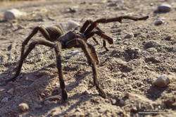
The title photograph is from a run on September 5, 2012. The raised abdomen is a defensive posture. Tarantulas will scrape their abdomen with their bristly rear legs, launching irritating (urticating) barbed hairs into the air. Most tarantulas I’ve encountered this time of year do not react defensively — they’re just interested in finding a mate.
A search on iNaturalist shows a few observations ( 2 to 6) of tarantulas in the Ahmanson area each year since 2020.
Some related posts: Tarantula Time, Sting of the Tarantula Hawk, Tarantula Hawk
From this afternoon’s out and back run from the Victory trailhead at Ahmanson Ranch to Cheeseboro Ridge.
Updated October 17, 2013.
As I started up the Chumash Trail, a patchwork of clouds filled the sky, and the fresh smell of a recent shower filled my lungs. A strong and unseasonably cold low pressure system was producing the first widespread rainfall of Southern California’s 2013-14 rain season.
I hoped there would be another shower during my run. The plants and animals needed it and I needed it. It had been many months since I had run in the rain on a local trail.
As I worked up the trail I thought about how dry it had been. Downtown Los Angeles’ 2012-13 water year (Jul 1 – Jun 30) was the sixth driest on record. Rainfall in Los Angeles since January 1 has been about 25% of normal. The 2012-13 Sierra snowpack was one of the worst on record.
Will this rain and snow season be any better? For months I’ve been monitoring climate data and forecasts looking for something on which to base a 2013-14 Winter Outlook. Historically, ENSO has been the big dog in Southern California rain season weather with El Nino conditions generally producing wetter weather and La Nina conditions generally drier.
But ENSO conditions are currently Neutral and are expected to remain so through the end of the year. Most climate models forecast there will be slow warming of SSTs in the equatorial Pacific (NINO 3.4 region) over the next several months, but at this time of the year it would be very unusual to have substantial warming. The CPC/IRI ENSO Forecasts from IRI’s October Quick Look indicate the probability of an El Nino developing before the end of the year is less than 20% — and 20% seems high.
One computer model that at times has been forecasting above average precipitation this Winter in Southern California is the Climate Forecast System version 2 (CFSv2). The CFSv2 is fully coupled ocean-atmosphere-land-sea ice model used to forecast parameters such as sea surface temperature, temperature and precipitation rate. While skillful at predicting tropical SSTs, the CFSv2 generally performs very poorly when forecasting precipitation over land, so forecasts such as this one for Dec-Jan-Feb must be viewed somewhat skeptically.
Another glass half-full observation is that the Madden-Julian Oscillation (MJO) has been relatively active this year and if this activity continues it provides recurring opportunities for enhanced U.S. West Coast precipitation. The downside is that it can result in periods of dry weather as well.
With the ocean and atmosphere neutral there’s just not much on which to base a rain season forecast. According to the Climate Prediction Center, the current winter precipitation outlook for most of Southern California calls for an equal chance of below average, average, or above average rainfall. I know — that’s no help at all — you might as well flip a three-sided coin!
Update October 17, 2013. The Climate Prediction Center released its updated U.S. Dec-Jan-Feb Precipitation Outlook today. The outlook now indicates an equal chance of below average, average, or above average precipitation for all of Southern California. The October CPC outlook is usually the basis for the initial official NOAA U.S. Winter Outlook.
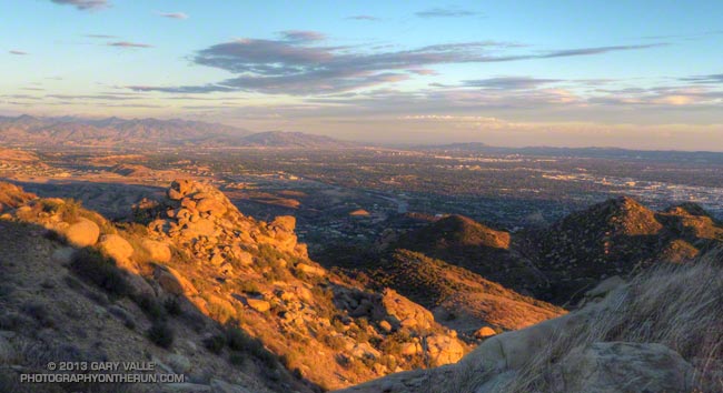
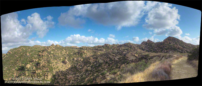
The title photo is of Rocky Peak Road, near its junction with the Chumash Trail. Here’s a larger version of the panorama.