Some Summers Are Hotter than Others

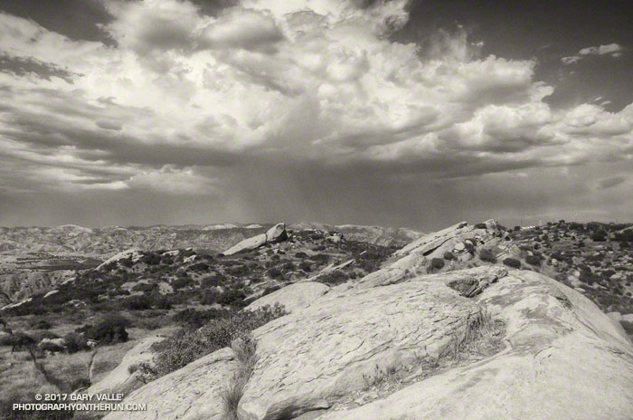
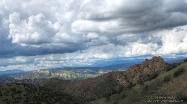
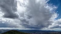
Thunderstorm and Rocks - Sage Ranch Park - August 31, 2017.

The photo above is from an afternoon run at Sage Ranch Park on August 31, 2017, during our recent heat wave. The thunderstorm in the distance is over Santa Clarita.

Around the time the photo was taken the temperature at the Cheeseboro RAWS was 110 °F, with an “in the sun” fuel temperature of 119 °F. The temperature at Ahmanson Ranch, where I often run on weekdays, was probably higher. I was running at Sage Ranch to try and take the edge off the heat — even if the reduction in temperature was only a few degrees.

During the heat wave the high temperature at Pierce College in Woodland Hills in the West San Fernando Valley exceeded 100 °F on nine consecutive days (August 24 to September 3) and exceeded 110 °F on five consecutive days (August 28 to September 1). Numerous temperature records were broken in Southern California and across the state. On September 1, Downtown San Francisco set a new all-time record high temperature of 106 °F.

At my West Hills weather station the high temperature for the month of June was 109 °F; for July 111 °F; for August 112 °F; and so far this September the high has been 113 °F. If I’m not heat-acclimated by now, I never will be.

After the Lake Fire: The Dollar Lake – Dry Lake Loop on San Gorgonio Mountain

Dry Lake in the San Gorgonio Wilderness

The north side of San Gorgonio Mountain was closed in June 2015 when the Lake Fire burned approximately 31,359 acres of forest, chaparral, sage, pinyon and Joshua tree habitat at elevations ranging from about 10,700′ to 5350′. As a result of the determined efforts of firefighters, only one residence and some remote outbuildings were lost.

Of the 30,487 acres reviewed by the Burned Area Emergency Response (BAER) team 4,327 acres (14%) were categorized as Unburned; 17,100 acres (56%) as having Low soil burn severity; 8,420 acres (28%) as having Moderate soil burn severity; and 640 acres (2%)with High soil burn severity. (Note that soil burn severity isn’t necessarily synonymous with fire intensity and fire effects such as tree loss.)

I’d been keeping an eye on the Alerts & Notices section of the San Bernardino National Forest web site to see if the Lake Fire closure order would be renewed. I was curious to see the extent and impacts of the Lake Fire and how the area was recovering. Plus, the Dollar Lake – Dry Lake keyhole loop is an outstanding trail run — one of the best in Southern California. In addition to climbing San Gorgonio Mountain (11,499′), it encompasses some of the most scenic areas on the peak.

The area’s trails reopened July 20. The weekend prior to the reopening San Gorgonio Wilderness Association volunteers worked on the South Fork and Dry Lake Trails, clearing a number of large trees, removing debris and other hazards and improving the trail tread.

A week and a half after the opening I pulled into the South Fork parking lot on Jenks Lake Road, excited to get on the trail. There was a slight chance of thunderstorms in the forecast, and I hoped to be off the summit and on my way down by 10:30 or 11:00.

Most of the run is in the San Gorgonio Wilderness and a wilderness permit is required. Check a map, but the general sequence of trails is the South Fork Trail, Dollar Lake Trail, Divide Trail, Summit Trail, Sky High Trail, Dry Lake Trail and then back down the South Fork Trail to the trailhead. This Google Earth image shows the western part of the Lake Fire burn area in relation to San Gorgonio Mountain and some of the area’s trails.

On this particular run I also wanted to check out the Fish Creek Trail and the “use trail” down to Lodgepole Springs and Dry Lake, so rather than continuing down the Dry Lake Trail from Mineshaft Saddle, I turned right (east) and followed the Fish Creek Trail to Fish Creek Saddle.

There were some downed trees and a lot of fire debris on the Fish Creek Trail. Extra care was required and I probably hiked as much of it as I ran. As I worked toward Fish Creek Saddle I could not tell how much of the canyon leading down to Lodgepole Spring had burned. The slopes on the southwest side of Grinnell Mountain had burned and some areas along the Fish Creek Trail had burned as well. Whether I descended to Lodgepole Spring from Fish Creek Saddle or returned to Mineshaft Saddle would be a judgment call.

Arriving at Fish Creek Saddle I was glad to see the forest was intact. The path down to Lodgepole Spring looked promising, but had not been used in some time. As it turned out most of the trees along the path had not burned. In places, runoff from the burned slopes above had resulted in some erosion and small flows of sandy soil. There were also the usual downed trees, but other than being a little challenging to follow, the path was generally OK.

I was nearly off the trail when the “chance of thunderstorms” forecast materialized into threatening gray clouds, a few sprinkles, and a couple of rumbles of thunder.

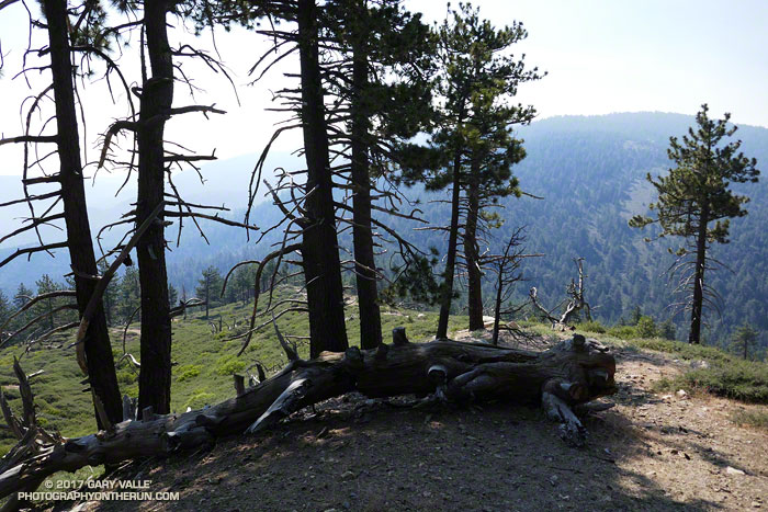
Here are a few photos taken during the run.

Some related posts: Running San Gorgonio: Dollar Lake – Dry Lake Variation, San Gorgonio Mountain: Dollar Lake – Dry Lake Trail RunLake Fire MODIS Fire Detections
Pinos to Abel Plus

Western terminus of the Vincent Tumamait Trail.
Grouse Mountain from the Vincent Tumamait Trail near Cerro Noroeste Road

I was glad I didn’t turn around and head back to the car. At the beginning of the run smoke from the Whittier Fire (near Lake Cachuma) covered Mt. Pinos in an ugly shroud. Fortunately, a couple of hours into the run, the wind shifted to the north, removing the smoky veil and greatly improving the visibility and air quality.

Hikers on the Vincent Tumamait Trail near Mt. Pinos.

Even it was smoky, at least the weather was cool. Following the torrid conditions at the Mt. Disappointment 50K the previous Saturday, and hot weather during the week, cool was good.

Mt. Pinos is often a good choice for escaping the triple digit heat of a Los Angeles heatwave. The elevation of the Chula Vista trailhead (8350′) is higher than the highest trailhead on Angeles Crest Highway — Dawson Saddle (7909′) and about 1000′ higher than the popular Inspiration Point (7370′) trailhead on the PCT.

Chumash spirit tower on Sawmill Mountain.

My usual “Pinos to Abel” run starts at the Chula Vista trailhead and follows a dirt service road to the summit of Mt. Pinos (8831′). At the nearby wildlife viewing area it picks up the Vincent Tumamait Trail and heads west, taking a short detour to Sawmill Mountain (8818′) and the Chumash spirit tower, and then continues toward Mt. Abel (Cerro Noroeste). The trail ends at Cerro Noroeste Road, but a short climb up through the pine trees leads to the summit of Mt. Abel (8280+’) and Campo Alto. On the way back I usually run down the North Fork Trail to the spring at Sheep Camp, and sometimes extend the run by descending to Lily Meadows Camp (6250′).

Runners on the Vincent Tumamait Trail below Mt. Pinos.

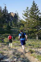
It’s rare to see other runners doing the Pinos to Abel run. Dan and Dameon first passed me descending from Mt. Pinos. Our paths would cross several times over the course of the morning. They were running in the Mt. Pinos area for the first time and having a great time exploring the trails.

One of those times was on the top of Mt. Abel. They were thinking about hitting Grouse Mountain (8582′) on the way back to Pinos and asked about the route. The use trail to Grouse branches off the Vincent Tumamait Trail near a saddle ENE of the peak and about 0.3 mile west of the North Fork Trail junction. It leads to the northern summit of Grouse’s twin summits in about a quarter-mile.

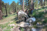
Horse taking a drink at Sheep Camp.
What’s in the bag?

I didn’t do Grouse Mountain today, but did take the North Fork Trail down to Sheep Camp. Today, the plan was to just go a “little way” down the trail below Sheep Camp to see if a particular plant was flowering. Beyond Sheep Camp the North Fork Trail drops like a rock, and it turned into one of those, “I’ll just go a little farther down” kind of things. Before I came to my senses I’d lost nearly 1000′ in elevation while looking for the plant.

After chugging back up to the spring at Sheep Camp, I refilled my Camelbak(TM) and then continued up to the Vincent Tumamait Trail and headed east, retracing my steps to Mt. Pinos, and back to the trailhead.

Some related posts: Thunderstorm, Vincent Tumamait Trail

Waiting for Rain: El Nino and the 2015-16 Southern California Rainfall Year

Thunderstorm over the Santa Monica Mountains

Due in part to El Nino and the Madden-Julian Oscillation (MJO) Southern California jump-started the 2015-16 rain season with above average rainfall in July and September.

Last year the NWS changed the WATER Year to October 1 – September 30, but the RAINFALL Year remains July 1 – June 30, as it’s been for decades.

Below is the monthly tabulation of rainfall for Downtown Los Angeles (USC) for the 2015-16 Rainfall Year, along with what is considered normal for the month.

Downtown Los Angeles Rainfall
Month Rainfall Normal
July 0.38 0.01
August T 0.04
September 2.39 0.24
October 0.45 0.66
November 0.01 1.04

So far this rainfall year Downtown Los Angeles (USC) has recorded 3.23 inches. Even with November as dry as it’s been we’re still more than an inch above normal for the rainfall year — about 1.46 inches above normal as of November 25.

Over the next couple of weeks the medium range models and other tools aren’t especially bullish on our chances for a good, soaking rainstorm in Southern California. Longer term guidance suggests an improving chance of precipitation as December progresses, and above average precipitation in January and February. We’ll see!

The title photo is from November 3. It shows a band of thunderstorms that moved southward across the San Fernando Valley and into the Santa Monica Mountains. The band produced cloud to ground lightning strikes and some heavy showers. Saddle Peak is in the distance on the left. The shower activity in the distance on the right is in the area of Kanan Rd. and the 101 Frwy.

A Two Mud Run Summer and Wet Winter Outlook for Southern California

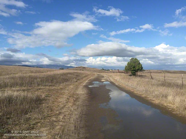
Mud puddles on Lasky Mesa following record rainfall on September 17, 2015.

Ahmanson Ranch gets notoriously muddy when it rains, but it is exceptionally rare for it to rain enough in the Summer to do a run in the mud. Due in part to a warm Pacific, El Nino and a little boost from the Madden-Julian Oscillation in early July, it’s been a record two mud run Summer at Ahmanson Ranch!

The first mud run day was on July 18, when the Cheeseboro RAWS recorded 1.32 inches of rain. That day I ran in the San Gabriels, where the main issue was thunderstorms.

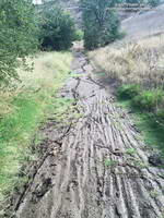
Mud in upper Las Virgenes Canyon following record rainfall on September 15, 2015.
Muddy Upper Las Virgenes Canyon

Tuesday (September 15) was a different story. It rained hard overnight — more than three-quarters of an inch — and in the afternoon I did one of my standard weekday loops from the Victory Blvd. trailhead — out East Las Virgenes Canyon, through Las Virgenes Canyon, and up the Beast to Lasky Mesa. It felt more like November than September. After running through a particularly muddy section in Las Virgenes Canyon, heavy plates of mud had built-up on my shoes. Normally I would curse, but on this run I just laughed. It was great to be out in the wet and muck.

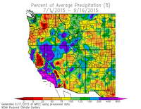
Western Regional Climate Center map of the percentage of normal precipitation in the West for the period July 1 to September 16, 2015.
WRCC Percent of Normal Precipitation

Both days set rainfall records at Downtown Los Angeles (USC). July 18 was the wettest day in July and July 2015 the wettest July since recordkeeping began in 1877. September 15 set a new rainfall record for the date and was the second wettest day in September on record. To date, September 2015 is the third wettest September on record. The rain year (July 1 to June 30) is off to a great start in Southern California and the 2015 El Nino has continued to strengthen.

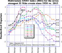
Multivariate ENSO Index (MEI) for the seven strongest El Nino events since 1950 vs. 2015.
MEI for Seven Strongest El Ninos Since 1950

Based on the July-August Multivariate ENSO Index (MEI), for the time of year the 2015 El Nino is one of the three strongest El Ninos since 1950. A survey of dynamical and statistical ENSO models by the IRI & CPC suggests continued warming in the central equatorial Pacific with a peak of the temperature anomaly in the Nino 3.4 region in the OND or NDJ season.

The 2015 El Nino is being compared to the “Super” El Ninos of 1997-98, 1982-83 and 1972-73. It’s too early to tell how the 2015 event will stack up against 1997-98 and 1982-83, but it already has exceeded the strength of the 1972-73 event. How might a Super El Nino affect Southern California rainfall? Historically, they have produced some of the wettest rain years on record. Downtown Los Angeles (USC) recorded 31.01 inches of rain in 1997-98 and 31.25 inches in 1982-83.

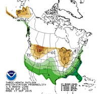
Climate Preciction Center's Winter Precipitation Outlook for December-January-February 2015-16
CPC Winter Precipitation Outlook

The climate context is different than it was decades ago, but very strong El Ninos are different beasts and rev up the atmosphere in a way that dominates global weather. Assuming the 2015 El Nino maintains (or increases) its strength into November or December, it should produce above average precipitation in Southern California this rain season, and perhaps result in an above average rain year for the southern half of the state. This is reflected in the Climate Prediction Center’s latest round of 3-Month Seasonal Precipitation Outlooks, including the Winter outlook for December, January & February 2015-16. We’ll see!

Related post: July Deluge a Preview of Southern California’s Upcoming Rain Season?

Chumash Trail Clouds and Sun

Cumulus clouds from the Chumash Trail

Instability associated with an upper low resulted in some pop-up showers and thunderstorms today.


As I ran up the Chumash Trail on the east side of the Simi Valley I kept a close eye on a cell that developed near Ladyface in the Agoura Hills. That cell didn’t track as much to the east as I thought it might, but other cells were developing to the east and south of Rocky Peak and Santa Susana Pass area and at one point I heard the rumble of thunder.

As it worked out, I only had a few sprinkles on the run, but drove home in the rain!