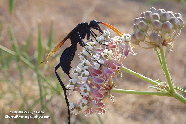
Tarantula Hawks are among the largest of wasps, and are said to have one of the most painful stings of any insect. As chilling as any science fiction, female tarantula hawks hunt, attack and paralyze a tarantula, and then use the spider’s inert — but still living — body as a host for the wasp’s egg and developing larva.
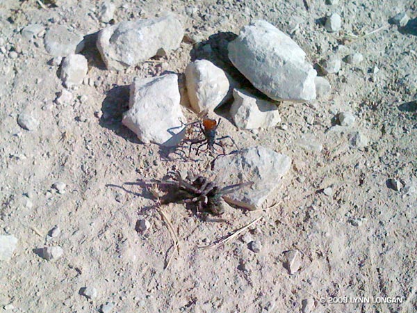
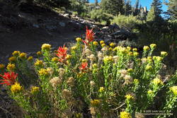
Males have straight antennae, and females curled antennae. This may be because the long, showy antennae of the male would be a serious liability when battling a tarantula. The title photo is of a male on a narrow-leaf milkweed (Asclepias fascicularis) at the start of the Chumash Trail in Simi Valley. Here’s another photo, taken in Las Llajas canyon by runner Lynn Longan, in which a female tarantula hawk has just attacked and paralyzed a tarantula.
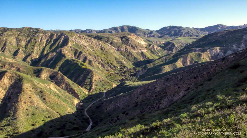
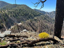
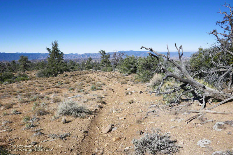
Several good runs start at the Chumash trailhead, and many variations are possible. It’s 2.6 miles up the trail to Rocky Peak Rd, and from there you can do out and backs north or south along the fire road, or loops via Las Llajas canyon, the Hummingbird Trail, or the Lower Stagecoach Trail. (Photo from a run on September 14, 2005.)
Whether it’s raining, 100 degrees, or snowing (!) you’re likely to see someone hiking, mountain-biking, or running Rocky Peak road in Rocky Peak Park. Switchbacking up from the 118 freeway, the fire road climbs along the spine of the Santa Susana mountains. It’s proximity to the San Fernando and Simi Valleys, and array of route variations, make it the choice of many for a morning or afternoon workout.
It’s not because it’s easy — the route is steep from the start, gaining 500 ft. in the first three-quarters of a mile, and 1200 ft. in just over 2 miles.
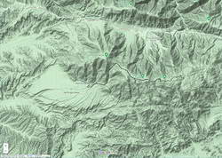
Following are some approximate one-way distances and elevation gains.
Hummingbird Trail: 0.8 miles 500 ft.
High point at turnoff to peak: 2.4 miles 1200 ft.
Johnson Motorway: 3.2 miles 1350 ft.
Chumash Trail: 3.8 miles 1390 ft.
Fossils: 4.8 miles 1800 ft.
Las Llajas Loop turnoff: 5.5 miles 1950 ft.
End of Rocky Peak Rd at Las Llajas Cyn Rd.: 6.3 2070 ft.
At times the site of a religious colony, a grit mine, an oil field, and a housing development, Las Llajas Canyon is now part of the Marr Ranch Open Space and Rocky Peak Park. Its oak groves, gurgling stream, varied plants, and unique geology make it a popular place to hike, run or ride.
According to California Place Names, Las Llajas might have originated from a misspelling of the Spanish word “llagas,” which literally means sores or wounds. Perhaps this was a reference to the area’s natural oil seeps. These would have been an important resource for the Chumash and early settlers.
The trailhead for Las Llajas Canyon is on Evening Sky Drive in Simi Valley. From the trailhead, it’s about 3.4 miles up the (mostly) dirt road to a windmill and oak-shaded trail junction. From the junction, a connecting trail crosses the creek and then climbs steeply to Rocky Peak Road. A strenuous 9.2 mile loop — Chumash-Las Llajas Loop — follows this route.
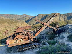
There are also some less-used side trails in Las Llajas Canyon. A use trail on the canyon’s east side starts about 0.4 mile from the trailhead and connects to Rocky Peak Road near the highest point in Rocky Peak Park. A very steep, eroded hill marks the beginning of the route. The trail ends at a large cairn near Rocky Peak Road. Fossiliferous limestone, composed of seashells, is found here. It is similar to that found at Coquina Mine.
About a half-mile up the trail splits — the Coquina Mine use trail switches back to the right, while a trail connecting to the Marr Ranch Trail continues straight ahead. After the switchback, the Coquina Mine trail traverses across a steep, rocky face that overlooks Las Lajas Canyon and then continues to the top of the peak. As the trail winds up the mountain, there are bits and pieces of rusted mining equipment and abandoned dig sites — signposts of success and failure on the meandering trail of time.
“Thank you so much for this extraordinary image of a P&H 206! Our company built Model 206 machines during the 1920s and 1930s. They were offered in shovel configuration, such as the machine you discovered in Southern California, and also in construction crane, dragline, clamshell, pile driver and backhoe options. It is amazing to behold such a well-preserved Model 206. The arid environment must be a factor.”
“During the last 20 years there has been irregular production from deposits of shell limestone on Rancho Simi, north and east of north from Santa Susana. The quarries are on hills 2 1/2 miles apart and 1 to 2 miles from the Los Angeles County line.”
The report goes on to summarize the operation at Coquina Mine:
“In 1929 Tapo Alto Shell & Fertilizer Company leased the deposit and produced limestone until 1935. They dug limestone with a 1/4-cubic-yard gasoline shovel, and screened and crushed it in a plant having a daily capacity of 15 tons. The principal product was poultry grit…”
“Present quarry is 200 feet long by 70 feet wide, with a 40-foot face. Material is handled by gasoline shovel, having a 1/4-yard dipper, into a l 1/2-ton truck which hauls it about 200 feet to the brow of the hill where it is dumped into a chute 300 feet long. This chute empties into a hopper which discharges into the boot of an elevator; to trommel screen, 4-mesh, screenings to bin, thence to elevator and Cottrell vibrating screens ; products to two-compartment bin ; over-size from trommel to rolls and bin. The plant is so arranged that either product can be put on dump by means of a conveyor. Plant is operated by 25-h.p. Fairbanks Morse gas engine. Plant has a daily capacity of about 15 tons. Products are — 8 + 10-mesh for chickens and — 10-mesh for little chicks.”
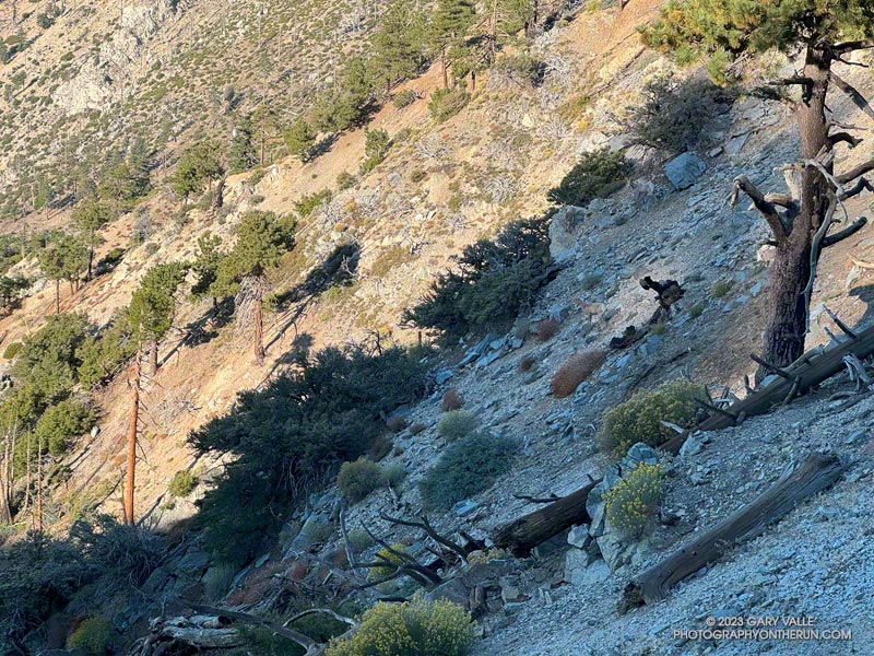
Bighorn sheep blend into the rocky terrain near Windy Gap
Had they not dislodged some rocks, I doubt I would have seen the three bighorn sheep in the photo above. They are easier to see in this zoomed-in photo of the sheep descending the rocky slopes just below Windy Gap (7,588′) in the San Gabriel Mountains. They crossed a brush-covered rib and disappeared from view.
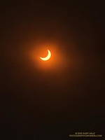
The partially-eclipsed sun crests a ridge east of Windy Gap.
A few minutes after seeing the sheep, I reached Windy Gap and stopped to put my arm sleeves away. It had been cool at the trailhead — about 40 degrees — but the temperature had warmed as I worked up the trail. As its name suggests, the wind can be fierce at Windy Gap, but this morning there was almost no wind, foretelling nearly ideal weather for today’s adventure.
Windy Gap was still in shade, and the sun was just peeking over the ridge to the east. You couldn’t tell, but the eclipse had already begun. The eclipse would be nearly total in parts of Oregon, Nevada, Utah, New Mexico, and Texas. In the Los Angeles area, the moon would obscure more than 70% of the sun’s disc.
Partially eclipsed sun.
From Windy Gap, I headed east on the Pacific Crest Trail toward Mt. Hawkins. From time to time, I would stop and check the progress of the eclipse using eclipse sunglasses. In sunny areas, I looked for lensed images of the sun in the shadows of trees but didn’t see any. Having needles instead of leaves, conifers don’t produce the myriad images of the eclipsed sun seen under trees with leaves.
With nearly three-quarters of the sun obscured, the light from the sun had become enfeebled. The feeling was more than that of a cloud passing in front of the sun. I stopped and listened… to nothing. It was eerily quiet. No birds called or sang, and only chill zephyrs of wind wafted about the area. Somehow, the sun was broken.
The south ridge of Mt. Lewis can be accessed from the CalTrans shed at Dawson Saddle.
As the eclipse slowly waned, I continued east in the corrupt light, past Mt. Hawkins and Throop Peak, to the PCT’s junction with the Dawson Saddle Trail. In what seemed fitting for the day, instead of continuing to Baden-Powell, I turned left and headed down the trail toward Angeles Crest Highway (Highway 2).
Why? Angeles Crest Highway was closed from Red Box to Vincent Gap, transforming Dawson Saddle into one of the more isolated areas of the Angeles National Forest. I hadn’t been on the Dawson Saddle Trail in years, and with Highway 2 closed, it would be a quirky way to climb Mt. Lewis. Instead of having one of the shortest approaches in the San Gabriels — a few feet from the CalTrans shed at Dawson Saddle — it would involve a trail run of nearly eight miles just to get to the base of the peak.
Angeles Crest Highway from the shoulder of Mt. Lewis.
The eclipse was nearly over when I reached the bottom of the Dawson Saddle Trail on Highway 2. From the trailhead, I ran up an empty Angeles Crest Highway a short distance to Dawson Saddle. Mt. Lewis’ south ridge was accessed from here.
Only about a half-mile long, the south ridge isn’t technical, but the first third is steep and rocky. The elevation gain from the saddle to the summit is about 500′. Offset from the crest of the San Gabriels, the flat summit of Mt. Lewis has unique views of the crest extending from Mt. Baden-Powell to Mt. Islip and beyond.
After a few minutes enjoying the summit, I turned southward and began working my way back down to Angeles Crest Highway, up to the PCT, over to Windy Gap, and back down to the trailhead in the Crystal Lake Recreational Area.
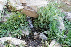
A couple leaving the camp saw that I was trying to collect drips of water from the nearly dry spring. I told them I was OK, and had water in my pack — I was just using a makeshift cup to get a couple of mouthfuls of cool water from the slowly dripping spring.
I had stopped at Sheep Camp (8300′) in the Chumash Wilderness, in Los Padres National Forest. The day was warm and the spring at the camp is usually a refreshing stop on the way back to Mt. Pinos and the trailhead at the Chula Vista parking area. Earlier, I’d talked to a runner training for the Kodiak 100, and he’d mentioned that the spring was a key source of water for his dog.
Trying to collect a mouthful of water from the spring at Sheep Camp
In recent years water has sometimes been an issue at the Sheep Camp spring. In July 2018, six out of the past seven Rain Years had been dry, and the flow of the spring was just a trickle. But it had been enough to slowly refill my Camelbak (TM) and get me down to Lily Camp (6600′) and back. Not so today.
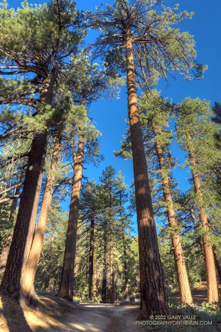
Even without the water, Sheep Camp is a pleasant and worthwhile detour. Old growth pines tower above and bright yellow sneezeweed and other flowers are sprinkled about the forest floor. In the Spring large patches of iris bloom in the damp areas.
Today, I was returning from Mt. Abel, after having done Mt. Pinos, Sawmill Mountain, and Grouse Mountain on the way to Mt. Abel from the Chula Vista parking area. Here is an elevation profile of the run/hike. The cumulative elevation gain on the 15.5 mile run is about 3700′.
North summit of Grouse Mountain.
The short side trips to the summits of Mt. Pinos and Sawmill require almost no extra effort, and the view from Sawmill — if it’s not too smoky or hazy — is wide-ranging. Getting to the twin summits of Grouse takes a bit more work, but it’s fun to follow the short use trail up the south summit and then to wander through the pines to the slightly taller north summit.
The descent that follows — down the use trail from Grouse and then down the Vincent Tumamait Trail to Puerto del Suelo, drops about 1000′ in elevation over 1.6 miles. This, of course, must be repaid on the way back!
When you reach the road at the end of the Vincent Tumamait Trail, you might remark, “But there’s no trail to Abel!” And you would be correct. It’s fairly straightforward to trek up through the forest from the road, though care is required due to the debris from forestry work in the area.
Rabbitbrush and paintbrush along the Vincent Tumamait Trail, northwest of Mt. Pinos.
Mesa Spring Trail near the top of San Emigdio Mesa.
For many that enjoy the outdoors, there is an insatiable desire to go where we have not been, learn what we do not know, and discover what we have not experienced.
Each time I’ve done the out and back trail run from Mt. Pinos to Mt. Abel, I’ve been curious about the Mesa Spring Trail. The trail leaves the Tumamait Trail at Puerto del Suelo, a saddle about 0.6 mile east of Mt. Abel Road, and descends to a campsite at a spring on the margin of San Emigdio Mesa. The mesa is the large alluvial fan shown on this Google Terrain Map overview.
The Mesa Spring Trail is part of an old trail shown on the USGS 1903 Mt. Pinos topo map. The old trail was part of a route that connected the Cuyama River to the historic El Camino Viejo a Los Ángeles. It followed Dry Canyon, went over Puerto del Suelo, and to the valley that is now the Pine Mountain Club. Like so many trails, it must have evolved from a hunting and trade route.
Google Terrain map showing San Emigdio Mesa and my route from Mt. Pinos
The Mesa Spring Trail is usually accessed from the West Tumamait Trailhead on Mt. Abel Road. But it occurred to me that starting at the East Tumamait Trailhead on Mt. Pinos might be an enjoyable way to do a longer out and back run. The Mesa Spring Trail looked like it might be similar to the North Fork Trail — a little less used and a bit more remote.
I left the Chula Vista parking area a little before 7:00 a.m. and started chugging up the road to the East Tumamait Trailhead at the Mt. Pinos Condor Observation Site. I planned to skip the usual side trips to Sawmill and Grouse. The spring was at a much lower elevation, and I wanted to get there before the temperature sizzled.
Once on the Vincent Tumamait Trail, it took a little over an hour to reach the top of the Mesa Spring Trail. The junction is marked with a new sign and tree branches on the ground. It is about 5.7 miles from the Mt. Pinos parking area.
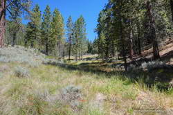
Plant communities change dramatically with elevation. This Jeffrey pine forest is at about 7000′.
The first couple of miles down from the junction, the trail more or less follows the drainage. About 10 minutes from the junction, a large pine tree had fallen and completely blocked the trail. I worked around the right (west) side of the tree, where some orange fence posts had been placed. A few minutes beyond the collapsed tree, the trail wandered around the right side of a pretty meadow and then back to the “V” of the dry stream.
For the next mile or so, the trail followed a typical down-canyon route. On the way down, there were some spots where I stopped, turned around, and made a mental note of what the trail did. It wasn’t so much a matter of getting lost, as it was not wasting time at an ambiguous spot on the way back.
About 2.3 miles down from the saddle, the trail climbed out of the canyon, taking a counterintuitive turn to the right. After reaching a ridgeline, the trail turned back left and continued downhill. But its wanderings were not over. The trail was working across the gullies at the top of the San Emigdio Mesa. It went up, down, and around, but eventually did go to Mesa Spring. There were “ducks” marking the route, but it really helped to have looked at a map and have a general idea of where the trail would go.
Mesa Spring is on the northern margin of San Emigdio Mesa.
Mesa Spring is a pretty green spot in a group of pinyon pines. As I neared the spring, I saw some coyote-like ears bobbing through the sagebrush, and not long after that, a deer bounded through the trees. At the spring, a squirrel leaped from the edge of the water-filled cistern to a nearby tree and various birds flittered in the pines. I heard a trickle of water near the cistern’s base but planned to get water at Sheep Camp, later in the run.
With its bounty of pinyon pine nuts, acorns, juniper berries, game, and more, San Emigdio Mesa provided vital resources for the local Chumash.
Although the Mesa Spring Trail continues down the mesa, the spring was my turnaround point. I had waited for a day when the weather was better for this run. A weak low-pressure trough moving through to the north had stirred up a little wind and taken the edge off the recent heatwave. It had been cool on the crest, but at 6000′ it was already hot in the sun. It was time to get moving, and in a few minutes, I was retracing my steps and headed back to Mt. Pinos.