Category Archives: weather

San Gorgonio Mountain Snow Follow Up

Hiker working up the Sky High Trail on San Gorgonio Mountain in Southern California
Hiker on the Sky High Trail

One of the things I’d been curious to see when running the Kodiak 50K in mid-August was how the summit snow band on San Gorgonio Mountain was holding up. The answer turned out to be fairly well. Now, a few weeks later, I was back on Gorgonio, chugging up the South Fork Trail, and on my way to see if any snow remained on the mountain.

Runoff from thunderstorms during the week had left the trail rocky and rutted. From the views of the mountain I’d glimpsed from the trail, I wondered if the rain had also washed away any remaining patches of snow.
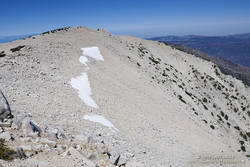
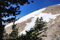
Snow band near the summit of San Gorgonio Mountain. September 7, 2019.
Snow band near the summit of San Gorgonio Mountain on September 7, 2019.

In addition to that question, I also want to follow up on my earlier “field checks” this Summer and see how much water there was in Dry Lake, and if any snow remained in the avalanche debris above Dry Lake.

I was about a quarter-mile from the Dry Lake – Dollar Lake junction at South Fork Meadows, making decent time, when I heard footsteps behind me. I stepped to the side so he could pass, and we talked as we worked up the trail. Kevin said he’d been climbing in the Sierra just about every weekend and was really well-acclimated.

I asked him what route he was doing to the summit, and he said the Dry Lake route. I told him I was doing the Dollar Lake Trail route up and the Dry Lake route down. He was clearly moving faster than me and said he was shooting for a time of 4:20 to the summit. I mentioned the Dollar Lake route was shorter and faster, and depending on the number of stops for photos, I expected to get to the summit in around 3:45. We talked about some Sierra peaks and being in the mountains, and after a couple of minutes, he began to pull away.
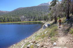
Trail runner at Dry Lake on San Gorgonio Mountain
Dry Lake on September 7, 2019.

The early morning temperature had been a little more chilly than my earlier trips up Gorgonio this Summer. I debated pulling on my sleeves, but by the time I was in the sun on the Dollar Lake Trail, the temperature had warmed to a comfortable 50-something — perfect for ascending the peak.

The summit of San Gorgonio was a very busy place when I arrived. I’d estimate 40-50 people were on or around the summit. Most were part of one huge group that had come up Vivian Creek.

The good news was part of the summit snow band had not melted. Wow! It was September 7, and there was still snow in Southern California!
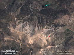
Copernicus Sentinel satellite imagery of snow on San Gorgonio Mountain on August 27, 2019.

Kevin caught up to me on the descent of the Sky High Trail. We’d both made the summit within a couple of minutes of our projections, leaving little doubt that the Dollar Lake Trail is the fastest route to the summit from the South Fork Trailhead.

I didn’t see any snow remaining in the avalanche debris above Dry Lake. The lake itself was in great shape, and the streams at South Fork Meadows were flowing nearly as vigorously as they had been a month ago.

I’ve added a couple of photos from this trip to the San Gorgonio Mountain Snow, Avalanches and Glaciers slideshow.

Update November 26, 2019. A small amount of snow from the 2018-19 season has survived on San Gorgonio Mountain until the first persistent snow of the 2019-20 season! Copernicus Sentinel satellite imagery from November 17, 2019 showed small patches of snow in two areas. The first winter storm of the season brought snow to the mountains a couple days later, and more snow is expected over the Thanksgiving holidays.

Update October 21, 2019. Copernicus Sentinel satellite imagery from October 21, 2019 still showed a few very small patches of snow on San Gorgonio Mountain. One of the patches is at a surprisingly low elevation of about 10,360′.

Update September 18, 2019. Copernicus Sentinel satellite imagery from September 18, 2019 still showed a few small patches of snow on San Gorgonio Mountain.

Related post: San Gorgonio Mountain Snow, Avalanches and Glaciers

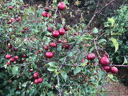
Hollyleaf Redberry Along the Sage Ranch Loop Trail

Hollyleaf Redberry Along the Sage Ranch Loop Trail
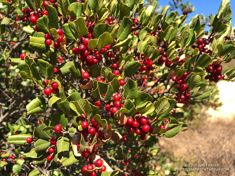
Hollyleaf Redberry

As is usual, it’s been hot and dry in the Los Angeles area this summer. Most of the low elevation wildflowers have come and gone, and the last measurable rain at Downtown Los Angeles (USC) was more than 90 days ago.

Holly-leaved cherry along the Backbone Trail
Holly-leaved cherry along the Backbone Trail.

Even so, there are still some colorful reminders of our wet 2018-19 rain season sprinkled along the trails of the Santa Monica Mountains and Simi Hills.

In the wake of all that rain, and the blooms that followed, several chaparral shrubs have had large crops of berries and fruit, among them hollyleaf redberry (Rhamnus ilicifolia), holly-leaved cherry (Prunus ilicifolia), and toyon (Heteromeles arbutifolia).

Are they edible? While all three plants were used as food sources by indigenous populations, knowledge of appropriate use and preparation is essential for safe consumption.

San Gorgonio Mountain Snow, Avalanches and Glaciers
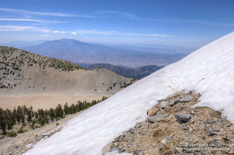
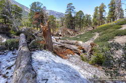
Snow on the Sky High Trail on San Gorgonio Mountain on July 27, 2019.
Snow on the Sky High Trail on San Gorgonio on July 27. San Jacinto Peak is in the distance.

Update July 21, 2023. Another big snow year. This Google Earth image of San Gorgonio Mountain is overlain with Copernicus/ESA Sentinel 2 imagery taken on July 19, 2023. The GPS track (yellow) is the upper portion of the Dollar Lake – Dry Lake Loop, a keyhole loop that starts at the South Fork Trailhead.

The weather was Southern California perfect. Shorts and short-sleeves were the dress of the day. Winds were light, no thunderstorms were in the forecast and no large wildfires polluted the air. Although temps in the valleys were nearing 100 degrees, the weather on the summit of 11,499′ San Gorgonio Mountain was altitude-conditioned bliss.

I’d spent about 15 minutes enjoying the summit, then run back down the Summit Trail. Turning left onto the Sky High Trail, I continued a keyhole loop that had ascended the South Fork Trail, Dollar Lake, and San Bernardino Divide Trails. Altogether, the route was about 21 miles long and the approximate elevation gain/loss was 4700′.

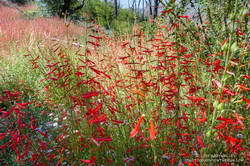
San Gabriel beardtongue (Penstemon labrosus) along the South Fork Trail.
Penstemon along the South Fork Trail.

From the start of the run, the effects of the wet 2018-19 Winter and big snowpack were everywhere. Wildflowers bloomed in profusion, seeps and small streams greened the landscape, and grasses and ferns grew thick beneath the trees. The roar of the streams at South Fork Meadows left little doubt as to what kind of Winter it had been.

On the way up the Dollar Lake Trail, I’d seen elongated patches of snow in the chutes along the crest. While there was no snow directly on the trail between Dollar Lake Saddle and the summit, there was more snow than usual on the north side of the peaks.

But there was snow on the Sky High Trail. Topping out at over 11,300′, the Sky High Trail is one of the most spectacular trails in Southern California. I marvel at its airy location every time I run it. Near the top of the trail, I’d crossed a small patch of snow and thought, “Well, at least there was a little snow on the trail.”

Large patch of snow on the Sky High Trail at an elevation of about 11,100' on July 27, 2019.
Large patch of snow on the Sky High Trail at an elevation of about 11,100′ on July 27, 2019.

A little disappointed, I’d put my poles away and continued running down the trail. At around 11,100′ I rounded a corner and surprise, surprise — there was a much larger patch of snow on a southeast-facing section of trail. It was about 100 yards across and steep enough that a fall would be a bad idea. Fortunately, the snow conditions were perfect. A few hikers had recently traversed the snowfield, and I followed in their footsteps.

However, that wasn’t the last of the snow. At an elevation of about 10,200′, not far past the C-47 crash site, the trail crosses a long chute that extends nearly to the top of Gorgonio. The snow in that chute had melted just enough that a thin strip of trail was exposed.

Thinking that had to be the last of the snow, I continued the traverse to Mineshaft Saddle (9936′) and began the descent of the Dry Lake Trail. Once past a rocky section of the trail, I picked up the pace, energized by the increased oxygen at lower elevation. Enjoying the downhill, I descended into an area of converging chutes and gullies, when the path through the lodgepole forest abruptly ended.

Avalanche debris on the Dry Lake Trail above Dry Lake. July 27, 2019.
Avalanche debris on the Dry Lake Trail above Dry Lake.

The trail was obliterated. Large trees were ripped from the ground, broken, tossed, and piled up as if they were matchsticks. Underneath the debris were mounds of dense, icy snow — the remnants of an avalanche. This report on SoCalSnow.org includes photos of an avalanche in February 2019 on the north face of San Gorgonio and mentions previous avalanches.

That snow, at an elevation of about 9400′, had finally been the last on the trail. Because the compressed snow is effectively a big block of ice, it could be around for a while.

In the area of the avalanche, the Dry lake Trail enters a large area of rocky rubble that extends into the Big Draw. According to the Dibblee Geologic Map for San Gorgonio Mountain, this rubble is glacial till, produced by the largest of several pocket glaciers that existed on San Gorgonio Mountain, Shields Peak, and San Bernardino Peak.

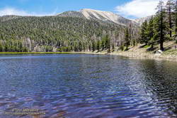
San Gorgonio Mountain's summit, on the left of the crest, is more than 2400' above Dry Lake.
This is the first time Dry Lake has been full this time of year since 2011.

Continuing down the trail to Dry Lake I saw where some of this season’s meltwater had gone — for the first time since 2011, Dry Lake was full in late July.

Last Saturday’s run was so enjoyable that yesterday I went back to Gorgonio and did it again. As might be expected during a Southern California Summer heatwave, the snow on the Sky High Trail, and elsewhere, is melting fast and won’t be around for long.

Here are a few photos taken along the way. The album includes photos from both the July 27 and August 3 runs. A couple of photos from a run on September 7 were also added.

Some related posts: San Gorgonio Mountain Snow Follow Up, Still a Little Snow in Southern California; San Gorgonio Mountain: Falls Creek Loop, August 2017; After the Lake Fire: The Dollar Lake – Dry Lake Loop on San Gorgonio Mountain

Upper Las Virgenes Creek Still Flowing in Mid-July

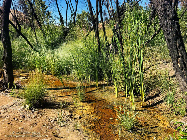
Upper Las Virgenes Creek, July 17, 2019.

Following our five year drought, Downtown Los Angeles and many neighboring areas recorded above-average rainfall in two of the last three rain years. This has had obvious and observable effects on the area’s plants and animals and aided in the ongoing recovery of habitats affected by drought and wildfire.

This is the first time since the Summer of 2011 that there has been flowing water in upper Las Virgenes Creek in mid-July at the crossing near the Cheeseboro connector. It’s just a trickle, but keep in mind that during some of the drought years, this section of upper Las Virgenes Creek never flowed.

Update November 19, 2019. Increased surface water and pooling in Upper Las Virgenes Creek. See the post Running Into Fall.

Update August 28, 2019.  The surface flow of Upper Las Virgenes Creek near the Cheeseboro connector is down to a bare trickle and some small pools.

Update August 7, 2019. Upper Las Virgenes Creek is still trickling.

Notes: In rain year 2016-17 Downtown Los Angeles (USC) recorded 19.00 inches of rain from July 1 to June 30, and in 2018-19, 18.82 inches. During the intervening rain year, 2017-18, only 4.79 inches was recorded.

Warming Up for the ANFTR Trail Races

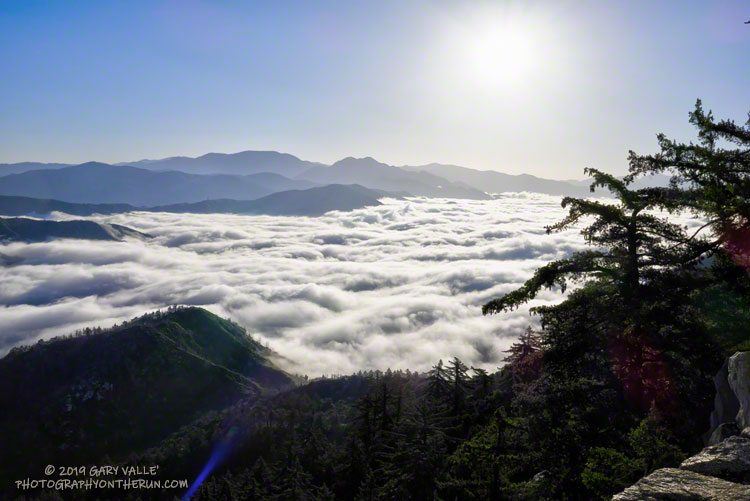
Stratus in the San Gabriel River drainage from Mt. Wilson road.

Was back on Mt. Wilson this morning, enjoying the mountains, and getting in a little more training for the upcoming Angeles National Forest Trail Run races.

There were already two cars parked in the loop road turnout when I got there, and another car pulled in behind me. All were runners.

The turnout is near the start of the ANFTR course and most of the runners were planning to do the ANFTR 25K loop or a variation. One runner — training for the ANFTR 60K and AC100 — was doing the 50K course.

The extensive layer of low clouds in the canyons of the West Fork and East Fork San Gabriel River at the start of the run was indicative of a cool onshore flow. Too cool and comfortable, really. Anticipating warmer temperatures for the ANFTR race, I wore an extra layer for the run, and probably should have worn more.

The last two years the ANFTR races have been run during record-setting heatwaves. We’ve had a lot of cool weather this year and for a while it looked like the pleasant weather might carry over to race day, July 6. But following the finest of ANFTR/Mt. Disappointment traditions, it now looks like temps will probably be warming up for the race. Maybe not quite as hot as the last two years, but still on the toasty side. We’ll see!

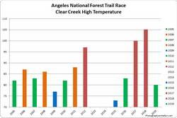
The highest temperature recorded at Clear Creek on the day of the ANFTR/Mt. Disappointment races for 2005-2019.
High at Clear Creek for the 2005-2019 ANFTR/Mt. Disappointment races. Click to enlarge.
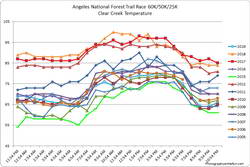
Average hourly Clear Creek temperatures on the day of the ANFTR/Mt. Disappointment races for 2005-2019.
Hourly Clear Creek temperatures for 2005-2019 ANFTR/Mt. Disappointment races. Click to enlarge.

Update Thursday, July 11, 2019. As it turned out, temperatures for the 2019 edition of the Angeles National Forest Trail Run were in the “middle of the pack” compared to other years. The high temperature recorded at the Clear Creek RAWS on July 6 was 80°F. This was down 25°F from 2018. Hourly fuel temperatures at Clear Creek ranged from 101°F to 104°F between noon and 5:00 pm. The high at the Mt. Wilson RAWS on July 6 was 75°F, down 20°F from 2018.

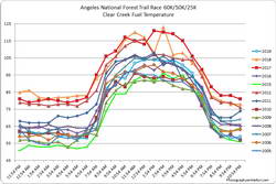
Average hourly Clear Creek fuel temperatures on the day of the ANFTR/Mt. Disappointment races for 2005-2019.
Hourly Clear Creek fuel temperatures for the 2005-2019 ANFTR/Mt. Disappointment races. Click to enlarge.

Note: The temperature in a commercial weather station is measured inside a white, ventilated instrument housing, several feet off the ground. Mid-day temperatures in the sun, in the summer, with a cloudless sky will be much warmer than this. Some stations, such as Clear Creek, also measure the fuel temperature — the temperature of a pine dowel in direct sun about a foot off the ground. According to the NWS (and common sense) exposure to full sunshine can increase heat index values by up to 15°F. In my experience the fuel temp gives a better indication of the actual temperature a runner can experience in the sun, especially on exposed mountain slopes facing the sun.

Update Monday, July 1, 2019. Last week the GFS weather model was forecasting temps on race day to be near 100 at the lower elevations and over 90 on Mt. Wilson. This morning’s GFS max temperature forecasts are down about 10 degrees from that. Basically highs in the low 90s (in the shade) for the lower elevations and around 80 at Mt. Wilson. Temps in the sun, especially on exposed sun-facing slopes, could still top 100. If the forecast holds, the temperatures today should be similar to those on race day. We’ll see! Here are links to the Clear Creek RAWS and Mt. Wilson RAWS.

Some related posts: ANFTR/Mt. Disappointment 2019, Another Scorching Angeles National Forest/Mt. Disappointment Trail Race, Record Heat for the 2017 Mt. Disappointment 50K & 25K

Lasky Mesa: Dark Clouds and Sun

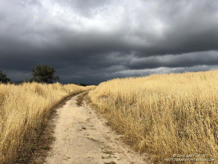
Dark Clouds and Sun. Photography by Gary Valle'.

From a run this May in Upper Las Virgenes Canyon Open Space Preserve (Ahmanson Ranch).

Normal rainfall for May at Downtown Los Angeles (USC) is 0.26 inch. This year Los Angeles recorded 0.81 inch in May, according to the NWS .

It was definitely wet and cool! Nineteen days were partly cloudy to cloudy. Ten days recorded at least a trace of rain. The average high was 70 degrees.

Oddly, during our recent drought, above normal May rainfall totals were recorded in 2011 (0.45 inch), 2013 (0.71 inch), and 2015 (0.93 inch). The most rainfall recorded in May at Los Angeles was 3.57 inches in 1921.