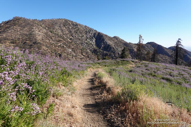
Poodle-dog Bush along the Pacific Crest Trail near Islip Saddle with Mt. Williamson in the background.
Nope, my eyes weren’t deceiving me, the hiker was carrying his full-size poodle up the trail.
I was running down the PCT, east of Islip Saddle, after a run/hike to Mt. Hawkins and Throop Peak. I’m guessing the hiker was carrying his dog to keep it out of the Poodle-dog Bush on both sides of the trail.
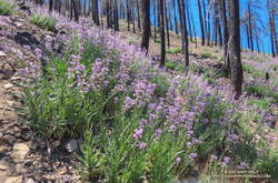
Poodle-dog bush along the PCT above Islip Saddle
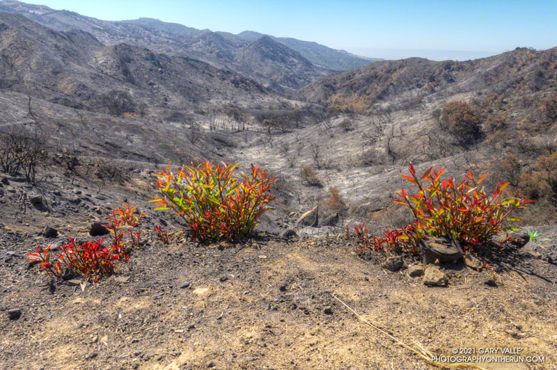
Poodle-dog Bush (Eriodictyon parryi) is a fire-follower that can cause severe dermatitis in some people. In this case the plants sprouted following the 2020 Bobcat Fire.
The last big outbreak of Poodle-dog Bush followed the 2009 Station Fire. At that time many people were unfamiliar with its potential effects, and were caught off-guard.
The plant can get you in a couple of ways — the plant’s resin can affect sensitized people in a manner similar to poison oak, and the plant’s numerous hairs can break off and irritate the skin.
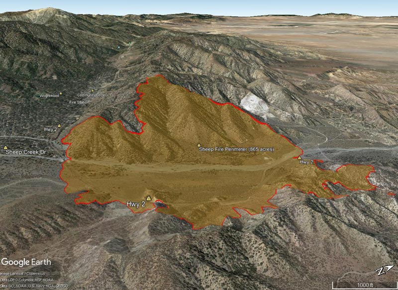
Good news! According to the Sheep Fire Incident Page on InciWeb, as of yesterday evening the fire was 90% contained. Full containment is currently projected to be on June 22, 2022 by about 6:00 PM.
The Google Earth image above, and the interactive map linked below, show just how close the fire was to Wrightwood.
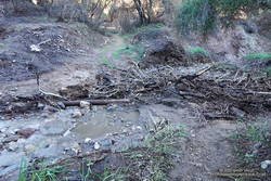
I had just waded down a 50 yard stretch of creek where the Santa Ynez Canyon Trail used to be. Three hikers working up the canyon were trying to find a way past the flooded section without getting their boots wet. That wasn’t going to be easy.
Debris at creek crossing in Santa Ynez Canyon.
I had been doing the same thing higher in the canyon. It was a chilly morning, and I had no great desire to soak my shoes in cold water. The usual rock and limb crossings had worked well until the trail ended in a broad area of flowing creek. Once my shoes were wet, it simplified the process.
That the trail was flooded following several days of rain wasn’t that surprising. What was a surprise is that there hadn’t been higher flows and more damaging flash floods in the canyon.
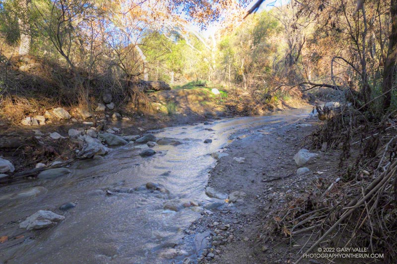
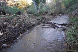
Creek crossing near the Santa Ynez Canyon Trailhead
Santa Ynez Canyon was the focus of the May 2021 Palisades Fire, and a large part of the drainage was burned to a moonscape. Burned slopes often amplify runoff from heavy rain, producing damaging flash floods and debris flows. While there was clearly high flows in the canyon, the levels were less than what I’ve seen in similar circumstances, in other burn areas. One possibility is that unburned trees and brush along the streambed higher in the canyon had attenuated the flow.
After doing the out and back on the Santa Ynez Canyon Trail, I continued down to Trippet Ranch and then, like last week, returned using the Musch, Garapito, and Bent Arrow Trails.
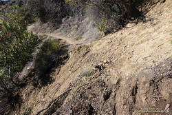
Section of the Bent Arrow Trail damaged by a slide
There were a number small rock slides, sluffs, and sediment flows along the trails and roads. A couple of people were working on clearing the limbs and small trees that had fallen across the Garapito Trail. The collapsed oak at the bottom of the Garapito Trail had settled, and was easier to get through this time.
The trail that really took it on the chin was the Bent Arrow Trail. Several sections of the trail were damaged by slides.
I usually do the Santa Ynez Canyon Trail as part of the Trailer Canyon – Santa Ynez – Trippet Ranch Loop. Tacking on the trail as an out and back addition to the loop was slightly shorter, but had a little more elevation gain/loss.
From mid Summer into Fall, the vibrant yellow flowers of rabbitbrush add a refreshing hit of color to the greens, grays, and browns of the San Gabriel Mountains.
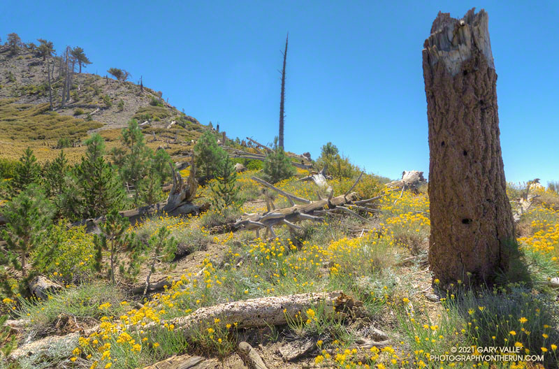
The title photo was taken along the PCT, at an elevation of about 8600′, near Mt. Hawkins. The area was burned in the 2002 Curve Fire. Here, and elsewhere in the burn area, new trees — now in their teens — are slowly replacing some of the trees lost in the fire.
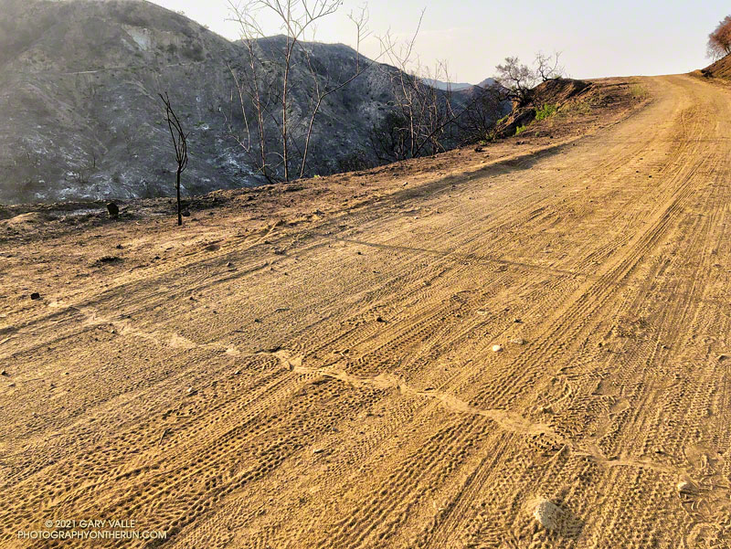
The rattlesnake track above was one of several snake tracks on Eagle Springs Fire Road this morning. This area, which is below Eagle Rock in Topanga State Park, was severely burned in the May 2021 Palisades Fire.
Laurel sumac crown sprouting along Eagle Springs Fire Road
The 2021 Palisades Fire began the evening of May 14, 2021 in Santa Ynez Canyon, near Michael Lane in Pacific Palisades. According to the Los Angeles Fire Department Palisades Fire incident page, 1202 acres were burned, one firefighter was injured, 710 structures were threatened, but no structures were damaged or destroyed. The fire was fully contained on May 26.
Most of Topanga State Park was closed as a result of the fire. The Park reopened, with restrictions, on June 11. On June 13, I found myself chugging up the Garapito Trail toward Eagle Rock, and wondering what I was going to find.
I was doing a variation of one of my favorite trail runs in the eastern Santa Monica Mountains — the Trippet Ranch Loop.
This trail run links together several single-track trails and fire roads between Marvin Braude Mulholland Gateway Park (Top of Reseda) and Trippet Ranch. With the addition of an out and back segment on the the Santa Ynez Canyon Trail, the route included all the trails impacted by the fire.