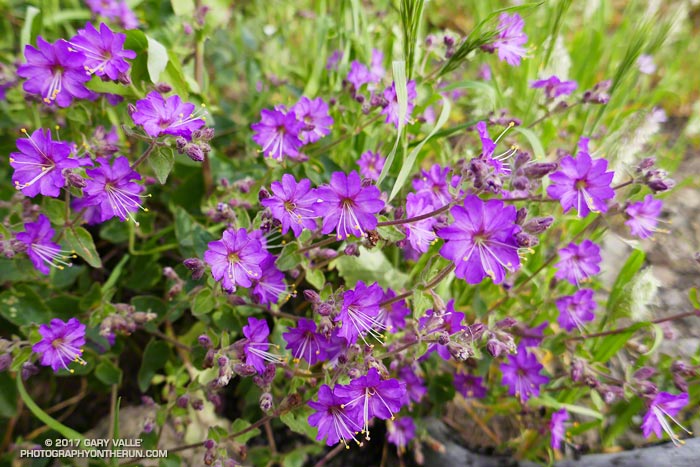
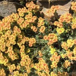
Wishbone bush (Mirabilis californica) likes full sun and is usually one of the first plants to bloom as Winter days slowly start to lengthen.
This plant is along the Old Boney Trail segment of the Backbone Trail near the Blue Canyon junction.
The plant’s name refers to its forked stems.
From Saturday’s out and back run to the Chamberlain Trail from Wendy Drive.
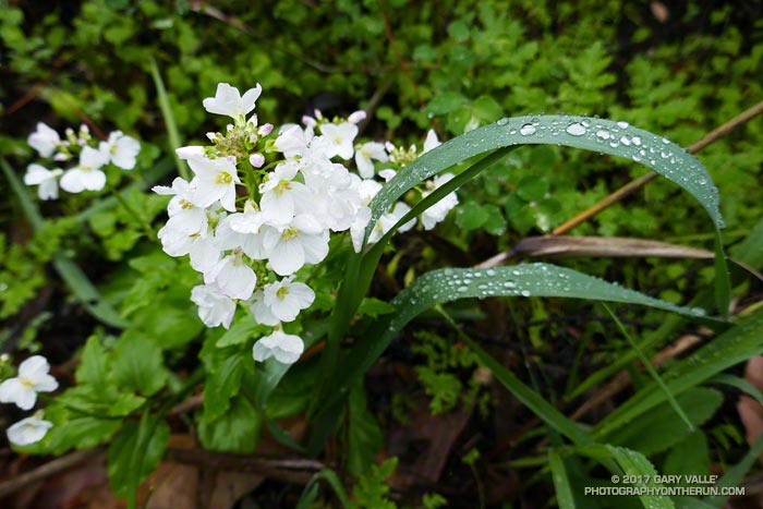
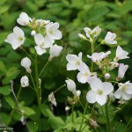
Milkmaids (Cardamine californica) are among the first flowers to bloom in the Santa Monica Mountains in the early Winter. The plant prefers the the coast live oak understory, and the four-petaled white blossoms stand out brightly in the shade of the trees.
These are along the Serrano Canyon Trail in Pt. Mugu State Park. This photo was taken February 4, 2017, but milkmaids were blooming on this trail as early as January 1, 2017.
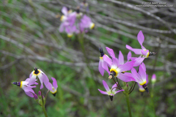
The title photo is Padre’s shooting star (Primula clevelandii, formerly Dodecatheon clevelandii) along the Old Boney Trail. Click an image below for more info and to display the image full-size.
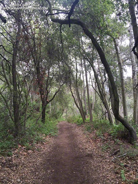
OK, the last few miles of last Saturday’s long run were a bit of a struggle. But the run was also a bit strenuous, so I tried not to read too much into it. The following morning I was up early enjoying the Winter green along the Garapito Trail. That run went well enough, but the weekend left me wondering if my revised training plan was going to work.
The plan for today was to do around 26 miles, but the question was what kind of 26 miles and where? After debating several options I finally settled on a run from Marvin Braude Mulholland Gateway Park at “the end of Reseda.” The route would merge the Will Rogers – Temescal Canyon loop with the Trailer Canyon – Santa Ynez Canyon – Trippet Ranch loop. The term “loop” is used loosely here, just meaning that the run starts and ends in the same place, but isn’t an out & back.
I’d done the loop a couple of years ago and my recollection was that it was around 26 miles with an elevation gain of something over 5000′. It’s a good run to do self-supported since water is usually available at Will Rogers, Temescal Canyon and Trippet Ranch. It can be brutal on a hot day, but that’s true of most lower altitude runs in Southern California.
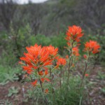
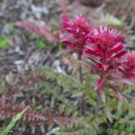
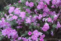
Rain-soaked Prickly Phlox
Hot temps were not going to be my problem today. Mostly cloudy skies were forecast with very light rain in the morning. The heavier rain was supposed to hold off until around midnight. It had already rained a little when I left for the trailhead, but conditions were supposed to improve during the middle of the day.
Running up to the Hub I had no clue how the run was going to go. I usually don’t until 2-3 hours into a long run. At around two hours I was at Will Rogers and feeling pretty good. At three hours I was nearing the “waterfall” in Temescal Canyon and at four making the turn left down Trailer Canyon.
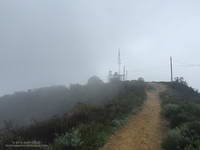
Green Peak on Temescal Ridge
Usually the decision to turn down Trailer Canyon is a painful one. You’ve done all that work to get up to Green Peak on Temescal Ridge and now you’re going to run down Trailer Canyon and give it all away? Today, for some reason, losing all that elevation and then having to gain it back again wasn’t a big deal — it was just another part of the course.
The run continued to be uncomplicated until near the rock slabs in Santa Ynez Canyon, when I decided to check the mileage on my Garmin. 20.2 miles… Hmm, that seems a little long… Is it only six miles back to Reseda? I don’t think so…
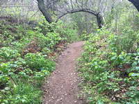
Poison oak on the Santa Ynez Canyon Trail
I still had over a mile to the Trippet Rnach parking lot and from there my usual route back to Reseda on the Musch, Garapito and Bent Arrow Trails would be around 7 miles. I briefly debated shortening the route. The thing is, despite last week’s issues, I felt good and the run was going well. The conditions were perfect, so why not run the route as planned?
As things turned out today’s run was 5 miles longer than last Saturday’s and had about the same elevation gain. Somehow that translated into a 30 minute faster run than last week and legs that weren’t stiff or crampy.
What changed from last week to this week? If only I could figure that out!
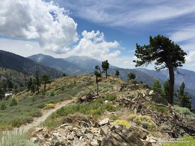
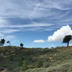
The day before the Angeles Crest 100, after checking in for the race in Wrightwood, I drove over to Inspiration Point to have lunch, go for a short hike, and enjoy being in the mountains. The day was exceptional.
Lightning Ridge skyline and clouds
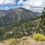
Pine Mountain and Mt. Baldy from Lightning Ridge
Blue Ridge, Pine Mountain and Mt. Baldy from Lightning Ridge
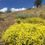
Sulphur flower
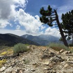
Mt. Baden-Powell from Lightning Ridge
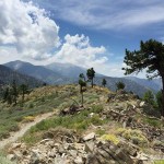
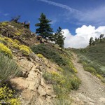
PCT near Inspiration Point
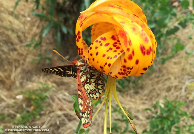
Sulphur flower along PCT near Inspiration Point
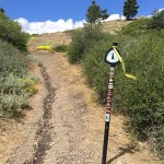
PCT marker at Inspiration Point
Click an image for more info and to display the image full-size.