Category Archives: running|adventures

July Fourth Trail Run to Trippet Ranch, Hondo Canyon and Saddle Peak

Bay trees on the Hondo Canyon Trail

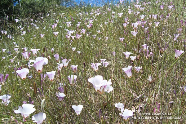
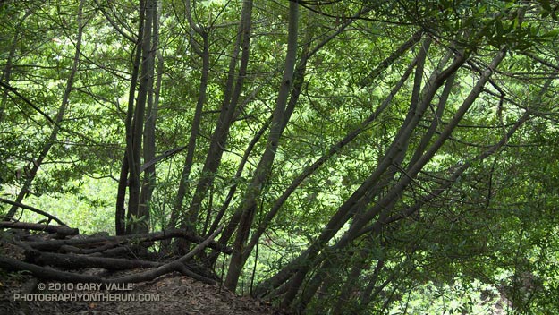
It was about 9:45 a.m., and I was switchbacking up through a surprisingly dense forest of California bay on the Hondo Canyon segment of the Backbone Trail. The trail was carpeted in bay leaves, and a hint of the sharp, sweet smell of bay lingered in the still morning air. It had been four years since I had run this trail, and I had forgotten just how lush and green it was. The geology, oaks, bay trees, ferns, and poison oak were spectacular.

The run from the end of Reseda to Saddle Peak (and back) was going well. The route was a tricky one, and it really helped that I had done it before. Lower in the canyon there had been a misleading Backbone Trail marker, and that was just one of several potential gotcha’s.

Even if you know the way, the run is no gimme. Depending on the route used, its length works out to around 26 – 28 miles, and it has a legit elevation gain/loss approaching 5000′. Throw in the route-finding challenges, and it’s possible to have a long day.

The run starts at Marvin Braude Mulholland Gateway Park, on the San Fernando Valley side of the Santa Monica Mountains. The first leg of the run goes to Trippet Ranch. I usually run the fire roads out to Trippet Ranch, and then take the Musch, Garapito, and Bent Arrow trails on the way back to Reseda.

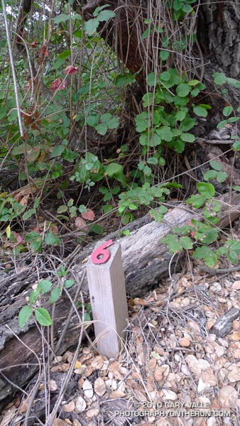
The route-finding fun begins on the Dead Horse Trail at Trippet Ranch. From Trippet Ranch to Saddle Peak the route is all on the Backbone Trail, and is (almost) all single track. Some of it is marked, and some of it isn’t. Some of it is obvious, and some of it is not.


The most obscure section is between Topanga Canyon and Old Topanga Canyon. From the Dead Horse Trail parking lot, the Backbone Trail starts behind the bathrooms and follows a brushy canyon down to Topanga Canyon Blvd. The trail picks up again across Topanga, about 50 yards west on Greenleaf Canyon Road. The trail is on the left, just before a creekbed, and leads uphill. There are some nature trail markers along the steep trail, and the top of the hill is about a quarter-mile from Greenleaf. From the top of the hill, the trail zigs south and zags west, working down to a dirt road. The route continues across the road and down an overgrown slope to the north side of the water tanks. A trail leads northwest from the water tanks and down to Old Topanga. The total distance from Topanga to Old Topanga is about 0.6 mile.

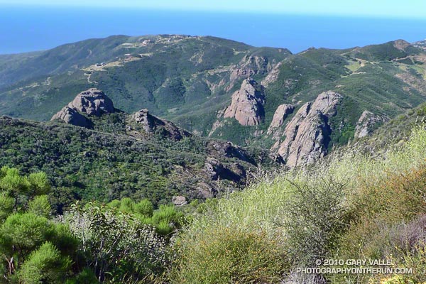
I was glad to have that convoluted stretch behind me. A few minutes ago I’d reached the top of Hondo Canyon, and turned onto the Fossil Ridge Trail. When the visibility is good, the views along Fossil Ridge and the crest leading to Saddle Peak are excellent. Today the marine layer had been slow to clear, and the tops of the peaks were cloaked in fog. The chaparral plants were so wet that I was able to squeeze a gulp of water from the brush-like flowers of a laurel sumac.


After about a half-mile on the Fossil Ridge Trail, I emerged from the chaparral, turned left on Topanga Tower Mtwy, and ran down to the popular overlook at the junction of Schuerren, Stunt, and Saddle Peak roads. Here I continued west across the highway and scrambled up to a ridgetop trail that leads to a big water tank. From the water tank it’s about  0.3 mile up the trail to the turn-off to Saddle Peak, and then another 0.4 mile to the summit. The western peak (2805′), the one with all the communications equipment, is the high point.

Keeping in mind that GPS traces are not exact, and the route I used isn’t necessarily the “official” or “best” route, here’s a Google Earth interactive view of a GPS trace of my 27.5 mile route.

Some related posts: Garapito Trail Runs, Born to Run, Musch Trail Mule Deer, Red Rock Canyon – Hondo Canyon – Saddle Peak Loop

Three Points to Waterman Mountain, the Long Way

Twin Peaks (East) from the Mt. Waterman Trail

Twin Peaks (East) from the Mt. Waterman Trail

Today was the first chance I had had to run the recently reopened stretch of the Pacific Crest Trail between Three Points and Cloudburst Summit. Originally within the Station Fire closure area, this segment of trail was reopened when the size of the closure area was reduced in late May. In addition to checking this section of the PCT, I also wanted to see the condition of the forest and trail at the current closure boundary near Mt. Waterman.


Pacific Crest Trail about a mile east of Three Points
Between Three Points and Cloudburst Summit, the PCT generally parallels Angeles Crest Highway (Hwy 2), and crosses the highway several times. In general, the burn severity along the trail appeared to match the burn severity depicted in the NASA Ikhana BAER image and Angeles National Forest BAER Station Fire Soil Burn Severity Map. In the first two miles some trees were lost, but much of the forest in the immediate vicinity of the trail did not appear to be severely burned.


That was not the case about a half mile west of Camp Glenwood, where the PCT crosses Hwy 2 and climbs up a hill. Here the burn severity was much higher, and most of the trees were killed. The trail was in good shape and it didn’t take long to get through this section and back into the unburned forest. Remarkably, Camp Glenwood was unscathed.

The remaining 3 miles to Cloudburst Summit were not burned. Some trail work had been done on this stretch, as well as down in Cooper Canyon. As always, the running through Cooper Canyon was superb. At the PCT’s junction with the Burkhart Trail, I turned right and climbed up to Buckhorn Campground, and then followed the camp entrance road up to Hwy 2.  From here it was a short jog west to the Mt. Waterman Trail.

Most of the forest of Jeffrey pine and incense cedar on the east side of Mt. Waterman was outside of the fire area, and it wasn’t until near the junction with trail 10W04, that some damage from the fire could be seen. It looked like spot fires had run up the mountain, burning primarily in the understory. The north face of Twin Peaks, across from Mt. Waterman, appeared to be unaffected by the fire.

It is unclear why the Forest Service chose to define the updated Station Fire closure area (Forest Order No. 01-10-02) so that the trail to Twin Peaks remains closed. Based on the Forest Service’s own BAER report, the burn severity down to Twin Peaks Saddle is generally categorized as low to very low/unburned, and the north face of Twin Peaks is outside of the burn area.

Some related posts: Cooper Canyon Cascade & Falls, Mt. Wilson Area Peaks From Twin Peaks

Father’s Day Out & Back to Mt. Baden-Powell

Snow on the PCT below the summit of Mt. Baden-Powell.

Brett was down for Father’s Day, and today we hiked/ran Mt. Baden-Powell (9399′). Baden-Powell is one of the most popular peaks in the San Gabriel Mountains, and several of my favorite trail runs visit its summit.


Lodgepole pine forest
The trail from Vincent Gap switchbacks up through an old-growth forest of Jeffrey pine, sugar pine, white fir and lodgepole pine. There are some impressive trees. The Wally Waldron Limber Pine, near the summit, is estimated to be 1500 years old, and some limber pines in the area are thought to be even older.

Today, the weather was perfect for pushing the pace. Along the trail fresh green growth could be seen on limb tips of the white firs, and yellow wallflower, red paintbrush, and blue larkspur added a mix of color to the understory.

Not far from the trailhead we had seen fresh Vibram FiveFinger (VFF) tracks headed up the trail, and we were talking about the minimalist shoe. Today Brett was in conventional shoes, but on his home trails about half his runs are in VFFs. He was recounting how the specialists doing a video gait analysis had been blown away when he switched from regular running shoes to VFFs.

I had asked Brett how many miles he had logged on his VFFs, but before he could answer, our conversation was interrupted by a loud shout of “25!” from somewhere on the trail above. A couple of minutes later, and a bit closer, there was another shout of “24!”

Named after the founder of the scouting movement, Mt. Baden-Powell is the culminating point of the scout’s Silver Moccasin Trail. Most summer weekends you’ll find one or more youth groups on their way to the summit of Mt. Baden-Powell. This enthusiastic group was counting down and calling out the 38, 40 or 41 switchbacks (depending on the reference) on the way to the summit.

One of the more interesting hikers on the trail was a hard looking Royal Marine veteran that was thru-hiking the Pacific Crest Trail. Hoping to minimize snow issues on the high Sierra passes, he was a little behind the main wave of PCTers. He had stopped at Lamal Spring to fill some water bottles, and told of hellish temperatures in the desert.


Mt. Baldy from Mt. Baden-Powell
Here the temps had been nowhere near triple digits, but a considerable amount of snow had melted in three weeks since I had last been on the peak. Even so, there were still some large patches of snow on the steep slopes north of the summit, and on the north side of the ridge extending west to to Mt. Burnham.

After topping out, we hiked out along the scenic south ridge of the peak. To the southeast, across the mile deep chasm of Vincent Gulch, some ribbons of snow could still be seen on Mt. Baldy’s north face. After a few minutes we returned to the summit, and began the much easier run down the peak. It was a great way to spend Father’s Day!

Some related posts: Running Hot & Cold, Wally Waldron Limber Pine, Bear Cubs on the South Fork Trail, PCT from Inspiration Point to Islip Saddle

Holcomb Valley 33 Mile Trail Run 2010

Jeffrey pine on the Cougar Crest Trail, near Big Bear Lake.

At aid station #2 we turned onto the Pacific Crest Trail, and followed the smooth single-track through a serene Jeffrey pine forest on the north slopes of Delamar Mountain. It was a little chilly and breezy at 7800′, and the strong June sun felt good on my bare arms. I was at about mile 9 of the Holcomb Valley 33 Mile Trail Run and all was good. The subtle vanilla scent of the pines wafted through the trees, and here and there bright yellow blossoms of western wallflower seemed to mark the way.

Rounding a corner, a pine framed image of Big Bear Lake and snow covered San Gorgonio popped into view. Behind me, a runner exclaimed, “Gorgeous!” As she passed, she commented, “This is my favorite race!” And I can see why. Not only is the race well organized, with great aid stations and super helpful volunteers, it challenges the runner with a unique mix of terrain and altitude.


Some stretches of the course are smooth and fast, some technical, and some downright gnarly. Most of the hills are not steep — at least by sea level standards — and the total elevation gain/loss is only about 3600′. But the gotcha is this: the course has the highest average elevation of any 50K race in Southern California, including the Bishop High Sierra 50K! Nearly 30 miles of the course is above 7000′, and the altitude has an unavoidable effect on performance, particularly for the unacclimatized, middle-of-the-pack runner.

How much of an effect? There is an often referenced chart in the book the Daniels Running Formula that can be used to estimate how much slower we will run at a particular altitude. Using an online running calculator based on the chart, we can project that a runner that does a 33 mile course at an elevation of 1000′ in 6.5 hours would take about 7 hours at 7500′ — assuming the runner is fully acclimatized! In the book, Daniels says that the increase in time could be as much as double for an unacclimatized runner. So 33 miles in 6.5 hours near sea level might turn into 7.5 hours at 7500′.

At altitude, elite runners have an advantage — even more of an advantage than they have at lower elevations. Because of the reduction in air density and drag, running at altitude at their faster pace is more efficient than near sea level. This partially offsets the loss in aerobic power that results from the reduction in atmospheric pressure. Again using the Runworks calculator, a runner that runs 33 miles in 4 hours at 1000′, would be projected to run about 4:18:00 at 7500′.


Apparently immune to the altitude, and flowing over the rocky sections of trail like the wind, Michelle Barton and Jorge Pacheco set new records on the Holcomb course this year. Michelle Barton flew through the 33 mile course in 4:56:21 (8:59 min/mi), and Jorge Pacheco cranked out an amazing 4:13:44 (7:41 min/mi). To put those times in perspective, this year the median time (half the runners above, half below) was  about 7:36:00.

Here is a Cesium ion interactive view of my GPS trace of the 33.1 mile course, and an elevation profile generated in SportTracks. Distances specified are based on the trace, and were calculated in SportTracks. During the race the only segment that seemed significantly longer than expected was from aid station #4 to aid station #5. Part of the reason is it was a tough leg, and has some very rocky stretches. But it also looks like the segment was about 7 miles long, rather than the expected 5.9 miles.

Many thanks to Pam and Gary Kalina, Bear Valley Search & Rescue, the sponsors, and all the volunteers for a great race! All the results can be found on the Holcomb Valley Trail Runs web site.

Running Hot & Cold

Mt. Baldy from the summit of Mt. Baden-Powell

Mt. Baldy fron the summit of Mt. Baden-Powell

Yesterday, Woodland Hills topped the 90° mark for the first time this year. But somebody forgot to tell the local mountains about the warmup. This morning, I was about a mile into an out and back trail run from Islip Saddle to Mt. Baden-Powell, and with the wind chill, it felt like the temp was in the 40’s.

It was chilly in running shorts, and I debated pulling some warmer clothes from the pack. In addition to a short-sleeve shirt, I did have on a pair of pull-on long sleeves. For the moment that seemed to be enough. Rounding a corner, the trail leveled, and up ahead I could see a hiker headed my way. Based on the time, I figured he was descending from Little Jimmy Campground. We exchanged greetings, and as we passed, he commented, “you know there’s a lot of snow on the trail.”


Snow on the crest near Mt. Baden-Powell
This Spring the weather in California has been dominated by a series of cool troughs, slowing the snow melt and in some cases adding to it. It its May 27th Summary of Snow Water Content, California Cooperative Snow Surveys reported the statewide snowpack at nearly twice the normal amount for the date. Squaw Valley reopened for Memorial Day weekend; and with over 100 inches of snow since April 1, Mammoth Mountain plans to operate through July 4.

On the shaded, north facing slopes of Mt. Islip there was more snow than I’d seen since the Spring of 2005.  It couldn’t be avoided. However, the route was well-traveled, and where there was snow, dirt-covered steps eased the way. I had picked up a short length of downed fir, and it worked OK as a crude ice axe, or if you prefer, a stubby trekking pole. It enabled me to move a little faster, and had the added benefit of keeping my upslope hand out of the snow.


Seedling Jeffrey Pine in ghost forest
It didn’t take long to reach Windy Gap (7588′), and soon I was working up the trail to the gap above Windy Gap. Here the trail winds through a ghost forest of old growth trees, burned in the 2002 Curve Fire. Recovery has been slow, and it was heartening to see a young Jeffrey pine in the midst of all the deadwood. It also gave me a sobering perspective of the time that was going to be required for the recovery of the forests decimated by the Station Fire.

The trail climbs up to the crest of the San Gabriels near peak 8426, about a mile east of Windy Gap. From here it more or less follows the prominent divide all the way to Mt. Baden-Powell (9,399′). It’s the “more or less” part that’s key in a snowy year. The shaded north side of the divide may be completely snowbound, while the crest and south side are snow free. The way the ridgeline is oriented, storm winds create deep bands of snow along and just north of the crest. In places the trail can be buried in several feet of snow.


Snow on the crest east of Mt. Burnham
On the east side of Mt. Hawkins I checked out a tree that had been struck by lightning, and then continued along the ridge. The wind was little more than a breeze now, and the temperature comfortable. I pulled off my running sleeves, and then followed the trail across the warm, south facing slopes of Throop Peak. Sometimes on the trail, and sometimes on the crest, I descended to a saddle and then climbed up and over Mt. Burnham (8997′).

On the summit of Mt. Baden-Powell there was almost no wind. The sun was warm and the air clear. Across Vincent Gulch Mt. Baldy gleamed alpine white, its summit ridges still heavy with corniced snow. Many miles to the east, snow could also be seen on San Gorgonio Mountain, and Mt. San Jacinto. A Clark’s nutcracker complained raucously from the top of a Lodgepole Pine, and I assured the bird that I would be leaving the summit soon.

Some related posts: San Gabriels High Five, Islip Saddle – Mt. Baden-Powell Out & Back

The Best Kind of Training

Crags below the Backbone Trail

The great view confirmed it — we had run uphill. The new section of the Backbone Trail was so well-graded that the 850 feet of elevation gain from the trailhead at Encinal Canyon Rd. seemed almost effortless. For the next 14 miles, we would run through one of the most scenic areas of the Santa Monica Mountains; a rough and rugged highland with a character that might put it halfway around the world, rather than 35 miles from downtown Los Angeles.


Mariposas
On this May Day morning, the canyons were cool, the sun warm, and the skies clear. From the craggy heights views extended from Catalina to the Channel Islands; and from Topa Topa to the San Gabriel Mountains. Winter rains had produced a profusion of wildflowers, accenting the trails with the whites, blues, yellows and reds of Spring.

It was an extraordinary day in which mile after mile of trail would pass underfoot with surprising ease. It was the best kind of training — a run in which the training was an afterthought, and the focus was on the experience, rather than the logbook.

Here’s an interactive Cesium ion view of the 23 mile route from Encinal Canyon Rd. to PCH at Sycamore Canyon. The elevation gain on the run was about 2500 ft., and elevation loss about 3800 ft. Continuing to the Ray Miller trailhead by way of the Wood Vista, Overlook and Ray Miller trails would add about 3 miles and another 1000 ft. of gain. Another option would be to run through Serrano Valley to Sycamore Canyon. The Fireline Trail is a short distance down canyon from the Serrano Valley Trail, and could also be used to link to the Overlook and Ray Miller trails.

And here’s a photo of the Yerba Buena segment of the Backbone Trail when it was under construction in 2003.

Related post: Boney Mountain Crags