Category Archives: running|adventures

Holcomb Valley 33 Mile Trail Run 2010

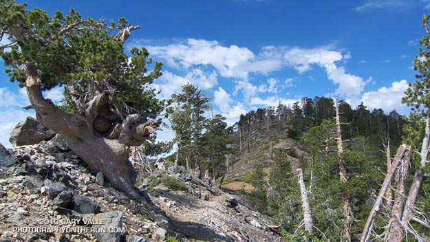
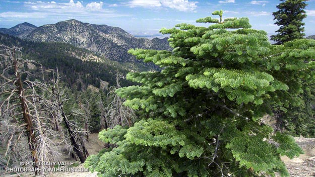
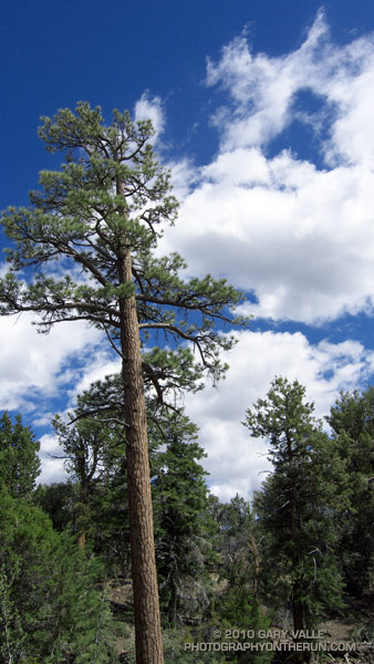
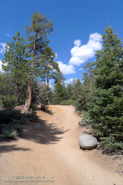
Jeffrey pine on the Cougar Crest Trail, near Big Bear Lake.

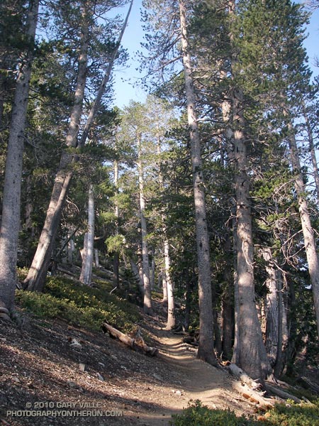
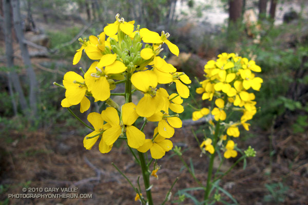
At aid station #2 we turned onto the Pacific Crest Trail, and followed the smooth single-track through a serene Jeffrey pine forest on the north slopes of Delamar Mountain. It was a little chilly and breezy at 7800′, and the strong June sun felt good on my bare arms. I was at about mile 9 of the Holcomb Valley 33 Mile Trail Run and all was good. The subtle vanilla scent of the pines wafted through the trees, and here and there bright yellow blossoms of western wallflower seemed to mark the way.

Rounding a corner, a pine framed image of Big Bear Lake and snow covered San Gorgonio popped into view. Behind me, a runner exclaimed, “Gorgeous!” As she passed, she commented, “This is my favorite race!” And I can see why. Not only is the race well organized, with great aid stations and super helpful volunteers, it challenges the runner with a unique mix of terrain and altitude.


Some stretches of the course are smooth and fast, some technical, and some downright gnarly. Most of the hills are not steep — at least by sea level standards — and the total elevation gain/loss is only about 3600′. But the gotcha is this: the course has the highest average elevation of any 50K race in Southern California, including the Bishop High Sierra 50K! Nearly 30 miles of the course is above 7000′, and the altitude has an unavoidable effect on performance, particularly for the unacclimatized, middle-of-the-pack runner.

How much of an effect? There is an often referenced chart in the book the Daniels Running Formula that can be used to estimate how much slower we will run at a particular altitude. Using an online running calculator based on the chart, we can project that a runner that does a 33 mile course at an elevation of 1000′ in 6.5 hours would take about 7 hours at 7500′ — assuming the runner is fully acclimatized! In the book, Daniels says that the increase in time could be as much as double for an unacclimatized runner. So 33 miles in 6.5 hours near sea level might turn into 7.5 hours at 7500′.

At altitude, elite runners have an advantage — even more of an advantage than they have at lower elevations. Because of the reduction in air density and drag, running at altitude at their faster pace is more efficient than near sea level. This partially offsets the loss in aerobic power that results from the reduction in atmospheric pressure. Again using the Runworks calculator, a runner that runs 33 miles in 4 hours at 1000′, would be projected to run about 4:18:00 at 7500′.


Apparently immune to the altitude, and flowing over the rocky sections of trail like the wind, Michelle Barton and Jorge Pacheco set new records on the Holcomb course this year. Michelle Barton flew through the 33 mile course in 4:56:21 (8:59 min/mi), and Jorge Pacheco cranked out an amazing 4:13:44 (7:41 min/mi). To put those times in perspective, this year the median time (half the runners above, half below) was  about 7:36:00.

Here is a Cesium ion interactive view of my GPS trace of the 33.1 mile course, and an elevation profile generated in SportTracks. Distances specified are based on the trace, and were calculated in SportTracks. During the race the only segment that seemed significantly longer than expected was from aid station #4 to aid station #5. Part of the reason is it was a tough leg, and has some very rocky stretches. But it also looks like the segment was about 7 miles long, rather than the expected 5.9 miles.

Many thanks to Pam and Gary Kalina, Bear Valley Search & Rescue, the sponsors, and all the volunteers for a great race! All the results can be found on the Holcomb Valley Trail Runs web site.

Running Hot & Cold

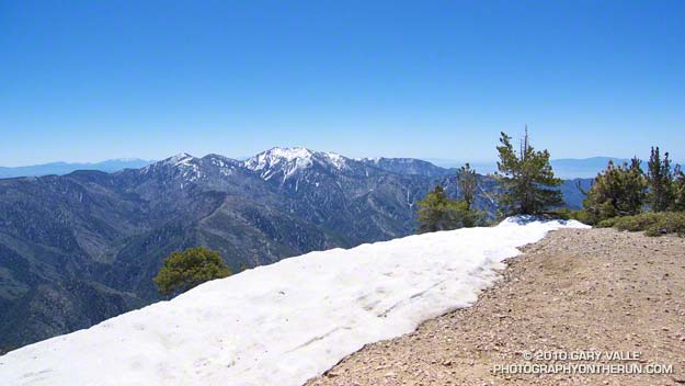
Mt. Baldy from the summit of Mt. Baden-Powell

Mt. Baldy fron the summit of Mt. Baden-Powell

Yesterday, Woodland Hills topped the 90° mark for the first time this year. But somebody forgot to tell the local mountains about the warmup. This morning, I was about a mile into an out and back trail run from Islip Saddle to Mt. Baden-Powell, and with the wind chill, it felt like the temp was in the 40’s.

It was chilly in running shorts, and I debated pulling some warmer clothes from the pack. In addition to a short-sleeve shirt, I did have on a pair of pull-on long sleeves. For the moment that seemed to be enough. Rounding a corner, the trail leveled, and up ahead I could see a hiker headed my way. Based on the time, I figured he was descending from Little Jimmy Campground. We exchanged greetings, and as we passed, he commented, “you know there’s a lot of snow on the trail.”


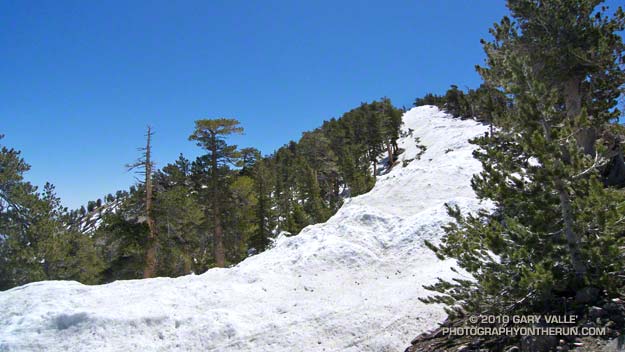
Snow on the crest near Mt. Baden-Powell
This Spring the weather in California has been dominated by a series of cool troughs, slowing the snow melt and in some cases adding to it. It its May 27th Summary of Snow Water Content, California Cooperative Snow Surveys reported the statewide snowpack at nearly twice the normal amount for the date. Squaw Valley reopened for Memorial Day weekend; and with over 100 inches of snow since April 1, Mammoth Mountain plans to operate through July 4.

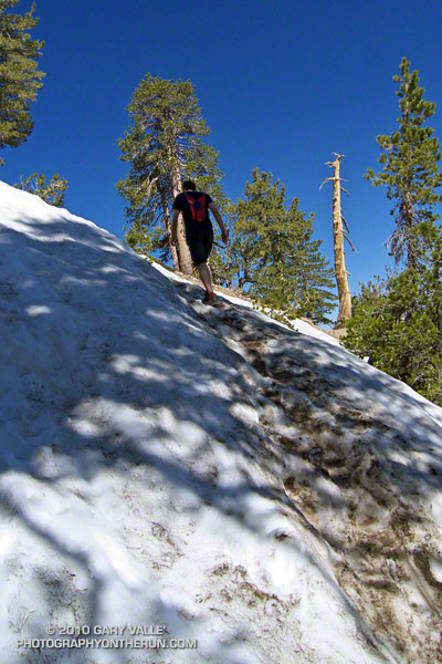
On the shaded, north facing slopes of Mt. Islip there was more snow than I’d seen since the Spring of 2005.  It couldn’t be avoided. However, the route was well-traveled, and where there was snow, dirt-covered steps eased the way. I had picked up a short length of downed fir, and it worked OK as a crude ice axe, or if you prefer, a stubby trekking pole. It enabled me to move a little faster, and had the added benefit of keeping my upslope hand out of the snow.


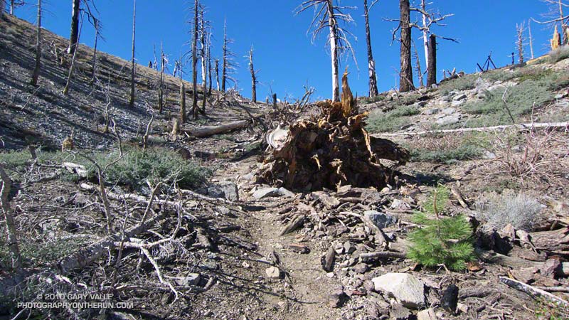
Seedling Jeffrey Pine in ghost forest
It didn’t take long to reach Windy Gap (7588′), and soon I was working up the trail to the gap above Windy Gap. Here the trail winds through a ghost forest of old growth trees, burned in the 2002 Curve Fire. Recovery has been slow, and it was heartening to see a young Jeffrey pine in the midst of all the deadwood. It also gave me a sobering perspective of the time that was going to be required for the recovery of the forests decimated by the Station Fire.

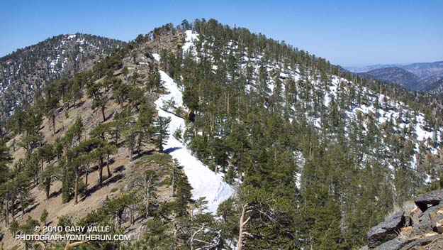
The trail climbs up to the crest of the San Gabriels near peak 8426, about a mile east of Windy Gap. From here it more or less follows the prominent divide all the way to Mt. Baden-Powell (9,399′). It’s the “more or less” part that’s key in a snowy year. The shaded north side of the divide may be completely snowbound, while the crest and south side are snow free. The way the ridgeline is oriented, storm winds create deep bands of snow along and just north of the crest. In places the trail can be buried in several feet of snow.


Snow on the crest east of Mt. Burnham
On the east side of Mt. Hawkins I checked out a tree that had been struck by lightning, and then continued along the ridge. The wind was little more than a breeze now, and the temperature comfortable. I pulled off my running sleeves, and then followed the trail across the warm, south facing slopes of Throop Peak. Sometimes on the trail, and sometimes on the crest, I descended to a saddle and then climbed up and over Mt. Burnham (8997′).

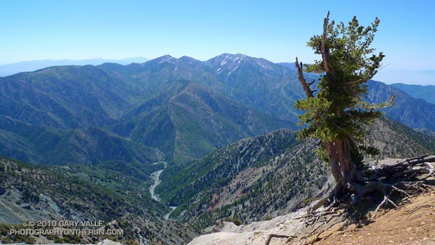
On the summit of Mt. Baden-Powell there was almost no wind. The sun was warm and the air clear. Across Vincent Gulch Mt. Baldy gleamed alpine white, its summit ridges still heavy with corniced snow. Many miles to the east, snow could also be seen on San Gorgonio Mountain, and Mt. San Jacinto. A Clark’s nutcracker complained raucously from the top of a Lodgepole Pine, and I assured the bird that I would be leaving the summit soon.

Some related posts: San Gabriels High Five, Islip Saddle – Mt. Baden-Powell Out & Back

The Best Kind of Training

Crags below the Backbone Trail

The great view confirmed it — we had run uphill. The new section of the Backbone Trail was so well-graded that the 850 feet of elevation gain from the trailhead at Encinal Canyon Rd. seemed almost effortless. For the next 14 miles, we would run through one of the most scenic areas of the Santa Monica Mountains; a rough and rugged highland with a character that might put it halfway around the world, rather than 35 miles from downtown Los Angeles.


Mariposas
On this May Day morning, the canyons were cool, the sun warm, and the skies clear. From the craggy heights views extended from Catalina to the Channel Islands; and from Topa Topa to the San Gabriel Mountains. Winter rains had produced a profusion of wildflowers, accenting the trails with the whites, blues, yellows and reds of Spring.

It was an extraordinary day in which mile after mile of trail would pass underfoot with surprising ease. It was the best kind of training — a run in which the training was an afterthought, and the focus was on the experience, rather than the logbook.

Here’s an interactive Cesium ion view of the 23 mile route from Encinal Canyon Rd. to PCH at Sycamore Canyon. The elevation gain on the run was about 2500 ft., and elevation loss about 3800 ft. Continuing to the Ray Miller trailhead by way of the Wood Vista, Overlook and Ray Miller trails would add about 3 miles and another 1000 ft. of gain. Another option would be to run through Serrano Valley to Sycamore Canyon. The Fireline Trail is a short distance down canyon from the Serrano Valley Trail, and could also be used to link to the Overlook and Ray Miller trails.

And here’s a photo of the Yerba Buena segment of the Backbone Trail when it was under construction in 2003.

Related post: Boney Mountain Crags

Conejo Valley Sun and Boney Mountain Clouds

Conejo Valley from the north side of Boney Mountain.

Pushed up and over Boney Mountain’s two thousand foot western escarpment, Pacific winds condense into thick cloud along its jagged crest. At times breaking free of the mountain’s grasp, patches of cloud drift eastward, creating a patchwork of sun and shadow on the steep slopes, and in the valley below.

In the distance, the Ventura Mountains gleam with a mix of snow and cloud, and below the fields of Satwiwa stand out vibrant and green. At my feet hundreds of purple shooting stars dance in the wind; and nearby yesterday’s rain seeps and trickles from moss to lichen on the scraggy volcanic rock.

It is a remarkable morning, and an exceptional one to be doing the Boney Mountain north side loop. Here’s a short video of some of the views along the way.

Blue Skies and Sunshine for the 2010 Twin Peaks 50K & 50M Trail Runs

It had been a long time since I was on the summit of Santiago Peak (aka Saddleback). The last time was in 1975, when I flew from the peak on a Sunbird “Butterfly” hang glider. That day had been spectacular, and this was turning out to be a spectacular day as well.

In the throes of an El Niño Winter, Southern California had been pummeled by a series of Pacific storms. With all the rain and snow it seemed unlikely that the Twin Peaks 50/50 would be run as planned. But the key access roads didn’t wash out, most of the snow melted, and blue skies and great weather greeted runners race day morning.


Twin Peaks 50K Elevation Profile
The race started at the bottom of Indian Truck Trail, off the I-15 near Corona. It was warm enough that in our 8:00 wave of 50K runners, only a few people wore sleeves and extra clothing. As we worked up the first switchbacks into the sun, those were quickly shed. The enthusiasm of the other runners was contagious, and this helped with the challenges of the initial 7 mile, 2600′ climb to the Indian Truck Trail aid station.

At that first aid station I grabbed a GU gel, and then headed east on the Main Divide Road toward West Horsethief. For some reason I had it in my head that I might get to run on the flat here for a few minutes. The only way that was going to happen is if I ran around the aid station table. On this course you’re either going up or you’re going down, and here the arrow still pointed up.

The views along the Main Divide were fantastic. The high peaks of Southern California — Mt. Baldy (10,064′), San Jacinto Peak (10,834′) and San Gorgonio Mountain (11,499′) — glistened in the morning sun, their new snow impossibly white. Down in the valley, an ant-like stream of vehicles moved along the Corona freeway, and our parked cars glittered like a string of tiny beads along Santiago Road. To my right, steep, chaparral covered slopes plunged into the depths of Trabuco and Holy Jim canyons. Somewhere down there was the Holy Jim aid station, and it looked like a long way down.

Billy and Lori working the West Horsethief aid station.
At the West Horsethief Trail aid station (10.2 mi), Billy and Lori greeted me with big smiles and asked if there was anything I needed. I had just been asking myself that same question, wondering if I had enough water to make it to Holy Jim. I guessed that I did, thanked them for being there, and turned down the single track trail.

Varied and technical, the West Horsethief and Trabuco trails were my favorite part of the course. While some sections were rocky, or V-rutted from recent rains, long stretches of of the trail were smooth and fast. Once down in the canyon, the creek crossings on the Trabuco Trail were great fun. With the warm weather, wet socks and squishing shoes were no big deal. The lush green growth and the burbling stream eased the long run down the canyon, and at about the 3 hour mark, I reached the Holy Jim aid station (14.5 mi).

This aid station is on the opposite side of the mountain from the start. You’ve done a lot of work to get there, and you’re going to do a lot more to get back. From here it is about 8 miles and a 3900′ gain to the summit of Santiago Peak. It took a while to work up past the cabins in Holy Jim Canyon to the start of the Holy Jim Trail. I knew I was on-route, but I hadn’t run any of these trails, and worried I might accidentally run up somebody’s long driveway.

As I climbed out on the first switchbacks above the creek, Hiroki Ishikawa, the eventual winner of the 50 mile race, rounded a switchback. Elite athletes stand out in any sport — there is a an efficiency and fluidity of movement that is unmistakable. Hiroki was quicksilver fast, and seemed to flow effortlessly down the trail.

In contrast, I felt a little like mud trying to flow uphill. Fortunately, long stretches of the trail were runnable, and ever so slowly I rose above Holy Jim Canyon. Gradually, the peak tops and rigelines that had been towering above me fell away. About 4.5 hours into the race, I reached the top of the Holy Jim Trail at Bear Springs, and turned left onto the Main Divide road.

The surprising thing about this shady nook is that when you reach this point, you’ve only done a little more than half (56%) of the gain from Holy Jim to Santiago Peak. But hey, I was happy with that, and it felt good to be in the pines and plodding up toward the peak.

It took about 30 minutes to reach the big switchback at the Upper Holy Jim checkpoint (21.1 mi). From here the summit towers looked tantalizing close. I was happy to keep pace with the “runner in blue” about a hundred yards ahead.  As we neared the top of the peak, sun turned to shade, and the road became covered with snow. It was a cool way to finish a warm climb, and a not so subtle reminder of what the weather might have been.

Leaving the top of Santiago Peak (22.6 mi) I thought back to that day in 1975. I wouldn’t be flying down the mountain today, with a hang glider or without. In its own way the 10 mile descent from the peak would be just as challenging as the climb up earlier in the day. But I wasn’t thinking about that. I was smiling and thinking that the running had been about as good as trail running gets.


Twin Peaks 50/50 Finishers MedalMany thanks to RD Jessica DeLine, and all the volunteers and runners for an excellent event! Kudos to the 50 mile runners, who not only got to climb Santiago Peak via Holy Jim, but had the pleasure of running down Holy Jim and then climbing up West Horsethief and doing Santiago a second time.

Here’s an interactive Cesium browser View of the 50K course, and an elevation profile generated in SportTracks. Based on my GPS track, the distance worked out to a little over 33 miles, with an elevation gain of about 7600′. The elevation gain was hand calculated using SRTM corrected profile elevations. (For more info about measuring elevation gains on mountain trail runs, see the post What’s the Elevation Gain?)

When split times are available, you can learn a lot about how you, and others, ran the course. Everyone’s race is unique, and no one approach works the best. In the following listings, I’ve calculated the time from the start to each aid station, the time between aid stations, and the split rank at each aid station. These are totally unofficial. In a few places where a split time was invalid (for example earlier than a previous aid station) I’ve substituted estimated times. The “Rank” indicated is based on the time from the start to that point in the course. In both the 50K and 50M the top runners had missing splits, so for that split, they will not be included in the split rankings.

Here are the 50K Split Calculations and the 50M Split Calculations. If you want to send me your corrected or missing splits, I will update the listings when I have a chance. Please see the Twin Peaks 50/50 web site  for official results and information.

Serrano Valley – La Jolla Valley Scenic Loop

Lynn and Frank at the ranch in Serrano Valley.

This is one of my favorite medium length trail runs in the Santa Monica Mountains. It starts at the Ray Miller trailhead and explores the scenic grasslands of the Serrano and La Jolla Valleys. Along the way there are spectacular ocean and mountain vistas from the Ray Miller Trail and the summit of Mugu Peak.


Serrano Valley
Most of the route is on single track trail, and except for a short out & back segment to “The Ranch” in Serrano Valley, it is a complete loop of about 20 miles. Many variations are possible.

One of the better online maps I’ve found of the area is an Interagency Trail Management Map produced by the NPS Santa Monica Mountains National Recreation Area GIS Lab. It shows the status of trails and public lands in the Santa Monica Mountains and is broken into three parts: WestCentralEast. Additional NPS SMMNRA trail management plan maps include Proposed Backbone Trail Facilities and Trails and Proposed Regional Trails.

Here is a Cesium browser View of a GPS trace of our route from the Ray Miller trailhead and through Serrano and La Jolla Valleys.

Related post: Serrano Valley – La Jolla Valley Loop, Serrano Valley from the Chamberlain Trail