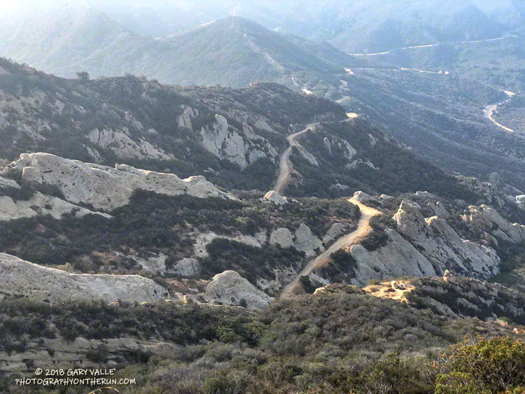
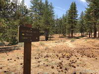
From a recent run on the Secret Trail, Calabasas Peak Motorway and Red Rock Road.
Related post: Red Rock Canyon from the Red Rock Trail

From a recent run on the Secret Trail, Calabasas Peak Motorway and Red Rock Road.
Related post: Red Rock Canyon from the Red Rock Trail
It’s been nine years since the Station Fire burned 160,577 acres in Angeles National Forest. The Red Box – Bear Canyon – Gabrielino loop is a long time favorite adventure run that I’ve enjoyed doing many years before and after that 2009 fire.
The loop was the first I did when the area reopened in May 2011. The trails were in poor shape — overgrown and damaged from flash floods. The notorious fire-follower Poodle-dog bush had flourished in the wake of the fire and was particularly bad along the Gabrielino Trail between Switzer’s and Red Box. Thinking I was “immune” to the plant, I brazenly plowed through it, and as a result spent several inflamed nights trying to sleep in a reclining chair.
Each year Bear Canyon and upper Arroyo Seco recover a little more. Poodle-dog bush is in decline and in many areas nearing the end of its life-cycle. The chaparral, bay trees and oaks are all recovering; and the bigcone Douglas-firs that survived the fire have become more fully-foliaged.
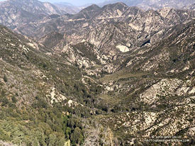
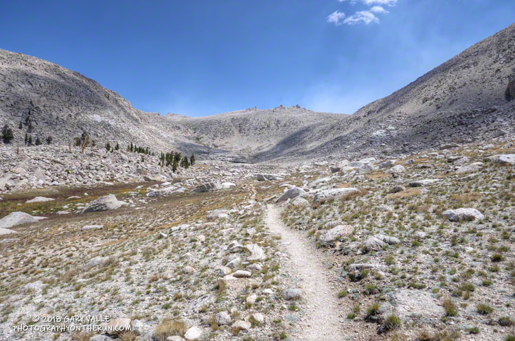
This year Bear Canyon was a little drier than last. The creek was a trickle, disappearing in the sand in some areas and creating small pools in others. The path in the upper part of the canyon, above Bear Canyon Camp, was better defined, but still tricky to follow in some spots.
With the dry conditions, most of the poison oak had already turned red. It was easy to spot, but difficult to avoid. The “stinging nettle” creek crossing higher in the canyon wasn’t as overgrown as last year, but I still managed to brush against a plant or two.
Bear Canyon ends at Arroyo Seco, downstream of Switzer Falls. After turning upstream on the Bear Canyon Trail, I hadn’t run far when I encountered a couple of mountain bikers. They asked me, “is this the trail to JPL?”
This wasn’t the first time that I’d encountered misplaced riders or hikers on this section of trail. Some get misplaced looking for the falls and others mistakenly follow the Bear Canyon Trail down into Arroyo Seco instead of continuing high in the canyon on the Gabrielino Trail. Because of the completion of the restoration of the Gabrielino Trail there were a few more riders on the trail than usual.
Here are a few photos taken along the way.
Some related posts: Bear Canyon Loop: If the Poison Oak Doesn’t Get You, the Stinging Nettle Will; After the Station Fire: Red Box – Bear Canyon – Gabrieleno Loop; After the Station Fire: Contact Dermatitis from Turricula parryi – Poodle-dog Bush
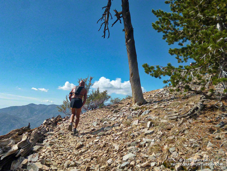
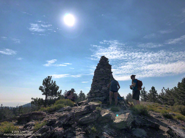
I already had my camera out and paused briefly to take the picture above. We were at about 9800′ on the rocky trail up Sugarloaf Mountain (9952′) and a little less than a half-mile from the summit. At the time, I wasn’t sure how far it was to the top. I thought we were getting close, but I’d thought that before.
Although I’ve done the Kodiak 50M a few times, I’ve always run the Siberia Creek (counterclockwise) course, so the ascent of Sugarloaf was totally new to me. The top of the peak is a stout six mile, 3000′ climb from the Sugarloaf Aid station, and for the uninitiated, there are many false summits along the way.
It was good to be feeling good. I’d run at altitude a lot this summer and it was helping. Running along the summit ridge didn’t feel much different than running on Lasky Mesa. And the weather was nearly ideal. No crazy 100 degree temps — just a few puffy, postcard clouds to dress up the day.
A five-minute jog along the crest ended on the summit. Bear Valley SAR was on top, checking runners in. Before the race they had lugged 1500 lbs. of water two-thirds of the way up the mountain. (Thank you!)
Participation in the 100M, 50M & 50K Kodiak Ultra Marathons has been increasing every year, and really jumped up this year. In 2016 the Sugarloaf Back 50K had 27 finishers and last year the Siberia Creek Back 50K had 57. This year there were 148 finishers in the Back 50K. With an average elevation of 7777′, a high point just shy of 10,000′, and around 6500′ of elevation gain, it’s one of the more challenging 50Ks in California.
It’s one thing to run the last 32 miles of a course, and quite another to run those last miles after running 70 other miles. The Kodiak 100 milers (and 50 milers) were impressive. One trait all seemed to share was a laser-sharp focus on the task at hand. That was certainly the case for veteran Army Ranger Ben Brown, who was running his first 100M in support of 9 Week Warrior — a nonprofit started by Ben and his wife to help veterans, police officers and firefighters. Ben finished the race strong, cruising past me (again) on the dirt road down to the village.
Not all races end the way we want them to. Part way up Sugarloaf I talked to a friend of Ruperto Romero’s and was disappointed to hear that Ruperto, Tony Torres and Mario Martinez missed a turn before the Dump Aid Station (Mile 56). The three had been leading the 100M Prize Purse race since the Champion Aid Station (Mile 20.5). Ruperto won the 100M event last year.
Elan Lieber was the eventual winner in the 100M Prize Purse division in a time of 22:02:08. Daniela Seyler won The Kodiak 100M and was the fastest woman overall in the 100M with a time of 24:09:59. Robby Haas (9:31:09) and Rachel Hallummontes (10:52:48) won their respective divisions in the 50M; and Andrew Cassano (5:49:14) and Emma Delira (6:46:44) topped their divisions in the 50K. All the results are posted on Ultrasignup.
Many thanks to new Kodiak RDs Susie Schmelzer and Harald Zundel, and to Team Kodiak, all the volunteers, Bear Valley SAR, HAM operators, medical personnel, and everyone that helped put on the event.
Here are a few photos taken along the way.
Related post: Kodiak 50 Mile 2017 – Smiling at the Finish
The smoke in the Owens Valley was as thick as PCH fog, and I wondered if it would extend into the higher elevations of the Sierra.
From Whitney Portal Road I couldn’t see any of the ridges on Lone Pine Peak and the visibility at the bottom of Horseshoe Meadow Road wasn’t much better. Gradually, as I drove up one long switchback and then another, the smoke thinned. At Horseshoe Meadow the sky in the direction of the crest was a decent Sierra blue, but smoke still spoiled the views down the canyons and over the valley.
As usual, I parked at the equestrian and overflow parking area for the New Army Pass Trail. From here, the start of the Cottonwood Pass Trail is a 5 minute walk SSW through the trees and downhill. I prefer to do the loop clockwise, going over Cottonwood Pass first, and then New Army Pass later in the run. Late season, I’ve also done the loop using (old) Army Pass, but that is more of a mountaineer’s route and is often blocked by snow and ice.
New Army Pass is fairly high — 12,300′ — and the east side is quite steep near the top. Depending on the year, snow and ice can be an issue, even in mid-summer. When doing the loop clockwise, confirm in advance that New Army Pass will be passable with your level of experience and the equipment you’ll be carrying.
For more details see the related posts below.
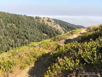
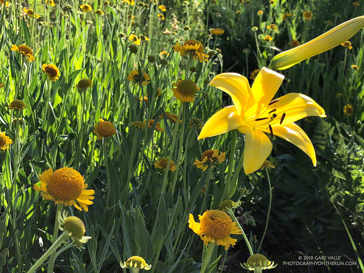
Here are a few photos from the run.
Some related posts: Cottonwood Pass – New Army Pass Loop 2013, Cottonwood – Army Pass Loop, Cottonwood Pass – New Army Pass Loop 2011
Yellows, reds and greens marked its location, but the seep above Sheep Camp was dry. As I approached the camp, the uppermost campsite was empty and I wondered if the spring at the camp was also going to be dry. If it was, I was going to have to revise my running plan.
So far the run had gone well. From the Chula Vista parking area (8350′), I’d run the service road up to Mt. Pinos (8831′), then followed the Tumamait Trail west to Mt. Abel Road. Along the way Sawmill Mountain (8818′)and Grouse Mountain (8582′) had been short side trips; and from the end of the trail, the summit of Mt. Abel (8280′) was a short hike up through the pines.
Compared to the triple-digit temperatures in the parched West Valley — as high as 117 °F this July — the temps on the Tumamait Trail had been wonderfully cool. The hotter than average weather seems to have become the new norm, and also — unfortunately — the resulting wildfires.
On a run here Last July, smoke from a fire near Lake Cachuma had nearly enveloped Mt. Pinos. Today several fires were burning in California, and once again smoke could be seen in the valleys and canyons to the north of the mountain.
To get in a bit more mileage and elevation gain the next part of my run was supposed to be an out and back to the sun-baked environs of Lily Meadows (6600′). That wasn’t going to happen if the spring was dry.
When I stopped at the wildflower-accented spring I could see that there was the barest thread of water trickling from the pipe. It didn’t look like much, but it filled my 18 oz. cut-off water bottle in about three minutes. I gulped down most of the first bottle and it took a couple more to fill my Camelbak. In about 10 minutes I was headed downhill.
The North Fork Trail is far less used than the Tumamait Trail. That’s part of the fun. Thunderstorms had not only wiped away any previous tracks, but had severely eroded some sections of the trail as well.
With the loss of elevation came an increase in temperature. By the time I reached Lily Meadows Camp the temp was in the 90s. This time of year there were no lilies or meadows at the campsite, but there was a nice grove of Jeffrey pines and a new camp table!
I didn’t spend much time down there. There was a hill to climb and the cool temps along the crest were only about an hour away.
Some related posts: Pinos to Abel Plus, Thunderstorm, Vincent Tumamait Trail
There seems to have been some carryover from the wet rainy season we had in 2016-17 to this year. The 2017-18 rain season was very dry — the third driest on record at Downtown Los Angeles — but seeps at Waterman Meadow, along the Burkhart Trail below Buckhorn were still wet. In general plant growth along trails has been more than I expected in such a dry year.
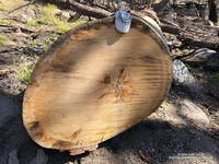
Wet and dry periods can be seen in the growth rings of the large Jeffrey pine along the Three Points – Mt. Waterman Trail just west of the Twin Peaks Trail junction. A more careful count of its rings totaled about 500. No matter how careful the count, because of the various anomalies that occur with tree rings, some form of crossdating is usually required to confidently assess the age of a tree. Even so, it is clear this was an old tree.
The first few miles of the loop were gloriously cool, but by the time I reached Cooper Canyon and was working up to Cloudburst Summit on the PCT, the sun beat down on me in a familiar refrain.
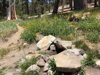
Here are a few photos taken on the loop.
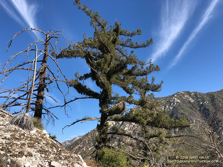
Related post: Cool Weather, Old Trees, Grape Soda Lupine and a Restored Trail