After the Station Fire: Back to Bear Canyon

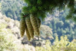
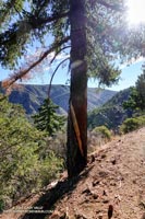
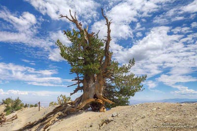
Bigcone Douglas-fir burned in the 2009 Station Fire. September 1, 2018.

It’s been nine years since the Station Fire burned 160,577 acres in Angeles National Forest. The Red Box – Bear Canyon – Gabrielino loop is a long time favorite adventure run that I’ve enjoyed doing many years before and after that 2009 fire.

The loop was the first I did when the area reopened in May 2011. The trails were in poor shape — overgrown and damaged from flash floods. The notorious fire-follower Poodle-dog bush had flourished in the wake of the fire and was particularly bad along the Gabrielino Trail between Switzer’s and Red Box. Thinking I was “immune” to the plant, I brazenly plowed through it, and as a result spent several inflamed nights trying to sleep in a reclining chair.

Each year Bear Canyon and upper Arroyo Seco recover a little more. Poodle-dog bush is in decline and in many areas nearing the end of its life-cycle. The chaparral, bay trees and oaks are all recovering; and the bigcone Douglas-firs that survived the fire have become more fully-foliaged.

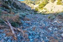
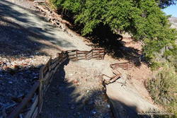
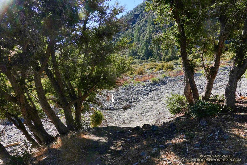
Bear Canyon from the upper Bear Canyon Trail.
Bear Canyon from the upper Bear Canyon Trail. Click for larger image.

This year Bear Canyon was a little drier than last. The creek was a trickle, disappearing in the sand in some areas and creating small pools in others. The path in the upper part of the canyon, above Bear Canyon Camp, was better defined, but still tricky to follow in some spots.

With the dry conditions, most of the poison oak had already turned red. It was easy to spot, but difficult to avoid. The “stinging nettle” creek crossing higher in the canyon wasn’t as overgrown as last year, but I still managed to brush against a plant or two.

Bear Canyon ends at Arroyo Seco, downstream of Switzer Falls. After turning upstream on the Bear Canyon Trail, I hadn’t run far when I encountered a couple of mountain bikers. They asked me, “is this the trail to JPL?”

This wasn’t the first time that I’d encountered misplaced riders or hikers on this section of trail. Some get misplaced looking for the falls and others mistakenly follow the Bear Canyon Trail down into Arroyo Seco instead of continuing high in the canyon on the Gabrielino Trail. Because of the completion of the restoration of the Gabrielino Trail there were a few more riders on the trail than usual.

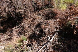
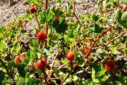
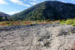
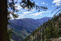
Here are a few photos taken along the way.

Some related posts: Bear Canyon Loop: If the Poison Oak Doesn’t Get You, the Stinging Nettle Will; After the Station Fire: Red Box – Bear Canyon – Gabrieleno Loop; After the Station Fire: Contact Dermatitis from Turricula parryi – Poodle-dog Bush

Running Mt. Wilson’s Rim Trail

San Gabriel Mountains from the Rim Trail on Mt. Wilson. Photograph by Gary Valle.

This morning’s run from Mt. Wilson started with striking views of the Southern California’s mountains from the Rim Trail. An extensive marine layer heightened the contrast between the highlands and the lowlands, with peaks such as Mt. Baden-Powell, Mt. Baldy and Monrovia Peak standing starkly above the ocean of clouds. Beyond Mt. Baldy, San Gorgonio Mountain could be seen, more than 75 miles distant.

A section of the Rim Trail between Mt. Wilson and Newcomb Pass.

The Rim Trail connects Mt. Wilson (5710′) to Newcomb Pass (~4100′). A trail and firebreak between Mt. Wilson and Newcomb Pass are shown in the 1934 “Advance Sheet” for the the first USGS 1:24000 map of the area, the Mt. Wilson Quadrangle. The route of the trail depicted in the finalized 1939 edition of the map is essentially the same as the Rim Trail today.

The somewhat primitive and adventurous character of the Rim Trail makes it a favorite. Most often I run the Rim Trail as the first leg of a loop that follows the Gabrielino Trail down to Chantry Flat and then returns to Mt. Wilson on the Upper Winter Creek and Mt. Wilson Trails.

Poodle-dog bush (Eriodictyon parryi) near the top of Mt. Wilson.
Poodle-dog bush .

There is still some Poodle-dog bush along the Rim Trail and also on the connector trail between the top of the Kenyon Devore Trail and the Mt. Wilson Trail parking lot. As long as you see it, it is easily avoided. Poodle-dog bush is a fire-follower — in this case from the 2009 Station Fire — that can cause contact dermatitis. Here’s a closer look at the flowers.

Today, instead of turning right at Newcomb Pass toward Chantry Flat, I turned left on the Gabrielino Trail, . This leads down to Devore Camp — an isolated trail camp along the W.F. San Gabriel River. (Think creek!) From Devore Camp the Gabrielino Trail is followed up-canyon to West Fork Camp and then to the Kenyon Devore Trail. The Kenyon Devore Trail is then used to get back up to Mt. Wilson. There are other variations as well.

Blackberry along the Gabrielino Trail between Devore Camp and West FOrk.
Blackberry along the Gabrielino Trail

While the Gabrielino Trail between Spruce Grove and Chantry Flat is one of the most used in the range, the Gabrielino Trail between Newcomb Pass and West Fork is a rustic trail that sees far less use. On previous outings, I had not seen anyone on this segment of the trail. Today, I was surprised to find a backpacker at Devore Camp. I had to laugh when the first thing he said was, “Man, there is a lot of poison oak around here!”

There sure was…

Some related posts: Mt. Wilson – Newcomb Pass – Chantry Flat Loop; Bigcone ENSO Prediction, Poodle-dog Bush Blues, and a Surprise on Kenyon Devore; Why Won’t My Smart Key Work?

Misplaced on Mt. Wilson

View from the Rim Trail on Mt. Wilson

I’d just finished an 18 mile loop from the top of Mt. Wilson and was changing my shoes, when I noticed a group of six hikers walking down the Mt. Wilson loop road toward me. I’d started my run before the Mt. Wilson gate was open and was parked in a turnout near the top of the Kenyon Devore Trail.

Poodle-dog bush along the Rim Trail on Mt. Wilson.

The run over to Newcomb Pass, down to Chantry Flat, and then back up to Wilson had gone well. If you don’t mind a little Poodle-dog bush and a lot of poison oak, the Rim Trail is one of the hidden gems of the San Gabriels. And the Gabrielino Trail’s excursion through the forests and along the creeks of Big Santa Anita Canyon is a classic.

When the group reached me, one of them asked,”We’re looking for the Winter Trail, do you know where that is?” I did know where the Upper Winter Creek Trail was, because I’d just been at the top of it about 45 minutes earlier.

With its maze of antennae, telescopes and other facilities, it’s not uncommon for hikers and runners unfamiliar with the top of Wilson to become temporarily misplaced. The trails are, of course, on maps — including Google Maps — and described in various online and offline resources.

Bigleaf maple along the Gabrielino Trail in Big Santa Anita Canyon.

In this case the hikers didn’t know where they had parked and they didn’t know the route that had taken up the mountain. If you don’t have a clue where you need to go, a map isn’t very useful.

When I described where they needed to go, there were groans all around.

It was midday, the weather was good, it wasn’t hot, they had water and a phone, they would be hiking mostly downhill, and there were plenty of other hikers on the trail. Unless they did something really stoopid, it was just going to be a long day.

Front Range Duo: San Gabriel Peak and Strawberry Peak

Bigcone Douglas-fir on San Gabriel Peak

The two highest peaks in the front range of the San Gabriels, Strawberry Peak (6164′) and San Gabriel Peak (6161′) are about three miles apart as the raven flies and about 6 miles apart by trail. If you don’t mind running/hiking a third of a mile on Mt. Wilson Road, you can do both of them from Red Box as a 12 mile run/hike with a total gain of about 3000′.

Strawberry Peak and Mt. Lawlor from San Gabriel Peak.

Earlier this morning, I’d done San Gabriel Peak. It’s the shorter of the two ascents — from Red Box it’s about 2.4 miles to the summit. While the elevation gain is nearly the same as climbing Strawberry, it is a less strenuous and more straightforward peak. Except for a short stint on the service road below Mt. Disappointment, the grade of the San Gabriel Peak Trail is relatively constant — and the trail goes all the way to the summit.

Josephine Peak (5558') and Mt. Lukens (5074') from the summit of Strawberry Peak.
Josephine Peak and Mt. Lukens from the summit of Strawberry Peak.

The route up Strawberry Peak is distinctly different. The initial 2.5 miles follows the Strawberry Peak Trail to Lawlor Saddle, gaining a moderate 500′ along the way. From there a steep, rough and sometimes rocky use trail ascends 950′ in a little over a mile to Strawberry’s summit.

That’s where I was now — nearly at the end of that brutal mile-long climb. My heart was racing and my legs felt like Jello. Reaching the crest of Strawberry’s final false summit, I jogged across the shoulder of the peak and on uncooperative legs climbed the final few feet to the summit.

To the southeast, San Gabriel Peak and Mt. Disappointment stood across the canyon and further to the east, indistinct in the morning haze was snow-capped Mt. Baldy. To the west, the view extended past Josephine Peak and Mt. Lukins to the San Fernando Valley, Santa Monica Mountains and Santa Susana Mountains.

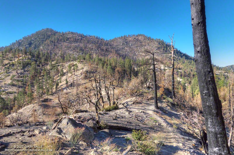
The southwest side of San Gabriel Peak was burned in the 2009 Station Fire.

Recovery from the devastating 2009 Station Fire continues on both peaks. The amount, extent and size of Poodle-dog bush (Eriodictyon parryi) in the burn area is slowly diminishing. Some plants have died, but there are still viable plants of which to be wary. These plants were on the San Gabriel Peak Trail, above the notch, on the final climb to the summit of the peak. I don’t recall seeing any Poodle-dog bush on the ascent of Strawberry from Red Box, but it is still present on the west side of the peak.

Some related posts: Strawberry Peak, Switzer’s and the Old Colby Trail, Bear Canyon Loop Plus Strawberry Peak, After the Station Fire: Ten Miles – Four Peaks

Waterman Mountain: Fallen Trees, Forest and Ferns

Area burned by the Station Fire on Waterman Mountain

The area in the image above was burned by the Station Fire on September 7, 2009. That morning I’d just crossed the peak-top finish line of the Baldy Run to the Top and using a tiny point and shoot camera took this snapshot of the Station Fire burning on Mt. Waterman.

Station Fire burning on Waterman Mountain the morning of September 7, 2009
Station Fire on Mt. Waterman

The image of the fallen trees and ferns is from today’s counterclockwise circuit of Waterman Mountain from Three Points. It was taken at an elevation of about 7100′ about 3.5 miles from Three Points and about 1.5 miles west of the Twin Peaks Trail junction. Here the Station Fire burned swaths of forest, running up steep gullies and ridges on the south slopes of the mountain.

Part of a Burned Area Emergency Response (BAER) image taken of the Station Fire Burn Area by the NASA Ikhana remotely piloted aircraft
Ikhana BAER Burn Intensity

The purple hues in this Burned Area Emergency Response (BAER) image taken by the NASA Ikhana remotely piloted aircraft in 2009 are indicative of the burn severity in the vicinity of Three Points and Mt. Waterman. (Ikhana image courtesy of NASA Dryden and NASA Ames. Composite image created using Google Earth Pro.)

Coulter pines burned in the Station Fire along the Three Points - Mt. Waterman Trail
Pines Burned by the Station Fire

The yellow track in the BAER image is of the Three Points – Mt. Waterman loop. The track includes a side trip to the summit of Mt. Waterman I didn’t do today. About one-third of the approximately 20 mile loop was impacted by the fire. If the loop is done counterclockwise the first couple of miles are the most severely burned and have the most downed trees and Poodle-dog bush. Use trails have developed around the fallen trees, but it seems a new tree or two has fallen each time I do the route. With care the Poodle-dog bush is generally avoidable.

Some related posts: After the Station Fire: After the Station Fire:Three Points – Mt. Waterman Loop, Three Points – Mt. Waterman Loop, Southern Pacific Rattlesnake on the Burkhart Trail, Twin Peaks Trail Run

Strawberry Peak Summit Loop

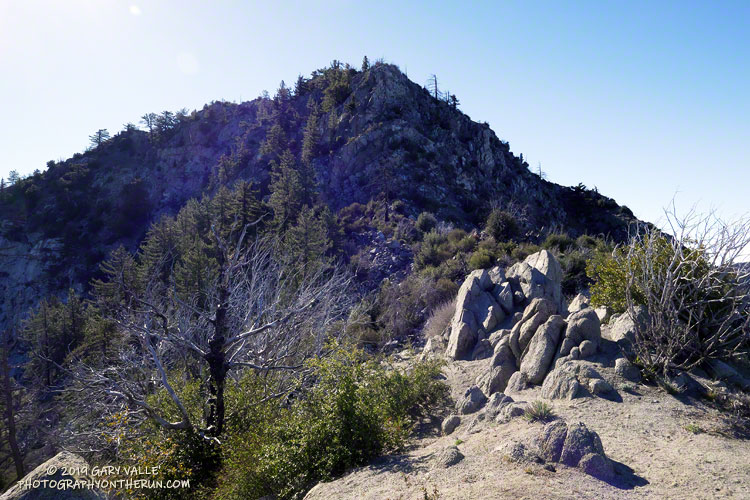
View down west ridge of Strawberry Peak

It was about 8:30 a.m. and I was nearly to the top of the steep, rocky ridge on the west side of Strawberry Peak. I gazed over the rocks and ridges to the layer of stratus that partially filled the Los Angeles basin and valleys and tried to find Saddle Peak or Castro Peak. These peaks would mark the location of Malibu Creek State Park. Today some friends were doing the Bulldog 50K and I wondered if the marine layer was too shallow to take the edge off the heat forecast for later in the day.


The loop over the top of Strawberry Peak is a more adventurous variation of the Strawberry Peak Circuit. Closed for 4 1/2 years by the Station Fire, the trails necessary to do the circuit and approach the peak — Josephine Peak Fire Road, Strawberry Spur Trail, part of the Colby Canyon Trail and Strawberry Peak Trail — reopened in late May. The trails from Josephine Saddle to the summit of Strawberry and from the summit down to Lawlor Saddle are unofficial paths created by use.

I’d done the circuit around Strawberry in July a couple of weeks before the Angeles Crest 100. Today’s hike, run and climb over the top of the peak was a fun way to continue to recover from the exertions of that event. As was the case with the Strawberry Peak Circuit, I started the loop at Clear Creek, but it is also possible to start at Switzer’s Picnic Area or Red Box.


Like anything adventurous, if it’s in your comfort zone the challenges can be fun; if not, the adventure can quickly turn into a nightmare. This route requires rock climbing and route-finding skill and a bad choice can ruin your whole day.  Strawberry Peak has been the site of numerous search and rescue operations. The rock on the west side of the peak is of variable quality and if you go off-route it’s easy to become trapped in a spot where you can’t safely go up or down.

Not only is the route-finding tricky on the rock climbing sections. As a result of the growth of Poodle-dog bush following the Station Fire, the use trail on the upper ridge on the west side of the peak is more circuitous than it used to be. Although much of the Poodle-dog bush was wilting and in some cases dying, it can still cause dermatitis. By staying on the use trail it was mostly avoidable. There was a bear track on this section of the ridge and I wondered if the tracks I’d seen on the Strawberry Peak Circuit were from the same bear.

The last section of rock climbing ends abruptly just below the summit. The use trail on the east side of the summit involves no rock climbing and sees much more traffic. Though steep and loose, by fell-running standards it is mostly runnable. At Lawlor Saddle the maintained trail begins and continues to Red Box. From there the loop is closed using the Gabrielino Trail and Nature’s Canteen Trail. Since I was last on the trail in July, the Nature’s Canteen Trail had been re-cut and was in great shape.

Some related posts: Strawberry Peak Traverse, Strawberry Peak Circuit