Strawberry Peak Circuit

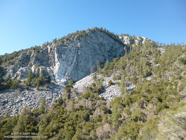
North face Strawberry Peak

After being closed 4 1/2 years because of the 2009 Station Fire, Strawberry Peak and the trails comprising the Strawberry Peak loop reopened on May 25, 2014. Today, I finally got a chance to get back on the 15+ mile circuit around Strawberry, and was excited to find that much of it was in better shape than before fire.

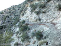
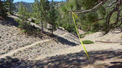
Colby Canyon Trail about 0.25 mile from Josephine Saddle
Colby Canyon Trail near Josephine Saddle

I’d heard that COBRA was instrumental in the restoration of the loop, but that is only part of the story. The preservation and maintenance of trails is now largely a community effort — in this case CORBA, Mount Wilson Bicycling Association, Sierra Club, Los Angeles Conservation Corps, National Forest Foundation, REI, Bellfree Contractors, and the BSA all contributed to the effort.

The loop, which is part of the ANFTR/Mt. Disappointment 50K course, circumnavigates Strawberry Peak. The trails that comprise the loop are Josephine Fire Road, Strawberry Spur Trail, Colby Canyon Trail, Strawberry Peak Trail, Gabrielino Trail, and Nature’s Canteen Trail. The loop can be started at Red Box, Colby Canyo, Switzer’s or Clear Creek. I usually start it at Clear Creek so I can refill my hydration pack from the water faucet at the Haramokngna American Indian Cultural Center at Red Box. (Note: Water might not be available here, especially in winter!)

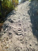
Bear tracks on the Strawberry Peak Trail.
Bear tracks on the Strawberry Peak Trail

Some things to note. The Colby Canyon Trail and the use trail up Strawberry Peak are somewhat hidden from view when you first get to Josephine Saddle. The trails are on the east side of the saddle, and well used. The Gabrielino Trail between Red Box and Switzer’s Picnic area is generally in good shape, but watch out for Poodle-dog bush. The start of Nature’s Canteen Trail is not currently marked. It can be picked up near the top of the paved road that climbs up from Switzer’s, near the telephone/power line poles. It starts on the west side of the road. Most of the trail was overgrown, but it looked like it was being restored, starting at its west end.

I was glad to see that most of the bigcone Douglas-fir on the north side of the peak survived the fire and that Strawberry Potrero was mostly intact. There was a nice set of bear tracks between Strawberry Potrero and the steep section of the Strawberry Peak Trail above the Colby Canyon Trail junction.

Here’s an overview of the Strawberry Peak circuit and an interactive Cesium browser View of the route that can be zoomed, panned, tilted and rotated.

Some related posts: Strawberry Peak Traverse, Blue Skies and Short Sleeves on Strawberry Peak

Three Points Loop: Lemon Lily Along the Mt. Waterman Trail

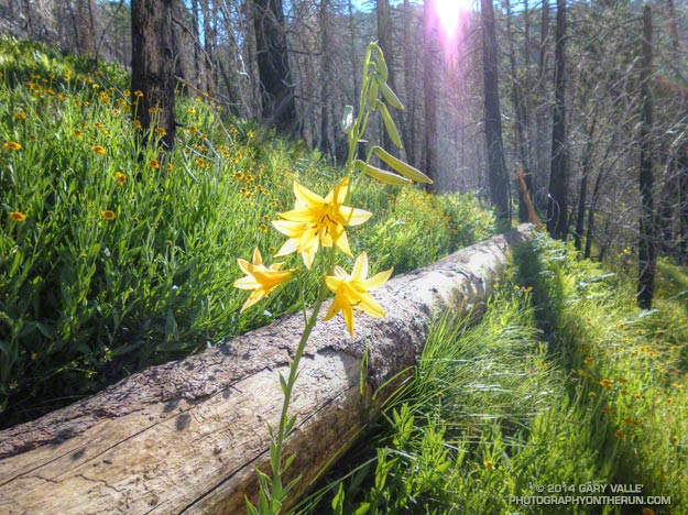
Lemon lily along the Three Points - Mt. Waterman Trail. border=0 src=

The bright yellow lemon lilies marked the trail. I hopped up on the log, followed it to it’s end, and stepped off. An ill-defined path through thick ferns gradually became more distinct and after a few yards became easier to follow.

I was on the Three Points – Mt. Waterman Trail (10W04) and doing a counterclockwise circuit of the 20-mile Three Points – Mt. Waterman loop. Counterclockwise because it was a way I could get in some additional training on the Cooper Canyon section of the AC100 course and also check how the south-facing slopes of Mt. Waterman were recovering from the 2009 Station Fire.

The Mt. Waterman Trail is less used than the major trails in the area, such as the PCT and Silver Moccasin Trail.  While it has seen some post-fire maintenance, it has more of the character of a “use trail” — as it did before the Station Fire. The trail is indistinct at times, winding its way around fallen trees and simply defining its route through use.

Some sections of the Mt. Waterman Trail near Three Points were severely burned. Higher up the mountain the fire made long runs up parallel ravines and ridges, creating a patchwork of burned understory and trees. The chaparral in the severely-burned areas appears to be recovering at a more or less normal rate. Of course the trees will take longer to grow, and it was great to see some pine seedlings and incense cedar seedlings have sprouted in the burn area.

The loop joined the AC100 course at Buckhorn Campground, descending the Burkhart Trail and then following the PCT up Cooper Canyon to Cloudburst Summit. From here it is nearly all downhill to Three Points.

Some related posts: Lemon Lily Along the Burkhart Trail, Three Points Loop Twice, Southern Pacific Rattlesnake on the Burkhart Trail, After the Station Fire: Three Points – Mt. Waterman Loop

Running San Gorgonio: Dollar Lake – Dry Lake Variation

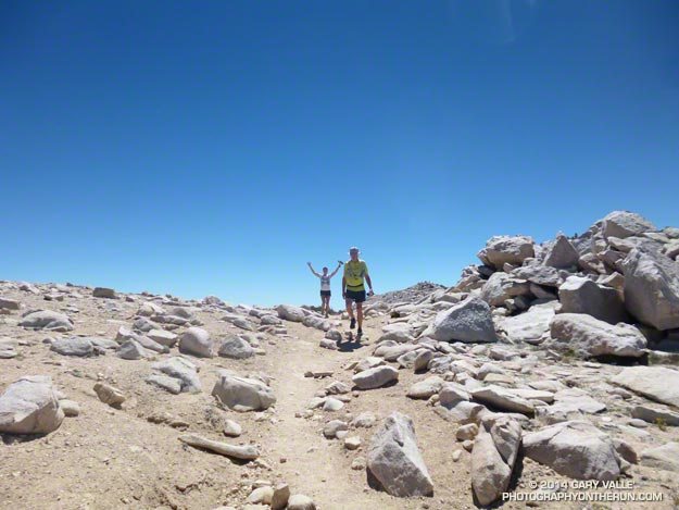
That’s Art and Ann just west of the summit of San Gorgonio Mountain, which can be seen behind them. The peak is the highest in Southern California, with a summit elevation of about 11,500′.

The ascent of the peak had gone well. Including a stop a South Fork Meadows to top off our water, and another quick stop to talk to Dan the Ranger, we’d left the car just after 7:00 and made it to the summit about 10:30 am. With the short-sleeves and shorts summer weather and zero chance of thunderstorm, the summit was a busy place.

We were doing a variation of the South Fork – Dollar Lake Trail – Dry Lake Trail keyhole loop. The variation was that instead of descending the Dry Lake Trail from Mine Shaft Saddle, we continued over to Fish Creek Saddle and descended a “use trail” past (dry) Lodgepole Spring, rejoining the Dry Lake Trail at the Dry Lake outlet.

It seems to me that doing the loop counterclockwise — going up the Dollar Lake Trail — maximizes the runnability of the route as a whole. With spectacular trails and scenery the route is every bit as enjoyable as a run in the Sierra, and is my favorite route up Gorgonio from the South Fork trailhead.

Some related posts: Dollar Lake – Dry Lake Trail Run, Falls Creek Loop August 2013, San Gorgonio High Line 2009

Crest of the Angeles

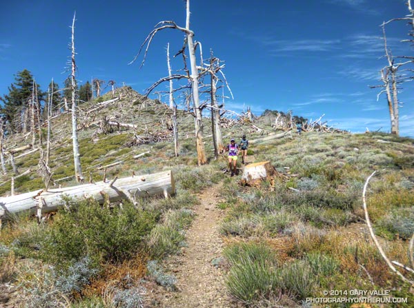
Runners on the PCT west of Mt. Hawkins

Between Vincent Gap and Islip Saddle the Pacific Crest Trail follows one of the most scenic stretches of trail in Southern California, skirting the summit of Mt. Baden-Powell (9399′) and passing Mt. Burnham, Throop Peak and Mt. Hawkins before leaving the crest at Windy Gap (7600′), just east of Mt. Islip. It has long been a favorite of hikers and runners.

There are several ways this classic stretch of trail can be incorporated into a run or hike. Today we were doing the segment as part of a training run for the 2014 Angeles Crest 100 Mile Endurance Run. The AC100 starts at Wrightwood, California; then using parts of the PCT, Silver Moccasin, Gabrielino and several other trails, the AC100 works west through the peaks and canyons of the San Gabriel Mountains to Loma Alta Park near JPL.
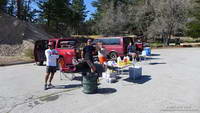


The AC100 training runs, organized and supported by AC100 co-director Hal Winton, cover the 100 mile course in approximately 25 mile segments. With the help of AC100 Racebook editor/photographer Larry Gassan and a host of generous volunteers, “Uncle Hal” makes it happen and always seem to be where runners need him to be. Today’s training run was the fourth, and last, of the 2014 series.
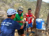


Just a few days before we’d done the third AC100 training run from Chantry Flats to the finish at Loma Alta Park. Beginning at Mile 75 of the AC100, this difficult segment includes the Wintercreek and Idlehour climbs and some of the most technical trails on the course. As a result of the drought water wasn’t easily accessible at Idlehour Creek, so Hal and 2013 AC100 finishers Dave Tan and Rainer Schultz were at the “Cape of Good Hope” on Mt. Lowe fire road to provide much-needed water to thirsty runners.
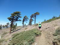


This morning’s run from Wrightwood had begun with an ascent of the Acorn Trail — a climb that matches foot for foot the 2650′ elevation gain of the PCT up Baden-Powell and is every bit as strenuous. After climbing up the Acorn Trail we’d joined the PCT and followed it along spectacular Blue Ridge, past the top of Mountain High Ski Resort, to Angeles Crest Highway at Inspiration Point. From there it had taken less than an hour to reach Vincent Gap and Hal’s aid station. A quick stop to refill my hydration pack and I was back on the PCT and chugging up Baden-Powell.

Far too many switchbacks later, far too much of the peak remained. I was maxed out and doing my best to keep up with Skye’s brisk pace. Finally we rounded a corner and I could see the Wally Waldron tree a 150 yards ahead. Just 150′ in elevation from the top of Baden-Powell, the gnarled and weathered limber pine — estimated to be 1500 years old — stands sentinel at the juncture of Mt. Baden-Powell’s summit trail and the PCT.
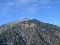


I’d pushed the pace up the Acorn and Baden-Powell climbs and now was paying the penalty. My legs were toast. When I’d reached the Wally Waldron tree the decision whether or not to go to the summit of baden-Powell had been very easy — one trail led steeply up and the other gently down. As we turned west onto the PCT I told Skye I was going to have to take it easy for a bit. She had already started to pick up the pace and it didn’t take long for her to disappear into the forest on the trail ahead.

After a while I glanced at my watch and was surprised to see that it was already 3:00 pm. Because of the long shuttle to Wrightwood we hadn’t started running until 9:20 am. After skirting Baden-Powell, I’d run past Mt. Burnham, struggled up to the shoulder of Throop Peak and now was near Mt. Hawkins. Here, the beginning of the descent to Windy Gap is marked by a prominent Jeffrey pine that has been struck by lightning.
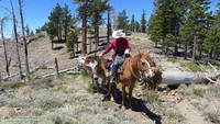


West of Mt. Hawkins the Pacific Crest Trail passes through a ghost forest of large trees burned in the 2002 Curve Fire. Recovery in the area is progressing well, and amid the dead trees are numerous pine and fir saplings. I ran this segment in mid-January and again at the end of May. Sometime between the two runs a large number of the dead trees had been blown down. During the May run it had been necessary to crawl over or work around a log jam of fallen trees. The trees likely blew down during a storm on February 28th, when Chilao recorded winds as high as 91 mph. That wasn’t necessary today, thanks to the expert trail work of PCTA volunteer Ray Drasher and his equine crew.
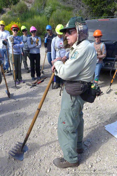


Most of the trail maintenance in the San Gabriels (and elsewhere) is now done by volunteers. One of the requirements to run in the AC100 is eight hours of trail work. This year AC100 entrants have worked on the Idlehour and Wintercreek Trails and will be working on the Gabrielino Trail below Newcomb Saddle in a couple of weeks. For more info about Hal and volunteering see the April 2014 issue of the VOLUNTEER TODAY newsletter (PDF).

Once through the ghost forest on Mt. Hawkins, it didn’t take long to get down to Little Jimmy Spring and from there over to Islip Saddle. It had been another tough training week in a series of tough training weeks. As I descended the final short switchbacks to the Islip Saddle parking area on Highway 2 I tried to visualize what it would be like on race day. How would I feel compared to today? Would I make here before noon? How hot would it be on Cooper Canyon? Would the cutoff at Cloudburst be a problem? Would I make it to Horse Flats before dark? On what trail would I be when sun rose for the second time during the run? All these and many other questions would be answered in just a few weeks.
Jon Sutherland Runs Every Day For 45 Years Plus

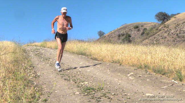
Jon Sutherland running at Ahmanson Ranch on day 16,446 of his 45+ year running streak.

Jon running at Ahmanson Ranch on day 16,446 of his 45+ year running streak.

Earlier this week, to the cheers of runners on the Notre Dame High School Cross Country team he coaches, Jon Sutherland broke Mark Covert’s U.S. record for the most days run consecutively. Jon’s run on Tuesday increased his daily run tally to 16,438 days — and counting.

It’s the “and counting” part that’s key. Jon has run on days of major earthquakes, record-setting rain and heat, national catastrophe and personal tragedy. He’s run through two knee operations, various strains, sprains and ills and several fractures — including a hip avulsion fracture.

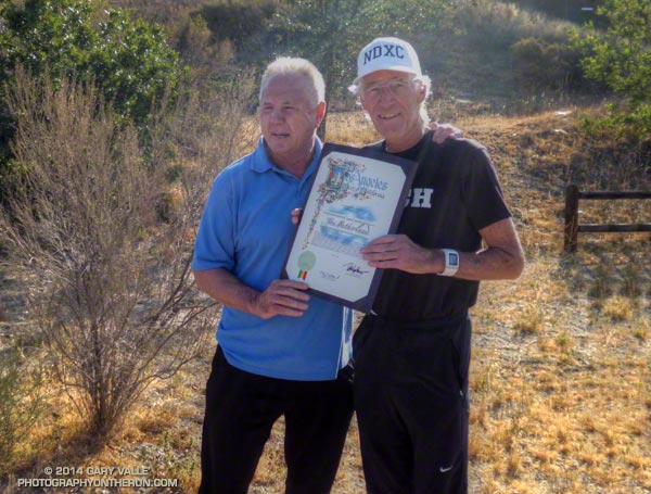
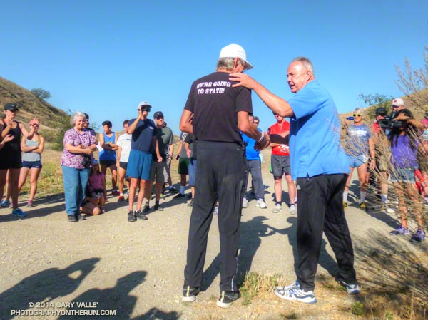
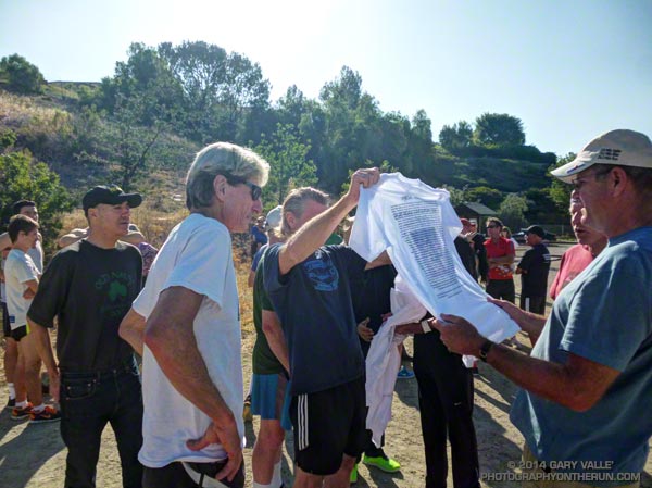
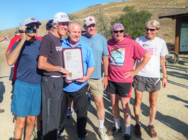
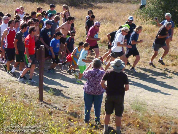
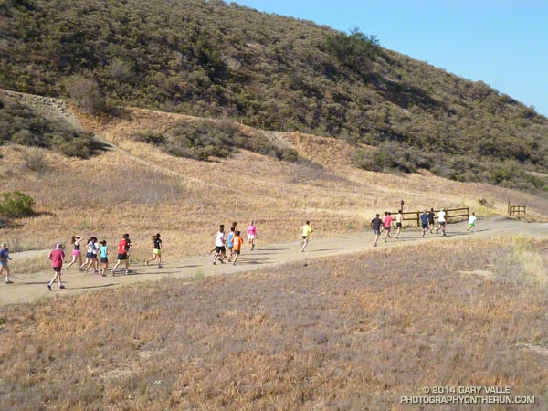
Today Jon hosted a “Running Rocks!” fun run/walk/hike at Ahmanson Ranch to thank all the people that have been part of his running life. During the celebration Councilmember Tom LaBonge (District 4) presented Jon with a Certificate of Accomplishment on behalf of the City of Los Angeles. Below are a few photos from the get-together.

Jon says he sees no stop sign, and plans to continue running every day. You can check his current count of consecutive days run on the U.S.A. Active Running Streak List.


Certificate Presentation


Jon & Councilmember Tom LaBonge


Running Rocks! T-Shirt


Jon & Runners


Start of the Fun Run


Fun Run at Ahmanson Ranch

Also see: Melissa Block’s Interview (NPR: All Things Considered), Eric Sondheimer’s article (Los Angeles Times), Lenny Bernstein’s article (Washington Post), Scott Douglas’ article (Runner’s World Running Times)

Related post: Jon Sutherland’s 40 Year Running Streak

Photography and inspiration from running and other adventures in the Open Space and Wilderness areas of California, and beyond. No ads. All content, including photography, is Copyright © 2006-2024 Gary Valle. All Rights Reserved.