Category Archives: nature|weather

Trippet Ranch Loop Plus the Santa Ynez Trail

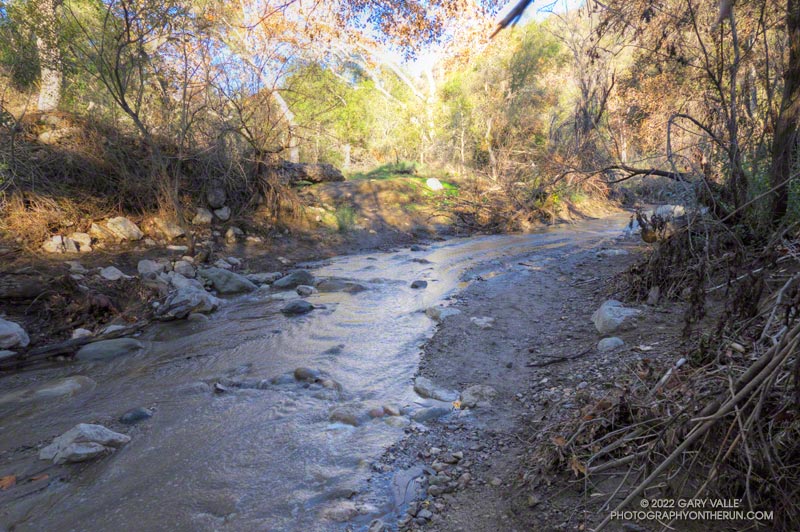
Creek crossing on the Santa Ynez Canyon Trail

I had just waded down a 50 yard stretch of creek where the Santa Ynez Canyon Trail used to be. Three hikers working up the canyon were trying to find a way past the flooded section without getting their boots wet. That wasn’t going to be easy.
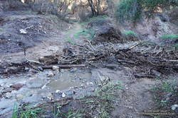
Debris at creek crossing in Santa Ynez Canyon.

I had been doing the same thing higher in the canyon. It was a chilly morning, and I had no great desire to soak my shoes in cold water. The usual rock and limb crossings had worked well until the trail ended in a broad area of flowing creek. Once my shoes were wet, it simplified the process.

That the trail was flooded following several days of rain wasn’t that surprising. What was a surprise is that there hadn’t been higher flows and more damaging flash floods in the canyon.
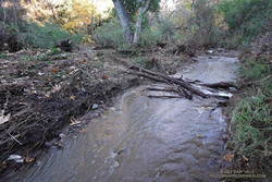
Creek crossing near the Santa Ynez Canyon Trailhead, on Michael Lane.
Creek crossing near the Santa Ynez Canyon Trailhead

Santa Ynez Canyon was the focus of the Palisades Fire, and a large part of the drainage was burned to a moonscape. Burned slopes often amplify runoff from heavy rain, producing damaging flash floods and debris flows. While there was clearly high flows in the canyon, the levels were less than what I’ve seen in similar circumstances, in other burn areas. One possibility is that unburned trees and brush along the streambed higher in the canyon had attenuated the flow.

After doing the out and back on the Santa Ynez Canyon Trail, I continued down to Trippet Ranch and then, like last week, returned using the Musch, Garapito, and Bent Arrow Trails.
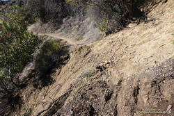
One of several sections of the Bent Arrow Trail damaged by slides. January 2,2022.
Section of the Bent Arrow Trail damaged by a slide

There were a number small rock slides, sluffs, and sediment flows along the trails and roads. A couple of people were working on clearing the limbs and small trees that had fallen across the Garapito Trail. The collapsed oak at the bottom of the Garapito Trail had settled, and was easier to get through this time.

The trail that really took it on the chin was the Bent Arrow Trail. Several sections of the trail were damaged by slides.

I usually do the Santa Ynez Canyon Trail as part of the Trailer Canyon – Santa Ynez – Trippet Ranch Loop. Tacking on the trail as an out and back addition to the loop was slightly shorter, but had a little more elevation gain/loss.

Some related posts: Trippet Ranch Loop After the Palisades Fire, Clouds, Canyons and Wildflowers, Running Between Storms on the Trippet Ranch Loop, Go Figure

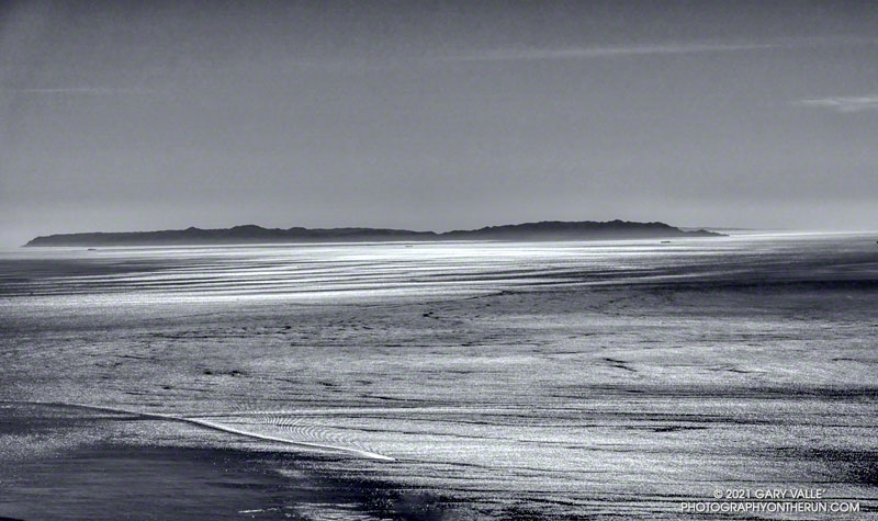
Catalina From Saddle Peak

Catalina From Saddle Peak

Another spectacular morning for a Southern California trail run.

The temperature on Saddle Peak was in the high-60s, with light winds out of the north.

The distance to Two Harbors from Saddle Peak is about 45 miles.

Looking For Christmas Berries

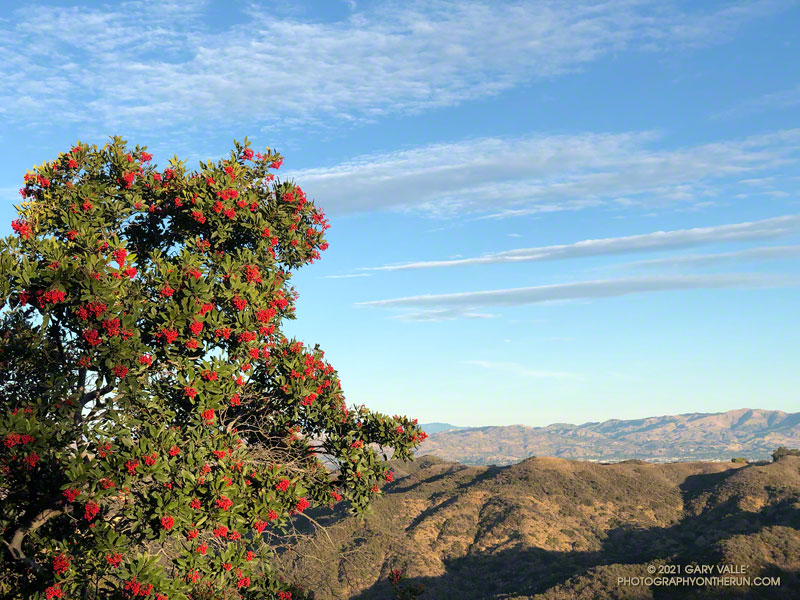
Toyon heavily-laden with berries
Toyon along the Garapito Trail (Winter 2019-2020)

A week after doing the out and back run to the Ray Miller Trailhead, I was back in the Santa Monica Mountains and doing another popular trail run — the Trippet Ranch loop. Near the top of the Garapito Trail it dawned on me I’d seen no berries on the toyon shrubs and trees along the way. These red-orange berries usually add a bit of Holiday color to the chaparral, and at one time were so sought after that a law was passed to protect them.

Toyon usually blooms in the Summer, producing green berries that slowly turn red-orange by the holidays. The title photo — of a toyon heavily loaded with berries — is from last Winter.

For the remainder of the run I checked most of the toyon along the trails back to the Top of Reseda. Not a single toyon had any berries.

How widespread was this? The following two weekends, I did runs in other areas of the Santa Monica Mountains. One was an extended version of the Bulldog Loop, and the other an out and back run from the Top of Reseda to the Oak Tree on Rogers Road segment of the Backbone Trail.

On those three runs I must have passed hundreds (thousands?) of toyon along the trail. Out of all of those I checked, only one had berries. It was near the water tank on Mesa Peak Mtwy fire road, at the top of the climb up from Tapia.

As you might expect, the most likely explanation for the lack of berries is the drought. Precipitation records for Downtown Los Angeles (USC) show that in 2019-2020, the rain season lasted about 5 months — from about mid November to mid April. Leading up to the flowering period for toyon the accumulated rainfall was a little above normal. The result was what you see in the title photo.

On the other hand, in 2020-2021, the rain season effectively began at the end of 2020 and ended in mid March. Less than half of normal rainfall was recorded going into the flowering period of toyon.

The toyon on Mesa Peak fire road that managed to produce some berries is situated near the crest of east-west oriented ridge. It probably benefits from enhanced precipitation because of its location.

Some related posts: Christmas Berry on the Garapito Loop, Best Trailhead to Start the Bulldog Loop, Will Rogers – Rivas Canyon – Temescal Canyon Trail Run

Out and Back Trail Run to the Ray Miller Trailhead from Wendy Drive

Hikers enjoy the spectacular scenery of California's Point Mugu State Park

When I parked at the Wendy Drive trailhead, there was just enough light to see a wide band of high clouds overhead. That was good news. With a well-advertised storm expected to move through the area the next day, I hadn’t been sure what weather to expect for today’s run.

Colorfully illuminated clouds a few minutes before sunrise on the Wendy Connector Trail

The general forecast was for low clouds and fog in the morning, giving way to partly cloudy skies in the afternoon. I was going to be running one of the more scenic trails in the Santa Monica Mountains — the Ray Miller Trail. High clouds and sunshine were a much better option than running in the fog or with gloomy, overcast skies.

Shortly after leaving the trailhead, the band of high clouds became underlit by the reds, oranges and yellows of the rising sun. It was going to be a good run.

The route-finding on this run is relatively straightforward. From the Wendy Drive trailhead on Potrero Road, run over to the Satwiwa Native American Indian Culture Center (see Satwiwa map). From the Culture Center run 4+ miles on Big Sycamore Canyon Road/Trail toward the beach. Some of this is paved.

La Jolla Canyon, PCH and Mugu Peak from the Ray Miller Trail

Once past the junction of Sycamore Canyon and Wood Canyon fire roads, take either the Wood Canyon Vista Trail (Backbone Trail) or Fireline Trail up to the Overlook fire road. From the top of the Wood Canyon Vista Trail turn left on Overlook fire road, or from the top of Fireline turn right, and follow the road to the top of the Ray Miller Trail. The Fireline option is about 0.4 miles longer. Here’s a map from the State Park website. Note that the La Jolla Canyon Trail is closed.

The Ray Miller Trail drops about 1000′ over 2.6 scenic miles. There is usually water available at the parking lot at the trailhead. Today the conditions were about as good as they get. The trail was in excellent condition. The temperature was in the mid-70s. The marine layer was holding offshore and a few puffy clouds had formed over the higher peaks.

One of the things about the Ray Miller Trail is that run/hike up it is almost as enjoyable as the run down. It is a very popular, and there are almost always runners and hikers on the trail. Running up a section of trail, I thought I recognized someone going down. It was nine-time Badwater finisher Chris Frost. We talked for a while about trails, running and races.

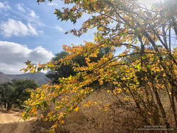
Fall color on a California sycamore along Wood Canyon Fire Road

From Overlook Fire road the route back to Wendy was a familiar one — Hell Hill, Wood Canyon Fire Road, Two Foxes Trail, Big Sycamore Canyon Road, Upper Sycamore Canyon Trail, Danielson Road, and the Satwiwa Loop Trail. Including a short jog over to PCH the run was a little over 24 miles with about 3100′ of elevation gain.

Here’s an interactive, 3D terrain view of the Wendy Drive – Ray Miller Out & Back trail run. The map can be zoomed, tilted, rotated, and panned. To change the view, use the control on the upper right side of the screen. Track and placename locations are approximate and subject to errors. Poor weather, and other conditions may make this route unsuitable for this activity.

Some related posts: A Windy Run, Walk, Ride, for Wildlife Research; Running to Ray Miller; Ray Miller Training Run

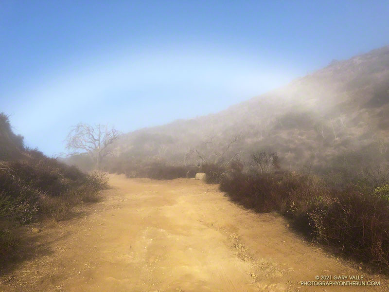
Fogbow Near the Top of Hell Hill in Pt. Mugu State Park

Fogbow Near the Top of Hell Hill in Pt. Mugu State Park

Fogbows form opposite the sun in a manner similar to rainbows, except the water droplets that create a fogbow are much smaller than raindrops. Because a fog droplet is so small, the physics of the interaction is different. The result is often a diffuse, primarily white bow.

The photograph of the fogbow was taken Sunday morning on an out and back run from Wendy Drive to Mugu Peak. The sun was about 14 degrees above the horizon. More about fogbows and other atmospheric phenomena can be found on Les Cowley’s Atmospheric Optics website.

Some related posts: Rainbow Colors in Cirrus Clouds Over Los Angeles, Out and Back Trail Run to Mugu Peak

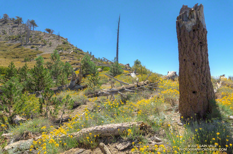
Rabbitbrush Along the PCT Near Mt. Hawkins

Rubber rabbitbrush (Ericameria nauseosa) along the PCT, near Mt. Hawkins

From mid Summer into Fall, the vibrant yellow flowers of rabbitbrush add a refreshing hit of color to the greens, grays, and browns of the San Gabriel Mountains.

The title photo was taken along the PCT, at an elevation of about 8600′, near Mt. Hawkins. The area was burned in the 2002 Curve Fire. Here, and elsewhere in the burn area, new trees — now in their teens — are slowly replacing some of the trees lost in the fire.

Related post: Bumblebee Feeding on Rabbitbrush