Since kayaking Arroyo Seco with Gary Gunder during the 1997-1998 El Nino, I’ve enjoyed revisiting the many drops and falls along Arroyo Seco when running in the area.
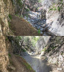
Arroyo Seco Sediment 2012 vs 2016. Click for larger image.
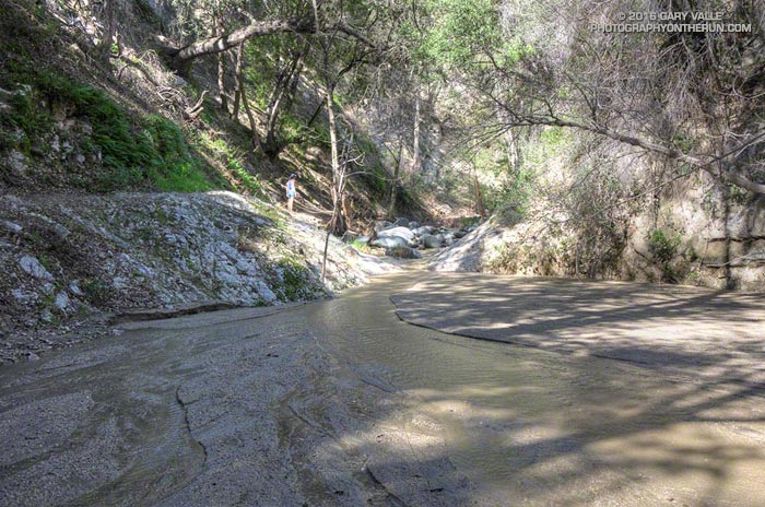
Doing a little sleuthing using Yelp reviews of Switzer Falls, it looks like the creek had low sediment levels in early January 2014, but was heavily silted in mid-March 2014. Based on this, it appears that the initial sedimentation event occurred during the storms of February 26 – March 2, 2014, when nearby Opids Camp recorded 10.95 inches of rain.
The origin of the 2009 Station Fire was in the Arroyo Seco watershed and it was one of the most severely impacted. A question that comes to mind is why did the Arroyo Seco drainage produce such a high rate of stream sedimentation in the February-March 2014 rain event, but not in the very high flows of February 2010 and December 2010, and the moderately high flows of March 2011?
Some of the factors likely include vegetative cover, rainfall rate, recent rainfall history, the soil’s hydrophobicity, the soil support provided by degrading root systems, the magnitude of the peak flow and the shape of the stream discharge curve. Our multi-year drought has been an amplifying factor, further reducing vegetative cover and soil support.
For more information regarding the history of the Arroyo Seco watershed and plans for its rehabilitation see the Arroyo Seco Foundation web site.
I stepped on top of the waist-high rock and with some effort pressed upward. It felt like my leg was going to blow apart at the seams. We were hiking up a steep section of Strawberry Peak, and were about a mile from the summit. I’d done Strawberry from Red Box innumerable times, but my legs had never felt like this.
Trail runners — and all of us that love the outdoors — are very good at finding ways to spend a little extra time outside. The first half of the day Skye and I had done the Bear Canyon loop and now we were climbing Strawberry Peak.
Bear Canyon
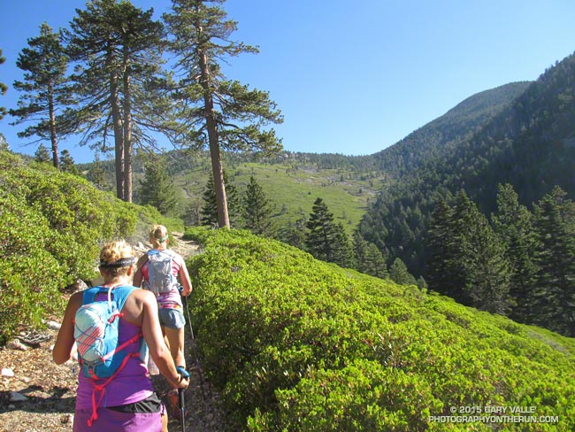
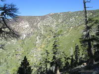
On its own the Red Box – Bear Canyon – Gabrielino loop is a demanding run. Because the canyon has been subject to numerous flash floods the Bear Creek Trail is a mix of classic mountain trail and segments of “use trail” through washouts and flood debris. Add in the elevation gain going from Red Box to Mt. Disappointment and from Switzer Falls back up to Red Box and you’ve got an adventurous run.
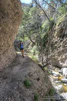
Bear Creek Trail near Arroyo Seco
About halfway through the canyon is Bear Canyon Trail Camp. Perched on a bench above the creek this idyllic camp was spared by the 2009 Station Fire. Because of the camp’s popularity the section of trail between Bear Camp and Arroyo Seco sees the most use and generally is in better condition than the section between Tom Sloan Saddle and Bear Camp.
The 16 mile loop we did today is the shortest that goes through Bear Canyon. The loop can be extended by linking in the Valley Forge Trail or circuit around Strawberry Peak, or doing what we did today — the out and back to the summit of Strawberry Peak.
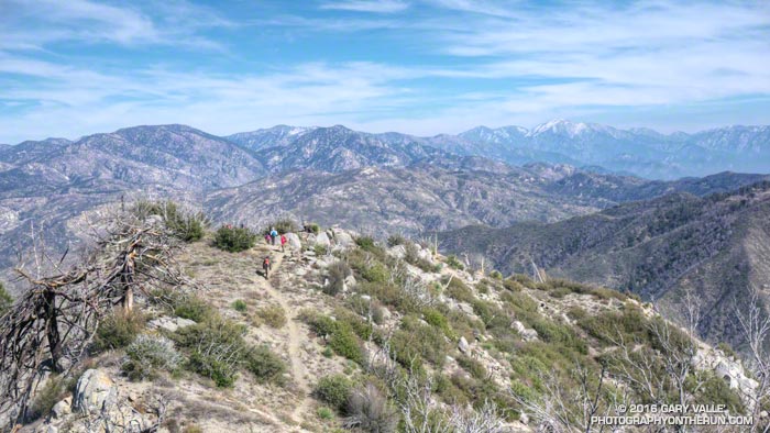
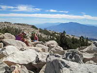
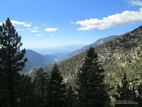
It was a little past noon and Downtown Los Angeles was about to hit a high of 100°F for the second consecutive day. From my vantage point I couldn’t quite make out Downtown; it was 80+ miles away, somewhere in the light haze to the west. Across Banning Pass Mt. San Jacinto loomed, massive and pyramidal, and down the spine of the range stood Mt. Baldy, surrounded by its siblings.
Summit of San Gorgonio Mountain
Ann, Patty and I were enjoying the summit of 11,503′ San Gorgonio Mountain following a 13+ mile run and hike from the Momyer Creek trailhead in Forest Falls. Although it is nearly four miles longer than the Vivian Creek route and gains an additional 1000′ of elevation (6500′ vs 5500′), this superb alternative is a more runnable way up the mountain, with more of backcounty feel and alpine flavor.
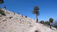
Alpine terrain above Little Charlton – Jepson saddle
It was cool on the summit, but I was still warm from running what I could of the final couple of miles up the peak. In that last stretch the trail contours around Jepson Peak, passes the Vivian Creek and Sky High Trail junctions, and then works its way up to the blocky summit of Gorgonio — the highest point in Southern California.
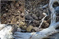
Lodgepole and Limber Pine cones.
Despite the record-setting hot weather, the temperature on the way up the mountain had been pleasant. Our pace had been conversational. Among other topics Ann told of her amazing experiences running the UTMB and Patty talked about photography and her trip to Zion. I spoke of lapse rates & compressional heating, Chinquapin nuts, and Lodgepole & Limber pines . At least for me, the miles passed with distracted ease.
The Lake Fire burned over the divide near Shields Peak.
From the switchbacks above Plummer Meadows you could see where the Lake Fire overran San Bernardino Peak Divide in the area of Shields Peak. The 31,359 acre Lake Fire started the afternoon of June 17 near the Forsee Creek trailhead southwest of Jenks Lake and burned a huge swath through the San Gorgonio Wilderness. The fire burned to within 0.4 mile of the summit, near the C-47B “Gooney Bird” crash site on the Sky High Trail. Here is a Google Earth view from the west along the crest of the San Bernardino Peak Divide showing part of the burn area and another view along the divide from the east. Much of the north and east side of Gorgonio is within the Lake Fire Closure Area.
Mill Creek Canyon from the Vivian Creek Trail
After about 15 minutes on the summit it began to get chilly and it was time to head down. The descent of the Vivian Creek Trail is as much of a challenge as the ascent of Falls Creek. Although I’ve run it many times, I conveniently forget just how convoluted, rocky, and technical it is. Part way down a double-fall of huge trees completely blocked the trail. One tree had broken on impact and the route choice was to either squeeze through the fracture or go the long way around.
We had become spread out on the descent, but were now running together on Valley of the Falls Drive. This 1.4 mile stretch on pavement connects the Vivian Creek trailhead to the Momyer Creek trailhead, completing the 24 mile loop. A short distance past the Fire Station we reached the gravel parking area. No longer obscured by trees, the view opened to a panorama of mountains that looked impossibly rugged and tall. Had we really just been up there?
My legs would answer that question following the two hour drive home.
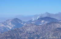
The area in the image above was burned by the Station Fire on September 7, 2009. That morning I’d just crossed the peak-top finish line of the Baldy Run to the Top and using a tiny point and shoot camera took this snapshot of the Station Fire burning on Mt. Waterman.
Station Fire on Mt. Waterman
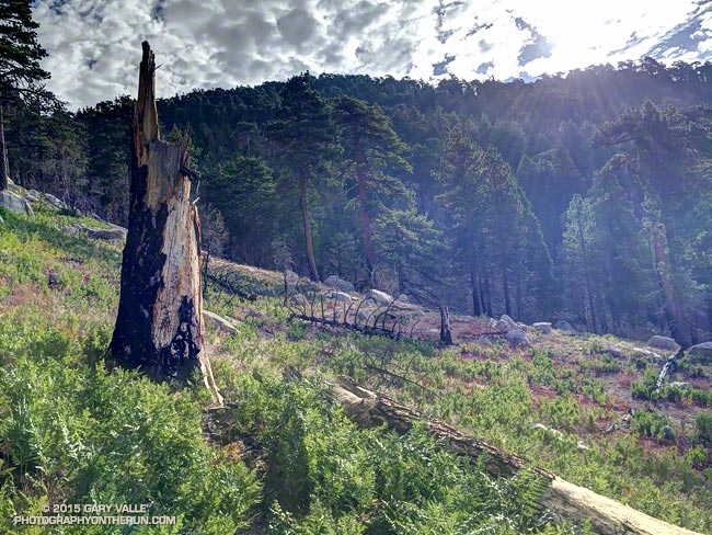
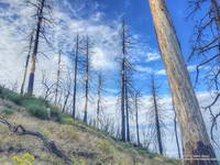
The image of the fallen trees and ferns is from today’s counterclockwise circuit of Waterman Mountain from Three Points. It was taken at an elevation of about 7100′ about 3.5 miles from Three Points and about 1.5 miles west of the Twin Peaks Trail junction. Here the Station Fire burned swaths of forest, running up steep gullies and ridges on the south slopes of the mountain.
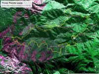
Ikhana BAER Burn Intensity
The purple hues in this Burned Area Emergency Response (BAER) image taken by the NASA Ikhana remotely piloted aircraft in 2009 are indicative of the burn severity in the vicinity of Three Points and Mt. Waterman. (Ikhana image courtesy of NASA Dryden and NASA Ames. Composite image created using Google Earth Pro.)
Pines Burned by the Station Fire
The yellow track in the BAER image is of the Three Points – Mt. Waterman loop. The track includes a side trip to the summit of Mt. Waterman I didn’t do today. About one-third of the approximately 20 mile loop was impacted by the fire. If the loop is done counterclockwise the first couple of miles are the most severely burned and have the most downed trees and Poodle-dog bush. Use trails have developed around the fallen trees, but it seems a new tree or two has fallen each time I do the route. With care the Poodle-dog bush is generally avoidable.
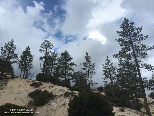
It wasn’t so much a surprise that there was thunder or that it was starting to shower again. It was that I was hearing thunder all around me — to the east toward Mt. Waterman and Twin Peaks, to the south toward Mt. Wilson and the San Gabriel Valley, and to the west toward Big Tujunga Canyon and the San Fernando Valley. This was clearly more than an isolated summer build-up. Pockets of showers, some light and some heavy, could be seen in the distance and I wondered just how wet I was going to get.
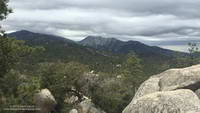
Mt. Waterman (left) and Twin Peaks from near Mt. Hillyer
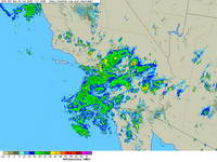
The answer was “pretty wet!” That was on a run in the San Gabriel Mountains on Saturday, and was the result of the first wave of moisture and instability associated with tropical system Dolores and a strong monsoonal flow from Baja. An even stronger surge of moisture followed Sunday afternoon with rain rates exceeding an inch an hour. From 5:15 p.m. to 5:25 p.m. a CBS Radio weather station on Mt. Wilson recorded a half-inch of rain in just 10 minutes!
Composite radar image for Southern California at 5:00 p.m. Sunday
Though the heavy rain created its own problems — including flash floods, debris flows and rock slides — the soaking rains helped quell the Pines Fire near Wrightwood and the North Fire near Cajon Pass. Over the three day period from Saturday to Monday the Big Pines Remote Automated Weather Station (RAWS), near the Pines Fire, recorded 3.12 inches of rain. Several stations in the San Gabriels recorded more than three inches of rain, including Clear Creek and Opids Camp.
Many locations set new records, not only for the date, but for any day in July. Downtown Los Angeles (USC) set rainfall records for the date on Saturday, Sunday and Monday. Downtown Los Angeles recorded 0.36 inch of rain Saturday. This is more rain than any day in any July since recordkeeping began in 1877. That one day of rainfall even broke the monthly record for July in Los Angeles! Prior to this event the wettest July on record was in 1886, when 0.24 inch was recorded.
Strengthening El Nino conditions and the active phase of the Madden-Julian Oscillation contributed to the development of Dolores in the Eastern Pacific, enhancing convection. Anomalously warm SSTs in the tropical and sub-tropical Eastern Pacific also played a role, helping to maintain the strength of Dolores and increasing the amount of water vapor entrained by the system.
This year’s El Nino is very different than last year’s on again, off again event. This year’s El Nino is already established, well-coupled with the atmosphere and growing in strength. It’s firing on all cylinders and at this point it appears the only question is, “How strong will it get?”