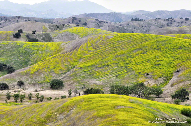
Mustard flowering in Cheeseboro Canyon reveals the underlying structure of a hill.
According to the Dibblee geologic map of the area, the strata are part of the Modelo Formation. And… the Modelo Trail passes directly over the top of the hill.
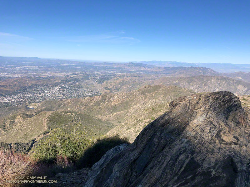
View west from Mt. Lukens, across the Crescenta and San Fernando Valleys.
It was a chilly 45 degrees in the canyon, and I had already resigned myself to having to wade across Big Tujunga Creek. But I didn’t even get my shoes wet. The water level was low enough that the large rocks placed across the creek were high and dry.
Low water made it easy to cross Big Tujunga Creek.
It was a good start to what was to be an excellent run and hike. As I gained elevation, it was evident there had been recent work on the trail. Trimmings from the brush along the trail were still green, and in several spots the tread had been freshly manicured. The higher I climbed, the more work had been done. In a couple of places, substantial washouts had been repaired.
Last year, the trailwork ended abruptly about halfway up the trail. Not so this year. An impressive amount of work had been done to clear the trail of a tortuous mix of dead scrub oaks and thorny brush. Without having to crawl over, around, and through those snarls, my roundtrip time to the summit and back was a full hour faster than last year. Many thanks to whoever worked on the trail!
Here’s an interactive, 3D terrain view that shows a GPS track of the route up and down the Stone Canyon Trail on Mt. Lukens. The view can be zoomed, tilted, rotated, and panned. Placemark and track locations are approximate and subject to errors.
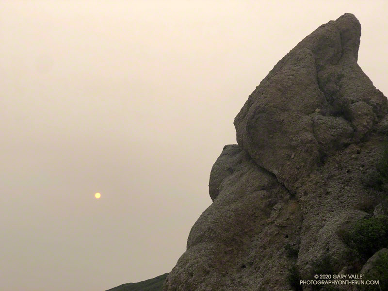
To the east, the sun rose orange, cast that color by a thick pall of smoke. From the Satwiwa Loop Trail, the view of Boney Mountain were surprisingly clear. As the air pollution sensors in the area had indicated, the air quality appeared to be passable. I hoped it would stay that way for the remainder of the run.
With all the National Forests in California closed through at least September 21, and the smoke from wildfires affecting many areas, I’d been fortunate to find a place where I could get out and stretch my legs.
I was doing a route I had done many times before — a loop incorporating the Western Ridge of Boney Mountain and the Chamberlain segment of the Backbone Trail. I’d last done the loop in June and was curious to see the condition of the Chamberlain Trail and how recovery from the 2018 Woolsey Fire was progressing.
From the top of Peak 2935, it seemed the “smoke front” to the east was slowly creeping closer. The flat, orange light was eerie. Continuing to Tri Peaks, I decided to skip the side trip to Sandstone Peak and followed the west Tri Peaks trail directly to the top of the Chamberlain Trail.
Foot traffic on the Chamberlain Trail had opened it up a bit, but there were still thousands and thousands of stalks of bleeding heart along the trail. The condition of the trail improved somewhat below Chamberlain Rock.
When I’d done the route in June, I’d seen no one until just before the junction of the Chamberlain & Old Boney trails. In June it had been a group of hikers. This time it was another runner, and we exchanged notes about the routes we were doing. Below the junction, I was surprised to find that one of the seeps on the Old Boney Trail was still wet.
After getting some water at the Danielson Multi-Use Area, I continued up Sycamore Canyon, finishing the run on the Upper Sycamore Trail, Danielson Road, and the network of Satwiwa trails.
Mesa Spring Trail near the top of San Emigdio Mesa.
For many that enjoy the outdoors, there is an insatiable desire to go where we have not been, learn what we do not know, and discover what we have not experienced.
Each time I’ve done the out and back trail run from Mt. Pinos to Mt. Abel, I’ve been curious about the Mesa Spring Trail. The trail leaves the Tumamait Trail at Puerto del Suelo, a saddle about 0.6 mile east of Mt. Abel Road, and descends to a campsite at a spring on the margin of San Emigdio Mesa. The mesa is the large alluvial fan shown on this Google Terrain Map overview.
The Mesa Spring Trail is part of an old trail shown on the USGS 1903 Mt. Pinos topo map. The old trail was part of a route that connected the Cuyama River to the historic El Camino Viejo a Los Ángeles. It followed Dry Canyon, went over Puerto del Suelo, and to the valley that is now the Pine Mountain Club. Like so many trails, it must have evolved from a hunting and trade route.
Google Terrain map showing San Emigdio Mesa and my route from Mt. Pinos
The Mesa Spring Trail is usually accessed from the West Tumamait Trailhead on Mt. Abel Road. But it occurred to me that starting at the East Tumamait Trailhead on Mt. Pinos might be an enjoyable way to do a longer out and back run. The Mesa Spring Trail looked like it might be similar to the North Fork Trail — a little less used and a bit more remote.
I left the Chula Vista parking area a little before 7:00 a.m. and started chugging up the road to the East Tumamait Trailhead at the Mt. Pinos Condor Observation Site. I planned to skip the usual side trips to Sawmill and Grouse. The spring was at a much lower elevation, and I wanted to get there before the temperature sizzled.
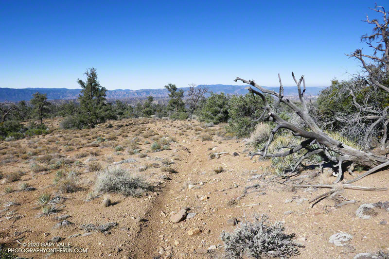
Once on the Vincent Tumamait Trail, it took a little over an hour to reach the top of the Mesa Spring Trail. The junction is marked with a new sign and tree branches on the ground. It is about 5.7 miles from the Mt. Pinos parking area.
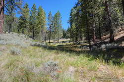
Plant communities change dramatically with elevation. This Jeffrey pine forest is at about 7000′.
The first couple of miles down from the junction, the trail more or less follows the drainage. About 10 minutes from the junction, a large pine tree had fallen and completely blocked the trail. I worked around the right (west) side of the tree, where some orange fence posts had been placed. A few minutes beyond the collapsed tree, the trail wandered around the right side of a pretty meadow and then back to the “V” of the dry stream.
For the next mile or so, the trail followed a typical down-canyon route. On the way down, there were some spots where I stopped, turned around, and made a mental note of what the trail did. It wasn’t so much a matter of getting lost, as it was not wasting time at an ambiguous spot on the way back.
About 2.3 miles down from the saddle, the trail climbed out of the canyon, taking a counterintuitive turn to the right. After reaching a ridgeline, the trail turned back left and continued downhill. But its wanderings were not over. The trail was working across the gullies at the top of the San Emigdio Mesa. It went up, down, and around, but eventually did go to Mesa Spring. There were “ducks” marking the route, but it really helped to have looked at a map and have a general idea of where the trail would go.
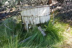
Mesa Spring is on the northern margin of San Emigdio Mesa.
Mesa Spring is a pretty green spot in a group of pinyon pines. As I neared the spring, I saw some coyote-like ears bobbing through the sagebrush, and not long after that, a deer bounded through the trees. At the spring, a squirrel leaped from the edge of the water-filled cistern to a nearby tree and various birds flittered in the pines. I heard a trickle of water near the cistern’s base but planned to get water at Sheep Camp, later in the run.
With its bounty of pinyon pine nuts, acorns, juniper berries, game, and more, San Emigdio Mesa provided vital resources for the local Chumash.
Although the Mesa Spring Trail continues down the mesa, the spring was my turnaround point. I had waited for a day when the weather was better for this run. A weak low-pressure trough moving through to the north had stirred up a little wind and taken the edge off the recent heatwave. It had been cool on the crest, but at 6000′ it was already hot in the sun. It was time to get moving, and in a few minutes, I was retracing my steps and headed back to Mt. Pinos.