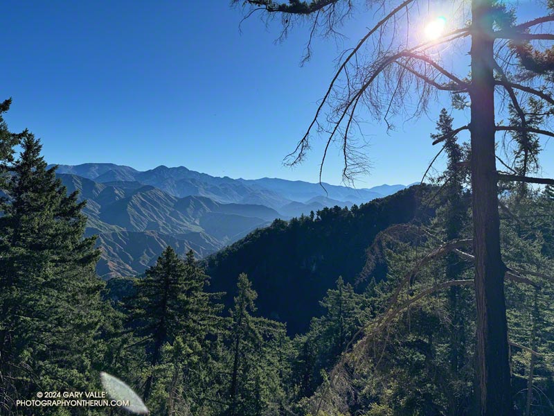
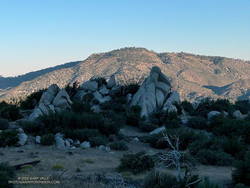
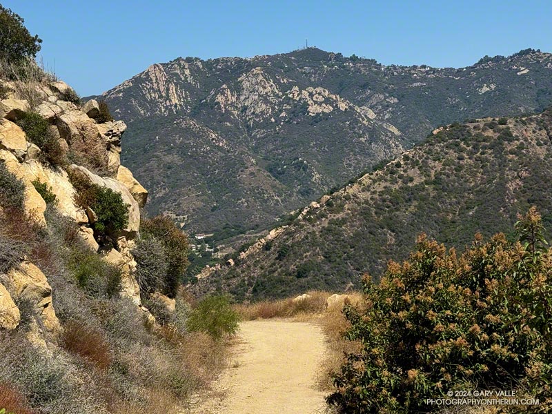
Mt. Pacifico (7124′) from low on the Three Points – Mt. Waterman Trail.
I was back on the Three Points – Mt. Waterman Loop and having a better time of it than in June. The June run had been near the Summer Solstice, with in-the-sun temperatures reaching 100°F. Today’s run was a few days away from the Fall Equinox. Not only was the temperature about 10 degrees cooler, the sun was lower in the sky and less intense.
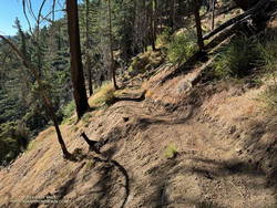
But much was the same as in June. There was still plenty of whitethorn on the first couple of miles of the Three Points – Mt. Waterman Trail — and a few prickly passages for anyone wearing shorts and short sleeves. Some trailwork had been done higher on the mountain, but a few fallen trees were still on the trail. Most of these were easy to step over, around, under, or through.
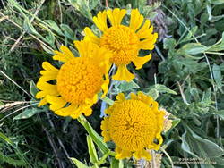
Late season Bigelow’s sneezeweed at Waterman Meadow.
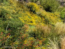
There was very little monsoon rainfall this Summer, but consecutive wet rainy season and a tropical storm had already recharged the seeps and small creeks. The creeks were only slightly lower than in June, and the places that had been wet and muddy in June were still wet and muddy. At Waterman Meadow, a few late-season blooms of sneezeweed beamed yellow in the midst of the greens of the grass and ferns.
The high point of the Three Points – Mt. Waterman Trail is near the junction with the trail to the summit of Waterman and the trail that comes up from Highway 2. It’s at an elevation of about 7686′. Including detours to get around downed trees, the junction is a bit more than 6 miles from Three Points. The junction marks the start of a nearly 2000′ descent over 4.7 miles to the PCT in Cooper Canyon.
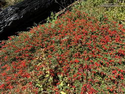
California fuchsia along the Burkhart Trail.
This morning, I encountered no one on the Three Points – Mt. Waterman Trail and only one pair of hikers on the normally busy Mt. Waterman Trail. Buckhorn Campground was nearly empty. I topped off my water at a convenient faucet at the campground and then started down the Burkhart Trail.
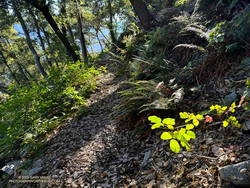
The creek in the canyon below the Burkhart Trail happily bubbled and gurgled, its water easily outpacing me as I descended to the PCT. Some work had been done on the trail to help those hiking to Cooper Canyon Falls cross the muddy seeps. Near one seep, a patch of dazzling red California fuchsia contrasted sharply with the coal black of a tree burned in the Bobcat Fire.
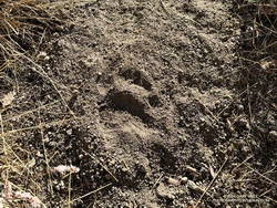
Black bear track.
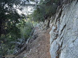
I wouldn’t say the trail has been abandoned, but it’s been quite a while since any trailwork has been done on the PCT between the Burkhart Trail and Cloudburst Summit. A mass of trees is still blocking the trail near the creek crossing at the bottom of Cooper Canyon. As expected following a fire, trees continue to fall on the trail. Parts of the trail along the creek or near seeps are overgrown with “Hey Bear!” willows.
The PCT in Cooper Canyon has been isolated by the 19-year closure to protect the critically endangered mountain yellow-legged frog. In December 2005, Angeles National Forest “temporarily” closed the Williamson Rock climbing area and the PCT between Eagle’s Roost and the Burkhart Trail. This Summer, the Forest Service extended the closure to at least December 31, 2026.
It’s difficult to accept that the Forest Service, conservation groups, and involved agencies have not agreed on a solution. Can’t the short stretch of the PCT that impacts frog habitat be rerouted? Only a few climbs at Williamson Rock directly impact the frog habitat. Does the entire climbing area need to be closed? Can’t bridges, walkways, and other structures be used to protect and even enhance frog habitat? There has to be solution. In 2005, I could not have imagined that 21 years later Williamson Rock would still be closed, and I might not have the opportunity to climb there again.
Goldenrod and California fuchsia along the PCT in Cooper Canyon.
On this run, it wasn’t necessary to stop at Cooper Camp to cool off. Although the temperature was in the 90s on the south-facing slopes traversed by the PCT, there was a bit of a cooling breeze. This and the lower sun angle made it far more pleasant than earlier in the year.
From Cloudburst Summit, it’s a little over five miles of (mostly) downhill to Three Points. Most of the running is on an old road bed. Although it can be tedious — especially when it’s hot — the segment is relatively fast-paced. Depending on the year, there are usually a couple of places to soak a hat and pour water over your head. But, as I learned one hot day, a rattlesnake may take exception to your intrusion!
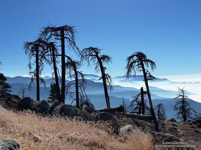
It was a sobering sight. I had stopped at a point on Mt. Waterman burned by the Station Fire in 2009 and the Bobcat Fire in 2020.
To the east, smoke from the Bridge Fire filled the canyons and clung to the ridges between Mt. Baldy and the East Fork San Gabriel River. A group of skeletal Jeffrey pines, once full and green, stood starkly in the foreground.
Another devastating fire had stormed through the San Gabriel Mountains, destroying homes and ravaging the forest and all that lives within. Not far away, the Line and Airport Fires were also burning, the extent of the three fires totaling over 117,500 acres.
Conventional methods of land and fire management usually do not prevent the rapid spread of a fire when forest or weather conditions are extreme — and extreme conditions are now the norm.
Incremental changes to long-established policies will not be enough to prevent runaway wildfires. Novel approaches must be considered, researched and evaluated. New tools and technology, including AI, need to be more widely applied. The hesitancy to spend money proactively must be overcome.
Today, it is difficult to do a hike or run of more than a few miles in the foothills or mountains of Southern California without passing through an area that has been burned in the past 25 years. In 50, 100, or 200 years what will the outdoor experience be? Will conifers only exist in widely scattered stands? Will the ecology be forever compromised?
Every effort must be made to mitigate the impacts of runaway wildfires and preserve the nature and ecology of our open space areas and wildlands.
Saddle Peak from the Mesa Peak Mtwy on the Bulldog Loop.
It was near dawn, and I was driving west on the 101 Freeway, going to the Wendy Drive Trailhead to do a run in Pt. Mugu State Park.
I’d just passed Moorpark Road and changed lanes to exit at Lynn Road. Suddenly, the whole car started to shake. The vibration was so intense it took a moment to realize I had a flat tire. [Expletive deleted!] I pulled onto the shoulder of the freeway and cursed again.
After decades without a flat, I had managed to have two in just three weeks. Both were early on Sunday morning and on the way to do a run. The first happened on Angeles Forest Highway while driving to Islip Saddle. That time, I was able to pull into a large turnout and change the tire. Traffic wasn’t an issue. Not so on the Ventura Freeway. The flat was on the driver’s side, and the shoulder was narrow. I called for service.
Apparently, there aren’t many roadside service vehicles out and about before sunrise on a Sunday. An hour and a half later, I was finally headed back to the San Fernando Valley.
I was first in line when Tires Buy Mark opened at 10:00. While waiting for the tire to be patched, I debated a Plan B for a run. Eventually, I decided to do an extended version of the Bulldog Loop. The run would be in the middle of the day, which wasn’t ideal, but it was nearby. It would be an excellent 16-mile run, even if a little on the toasty side.
At 11:30, I started up the short hill at the beginning of the Cistern Trail. Even though it wasn’t an unusually hot day, the temperature in the sun was already in the 90s, and there wasn’t a cloud in the sky.
It was slightly cooler on the trail along Malibu Creek. There was still water pooled in the creek, and I was glad the seasonal footbridge was in place. A pool near the M*A*S*H site was surprisingly large.
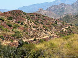
A section of Bulldog Mtwy low on the climb.
I expected it to be warm on the Bulldog climb, and it was. I just pretended I was on the second loop of the Bulldog 50K and continued chugging up the hill. Speaking of which… The Bulldog Ultra was the previous weekend, and a new course record was set in the 50K. Anthony Fagundes did the 29 mile course in the remarkable time of 3:30:03. This works out to an AVERAGE pace of 7:15 min/mile! His race analysis on Strava lists a split on the downhill on Mesa Peak Mtwy fire road at 5:25 min/mile. I don’t have the exact time, but on the first loop it looks like he did the Bulldog climb — from Crags Rd. to Castro Crest Mtwy — in about 30 minutes.
It took me a little longer than that to get up Bulldog. There was a noticeable drop in temperature as I worked up to the top of the long climb. On Castro Crest and Mesa Peak fire roads, the temperature was a relatively comfortable 80-something. The breeze from the ocean was intermittent, but when present, felt like air conditioning.
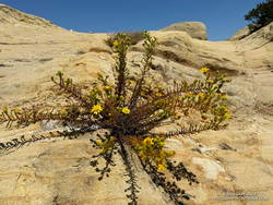
Santa Susana tarweed along the Backbone Trail, east of the Corral Canyon Trailhead.
The plant has a California Rare Plant Rank of 1B.2, which means it is considered “rare, threatened, or endangered in California and elsewhere…” The plant normally blooms after Winter rains. In the ANF technical notes** accompanying its description on SMMflowers.org, B. A. Prigge & A. C. Gibson describe how the plant may produce out-of-season flowers in the Summer, following a wet rain season with late Spring precipitation.
The option on Malibu Canyon Road requires crossing the highway twice. There is a pedestrian walkway on the east side of the bridge and a traffic light and crosswalk at Piuma Road. The trail that crosses the creek directly can be a little tricky to find because of other use trails in the area. When there is heavy rain, the flow may be too high to cross the creek safely.
Today, I decided to use the highway. There was a never-ending line of cars headed to and from the beach. It probably would have been faster — and safer — to use the trail. After crossing the creek on the highway bridge, and before doing the climb on the Tapia Spur Trail, I topped off my water at a faucet in the Tapia Day Use Area. Later, I also grabbed a quick drink at the water faucet next to the restrooms at the main Malibu Creek State Park parking lot.
From the main parking lot, it’s about 1.4 miles along Crags Road to the bottom of the Lookout Trail, and from there another three-quarters of a mile back to the Cistern Trailhead on Mulholland Highway.
Above are thumbnails of a few photos from the 16-mile out-and-back trail run to Mt. Baden-Powell from the Islip Saddle Trailhead. Click on an image for a larger photo and more information.
Almost two months had passed since I’d been on the PCT between Islip Saddle and Mt. Baden-Powell. Not a lot changed in the routine of the city in those seven weeks. The street sweeper still came by on Wednesday mornings, the trash was picked up each Friday, and the neighborhood looked pretty much the same as it did at the end of June.
Angeles Crest Highway was still closed between Islip Saddle and Vincent Gap. Gone was the noise of vehicles on the road below, replaced by the sound of the wind in the trees and the occasional outburst of a Clark’s nutcracker.
At the saddle near Mt. Hawkins, I stopped to photograph the stump of the Mt. Hawkins lightning tree. Perhaps weakened by one or more lightning strikes, this Jeffrey pine lost its crown during the Winter of 2019-2020. Now without bark, it’s easy to see that lightning followed the spiral grain of the tree. This tree has a right-hand spiral grain. When viewed from above, it is twisted counterclockwise.
It was windy and cool at higher elevation. The National Weather Service’s Wind Chill Temperature formula doesn’t apply to temperatures over 50°F, but with bare arms and legs, it can be surprisingly chilly when there is a strong wind and the temperature is in the 60s. Had I not been pushing the pace, I would have needed to pull the sleeves and shell from my pack.
Here is an interactive, high resolution, 3D terrain view of the out and back from Islip Saddle to Mt. Baden-Powell. An alternative start at the Windy Gap Trailhead in the Crystal Lake Recreation Area is also shown. Starting at this trailhead adds about 800′ of elevation gain. The map can be zoomed, tilted, rotated, and panned using the navigation control on the right. Track and placename locations are approximate and subject to errors. Poor weather and other conditions may make this route unsuitable for this activity.
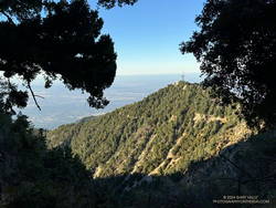
It was great to be back on the Rim Trail! One of the most underappreciated trails in Angeles National Forest, the 3.6 mile trail was closed in October 2020 because of the Bobcat Fire. It finally reopened in June of this year (2024).
Mt. Harvard from near the start of the Rim Trail.
This morning’s run had started at the top of the Kenyon Devore Trail from the same turnout on Mt. Wilson Circle Road as two weeks before. This time, instead of running down Mt. Wilson Road, I had descended a short distance on the Kenyon Devore Trail and turned right (east) on a half-mile long trail that connects to the main Mt. Wilson parking lot. From there I followed the “Authorized Vehicles Only” road toward the observatory about a quarter-mile to the signed start of the Rim Trail. Interpretive signs along the road note some of the area’s plants and trees.
On the way down the Rim Trail, I’d debated which route to take from Newcomb Pass. One option was to run over to Newcomb Saddle and take Rincon-Redbox Road to West Fork. Another was to follow the Gabrielino Trail to Devore Camp and then West Fork. The single-track route through Devore Camp is a more interesting option and is usually my choice.
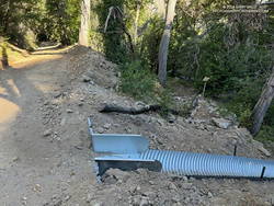
Trailwork on the Rim Trail near Newcomb Pass.
As I neared Newcomb Pass, I was surprised to see recent trailwork on the isolated stretch of trail. This was a hopeful sign the Gabrielino Trail between Newcomb Pass and Devore Camp might be in decent shape.
At Newcomb Pass, all signs of any trailwork ended. I looked at the first few overgrown yards of the trail connecting to Newcomb Saddle and thought, “I’ll give the Gabrielino Trail a try.” I could see an ill-defined path where the Gabrielino Trail should go and tried to follow it. No go. A lower path also appeared to be a dead end.
I enjoy the challenge of following little-used trails, but today was more interested in running than bushwhacking. Retracing my steps, I returned to the trail connecting to Newcomb Saddle.
Newly installed downslope drain blocking access to the Gabrielino Trail
It wasn’t as bad as I initially thought. The trail was a bit overgrown, but was on an old roadbed and pretty easy to follow. (Later, I discovered I had a bite from a larval tick, which I’m sure I picked up in the Newcomb Pass area.)
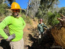
Jose and Gary cleaning debris underneath a log on the Gabrielino Trail near West Fork.
Running down Rincon-Redbox Road and lost in thought, I was somewhat startled to see a red truck round a bend. I was even more surprised when it turned out to be race director and trailmaster Gary Hilliard. Gary and Jose were out the weekend before the AC100 trying to chase down a couple of logs — one reported to be blocking access to the Newcomb Saddle aid station and another on the Gabrielino Trail “a half-mile from West Fork.”
I’ve had the privilege of running in all of Gary’s ANFTR/Mt. Disappointment races. No one works harder or is more dedicated to the trails of Angeles National Forest and trail running. I didn’t recall a log blocking the road, but it would only take Gary a few minutes to drive up to the aid station and be sure. With cruise control on and lost in thought, I continued running down to West Fork.
I’d been here two weeks before. The Rim Trail – Newcomb Saddle – Kenyon Devore Loop is the mirror image of the Mt. Wilson – Red Box – Kenyon Devore Loop. Two weeks ago it was around 10 degrees warmer and humid. I’d bonked on the climb, and wasn’t looking to repeat that experience today.
This morning – except for a couple of rattlesnakes – the run from West Fork couldn’t have gone better! I even jogged some of the less steep sections of the Kenyon Devore Trail!

 Above are thumbnails of a few photos from the 16-mile out-and-back trail run to Mt. Baden-Powell from the Islip Saddle Trailhead. Click on an image for a larger photo and more information.